Abandoned & Little-Known Airfields:
Northeastern Texas
© 2002, © 2016 by Paul Freeman. Revised 1/23/16.
This site covers airfields in all 50 states: Click here for the site's main menu.
____________________________________________________
Please consider a financial contribution to support the continued growth & operation of this site.
Athens Airfield (added 5/12/14) - Elders Field / Elder Field / (Original) Kilgore Airport (revised 6/22/13) - Gaskin Aux AAF #2 (revised 10/11/15)
(Original) Mount Pleasant Municipal Airport (revised 9/2/12) - Stewart Airport (added 1/23/16) - Wallace Airfield (revised 10/11/15)
____________________________________________________
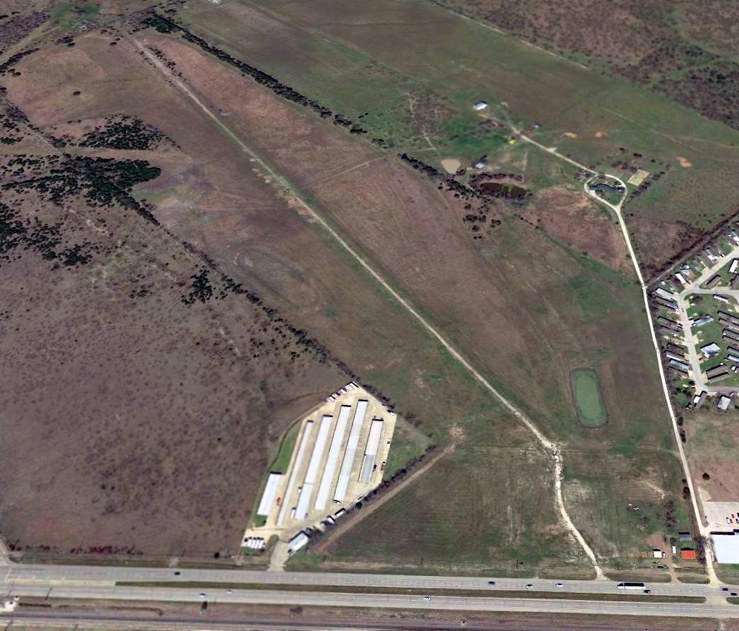
32.351, -95.266 (Southeast of Dallas, TX)
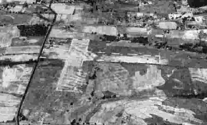
A 10/17/43 aerial view looking north at Stewart Airport from the 1945 AAF Airfield Directory (courtesy of Scott Murdock).
It depicted “Elders Field” as having 3 unpaved runways.
This small general aviation airport on the east side of Tyler was evidently established at some point between 1942-43,
as it was not yet depicted on the 1942 Shreveport Sectional Chart.
The earliest depiction which has been located of Stewart Airport was a 10/17/43 aerial view looking north from the 1945 AAF Airfield Directory (courtesy of Scott Murdock).
The directory described Stewart Airport as a 113 acre irregularly-shaped property having 2 sand & sod runways, measuring 2,500' north/south & 1,900' east/west.
The field was said to have 2 hangars, the largest measuring 120' x 80', and to be owned & operated by private interests.
According to Tyler resident Randy Gilbert, “Right after the war [WW2], a firm set up a plant to build the 'Texas Bluebird' airplane,
but I don’t think that they ever got off the ground.
Someone gave a program on it at our historical society.
The plant building was on the north side of Erwin Street & the east side of the loop.
There was also a long narrow building that was oriented northwest/southeast
that was about about 200' east of the loop & 500' south of East Erwin that was reportedly associated with the field.”
A 1947 aerial photo showed Stewart Airport as having 3 unpaved runways,
with 4 light single-engine aircraft visible near the buildings on the northwest corner.

The 1948 USGS topo map depicted Stewart Airport as having 3 unpaved runways, with a long building along the road on the west side.
Stewart Airport was evidently closed at some point between 1948-60,
as a 1960 aerial photo showed the 323 Loop having been built through the airport property,
but several hangars & airport buildings remained standing on the northwest portion of the airport site.
According to Tyler resident Randy Gilbert, “The 'Texas Bluebird' plant building remained until about 10 years ago [2006] when it burned.”

A 2015 aerial view showed no recognizable trace remaining of Stewart Airport.
The site of Stewart Airport is located southeast of the intersection of East Erwin Street & 323 Loop.
Thanks to Randy Gilbert for pointing out this airfield.
___________________________________________________
32.16 North / 95.86 West (Southeast of Dallas, TX)

Athens Airfield, as depicted on an 11/13/82 aerial view.
Not much is known about this apparent private airfield located due south of the town of Athens, including its date of construction, name, or purpose.
The earliest depiction which has been located of the Athens Airfield was an 11/13/82 aerial photo,
which depicted a single 5,000' asphalt north/south runway.
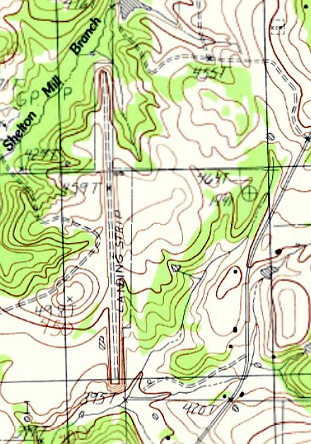
The 1984 USGS topo map depicted a single north/south runway at Athens, labeled simply as “Landing Strip”.

A 2/2/95 USGS aerial view looking northwest at the Athens Airfield.
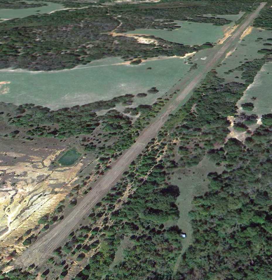
A 10/17/12 aerial view looking northwest showed the Athens runway as remaining intact though considerably deteriorated.
As of 2014 no airfield was listed with the FAA at the location of the Athens Airfield.
The site of Athens Airfield is located west of the intersection of Stonebridge & Route 753.
___________________________________________________
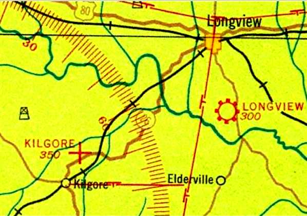
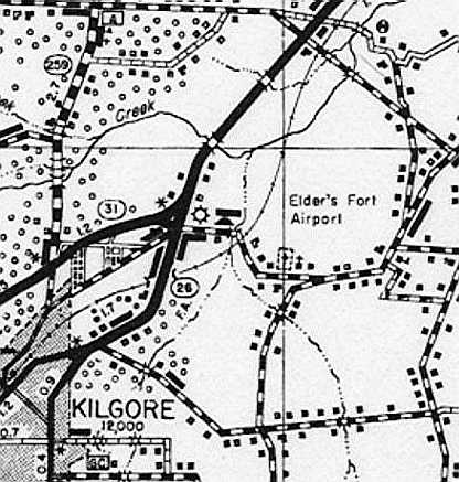
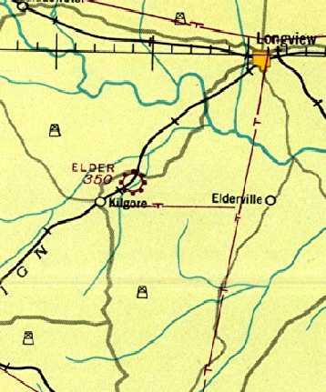
Elders Field / Elder Field / (Original) Kilgore Airport, Kilgore, TX
32.41 North / 94.85 West (East of Dallas, TX)
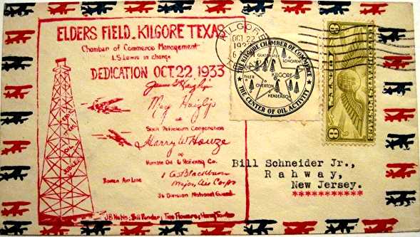
A postmark commemorating the 10/22/33 dedication of “Elders Field” (courtesy of Greg Patterson).
This small general aviation airport on the northeast side of Kilgore was dedicated on 10/22/33,
according to a commemorative postmark (courtesy of Greg Patterson).
The earliest depiction of which has been located of Elder Field
was on the 1934 Shreveport Sectional Chart (courtesy of Greg Patterson).
It depicted “Kilgore” as an auxiliary airfield.
A 1936 TX Highway Map (courtesy of Greg Patterson) depicted “Elder's Fort Airport”
as an open area with buildings along the southern periphery.

A 5/18/41 advertisement (courtesy of Greg Patterson) for Kilgore Flying Service & School of Aviation.
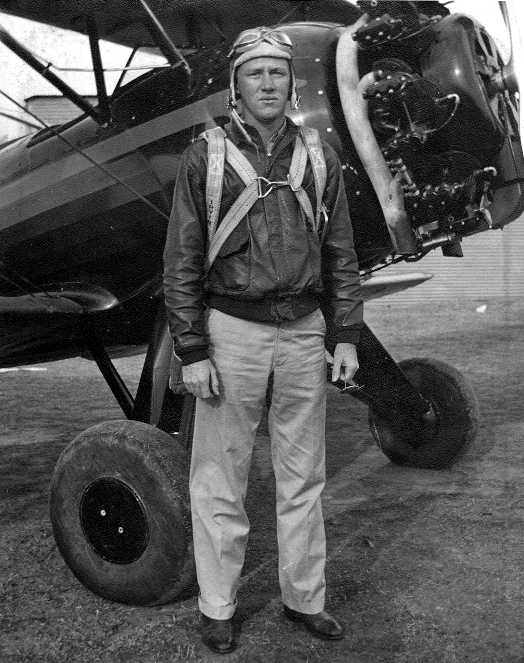
A 1943 photo (courtesy of Greg Patterson) of Civilian Pilot Training Program instructor H.E. Patterson
in front of a Waco biplane trainer at Elder Field.
Greg Patterson recalled, “My father H. E. Patterson was a Civilian Pilot Training Program instructor at Elder Field from 1942-44.
The Elder Field CPT program was associated with Kilgore Junior College.”
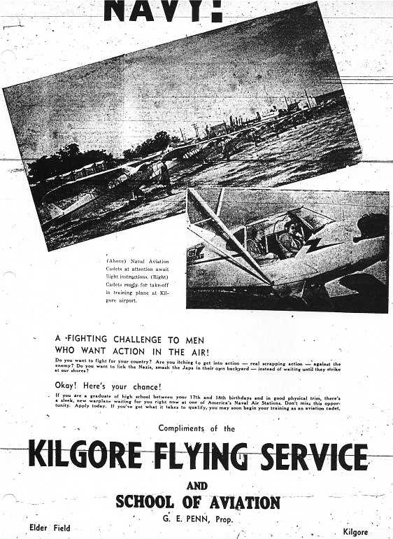
A 5/23/43 advertisement (courtesy of Greg Patterson) for Kilgore Flying Service & School of Aviation.

An undated photo of a line of Piper Cubs from a 5/23/43 advertisement (courtesy of Greg Patterson) for Kilgore Flying Service & School of Aviation.

The last photo which has been located of Elder Field
was a 10/17/43 aerial view looking north from the 1945 AAF Airfield Directory (courtesy of Scott Murdock).
It depicted “Elders Field” as having 3 unpaved runways.
The last aeronautical chart depiction of which has been located of Elder Field
was on the 1943 Sectional Chart (courtesy of Greg Patterson).
It depicted Elder as a commercial/municipal airport.
The 1945 AAF Airfield Directory (courtesy of Scott Murdock) described “Elders Field”
as a 200 acre L-shaped property having 3 sod & dirt runways, the longest measuring 2,650' NNE/SSW.
The field was said to have 4 wood & metal hangars, the largest measuring 120' x 90',
and to be owned & operated by private interests.
According to Greg Patterson, “Elder Field's Fixed Base Operator G. E. Penn moved his operation to the New Gregg County Airport when it opened on 7/14/47.”
Donald Martin recalled, “Elder Field... I worked there as a teen-age operations assistant in the summers of 1952, 1953, and 1954 & earned my Private License in payment.
The field was managed by Don Malarkey & his wife Vera. They were professional golfers & were away a great deal of the time leaving me as the sole operator.
It was a teenager's dream & my duties were everything from pumping gas, sweeping hangars, washing & waxing airplanes,
operating the office, and running the golf driving range located at the south end of the field.
We operated a Piper Cruiser, a Taylorcraft, 2 J-3 Cubs, a Cessna 120 & 140, and a Stinson Voyager.
My first logbook entry was 6/10/52 in Piper 2414M & my last was 12/16/54 in the same airplane.
I left Kilgore in January 1955 & understand the field closed shortly thereafter.”
Greg Patterson recalled, “My dad often pointed out the location of the field.
In 1970 it was grown over with small pine trees,
however we still found the concrete foundations for T-hangars northeast of the intersection of Highway 31 & Highway 349.”
Shayne Rogers reported, “I've got a 1978-79 aerial [photo]... amazingly the main runway was still wide open & barren!”
Greg Patterson recalled, “Into the 1980s the tree my dad pointed out, as the tree student pilot Menasco crashed a Waco trainer into in 1941, was still standing.
This large tree was near the old highway, now in a Halliburton oilfield services yard.”
The 1995 USGS aerial photo shows that a large retaining pond of some type occupied the majority of the airport property.
Greg Patterson recalled, “About 10-15 years ago [2008-2013]
the T-hangar foundations were bulldozed out of the way for a City of Kilgore storage yard.”
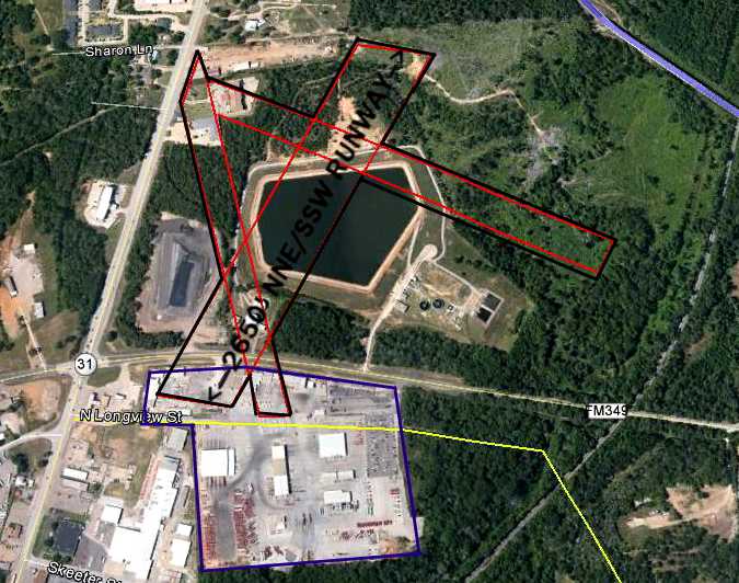
A 4/22/12 aerial annotated by Shayne Rogers to show the location of the Edler runways.
It does not appear to show any remaining trace of Elder Field.
Shayne observed, “FM 349 was not there in 1933- 1940s, it couldn't have been.
Highway 259 (north & south) is still right to the west of the former airfield & it lines up with the 1943 aerial picture.
After studying the topography, and the lay of the facilities (Halliburton Yard) that is just across FM 349 from the site,
I have determined that the west entrance to Halliburton, off Highway 259- is that old road.
Halliburton 'consumed' that road & just east of Halliburton's yard - you can see the remnants
(difference in terrain...old right of ways, old road beds, etc., and if you compare my picture to the sectional chart - everything lines up, even the railroad.”

A 6/21/13 photo by Shayne Rogers looking southwest along the northwest/southeast runway.
Shayne observed, “It's all younger tree growth so I am confident this picture is about the middle of the runway.”
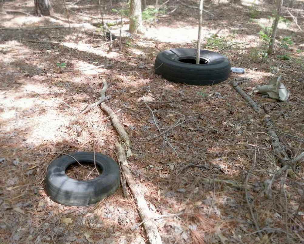
A 6/21/13 photo by Shayne Rogers of 2 Goodyear aircraft tires at the site of Elder Field.
Shayne observed, “I was walking the woods & stumbled on 3 aircraft tires...who'd a thunk it?
There was localized rubble piles with concrete in them- it was really full of gravel & had older style rebar in it... looks almost like runners/footings for t-hangars.”
The site of Elder Field is located northeast of the intersection of Route 31 & Route 259.
___________________________________________________
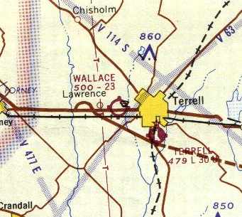
32.74 North / 96.32 West (East of Dallas, TX)
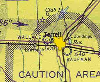
Wallace Airfield, as depicted on the February 1943 Dallas Sectional Chart (courtesy of Chris Kennedy).
The date of establishment of this small general aviation field has not been determined.
No airfield at this location was depicted on the September 1942 Dallas Sectional Chart (according to Chris Kennedy).
Barbara Wallace Simandl reported, “I am the granddaughter of one of the prior owners of the Wallace airport.
The information I have heard is that my father, James Wallace, and one or two of his brothers ran this airport.
I believe it was in existence prior to 1943 but am not sure.”
The earliest depiction of Wallace Airfield which has been located
was on the February 1943 Dallas Sectional Chart (courtesy of Chris Kennedy).
It depicted Wallace as a commercial/municipal field.
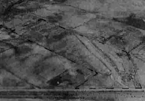
The earliest photo which has been located of Wallace Field
was a 10/21/43 aerial view looking north from the 1945 AAF Airfield Directory (courtesy of Scott Murdock).
It depicted Wallace as having an unpaved runway.
The 1945 AAF Airfield Directory (courtesy of Scott Murdock) described Wallace Field
as a 98 acre irregularly-shaped property within which was a 1,850' sod runway within a 2,100' x 1,200' sod all-way landing area.
The field was said to have a single 80' x 60' wood hangar,
and to be owned & operated by private interests.

The 1963 USGS topo map depicted “Wallace Airfield”
as having a single unpaved northwest/southeast runway.
Steve Harkins recalled, “I remember driving past there as a kid in the 1960s,
and seeing airplanes taking off & landing.”
The 1965 DFW Sectional Chart described Wallace Airfield as having a single 2,365' turf runway.
John Criswell recalled, “It had a short strip with a few T-hangars on the Northeast side.
The approach from the South had to be pretty steep
because of a drive-in theater located just across Highway 80
which cut across the threshold of the runway.
I got my ticket in 1965 at Dallas Redbird and remember one of my solo flights included a quick stop at Terrell.
The last time I was there, now many years ago, there was still a Stinson Voyager on the field, but not much else.
A strange being lived in a small travel trailer alongside the open-air hangars
and he used to just sit in a beat-up folding lawn chair in the shade watching.”

The 1967 TX Airport Directory (courtesy of Brad Stanford)
depicted Wallace Airfield as consisting of a single 2,365' turf Runway 15/33.
The manager was listed as Matthew Wallace.
The airfield configuration was unchanged in the 1970 TX Airport Directory (courtesy of Ray Brindle).
The July 1983 Dallas-Ft Worth Sectional Chart (courtesy of Chris Kennedy)
still depicted Wallace as a public-use airfield,
with a 3,500' unpaved runway.
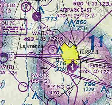
At some point between 1983-85, Wallace apparently became a private airfield,
as that is how it was depicted on the July 1985 Dallas-Ft Worth Sectional Chart (courtesy of Chris Kennedy).
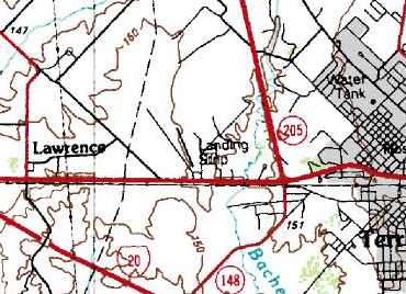
The runway was still depicted on the 1986 USGS topo map,
but it was labeled simply as “Landing Strip”, which may have indicated that the field had closed by that point.
Wallace Airfield was definitely closed by 1987,
as it was no longer depicted at all on the July 1987 CG-20 World Aeronautical Chart (according to Chris Kennedy).

A 1995 USGS aerial view looking north showed the area of the former Wallace Field runway was still clear,
but the site was otherwise unrecognizable as a former airport.

A Spring 2004 photo by Joe Hancock, looking north from Route 80 at the former Wallace hangar.
Joe observed, “I assume this old rusty hangar is about all that's left of it.
The old hangar used to have a sign reading 'Wallace Airfield, Matthew Wallace owner'.
I saw it many times passing on Highway 80.”
Steve Harkins reported in 2006, “The now-rusty main hangar building at the old Wallace Airfield
is still standing as of this past week.”
A circa 2006 aerial photo still showed the hangar standing.
However, a circa 2006-08 photo showed that the hangar had been removed.
The runway area still remained clear.
A 2014 aerial view looking north showed the runway area of Wallace Field remained clear,
The site of Wallace Airfield is located northeast of the intersection of Route 80 & Route 237.
___________________________________________________
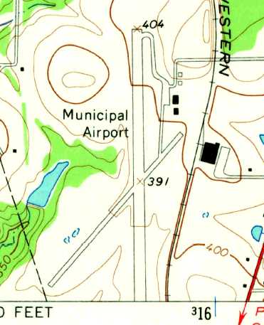
Hoffman Airfield / (Original) Mount Pleasant Municipal Airport, Mount Pleasant, TX
33.13 North / 94.98 West (East of Dallas, TX)

Mount Pleasant Municipal Airport, as depicted in the 1963 TX Airport Directory (courtesy of Steve Cruse).
This municipal airport was evidently established at some point between 1945-49,
as it was not yet listed among active airfields in the 1945 AAF Airfield Directory (courtesy of Scott Murdock) .
It was apparently originally known as "Hoffman" Airfield,
as that is how it was labeled on the 1949 Shreveport Sectional Chart (according to Chris Kennedy).
It was apparently renamed Mount Pleasant Municipal Airport at some point between 1949-62,
as that is how it was listed in the 1962 AOPA Airport Directory.
It was described as having 2 asphalt runways (4,000' 17/35 & 3,000' 3/21),
and the operator was listed as the William Phinney Flying Service.
The 1963 TX Airport Directory (courtesy of Steve Cruse)
depicted the field with somewhat more "conservative" runway lengths:
a 3,800' asphalt Runway 17/35 & a 2,600' oiled Runway 3/21.
An apron sat on the northeast corner of the field, with several small hangars.
The manager was listed as William Pinney, of the William Phinney Flying Service.
The earliest photo which has been located of Mount Pleasant Municipal Airport was a 1964 aerial view.
It depicted the field as having 2 asphalt runways, with 4 small hangars on the northeast side.
No aircraft were visible on the field.
The 1965 USGS topo map depicted Mount Pleasant Municipal Airport as having 2 paved runways, with 4 small hangars on the northeast side.
The airfield configuration was unchanged in the 1967 TX Airport Directory (courtesy of Brad Stanford),
but the manager was listed as Harrold Huneycutt.

The 1980 USGS topo map depicted the Mt Pleasant Municipal Airport as having 2 paved runways,
with a ramp with several hangars on the northeast side of the field.
The airfield configuration was unchanged in the 1985 TX Airport Directory (courtesy of Steve Cruse),
but the manager was listed as J.D. Roper.
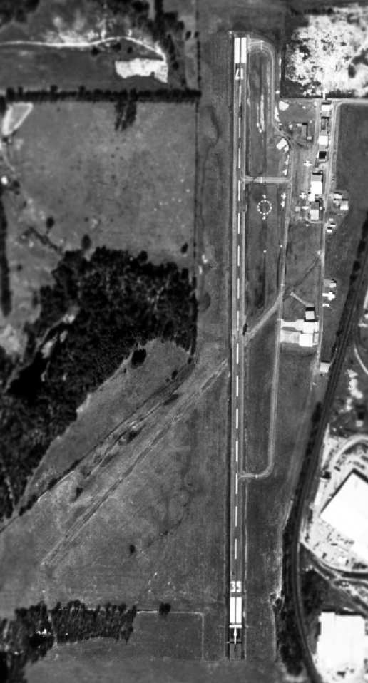
USGS aerial photo 1997, while the field was still open.
The original airport was closed in 2003
when it was replaced by a newly-built Mount Pleasant Municipal Airport to the east.
According to Mark Bergee, "I called over to the Mount Pleasant City Manager
and he told me that the old airport was sold to a private party for commercial development.
Unfortunately… there was a stipulation in the sale that disallows any aviation activity at the old airfield."
A circa 2006 aerial view looking east at the hangars which remain standing at the site of the original Mt Pleasant Municipal Airport.
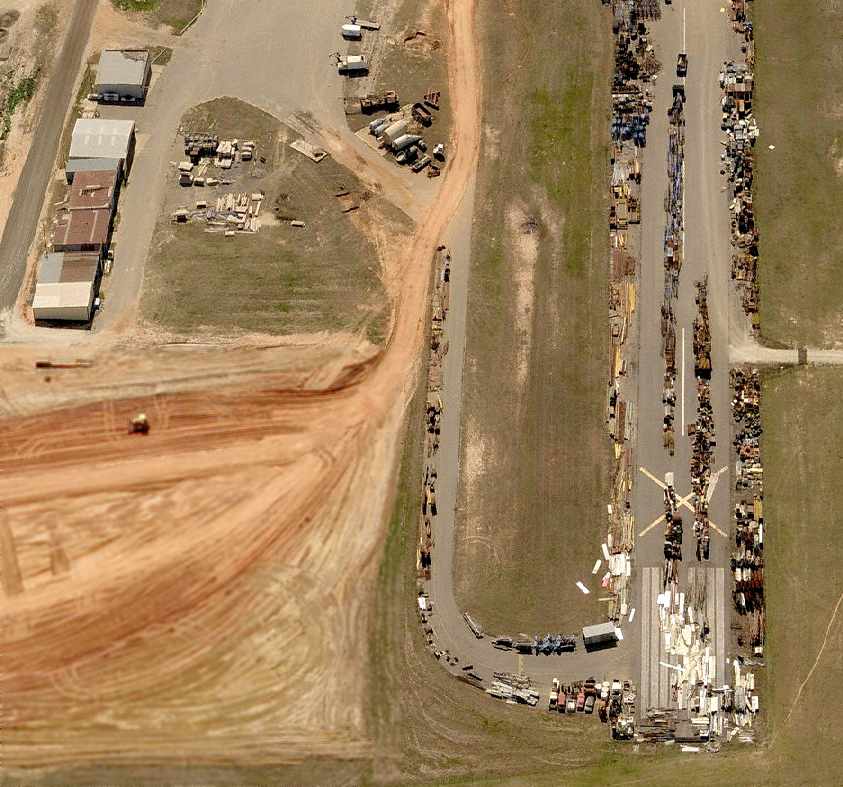
A circa 2006 aerial view looking south at the former runway & hangars at the site of the original Mt Pleasant Municipal Airport,
now used for storage of a large number of vehicles & other unidentified items.
The site of the original Mount Pleasant Municipal Airport is located west of the intersection of Route 271 & Airport Road,
appropriately enough.
___________________________________________________
Gaskin Auxiliary Army Airfield #2, Sherman, TX
33.51 North / 96.76 West (North of Dallas, TX)
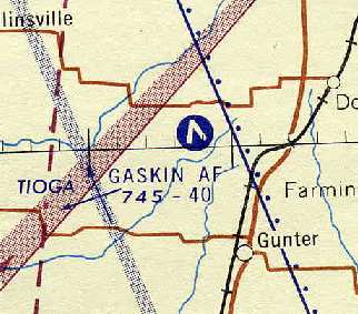
"Gaskin AF", as depicted on the 1957 Dallas Sectional Chart (courtesy of Chris Kennedy).
Photo of the airfield while open has not been located.
This 594 acre field was built during WW2 as one of 5 satellite fields for Perrin AAF (16 miles northeast),
which conducted basic flight training.
It was kept on inactive status after the end of WW2,
but was reportedly reactivated from 1948-1952 as Gaskin Air Force Auxiliary Field.
Strangely, "Gaskin AF" was depicted as an active airfield on 1957 Dallas Sectional Chart (courtesy of Chris Kennedy),
but it was not listed among active airfields on the chart's Aerodromes table,
so it is not clear if it was indeed still open in 1957.
The chart described the field as having 2 paved runways, with the longest being 4,000'.
The Gaskin airfield was no longer depicted at all on the 1958 USGS topo map.
Gaskin was definitely abandoned by 1964,
as it was not depicted at all (even as an abandoned airfield)
on the 1964 DFW Sectional Chart (courtesy of Ross Richardson).
The remains of the airfield were not depicted at all on recent USGS topo maps.
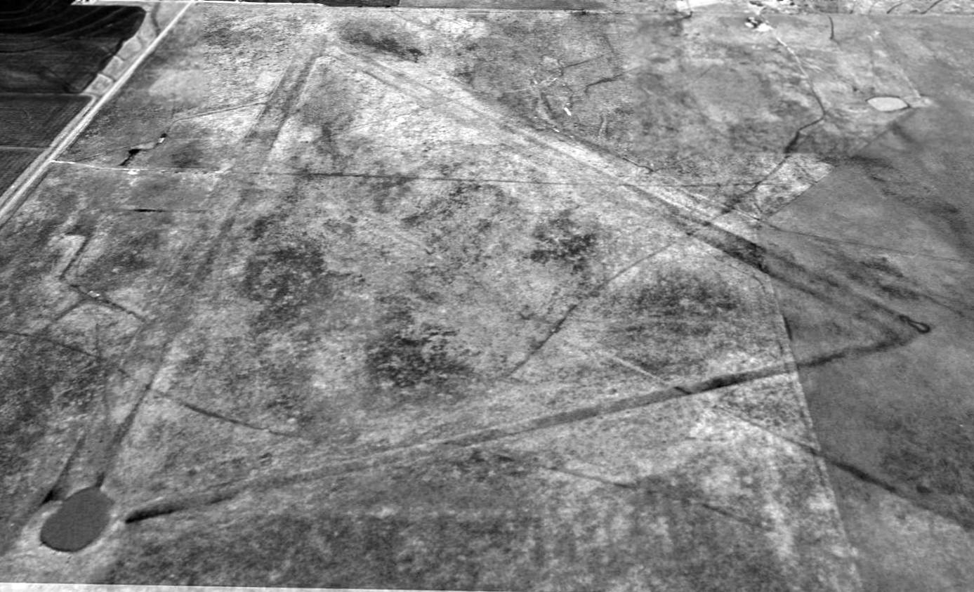
A 1995 USGS aerial view looking north showed the Gaskin Field pavement had been broken up & the land returned to farming,
but the outlines of the 2 runways were still clearly recognizable.
along with a connecting taxiway at the south end.
The outline of a ramp area to the west of the runways was also perceptible.
According to Bo Boggs, "There apparently was an east/west runway at one time.
The west end terminates in the tank at the south end of the north/south runway.
If you look at the aerial photo, you can see its remains also.
It is much more visible live as there was some fill required to raise the east end of it."
Ross Richardson said in 2003, "I came across Gaskin quite by accident.
I was flying from Sherman to Denton & flew over this pasture that sure looked like the photo you provide in your website.
I talked to some long time pilots in the area and they confirmed that it was a AAF field.
I wonder if it could be refurbished into a residential airpark. Hmmmm."
Bo Boggs reported in 2003, "I have been observing it for 4 years & each year it becomes less distinct."
Southwest Airlines pilot Will Ware reported that the Gaskin airfield was still recognizable from the air, as of 2007.
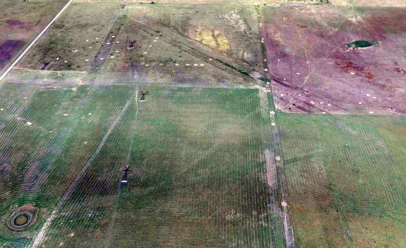
A 2014 aerial view looking north at the remains of the Gaskin airfield,
showing the outline still barely recognizable of the 2 runways & the connecting taxiway.
See also: http://www.airforcebase.net/usaf/perrin.html
____________________________________________________
Since this site was first put on the web in 1999, its popularity has grown tremendously.
That has caused it to often exceed bandwidth limitations
set by the company which I pay to host it on the web.
If the total quantity of material on this site is to continue to grow,
it will require ever-increasing funding to pay its expenses.
Therefore, I request financial contributions from site visitors,
to help defray the increasing costs of the site
and ensure that it continues to be available & to grow.
What would you pay for a good aviation magazine, or a good aviation book?
Please consider a donation of an equivalent amount, at the least.
This site is not supported by commercial advertising –
it is purely supported by donations.
If you enjoy the site, and would like to make a financial contribution,
you
may use a credit card via
![]() ,
using one of 2 methods:
,
using one of 2 methods:
To make a one-time donation of an amount of your choice:
Or you can sign up for a $10 monthly subscription to help support the site on an ongoing basis:
Or if you prefer to contact me directly concerning a contribution (for a mailing address to send a check),
please contact me at: paulandterryfreeman@gmail.com
If you enjoy this web site, please support it with a financial contribution.
please contact me at: paulandterryfreeman@gmail.com
If you enjoy this web site, please support it with a financial contribution.
____________________________________________________
This site covers airfields in all 50 states.