
Abandoned & Little-Known Airfields:
Southwestern Washington State
© 2002, © 2016 by Paul Freeman. Revised 10/6/16.
This site covers airfields in all 50 states: Click here for the site's main menu.
____________________________________________________
Please consider a financial contribution to support the continued growth & operation of this site.
Evergreen Field / Suggs Airport (revised 12/20/15) - Ocean Shores Airport / Corning Field (revised 10/6/16)
Scholl's Airport (revised 1/23/14) - Taylor Airport (revised 12/2/14)
____________________________________________________
46.11, -122.92 (North of Portland, OR)
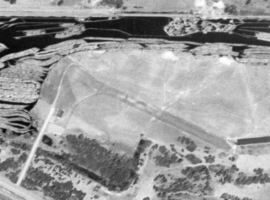
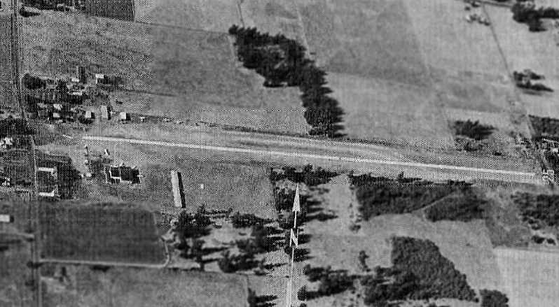
A circa 1949 aerial view looking east along the Taylor Airport runway (courtesy of Scott Kimball),
showing the hangar which would eventually become home to the Aerocar operation.
Taylor Airport was the factory airport for Taylor Aircraft, at which founder Molt Taylor developed the Aerocar,
a “roadable” aircraft which could be converted to a car by quickly removing the wings & rear fuselage.
The date of establishment of Taylor Airport has not been determined,
but according to the book “A Drive In The Clouds”, the firstpublic showingof the Aerocar
was at a junior chamber of commerce fly-in at the field next to the factory on 7/4/49,
and the Aerocar's first flight was on 11/4/49.
The earliest photo which has been located showing Taylor Airport while in operation
was a circa 1949 aerial view looking east along the Taylor Airport runway (courtesy of Scott Kimball),
showing the hangar which would eventually become home to the Aerocar operation.
According to Jerry Sorrell, “Molt flew his first Aerocars off this airport.”
A 10/25/51 USGS aerial photo showed Taylor Airport to have an unpaved northwest/southeast runway,
with the small Aerocar factory on the southwest side.
There were no aircraft visible on the field.
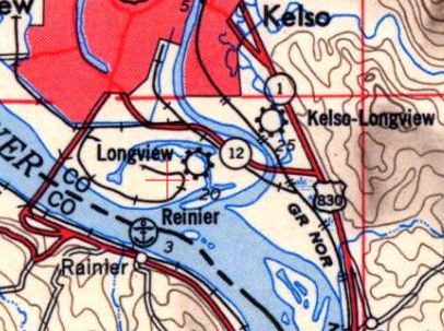
Longview Airport, as depicted on the 1953 USGS topo map.
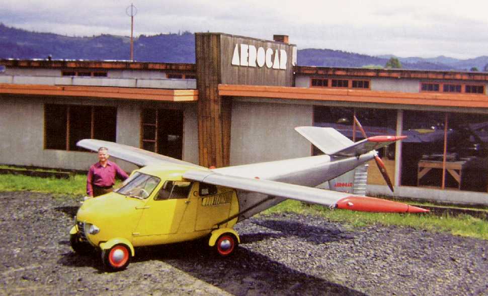
An undated (circa 1950s) photo of Molt Taylor & one of his prototype Aerocars in front of the Aerocar factory at Taylor Airport.
Note the art-deco “Aerocar” lettering on top of the building.
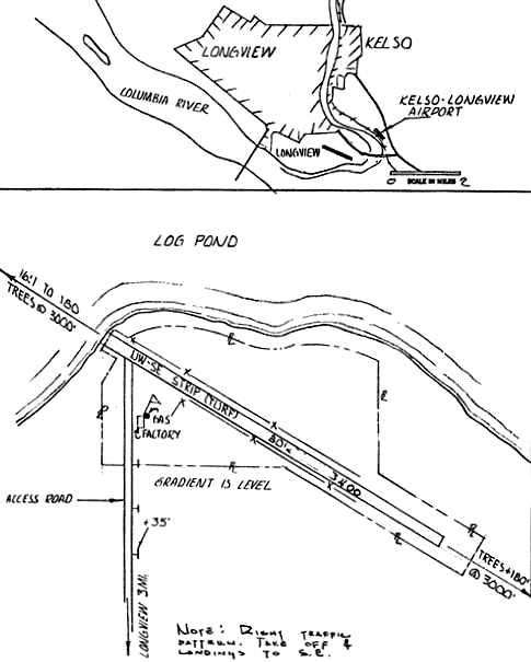
The location & layout of Taylor Airport from the 1959 Washington Pilot's Guide (courtesy of Jerry Sorrell).
It depicted Taylor Airport as having a single 3,400' turf northwest/southeast runway, with a factory on the southwest side.
The remarks said “Aerocar 'Flying Automobiles' built at field.”
Only 6 Aerocars were built.
Molt Taylor tried to arrange deals with several manufacturers for mass production, but none came to fruition.
Longview Airport was still depicted on the 1962 USGS topo map.
Jerry Sorrell recalled of Taylor Airport, “When I started to fly in the mid-1960s, this field still existed.”
Taylor Airport was not depicted at all on the 1967 Seattle Sectional Chart.
Jerry Sorrell recalled of Taylor Airport, “The airport closed probably in the late 1960s or early 1970s
when Molt moved his operation into the industrial area of Longview
and did further flight testing at the Southwest Washington Regional Airport in Kelso.”
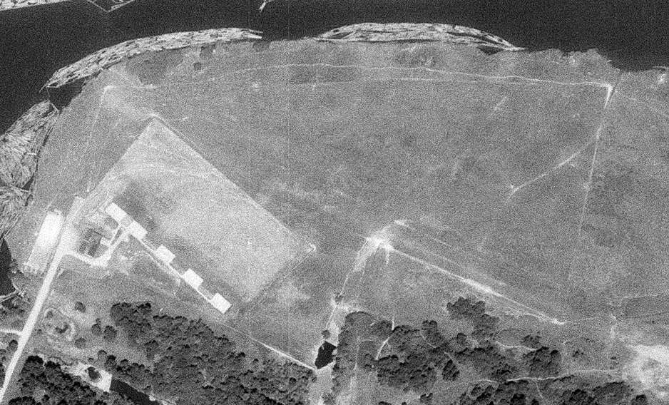
A 10/8/70 USGS aerial photo showed that an unidentified series of 5 concrete pads had been built on the west side of Taylor Airport,
which otherwise showed no signs of current aviation usage.
A 7/15/90 USGS aerial view showed a faint trace remaining of Taylor Airport's northwest/southeast runway,
and the foundation of the Aerocar factory was still visible on the west side.
The foundation of the Aerocar factory was still visible in a 1994 aerial photo.
A 2000 aerial photo shows that the foundation of the Aerocar factory was wiped clean at some point between 1994-2000,
but the outline of a portion of the Taylor Airport runway remained recognizable.
A 2003 aerial photo showed that a new road had been built through the center of the Taylor Airport site at some point between 2000-2003,
erasing the last traces of the runway.
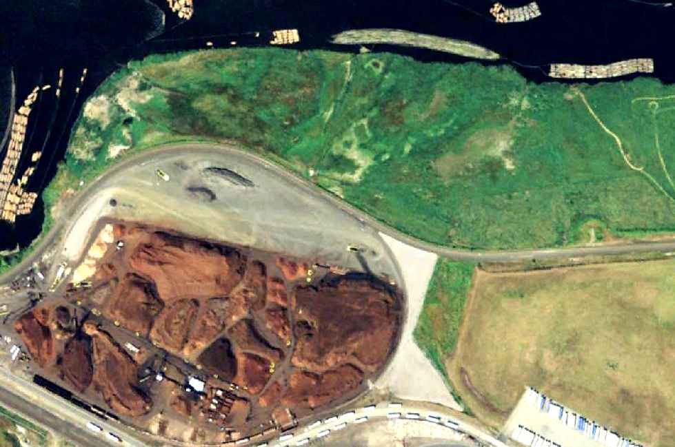
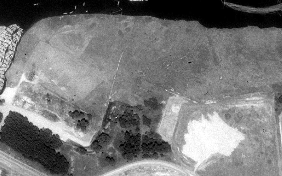
A 9/26/11 aerial view shows no trace remains at the site of Taylor Airport.
Jerry Sorrell observed in 2012, “The area has been reconstructed for other industrial purposes.
[It is] now used for wood products stockpile.”
The site of Taylor Airport is located east of the intersection of Fibre Way & East Mill Road.
____________________________________________________
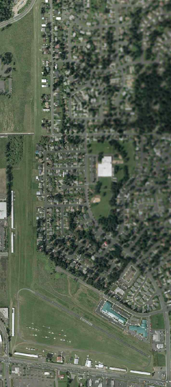
Evergreen Field (59S) / Suggs Airport, Vancouver, WA
45.62, -122.53 (North of Portland, OR)
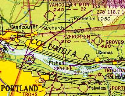
Evergreen Field, as depicted on the October 1948 Portland Sectional Chart (courtesy of Chris Kennedy).
Evergreen Field was founded in 1946, according to an article on Aero-news.net.
It was described as “a place where a flyer could stop for small town hospitality,
kids could earn flight time washing planes, students could learn to fly in taildraggers or contemporary planes.”
According to a 2/16/06 Vancouver Columbian article by Thomas Ryll (courtesy of Jerry Sorrell),
in “August 1944, Roy C. Sugg [was] granted a special conditional permit by the county planning commission for an airport on Mill Plain Road, 7 miles east of Vancouver."
In “1945, Wally Olson [bought] the airport.”
The earliest depiction of Evergreen Field which has been located
was on the October 1948 Portland Sectional Chart (courtesy of Chris Kennedy).
It depicted Evergreen as having a 2,700' unpaved runway.
Jerry Sorrell recalled, “Evergreen Field... I knew the owner, Wally Olsen.
I think Wally bought the airport from Mr. Suggs after WW2.”
The September 1954 Portland Sectional Chart (courtesy of Chris Kennedy)
continued to depict Evergreen as having a 2,700' unpaved runway.
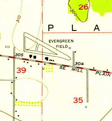
The 1954 USGS topo map depicted Evergreen Field as having a northwest/southeast runway, with a taxiway & 6 buildings along the south side.
Charles Luce recalled, “Evergreen was a bucolic, quintessential grass strip
when I was a kid living in Vancouver in the early 1960s.
We used to ride our bikes out the field to watch planes take off & land.
At that time, Mill Plain road was a rather desolate 2-lane highway. Only a few cars to contend with.”
According to a 2/16/06 Vancouver Columbian article by Thomas Ryll (courtesy of Jerry Sorrell),
famed pilot Charles Lindbergh visited Evergreen Field several times in the early 1960s.
Jerry Sorrell recalled, “Wally [Olson] told me years ago that Mr. Lindbergh's trips to the area were to visit his wife’s relatives in nearby Ridgefield.
He told me that Mr. Lindbergh would fly the planes on occasion. In those years, it would probably have been the Taylorcraft & Aeronca.
Wally said that Mr. Lindbergh wanted to remain anonymous, and Wally honored that request.
I always wondered if the Aeronca & Taylorcraft I leaned to fly in 1967, were the ones that Mr. Lindbergh may have flown.”
Evergreen Field was home to the Northwest Antique Airplane Club & Evergreen Fly-In since 1964,
according to an article on Aero-news.net.
The 1966 Washington Pilot's Guide (courtesy of Chris Kennedy)
depicted Evergreen Field as having a 2,700' turf Runway 10/28
and a second 2,100' gravel Runway to the south.
A row of T-hangars was depicted along the south side of the field.
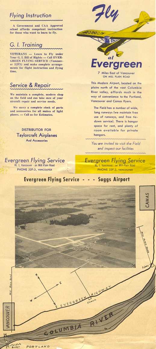
A 1960s brochure (featuring an undated aerial view looking northeast) from “Evergreen Flying Service – Suggs Airport” (courtesy of Jerry Sorrell).
Jerry Sorrell recalled, “Evergreen Field... I learned to fly there in 1967 & knew the owner, Wally Olsen. He gave me the ad.”
According to a 2/16/06 Vancouver Columbian article by Thomas Ryll (courtesy of Jerry Sorrell),
in “April 1968, the county approved a plan for Olson's 88-lot, 42-acre Evergreen Airpark subdivision
for residents with 'take home' planes that are taxied from the airport's main runways.”
The July 1969 Portland Sectional Chart (courtesy of Chris Kennedy)
depicted Evergreen as having a 2,600' unpaved runway.
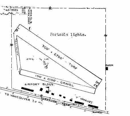
Evergreen Field gained a paved main runway & a crosswind grass runway at some point between 1969-71,
as the 1971 Washington Pilot's Guide (courtesy of Chris Kennedy)
depicted Evergreen as having a 2,600' Runway 10/28 (of which 2,300' was said to be blacktop),
along with a grass Runway 16/34.
Another row of T-hangars had also been added on the southwest corner of the field.
According to a 2/16/06 Vancouver Columbian article by Thomas Ryll (courtesy of Jerry Sorrell),
in “April 1973, the state's aeronautics director predicted a bleak future for Evergreen Airport,
saying it may not be able to stave off higher taxes & development pressure.”
By “June 1973, Evergreen had grown to 9 hangars & 140 planes, about half its capacity.”
According to a 2/16/06 Vancouver Columbian article by Thomas Ryll (courtesy of Jerry Sorrell),
in “December 1977, Olson told county commissioners that plans to extend 136th Avenue would kill chances for Evergreen's expansion.
The avenue was extended.”
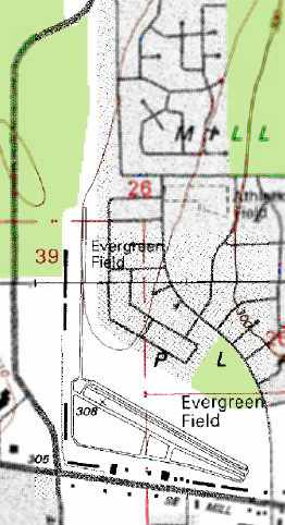
The 1995 USGS topo map depicted Evergreen Field
as having a single paved northwest/southeast runway (with a parallel taxiway),
along with an unpaved north/south runway.
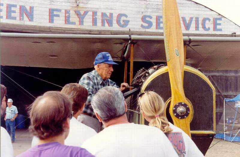
A late 1990s photo of Evergreen Airport owner Wally Olsen, in front of the Evergreen Flying Service hangar (courtesy of Collin).
According to a 2/16/06 Vancouver Columbian article by Thomas Ryll (courtesy of Jerry Sorrell),
Evergreen Field owner/operator Wally Olson died of cancer at age 86 on 7/17/97.
In “October 1997, the North-South Airpark Association, consisting of homes along a grass strip north of & connected to the airport,
won a 4-year legal battle when the state Court of Appeals concurs with a local judge's ruling that residents can use the area for takeoffs & landings.
The private airstrip will remain open after Evergreen closes.”
In “April 1998, after hearing a storm of opposition, the Vancouver Planning Commission unanimously voted
to recommend against rezoning for apartments a piece of land that had been part of Evergreen's north-south runway.”
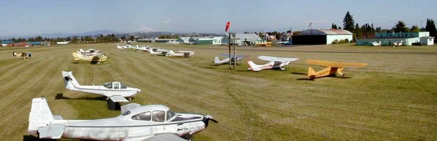
A May 2001 panoramic shot by Charles Luce of Evergreen Field.
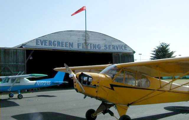
A May 2001 photo by Charles Luce of the Evergreen Flying Service hangar.
According to a 2/16/06 Vancouver Columbian article by Thomas Ryll (courtesy of Jerry Sorrell),
in “June 2001, the same day that Port of Vancouver officials announced they would not buy the airport,
the Olson family puts the 57-acre property up for sale, saying, 'The well has now run dry.'”
In November 2001, “The Olsons filed an application with the city, proposing development of the airport into commercial, light-industrial & office uses.”
In “April 2002, four years after buying 17 acres of the airport's north-south runway from the Olson family,
developer Walt Musa gained the city's OK to rezone the property.”
In “August 2002, the Northwest Antique Airplane Club's 43rd & final Evergreen event took place.”
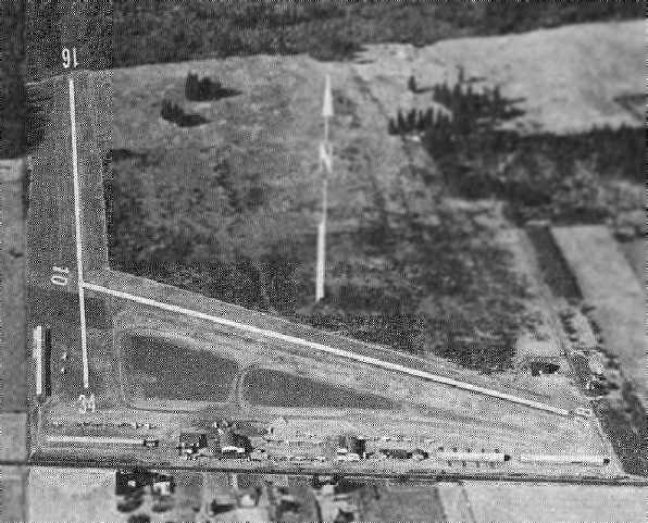
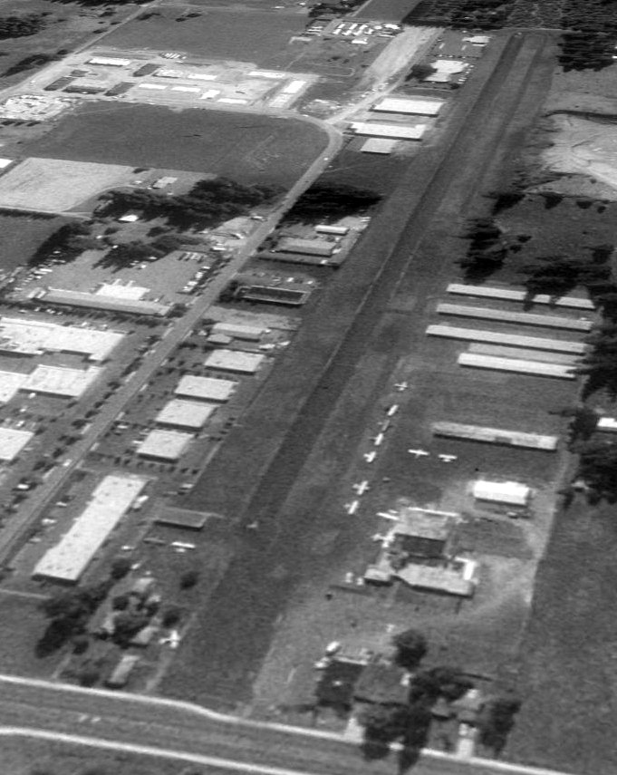
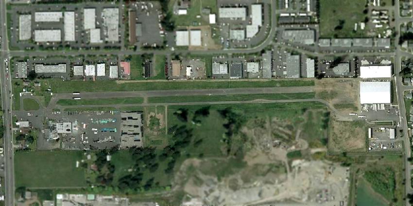
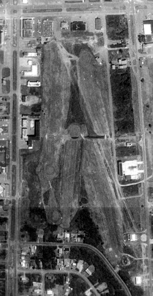
The 2002 USGS aerial photo depicted Evergreen Field
as being a very well-used airport, with over 50 aircraft visible parked on the field.
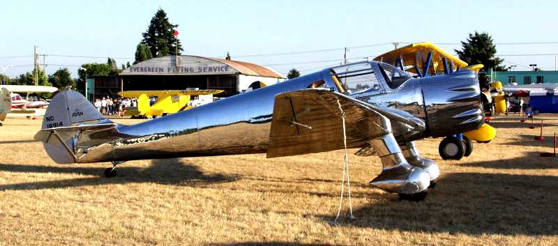
An 8/17/02 photo by Russell Williams of a beautiful 1938 Ryan SCW in front of the Evergreen Flying Service hangar.
The last aeronautical chart depiction which has been located of Evergreen Field
was on the Portland inset of the June 2005 Seattle Sectional Chart (courtesy of Mitchell Hymowitz).
It depicted Evergreen as having a single 2,100' paved northwest/southeast runway.
Unfortunately, the end for Evergreen Field came in 2006,
according to an article entitled “After 60 Years, Vancouver's Evergreen Field Shuts Down” on Aero-news.net.
The Northwest Antique Airplane Club held its final fly-in event at Evergreen in 2006,
“a bittersweet farewell party that saw over 250 guests & over 50 airplanes in attendance.
Until the flight school closed recently, Wally's original training fleet included several 1946 T-Crafts & a Cub -
and folks were welcome to wander around, poke a nose into an open hangar & say hello.
A multi-use business park - sporting with airport design cues -
will replace one of the last, great, old airports in the Vancouver-Portland area.
Somehow, that just don't seem right.”
In its last year of operation, the FAA Airport Facility Directory data for Evergreen Field
described it as having a 2,155' asphalt Runway 10L/28R
and a parallel 2,000' turf Runway 10R/28L.
The field was home to a total of 165 aircraft,
and it conducted an average of 186 takeoffs or landings per day.
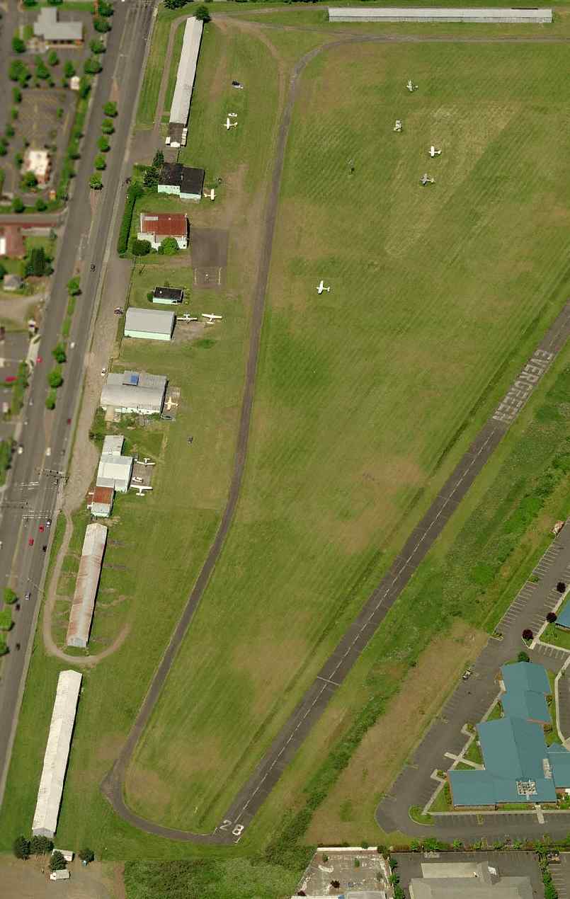
A circa 2006 aerial view looking west at Evergreen Field,
showing 10 single-engine aircraft parked on the field.
According to Charles Luce, “As Vancouver & Camus grew towards each other,
Mill Plain boomed with big box stores & housing developments.
Evergreen survived only as long as Wally Olson owned it.
After he died, the Olson Family claimed it could no longer afford to keep the airport open,
which sounds plausible considering what insurance & taxes must have become.
Of course, I'm also sure they made a boodle selling this prime lot on Mill Plain.”
Evergreen Field was scheduled to close on 7/18/06.
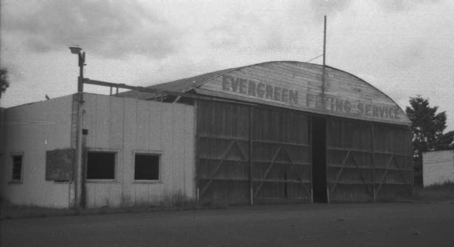
A 2007 photo by Joseph Kumanchik of the front of the Evergreen Flying Service hangar,
taken while “while the developers were waiting for plan approvals & proceeded with the demo[lition] work.”
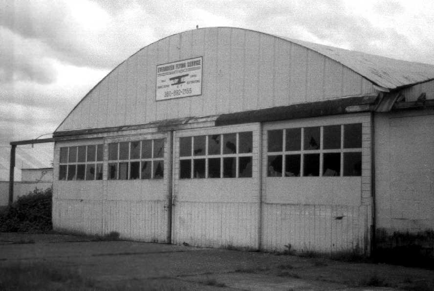
A 2007 photo by Joseph Kumanchik of the rear of the Evergreen Flying Service hangar.
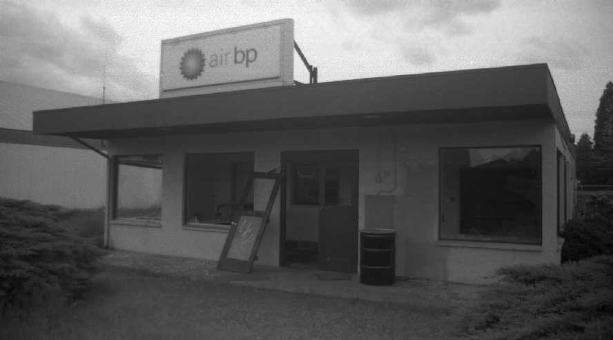
A 2007 photo by Joseph Kumanchik of the Evergreen Flying Service office.
Joseph Kumanchik reported in 2008, “The buildings are all gone now & development has begun.”
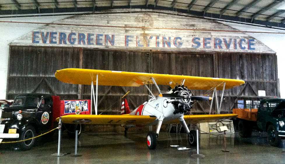
A 2012 photo by Patrick Joyce of the hangar wall bearing the sign “Evergreen Flying Service”,
saved from the wrecking ball & on display in the Western Antique Aeroplane & Automobile Museum.
Thank goodness that someone thought to save this relic of Washington general aviation for posterity.
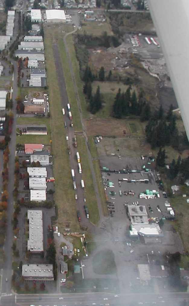
An 11/29/14 photo by Jonathan Westerling, “looking northwest along the remnants of Runway 28” at Evergreen Field.
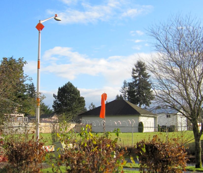
An 11/29/14 photo by Jonathan Westerling: “A windsock & a well-marked streetlight still mark the north end of Runway 16 at Evergreen.”

An 11/29/14 photo by Jonathan Westerling: “A closeup of the remaining hangars along the north/south runway at Evergreen spells out 'RUNWAY CLOSED'.”
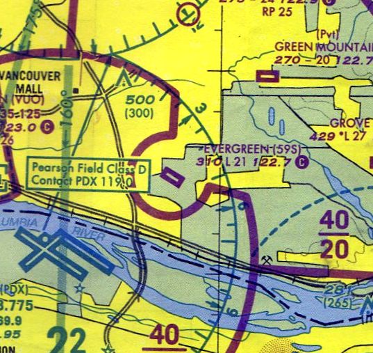
The site of Evergreen Field is located northeast of the intersection of Southeast Mill Plain Boulevard & Southeast 136th Avenue.
____________________________________________________
Scholl's Airport, Vancouver, WA
45.69, -122.545 (North of Portland, OR)
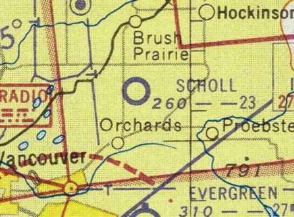
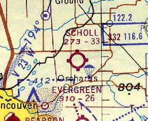
Scholl Airport, as depicted on the September 1954 Portland Sectional Chart (courtesy of Chris Kennedy).
This general aviation airport was apparently opened at some point between 1948-54,
as it was not depicted on the October 1948 Portland Sectional Chart (according to Chris Kennedy) or 1954 USGS topo map.
The earliest depiction of Scholl Airport which has been located
was on the September 1954 Portland Sectional Chart (courtesy of Chris Kennedy).
It depicted Scholl as having a 2,300' unpaved runway.
Jeannie Yanko recalled, “I have so many wonderful memories of visiting my Uncle, Neil Scholl,
who had his home & airfield there when I visited beginning in the 1950s as a child.
He was always my favorite relative & I cherished the times my family visited him.
I used to wander all over that place and I even remember a turkey farm next door
where I got a great electric shock from the fence trying to get to them.”

The earliest topo map depiction of Scholl Airport which has been located was on the 1954 USGS topo map.
It depicted Scholl as having a single east/west unpaved runway, with several buildings along the northwest & southwest sides.
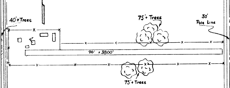
The 1963 WA Airport Directory (courtesy of Ron Dupas)
depicted Scholl's Airport as having a single 3,800' turf east/west runway.
Five buildings (hangars?) were depicted on the northwest corner of the field.
The July 1969 Portland Sectional Chart (courtesy of Chris Kennedy)
depicted "Scholl" as having a 3,300' unpaved runway.
An aerial view looking north at Scholl's Airport,
from the 1971 WA Airport directory (courtesy of Chris Kennedy).
At least 7 light aircraft are visible on the west end of the field.
The 1971 WA Airport directory (courtesy of Chris Kennedy)
depicted Scholl's Airport as having a single 3,300' turf Runway 7/25.
Several buildings or hangars were clustered around the west end of the runway,
and a total of 7 light single-engine aircraft were visible on the field.
The manager was listed as Elvin Pluckett.
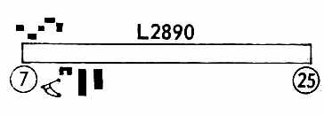
The 1972 Flight Guide (courtesy of Chris Kennedy) depicted Scholl's Airport as having a single 2,890' Runway 7/25.
Skydiving was listed as being conducted from the field.
Scholl's Airport was still listed as an active airfield in the 1976 AOPA Airport Directory (according to Chris Kennedy).
The last photo which has been located showing Scholl's Airport still open was a 7/14/90 USGS aerial view looking northeast,
showing a dozen single-engine aircraft parked on the west side of the field.
Nearby resident Paul Feddema reported, "The airfield itself was fully functioning until 1992-93
when a new housing development went in on the east side of the airfield, across 130th Avenue (on the [east] side, going north & south)."
The former runway was no longer depicted on the 1995 USGS topo map
(although the former airfield buildings were still depicted).
A 2000 USGS aerial photo showed the runway to remain intact at the site of Scholl's Airport,
with at least one closed-runway "X" symbol still visible in the middle of the runway.
The 2002 USGS aerial photo showed the site of Scholl's Airport to be unchanged from that depicted 2 years earlier,
with at least one closed-runway "X" symbol still visible in the middle of the runway.
Nearby resident Paul Feddema reported in 2004,
"The building to the southeast of the strip is a Minit-Mart,
the building immediately to the southwest of that is the former Airport Inn
with connecting hangar to the northeast of it where fuel, flight lessons, and skydiving were all advertised.
The hangar no longer connects through the building & is a distribution point for some kind of plumbing supply place.
The Airport Inn itself was even renamed, when the strip closed, as Rumors.
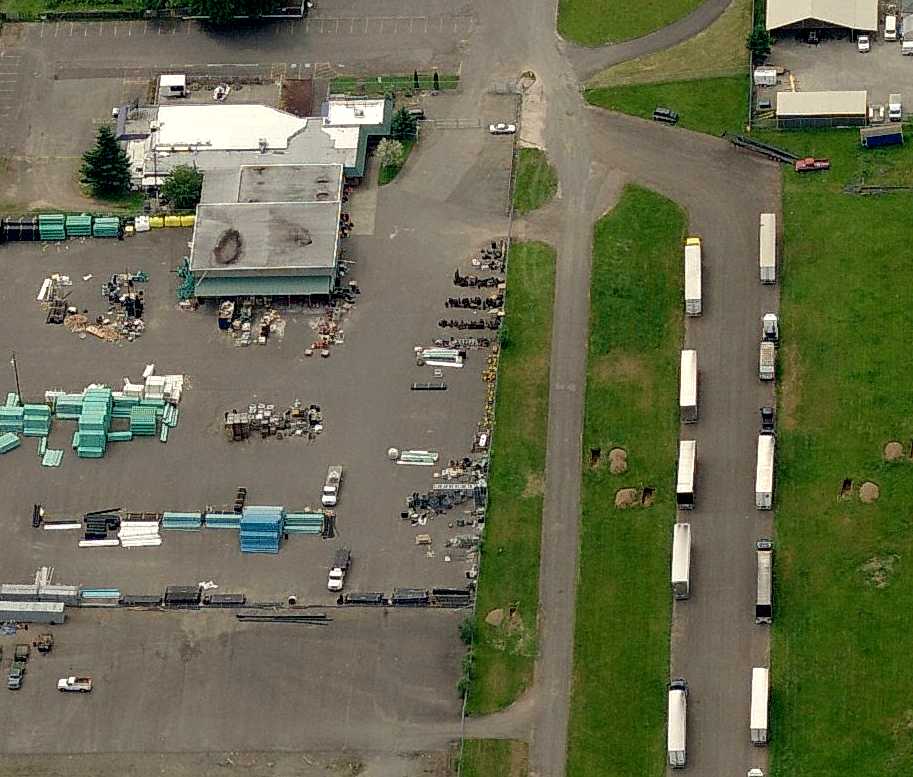
The strip itself functions as an access road for several businesses
that bought up the hangar space cheap & converted for their own uses.
Until a few years ago, and maybe even still,
the houses to the north of the airfield had their own private hangars
and I know of one that had a medium sized, all aluminum twin engine plane rotting in the backyard next to the former hangar.
It was weird considering the airfield had been closed for at least ten years by then."
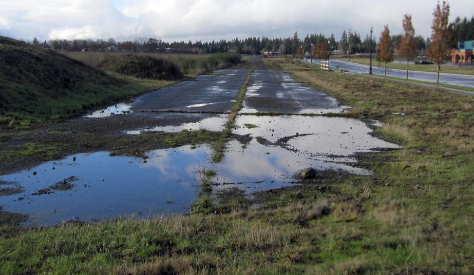
A 2005 aerial photo by Collin Gyenes looking east at the former runway of Scholl's Airport.
A circa 2007 aerial view looking west at the west end of the former runway of Scholl's Airport & the former hangar.
The site of Scholl's Airport is located southeast of the intersection of Northeast 117th Avenue & Northeast 95th Street.
____________________________________________________
Ocean Shores Airport / Corning Field (S26), Ocean Shores, WA
47.005, -124.164 (Southwest of Seattle, WA)
Ocean Shores Airport, as depicted in the 1963 WA Airport Directory (courtesy of Ron Dupas).
This former general aviation airport was located on a narrow peninsula along the Pacific Coast,
within a very small plot of land within the town of Ocean Shores.
The date of construction of Ocean Shores Municipal is unknown.
It may have been established at some point between 1962-63,
as it was not depicted on the 1955 USGS topo map nor listed among active airfields in the 1962 AOPA Airport Directory.
The earliest reference to the field which has been located
was in the 1963 WA Airport Directory (courtesy of Ron Dupas).
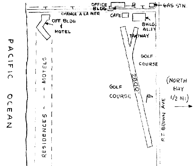
It depicted Ocean Shores Airport as having a single 2,800' oiled northwest/southeast runway.
A bowling alley & a café were depicted immediately adjacent to the north end of the runway,
but there were no hangars depicted.
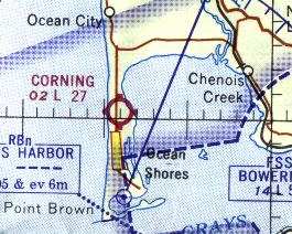
At some point between 1963-67, Ocean Shores Airport was apparently renamed to Corning Field,
as that is how it was labeled on the 1967 Seattle Sectional Chart (courtesy of John Voss).
The Aerodromes table on the Sectional described Corning as having a single 2,700' gravel runway.
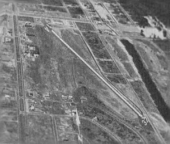
An aerial view looking north at Corning Field,
from the 1971 WA Airport directory (courtesy of Chris Kennedy).
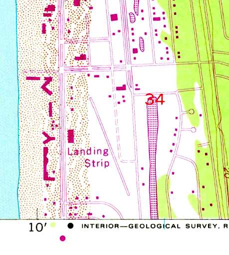
The 1973 USGS too map depicted Corning Field as having a single northwest/southeast runway, labeled simply as “Landing Strip”.
At some point between 1971-82, Corning Field was renamed to Ocean Shores Municipal Airport,
as that is how it was listed in the 1982 AOPA Airport Directory (courtesy of Ed Drury).
It was described as having a single 2,050' asphalt Runway 14/32,
and the operator was listed as Oceanaire.
The last photo which has been located of Ocean Shores Airport was an 8/4/83 aerial view.
It depicted the field as having an asphalt Runway 14/32, with 4 light aircraft parked among several small buildings on the north side of the field.
Karl Brohan “I have an interesting story about landing a CH-47A Chinook at Ocean Shores Airport in 1985.
It was a nice summer drill weekend in 1985. The C.O. of the 92nd Transportation Company, Medium Helicopter, based at Paine Field, wanted all available crews out flying.
We had to use up our fuel allotment or it would be reduced the following year. I was the Pilot In Command & I chose Lt. Jackie Reeves as my copilot.
We headed out to Ocean Shores on a magnificent sunny day. There was little wind as we made our approach & landing to the field which was very close to a golf course.
The parking checklist was in progress when the crew chief noticed a parent holding up a child so he could touch a slow moving rotor blade as it wound down!
The crew chief jumped out & directed the parent & the crowd forming around the aircraft to move back until the rotors had stopped.
Myself & the crew had lunch & returned to the aircraft about 45 minutes later to find the same crowd had set up lawn chairs under the rotors so they could watch the takeoff.
I explained that everyone must move away from the aircraft because of the danger from the rotors & possible flying debris from the rotors downwash.
The spectators moved back about 40' & wouldn’t budge any further.
We started up & decided a vertical takeoff was the safest departure so we wouldn’t fly directly over any people.
I pulled pitch with a slow turning vertical departure. The crew chief advised that the spectators in the lawn chairs were blown across the lawn!
I didn’t get to see that since I was scanning the area for other aircraft.”
Bob Bernsetin recalled, "I happen to have flown Skyhawks
during the period when Ocean Shores Municipal was still located in its original location."
He reported that in its later years, Ocean Shores Municipal Airport coexisted in close proximity with a golf course.
"In 1986, my last flight to Ocean Shores Municipal, the golf course was in operation already.
You landed amidst golfers whacking away.
Landing wasn't as much an issue as you might expect because the strip was at right angles to the coast
making the strong prevailing winds off the ocean the primary concern in my mind.
It would blow so hard as to make landings impossible on several attempts.
Finally making it in, the golfers were in my mind only as an afterthought.
Takeoff, on the other hand, was an entirely different matter.
I remember just at the point of roll crossing my fingers,
with a brief imagined moment of the golf ball striking my prop halfway down the runway.
Of course it didn't happen, and my trip home to Boeing field was as joyful as the rest of my flying career."
The location of this airfield, within the town of Ocean Shores,
was apparently the reason why it was replaced in 1986
by a new Ocean Shores Municipal Airport located at a less constrained site two miles to the northeast.
Bob Bernsetin recalled, "Imagine my surprise on a later vacation trip to Ocean Shores.
On a lark, I decided to visit the airport again, and only found a golf course!
I kept ignoring signs to the airport, that were obviously a mistake,
as I knew the airport had to be 'right here'!
Finally I went over to the new airport & saw it was indeed in a different place than I remembered.
I started to really wonder until I found evidence on the Internet of the decision to move the airport,
apparently very soon after I flew there."
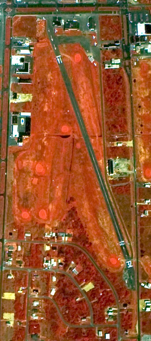
By the time of the 1990 USGS aerial photo, the former airport had been completely replaced by a golf course,
but the former runway outline (oriented northwest/southeast) was still recognizable.
The airport site is bounded by Ocean Shores Boulevard on the west, Chance A La Mer on the north,
Minard Avenue on the east, and Ensign Avenue on the south.
Thanks to Glenn Powell for pointing out Ocean Shores Airport.
____________________________________________________
Since this site was first put on the web in 1999, its popularity has grown tremendously.
That has caused it to often exceed bandwidth limitations
set by the company which I pay to host it on the web.
If the total quantity of material on this site is to continue to grow,
it will require ever-increasing funding to pay its expenses.
Therefore, I request financial contributions from site visitors,
to help defray the increasing costs of the site
and ensure that it continues to be available & to grow.
What would you pay for a good aviation magazine, or a good aviation book?
Please consider a donation of an equivalent amount, at the least.
This site is not supported by commercial advertising –
it is purely supported by donations.
If you enjoy the site, and would like to make a financial contribution,
you
may use a credit card via
![]() ,
using one of 2 methods:
,
using one of 2 methods:
To make a one-time donation of an amount of your choice:
Or you can sign up for a $10 monthly subscription to help support the site on an ongoing basis:
Or if you prefer to contact me directly concerning a contribution (for a mailing address to send a check),
please contact me at: paulandterryfreeman@gmail.com
If you enjoy this web site, please support it with a financial contribution.
please contact me at: paulandterryfreeman@gmail.com
If you enjoy this web site, please support it with a financial contribution.
____________________________________________________
This site covers airfields in all 50 states.