THE TAXING STONE OF CORSENCON
NEW CUMNOCK
© Robert Guthrie


The Acts of William I
'Grants his firm peace to all merchants coming to buy and sell at the burgh of Ayr and commands that toll and custom due to the burgh shall be given and received at Maich, Karnebuth, Loudon, Corsencon and Laicht. No toll or customs belonging to the burgh is to be taken outwith these marches'
Lanark 21 May, 1203 x 1207,
probably 1205.
'Precipio etiam firmitier ut apud Mach . et Karnebuth' . et Lowdun' . et Crosenecon . et Lachtalpin. Tolneium et alie consuetudines que Burgo debentur. dentur et recipiantur. '
The Acts of William I,
Edited by G. W. S. Barrow


The Royal Burgh of Ayr
In the closing decade of the 12th century, William the Lion, King of Scots built his royal castle at Ayr in the bailiery of Kyle, on the south bank of the River Ayr, near the river mouth. In the opening decade of the 13th century he established a royal burgh here, in order to develop overseas trade, and much needed revenue. The majority of burghs in Scotland at this time were situated in the east, on the North Sea coast line, providing lucrative trade links with continental Europe. Ayr, as the first royal burgh on the west coast, faced different challenges but trade soon developed particularly with nearby Ireland , France, and to a lesser degree with the Baltic countries.
The royal burgh not only sat at the mouth of the River Ayr, but also at the junction of the principal route from the south to the west coast, i.e.from the royal burgh of Dumfries through Nithsdale to New Cumnock and then on to Ayr; and the route north, i.e. taking in the Kyle Stewart burgh of Prestwick and Cuninghame burgh of Irvine, both of which would later attain royal burgh status.
Tofts, or homesteads, comprising six acres of land within the royal burgh were offered to new settlers, at an annual rent of twelvepence. Privileges for these new burgesses included weekly Saturday markets and freedom to trade without interference. Merchants visiting the markets to buy local goods such as wool, cloth, hides and cured fish or to sell their own wares, were guaranteed a safe conduct under a royal seal of approval. The royal burgh also enjoyed privileges within the broader trading precinct of the newly constituted sheriffdom of Ayr, created by William the Lion, through the amalgamation of the bailieries of Cuninghame, Kyle ( i.e. Kyle Stewart and King's Kyle) and Carrick.

Taxing Stone, Lachtalpen
The place-name Lachtalpen, or Lacht-Alpin, comprises the Gaelic element leac 'grave-stone' and the personal name Alpin, and is said to mark the burial place of a chief called Alpin, possibly the father of Kenneth MacAlpin, King of Scots. One tradition, explains that in 841, Alpin ransacked or 'entirely destroyed and devastated', Galloway, only to meet his death at the hands of a single man. He was buried where he fell, the spot being marked by an ancient standing stone. The place-name Lachtalpen has now disappeared from modern-days maps, but on the lands of Little Laight, stands the Taxing Stone, a half-mile or so, south of the Ayrshire-Wigtonshire border, formed by the Galloway burn, formerly known as March burn. It is not clear when this ancient monolith was re-named as the Taxing Stone, but it probably served this purpose from the time of the formation of the sheriffdom of Ayr, if not beforehand .Sir Herbert Maxwell, the renowned authority on Galloway place-names explains 'it is believed that a toll used to be levied here on goods or cattle passing from one district to the other'.
Lachtalpin Taxing Stone
Daphne Brooke
'Wild Men and Holy Places'
(Photo: Wigton District Museum Service)
More recently Thorbjorn Campbell, in his excellent new historical guide to Ayrshire, uses the Laight Taxing Stone to illustrate the privileges that the royal burgh at Ayr enjoyed 'Anybody taking goods out of the burgh's trading precinct had to pay a toll twice e.g. at the Little Laight Taxing Stone - once on leaving a trading precinct and again on entering another.'
On assessing the other toll and customs posts recorded in Ayr burgh charter of 1205, Thorbjorn Campbell considers that Crosencone (Krosenkone) may have been Kyle Castle, which once stood at the meeting place of the Geult Water with Glenmuir Water, in the parish of Auchinleck. An ideal location, he suggests for monitoring access to the north-west from Nithsdale, standing as it does in the shadow of Threeshire Hill (i.e. meeting point of Ayrshire-Lanarkshire-Dumfriesshire), adjacent to Corsencon hill. Earliest records of Kyle Castle, suggest it was erected in the l5th century, albeit perhaps on the site of a fortification of greater antiquity. It is 3 miles to the north-west of Corsencon hill and what would have been the march between the sheriffdoms of Ayr and Dumfries, and some 5 miles to the west of Threeshire Hill. Not wholly convinced by his suggestion of Kyle Castle, Thorjborn offers Black Bog Castle, the fictitious name given to Cumnock Castle (New Cumnock) as a possible alternative. Both suggestions seem to overlook the clarity given in the charter, i.e. that Crosenecon is a reference to Corsencon hill, situated in what is now the parish of New Cumnock.
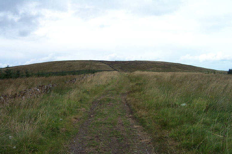
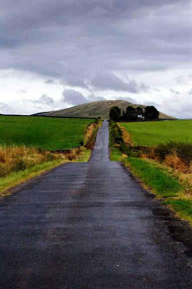
Corsencon Hill
Corsencon hill, a prominent landmark in the parish of New Cumnock is situated on the north bank of the River Nith, close to the boundary with the parish of Kirkconnel in Dumfriesshire. An early form of the name, Corswinton (Gaelic cor 'rounded hill', Old English 'swin-tun') suggest an early Anglian settlement, reinforced with the discovery of fragments of a 9th century Anglian cross on the lands of nearby Mansfield (formerly Garif). This settlement was probably situated close to the ancient route through Nithsdale, possibly a Roman Road, since 'a n ancient road with Roman characteristics has been traced continuously from the banks of the Garclaugh Burn, E of Street to the banks of the Hall Burn at Mounthope' [RCAHMS].
Unlike the modern-day road, the principal route from Kirkconnel, 8 miles to the east was on the north bank of the River Nith. Four miles downstream from Corsencon t he route passed a Roman post, close to the farm of Buttknowe [RCAHMS] , before heading north pass the farm of Lagrae to begin the climb round the back (north-face) of Corsencon hill. Here it may have joined another track coming in from Lanarkshire through the great woodland. Or perhaps the land between the southern-slopes of Corsencon and the River Nith was unsuitable for a road at that time. Studies of aerial photographs suggest a possible site of a Roman fort at Corsencon. [ ]
A reference to the road at Corsencon, contemporary with the creation of the toll and customs point is found in Blind Harry's 'The Wallace' ,
'At Corssencon the gait was spilt that tide,
forthi that way behovid thaim for to ride.'
Harry relates how the gait (road) was spilt (destroyed) necessitating Wallace and men to take a detour through Avondale, instead of the usual route.
Note : There was also probably another track on the south bank of the River Nith as witnessed by the discovery of the fragments of a later 10th century cross, of Scandinavian influence, on the lands of Over Cairn, across the river valley from Corsencon. Cairns and crosses were often used to mark boundaries on ancient routes, and the Cairn Cross surely marked the boundary between the ancient province of Kyle and the lands of Nithsdale.

To DUMFRIES
To LANARK
To AYR
The Taxing Stone of Corsencon
On searching along the single track road from Glen to the Craigdullyeart Limeworks ('Corsencon Caves') I found an old upright stone at the junction of this road with the track going west to Craigdullyeart Hill. The stone was being used as fence post with a small square hole cut into it, to secure the fence. Further searching failed to reveal a neighbour on the other side of the track, i.e. a possible gate post. The stone may well have been placed here at the time the track to Craigdullyeart hill was laid, but surely it was not moved too far from its original position, in the vicinity of Corsencon.
The stone is heavily marked but not in a way that could be interpreted as intricate carving, such as that found on ancient crosses. Could it be the remnants of a plain cross-shaft, with the cross-head lost in the adjacent moss? Or did this stone (recumbant or standing ) once mark the site of an ancient grave like that at Lacht-Alpin?
Or was it raised to mark the toll and customs post at Corsencon, as decreed in t he charter of William I, granted to the burgh of Ayr in 1205, the Taxing Stone of Corsencon


Sources :
G. W. S. Barrow (Editor) 'Regesta Regum Scottorum II , The Acts of William I, King of Scots (1165-1214). Edinburgh University Press , 1971
W. J. Watson 'The Celtic Place-Names of Scotland'. Birlinn Limited (1993)
John Strawhorn 'Ayrshire, The Story of a County', AANHS (1975)
Thorbjorn Campbell 'Ayrshire, A Historical Guide', Birlinn Limited (2003)
Sir Herbert Maxwell 'The Place-Names of Galloway, Castlepoint Press (2001)
Daphne Brook 'Wild Men and Holy Places', Canongate Press (1994)
Royal Commission on the Ancient and Historical Monuments of Scotland (RCAHMS)
Allan Wilson 'Roman Penetration in West Dumfries and Galloway : A Field Survey'
Transactions of Dumfriesshire and Galloway Natural History and Antiquarian Society,
Series III, Vol.64.
Ann McKim (Editor) 'The Wallace, Blind Harry', Cannongate Classics , 2003
Johan Blaeu, Atlus Novus (1654), Coila Provincia
The linear Mansfield road from New Cumnock to Corsencon hill