Connecticut History
Connecticut:
The Constitution State Atlas ![]()
Connecticut
History ![]()
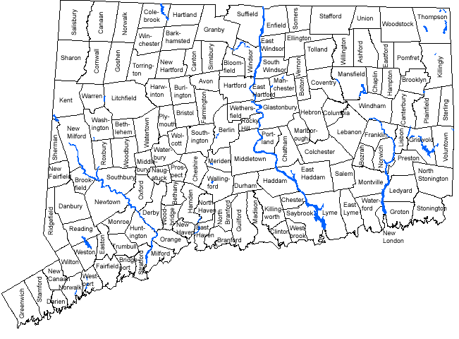
On the map below, Connecticut is represented by 145 towns, twenty-four towns less than today. Since 1847 many towns have split, forming new towns. Some have adjusted borders and have crept along this state. For instance, Danbury split and town of Bethel was born, Ridgefield lost a chunk of its northern end to Danbury, which now reaches the New York border. Other towns such as Huntington and Chatham are lost, their replacements are Shelton and East Hampton. To look back earlier than 1847, one would find less towns covering the surface. The town of Westbrook was once part of Saybrook, East Lyme part of Lyme, and Killingworth and Clinton were settled as Hammonasset.
Nutmeggers have a strong desire for their own identity, explaining why many Connecticut towns split while western state counterparts absorb into each other.
Sources:
UCONN MAGIC 1997
Fox & Co. Highways and Byways of Connecticut 1947
Connecticut History ![]()