|
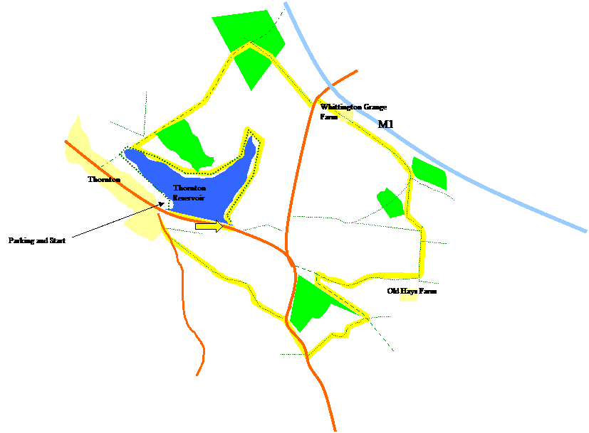
Starting from the car park at the west end of the dam, walk East across the
dam. Just after the end of the dam, turn left, and walk along the path
around the outside of the reservoir. At the second “point” of the reservoir
turn left onto the Leicestershire Round footpath. Follow the Leicestershire
Round signs, going straight on, along th edge of the woodland. Cross over a
brook, and walk into a wood. In the middle of the wood, at a cross-path,
turn right. Walk along this path until you reach the road. Here, turn left,
cross over, and then turn right along a track to Whittington Grange Farm.
Follow
the path through the farm, and walk parallel to the M1 until the corner of
the wood. Turn right, then cross over a brook and keep right at this
junction. Walk along this path, keeping the field boundary on your right,
crossing into the next field, and aiming along the left of the woods. Cross
another field boundary, and walk diagonally left to a cluster of buildings,
bending round to the right again. Walk straight on this footpath (don’t turn
left or right) aiming for Old Hays Farm.
Just
before the farm, at the end of the path, turn left, walking across fields,
crossing a brook, and eventually reaching a track. Turn left along this
track, doubling back on yourself, keeping he woods on your right.
At the
end of the woods, turn right, across a golf course. Follow the path to the
road. Turn right and walk along the road taking a footpath off to the left
along the side of Heather Close Farm. Keep on this path, past Busky farm,
reaching Merrylees Road. Turn right onto this road, walking back to
Thornton. Turn right at the end, and return to the car park.
|