| Junction 20 is at the south end of the Kingston Bridge.
It was originally designed as a triangular junction, connecting the
west flank and the south flank of the Inner Ring Road with the Renfrew
Motorway, but was only part completed.
These photos were taken in May 2003 when the West Street On-ramp was
closed for works on the bridge. |
|
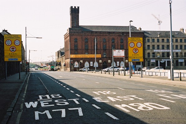 |
Looking west along Cook Street towards the M8 access at J20.
The large yellow signs indicate traffic prohibited from the Clyde
Tunnel - including the rare No Explosives sign. Normally this
traffic is diverted over the Kingston Bridge, but since this access is now
closed, it has to follow an alternate diversion route through the City
Centre instead.
|
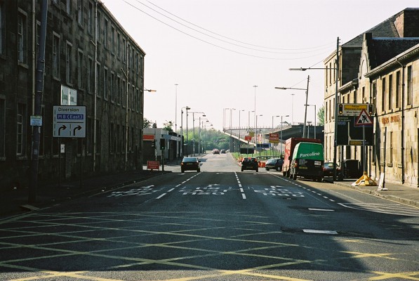 |
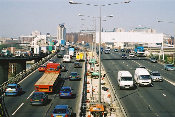
Cook Street approaching the junction. Normally there are two lanes
straight on for M8 West, but for the duration of the works, the lane
markings have been changed, and two lanes instead turn right. |
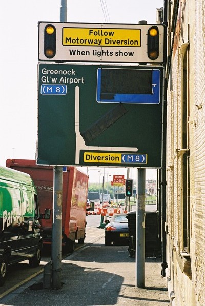 |
Diversion lights active! The normal signposting to the motorway
entry has been taped over. |
 |
The junction of West Street and , with the motorway access coned off. |
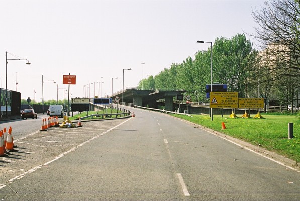 |
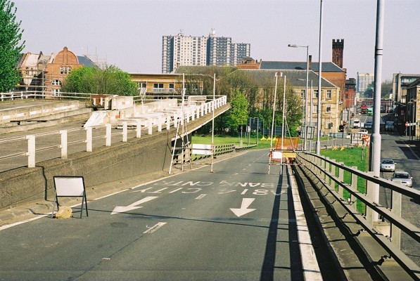
Start of the West Street on-ramp, showing altered signposting for the
works. The motorway signs have been taped over. Works
access is the gap in the cones at left. |
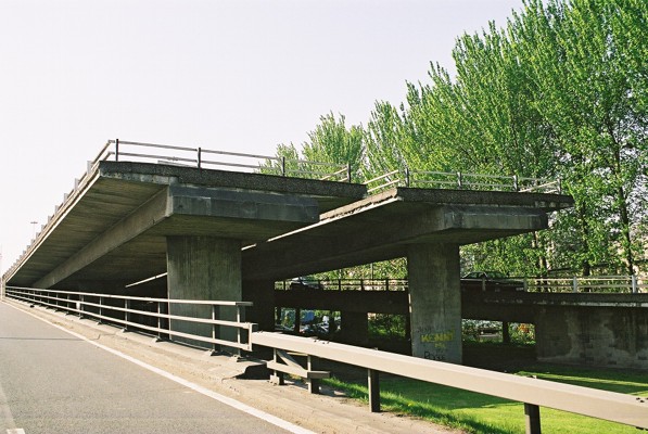 |
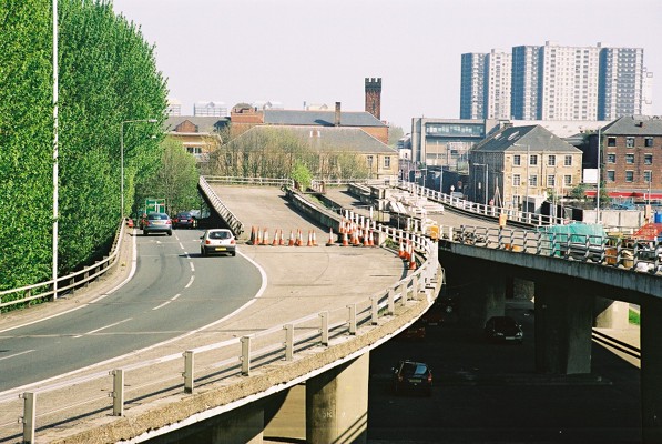
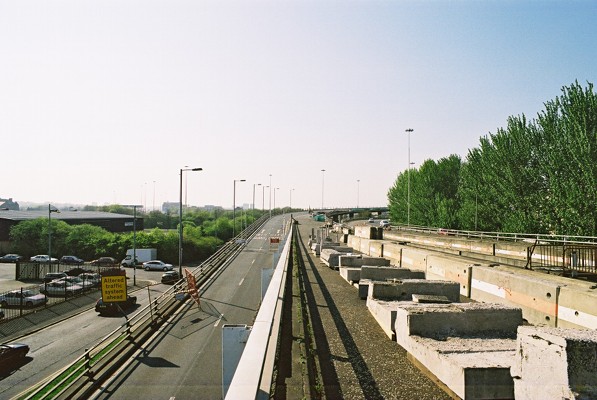
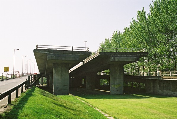
The most notable feature of J20 is this pair of ghost ramps rising out
to the east. |
 |
View up the West Street on-ramp.
There's normally no access from here to the M8 motorway proper - only
to the J19 exit for the A814 Clydeside Expressway and the J18 exit to the
A804 and the City Centre.
Lane 2 across the bridge was closed in the 1990s to allow works at J20
and to reduce loading on the bridge structure. The improvement in
traffic flow was such that the closure was made permanant once the works
were completed. There's now a steel barrier between lanes 2 and 3
right across the bridge.
The small sign at the right is a 10 mph speed limit for the works. |
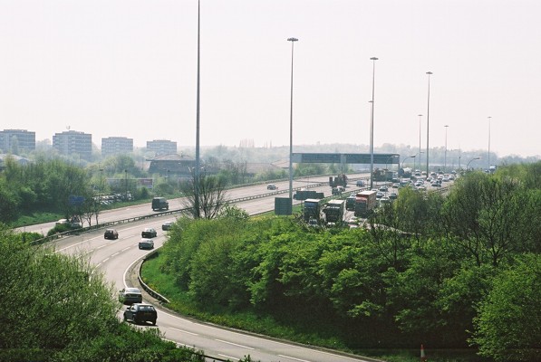 |
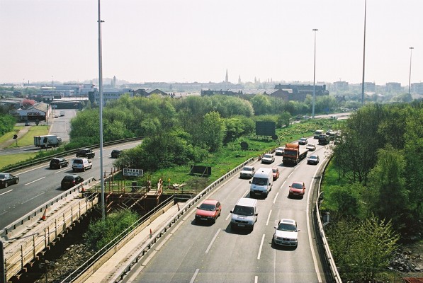
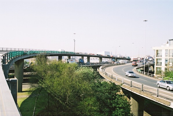
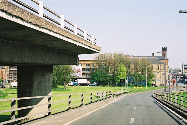
View west, with the southbound carriageway from the bridge in the
foreground being joined by the outer carriageway at J21. The trucks
are on the inner eastbound carriageway heading towards the bridge. |
 |
The separation of the motorway carriageways in the foreground was to
allow for the eastbound access from the Renfrew Motorway to the south
flank of the Inner Ring Road. |
 |
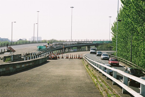
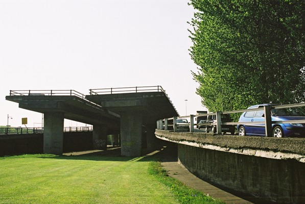
Looking S from the West Street On-ramp. Replacement of the bridge
parapets includes the approach ramps. |
 |
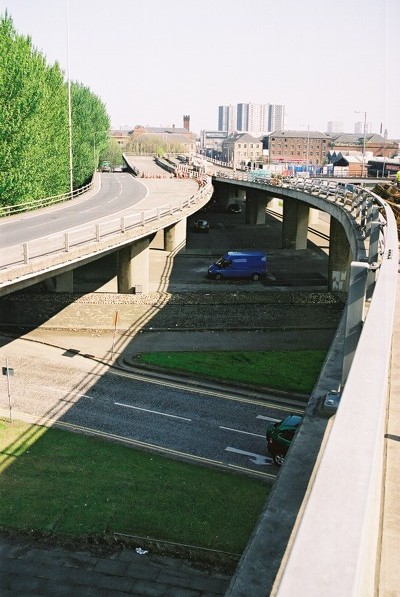
The view north along the Kingston Bridge, with the J20 West Street
on-ramp descending to join the motorway on the left, and the West Street
off-ramp as a double lane-drop at far right. |
 |
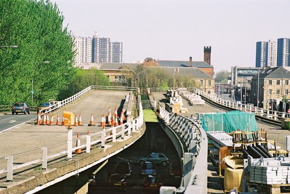
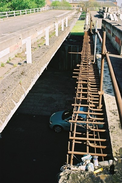
View down the ramp to the bridge.
The works in progress involve replacing the reinforced parapet, hence
the two large white steel structures cantilevered out around the edge of
the structure. The sliproad itself is being used as a car park, and
fabrication yard for the new steel reinforcing.
Works are expected to take 12-18 months for this side of the bridge,
followed by the same on the southbound side.
|
 |
Looking East from the on-ramp. |
 |
The 'ski-jump' ramps, with the proposed route of the south flank of the
Inner Ring Road beyond. |
 |
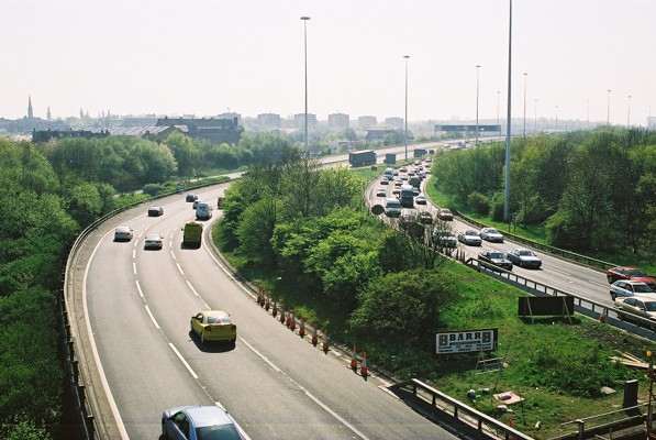
Looking east, showing gap between carriageways and surface streets
below. Again the broad gap between the carriageways would have
allowed the other eastbound carriageway to cross right over the top and
descend to join the rising motorway |
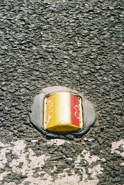 |
Typical reflector stud on the ramp. This is on the right side of
the carriageway, with amber, and red for wrong-way traffic. |
 |
Looking NE at J20, with the on-ramp sweeping over the mainline. |
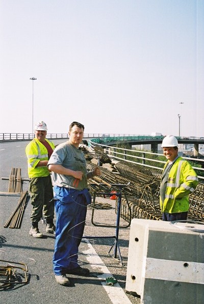 |
Workmen preparing the steel reinforcing for the new bridge
parapet. (Don't show this one to HSE!) |
 |
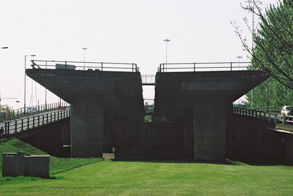
The end of the road!
The carriageways here would have been joined on either side by
carriageways from the Renfrew Motorway. |
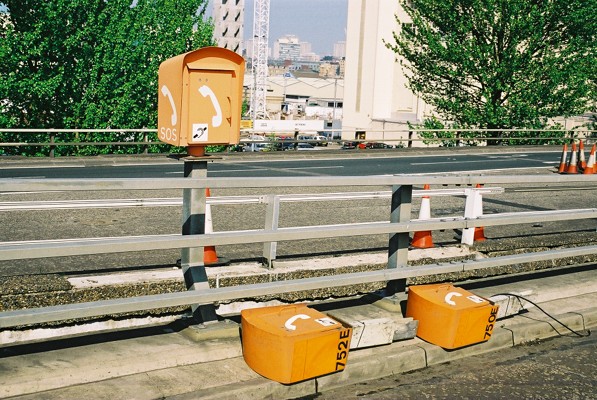 |
Emergency telephone, with two more displaced during the
works. |
 |
The new mounting is on an angled post behind the barrier; the original
mounting was an integral part of the barrier. |
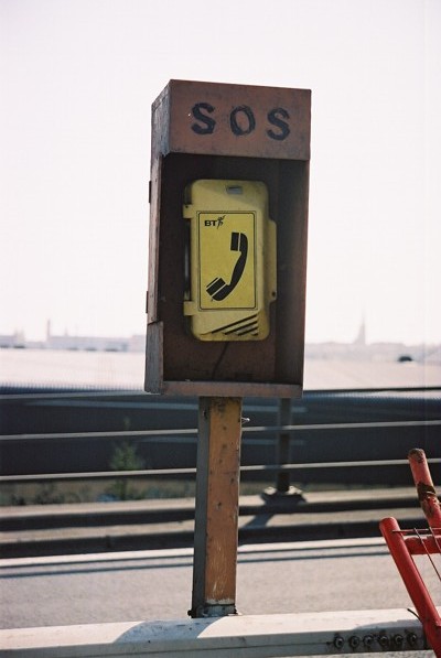 |
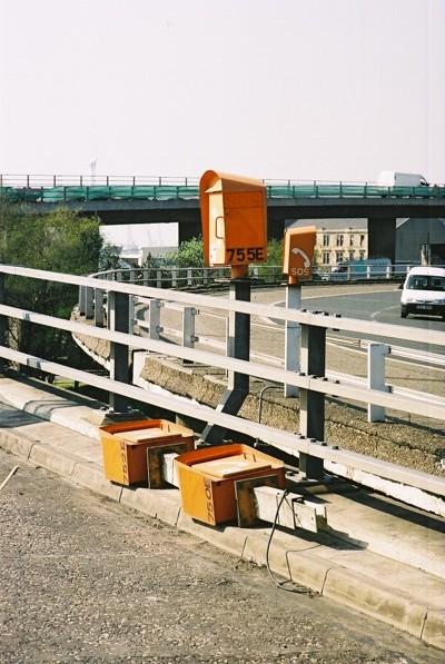
Alternative style telephone on the ghost ramp. This one looks
older considerably older than the others, although the BT logo suggests
that it was still in use until recently. |
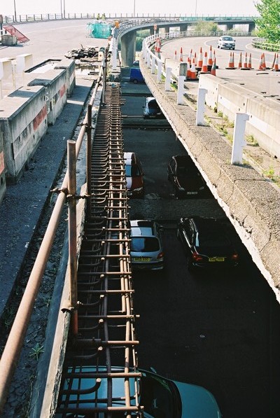 |
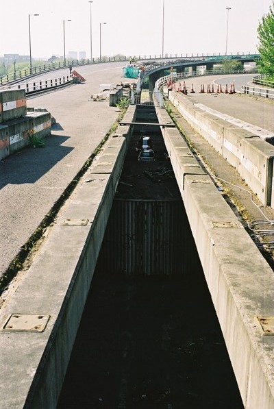
The unused ramps from J20 were used as a site for investigation into the
bridge parapet structure and possible replacements. On the right
side is an original section, showing the cracked lower corner. To
the left is a section which has been partially replaced.
In the middle distance at left is an area of bridge deck that has been
excavated to check problems with drainage.
|
 |
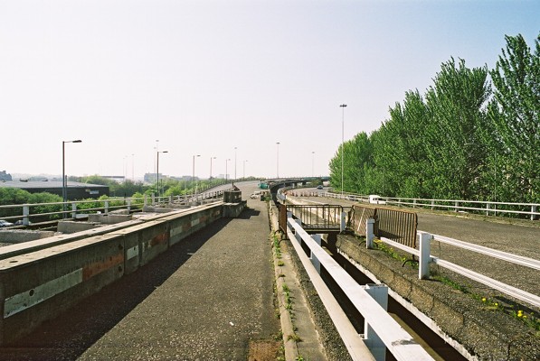
View east from the end of the 'ski-jump'. The buildings directly
opposite would have been demolished had the south flank of the Inner Ring
Road been built.
The splay on the slip roads would have allowed the carriageways from
the Renfrew Motorway to close in with the extended carriageways from the
Kingston Bridge.
The M74 extension will terminate on the M8 just to the south of this
point, and will not connect with the incomplete J20.
|
 |
View west from the end of the ramps.. |
 |
View west from the SE corner of the ramp.
The area is used for storage of sections of the bridge edge. |
 |
View west from the NE corner of the ramp. Two lanes of traffic
descending to West Street. |
 |
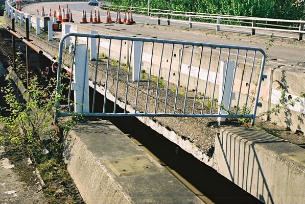
Trial section of new parapet. Barriers have been installed, but
subsequently removed. |
 |
New parapet, with an older section for comparison. |
 |
|
 |
View down the West Street on-ramp and along Cook Street. |
 |
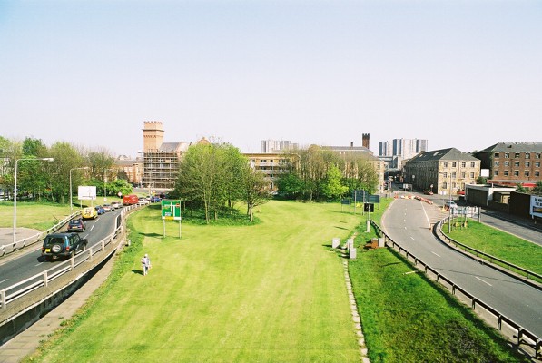
The end of the road for the Glasgow Inner Ring Road, looking through to
the buildings which would have been demolished had it been completed.
The Comprehensive Development Area, which allowed the M8 to be built in
the first place, ended at West Street. The neighbourhood beyond was
considered suitable for piecemeal redevelopment. The older buildings
are now considered a valuable part of Glasgow's architectural heritage,
and demolition would now be completely impractical.
|
 |
End of the ramps, showing the barriers continued across the end. |
 |
I doubt that the engineers who designed and built the ramps would have
expected that they'd need renovation before extension. |
 |
Traffic descending to West Street. This is the point that the
eastbound link from the Renfrew Motorway would have crossed over to join
the south flank of the Inner Ring Road. |
 |
|
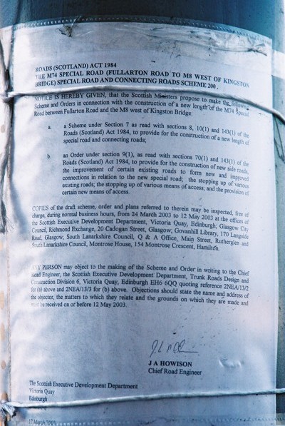 |
A sign of things to come!
Attached to a lamp standard in Cook Street is the official notice of
the M74 extension. Deadline for objections was 12 May 2003 - so it's
too late now! (Objections have been received, but it's not clear
what effect they'll have.)
The two minor parties in the Scottish Parliament - the Scottish Green
Party and the Scottish Socialist Party - are both opposed to the new road
and will attempt to have it cancelled in the Scottish Parliament.
The Executive and the four major parties in the Parliament are in favour
of the project.
|