
![]()
| Enhancements copyright (C) Marcia L. Peters,
all rights reserved |
|
Two Arcologies in a Ruined City |
||||||
|
Plain in East Nilosyrtis Region | |||||
| NASA Catalog: | http://ida.wr.usgs.gov/html/fha005/fha00501.html | |||||
Click on any thumbnail image below to see a high-resolution photograph
| Viking Context Images ~247m/pixel |
Viking Color Context Images |
|
|---|---|---|

|
 |
|
|
This structure is at the rightmost edge of the above Viking context
image,
approximately horizontally in line with the top of the large crater.
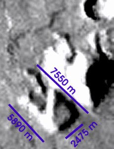
At 1.45 m/pixel x 1024 pixels, the little green rectangle (indicating the location of the MOC image, not shown) is 1484 m across. It occupies 6 pixels of width on the context image; therefore the 1024x1024 context image is about 247 m/ pixel. Here it is magnified 4x with some interpolation. |
| Here are the approximate dimensions: |
|
|
This is really, really big. Not a mansion in the conventional sense. A factory? An arcology? Both? It looks like at least two buildings. Some interesting features that I see:
|
|
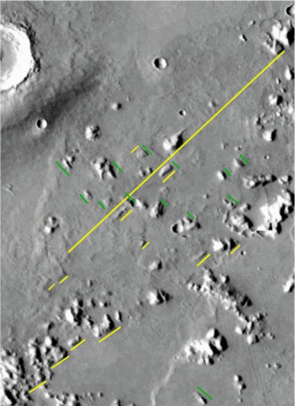
Some grid lines make the consistent
orientation of structures throughout this area more obvious. I think these structures were purposefully aligned.
Quite probably, this was a spread-out area where people lived, worked, and played (i.e., a city). |
