ARADCOM
Detroit - Cleveland
Defense Area
ARADCOM |
|
Detroit - Cleveland Defense Area |
| Unit: | 7/56 - 9/58, Battery A, 351st USA 9/58 - 8/61, Battery A, 68th USA |
| Activation Date: | July 1956 |
| De-activation Date: | 1961 |
| IFC Area: | GPS: +41.40774, -81.60659 |
| Launch Area: | GPS: +41.38778, -81.63271 |
| Radar(s): | LOPAR |
| Missiles: | 30 Ajax |
| Magazine(s): | 1 type B, 2 type C |
| Launchers: | 12 Ajax |
| Current Status: | |
| Comments: |

CL-48 IFC Area as seen in 2000
(Thanks to John Billings)

CL-48 IFC Area as seen in 2006/2007
(Thanks to John Billings)
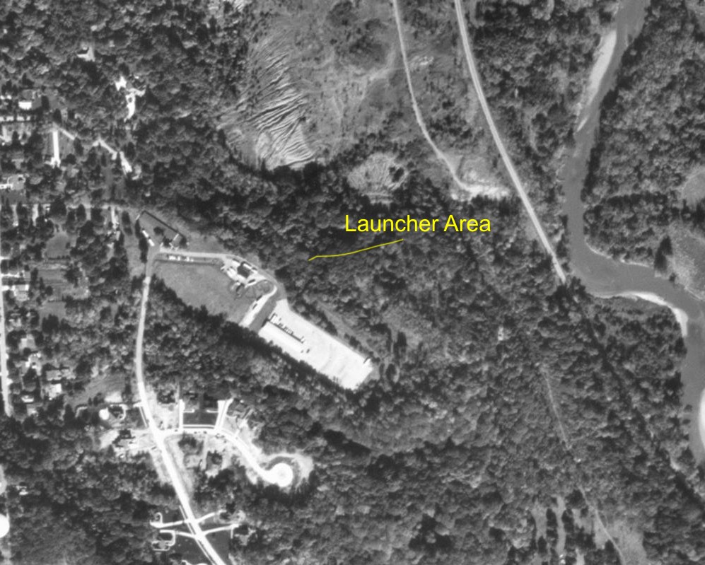
CL-48 Launcher Area as seen in 2000
(Thanks to John Billings)

CL-48 Launcher Area as seen in 2006/2007
(Thanks to John Billings)
Formerly Used Defense Sites Public Geographic Information System
| Property Name: |
NIKE CL-48 - GARFIELD HEIGHTS |
|||||
| Latitude: | 41° 23' 12" N |  |
||||
| Longitude: | 81° 36' 58" W | |||||
| City: | GARFIELD HTS.&INDP | |||||
| County: | CUYAHOGA | |||||
| State: | OH | |||||
| Corps Geographic Office: | Louisville District (LRL) | |||||
| Point of Contact: | LRL Public Affairs Office | |||||
| Public Affairs Office Phone Number: |
502-315-6766 | |||||
| Status on National Priorities List: |
Not Listed | |||||
| EPA Region: | 5 | |||||
| Congressional District: | 10 | |||||
| Restoration Advisory Board Available: |
No | |||||
|
|
||||||
| OPERATIONS AREA: 3 NIKE SILOS; ADMINISTRATION AREA: BLDGS., 2 RADAR TRACKING TOWERS. | ||||||
|
|
||||||
| SITE ACQUIRED JULY 1956. OPERATED AS NIKE DEFENSE FOR CLEVELAND OHIO UNTIL SITE WAS EXCESSED MARCH 1965. | ||||||
| Current Ownership Types(s): City | ||||||
| Cost to Complete (thousands): $18 | ||||||
This page was last updated on
02/15/2014
.
© 1998 - 2022 T. Bateman