
Software for Venera 15/16 Synthetic Aperture Radar mosaics.
Program VeneraView is created for PSPG-00456 CD-WO volume produced by the
Science Digital Data Preservation Task. (Other ID 83-053A-01A)
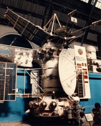
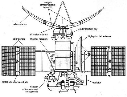
This data set contains radar image mosaics of the surface of Venus obtained by the Synthetic
Aperture Radar (SAR) on the Venera 15 and 16 spacecraft. The Venera data consists of 27 images
(quads) covering the latitude range of 25 degrees north to the north pole; however, two quads,
the 8th and 9th, are not included because they were not available at the time the CD was produced.
The quads cover the area from the north pole down to approximately 30 N latitude.
There are two types of tables that describe each quad in terms of latitude and longitude ranges.
Also, each quad is tiled (subframed) for fast access from the CD-ROM and is accompanied by a
low-resolution un-tiled browse image. The Venera 15/16 photomosaics were processed on the PDS VAX
at JPL using an obselete version of VICAR. Each quad was segmented into 16-20 full resolution
sub-images, each no larger than 1200 samples by 1200 lines. A browse image was also created by
scaling down the full resolution quad by a factor of 4.
This data set is available from National Space Science Data Center (NSSDC).
http://nssdc.gsfc.nasa.gov/
More about this data set at:
http://nssdc.gsfc.nasa.gov/database/MasterCatalog?ds=PSPG-00456
Example 1.
Venera 15/Venera 16 radar images.
Program options
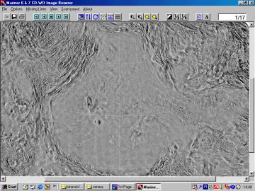
Low-resolution browse image (242 KB)
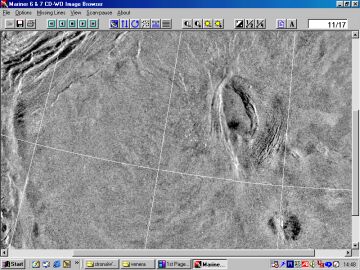
High-resolution image (250 KB)
Buttons

Additional options
Lakshmi Planum.
The higher-resolution imaginery obtained by Veneras 15 and 16 showed that most of the Lahshmi Planum was relatively smooth and higher than the adjacent area. The borders of the plateau are ultimately defined by the high ranges of Akna Montes to the west, Freyja Montes to the north and Maxwell Montes in the east. On Lakshmi's southern margin, a giant scarp called Vesta Rupes was discovered, beetwen 3 and 4 km high, dropping off to the south, and changing orientation part-way along its length.
Venera 15/16 - part of Vesta Rupes (full size 163 KB)
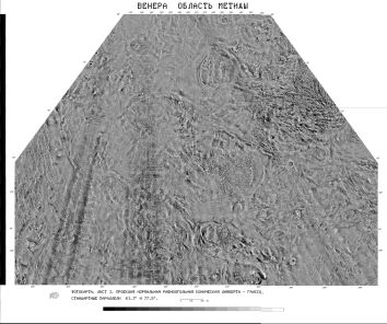
Example 4.
Tethus Regio.
About 150 impact craters were identified on Venus from Venera 15 and 16 radar imagery. From this data Ivanov and Basilevsky estimated an average surface age of 300 to 900 million years. The largest craters are multi-ringed, followed at smaller diameters succesively by structures with double rings, craters with one ring, craters with a central peak, craters having structureless floors and irregular craters.
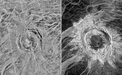
Venera 15/16 - double-ring 100 km diameter crater at Tethus Regio (full size 136 KB)
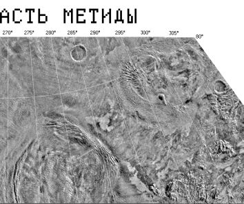
Example 5.
Metida Regio.
Coronas were first identified on Venera 15/16 images, together with related arachnoids, range in diameter from 60 to over 2000 km. Coronae are definied by a concentric structure consisting of an annulus of ridges or fractures, an interior that may be topographically positive or negative, and a peripheral moat or trough. Coronae are unique to Venus, more than 360 have been recorded.
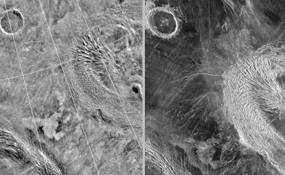
Venera 15/16 - Coronas and impact crater on Metida Regio (full size 133 KB)
Example 6.
Sedna Planitia
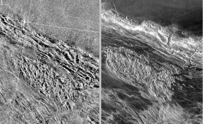
Lowlands, with their darker and smoothers radar signatures, have been likened to lunar maria and interpreted as lava-flooded basins. The image bellow shows a flat plains region composed of many lava flows, south-east of Lakshmi Planum. The radar back-scattering properties of Venus plains vary from very low to high.
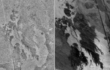
Venera 15/16 - Lava flow fields south of Lakshmi Planum (full size 127 KB)
Cassini Orbiter Image Viewer ( New )
Other Links :
Mariner IV First Flyby of Mars - by JPL engineer William L. Momsen
Venera 9, 10, 13, 14 - digital images of Venus' surface at Don P. Mitchell's site
For questions about this program, please contact:
mailto:piotr.a.masek@pro.onet.pl
Acknowledgements
I would like to thank:
visitors since 2002.10.20