 What's New! Detailed Sitemap All images © by Roberto Piperno, owner of the domain. Write to romapip@quipo.it. Text edited by Rosamie Moore. Page added in June 2011. |
  - Christian communities in Syria: Ezra - Christian communities in Syria: Ezra(God dividing Water from Heaven, fresco by Michelangelo, Sistine Chapel, Rome) Hauran is a region of Syria which is located south of Damascus and which had a period of great prosperity after being annexed to the Roman Empire by Emperor Trajan. A net of canals irrigated its fertile volcanic soil and the region became one of the granaries of the empire; Bosra, the capital of the province, was embellished with a large theatre, baths, colonnaded streets and basilicas, which all were built making use of the black basaltic stone which could be easily quarried because it formed several conical hills.
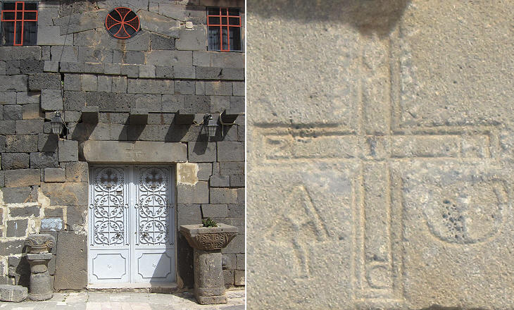
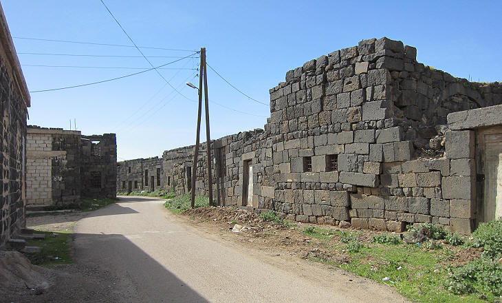
Hauran continued to flourish until the beginning of the VIIth century when first the Sassanids and then the Arabs invaded the region; its economy was badly affected by the collapse of trade and in the following centuries it was almost entirely abandoned. Zorava, a town east of Bosra, today known after the nearby village of Ezra or Izra'a, lost almost all its inhabitants; only a small community of Christians continued to live there and to maintain two churches built in the VIth century.
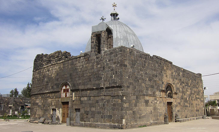
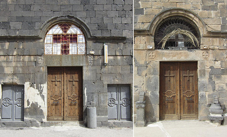
St. George's was built in 515 on the site of a previous temple; a Greek inscription on its western entrance says:The House of Evil was turned into the House of God. Hymns of cherubs replaced sacrifices offered to idols and God settles here in peace, where people used to anger him. The inscription indicates, that although southern Syria housed some of the first Christian communities, the allegiance to the ancient gods persisted well after the decree issued by Emperor Theodosius in 392 which proclaimed the Christian faith the sole religion of the Roman Empire.
St. George is one of the most popular military saints; he is also regarded as a saint and a martyr by Muslims; according to tradition he was born in Palestine and he became a trusted member of the guard of Emperor Diocletian; he was put to death during the 303 persecution ordered by that emperor. The traditional iconography which portrays St. George in the act of killing a dragon most likely derived from the Thracian horseman, a popular pagan funerary relief showing a horseman and a big snake.
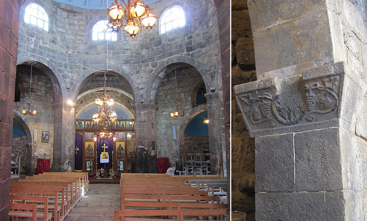
St. George's is thought to be the oldest building in Syria which has been continuously a site of Christian (Greek Orthodox) worship. For this reason it was visited in 1890 by Nicholas II, the last Emperor of Russia when he was Crown prince; the construction of the current dome was financed by the prince.
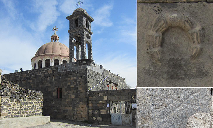
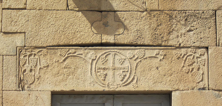
Ezra retains a second church of the VIth century, albeit largely reconstructed; it now serves a Greek Catholic community (the Christians of Syria are divided into some ten different churches). St. Elias' retains some very old reliefs and carvings which indicate that it was built making use of previous temples or basilicas.
The Jewish Prophet Elijah who lived in the Kingdom of Israel in the IXth century BC is regarded as a saint by Christians and he is also highly revered by Muslims; the fact that this church and St. George's survived through the centuries may well be due to the fact that they were dedicated to saints whom were accepted by Muslims.
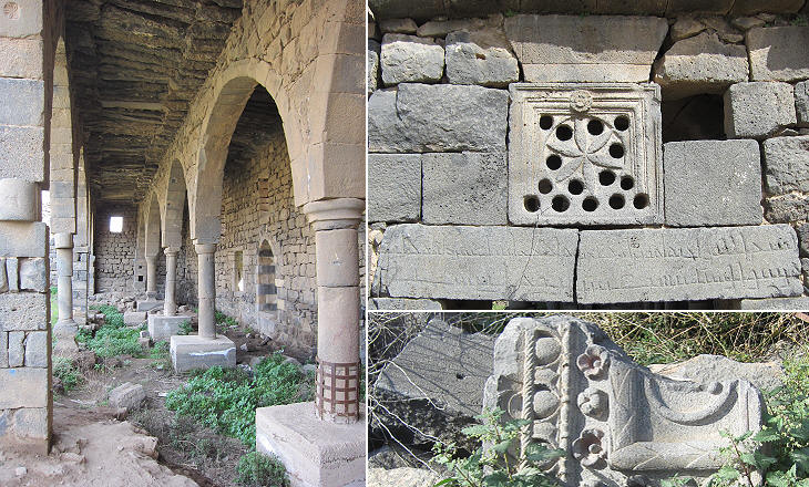
A detail in the decoration of some lintels in Islamic buildings (e.g. Zahiriyya Medrese in Damascus) originates from a device which is clearly visible in this lintel at St. Elias' where a small keystone (which resembles a piece of a puzzle) discharged laterally the impact of earthquakes, thus making the structure of the building more elastic.
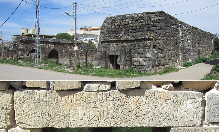
When exactly Zorava was abandoned is difficult to ascertain; the presence of a mosque built by the Ayyubids indicates that the town was still populated in the XIIth century; it is possible that the repeated Mongol invasions of Syria and the ensuing wars with the Mamelukes led to the final abandonment of the town; it is known that during these wars the Mamelukes used to burn fields and pasturelands to prevent the advance of the Mongol cavalry.
The complex probably included a Coranic school opposite the prayer hall, where one can still see the niche which indicated the direction of Mecca; construction materials, including columns, were taken from ancient buildings.
In the XVIIth century Druzes from Lebanon relocated to Hauran because of rifts among clans of their community; in 1860 a conflict between Maronites and Druzes, which led to the intervention of France in support of the Maronites, led other Druzes to migrate to Hauran, which for this reason is also called Jebel al-Druze (Mountain of the Druzes, although the region is basically a flat tableland). The newcomers repopulated some of the Roman towns and villages and nested their homes in the ancient buildings; although today the majority of the population has modern accommodation, still some farmers live in the houses of the first migrants.
Move to: Maaloula Qara Map of Syria with all the locations covered in this website     |