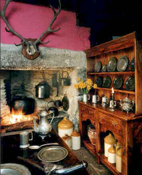
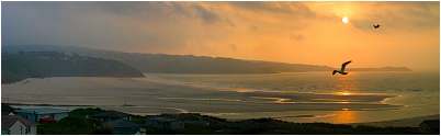
Johns Virtual Cornish Tours
John & Anna's kitchen
Its the Year 2003 and John and Anna Coles' have invited us all to join them around the fire in the kitchen at their home in Launceston, Cornwall. The Yule log burns brightly and the cider jugs await now is the time to begin our virtual tours of Cornwall. So fill your mugs toast the new year and sit back and enjoy.


Mouth of the Helford Passage
Among
the stalwarts of the Cornish List, the 'glue' that holds it together, year in
and year out, must be a certain 'lady of stone' in Colorado.
In many ways, that must be the most inappropriate introduction to Joan, who has
just sent me a very funny (but very rude) animated email. But alongside the
humour is the heart of a researcher dedicated to furthering our knowledge of the
stonemasons and quarry workers of Cornwall and Devon. But this tour of her
ancestral land hardly touches a stone quarry - until we reach a dramatic
landscape high on the roof-top of Cornwall's southern slopes.

Frenchman's Creek Ponsontuel Creek,
Our
Arthurian Charger is struggling a bit today - he's got both Anna and me on
board, and we're putting him through a punishing schedule, quite literally up
hill and down dale. We've ridden back from Traboe (on the Lizard) through the
beautiful winding road above the River Helford. Suddenly, as we pass over the
head of the Ponsontuel Creek, we see a dramatic panorama of glinting water
below, with a bird's eye view of the headwaters of the Helford Estuary,
boathouses, and picturesque boatyards.The cottages of Gweek lie scattered around
the bridge, the rebuilt band-room of Gweek Silver Band a pleasure to me (because
I vividly recall recording the band with an ominous crack in the wall behind me.
Not so much a question of the band 'lifting the roof' as 'Cracking the wall').
We drop rapidly into the village, cross the bridge which has the head of the
broad estuary on one side, and the merest trickle of water the other, and fork
left at the village shop. And this is where the poor old Charger starts to pant
a bit. We've commenced a very long, slow climb, past the tiny Mission Church
sitting on the hillside on the edge of Gweek, past Kestle Dee at the head of a
tiny valley to our right.
Onward and upward we travel along this old lane, which travels in an almost
straight line towards Falmouth. A wonderful avenue of twisted and stunted
Cornish oaks arches over our heads, and then we start to level out (although
only a bit, because ahead of us is a more exposed and barren scene). We've come
into a landscape of stone walls, great lumps of granite hacked from the soil and
piled up to form field boundaries. Of gorse and hawthorn blown into weird
lop-sided shapes by the south-westerly gales that sweep across this high ground
from the Atlantic.
Far below us we can see the ocean, and the lights of the Naval Air Station
alongside Gilly Gabben, and ahead of us we can see mine chimneys on the southern
edge of Wendron parish, and the great ridge road that runs between Helston and
Falmouth across this bleak land.
![]()

Ponstreath Farm and Phonebox
Photos John Coles
And
just before we reach that ridge road, on the side of a sheltered valley of
green, is Ponstreath Farmhouse. It is in completely the wrong place, because the
name means 'Bridge by the Beach or Sandy Place'. Yet here it sits, bold as
brass, 180 metres (nearly 600 feet) above sea level. Today, the house is owned
by a real character, running a digger hire business from the farmyard, and with
an old red telephone box (complete with a 'dummy' making a phone call) just
inside the elaborate beautifully carved gateposts - a real testament to the
stone-masons art.
The ridge road above is dominated by a vast electricity sub-station,
transformers and giant insulators bristling into the sky like a vast insect
swarm. Just beyond, among the granite quarries, is where Cornwall experimented
with 'hot-rock' technology, using super-heated water from deep underground to
drive the turbines to generate the power to feed the transformers that sit on
the hill.
![]()

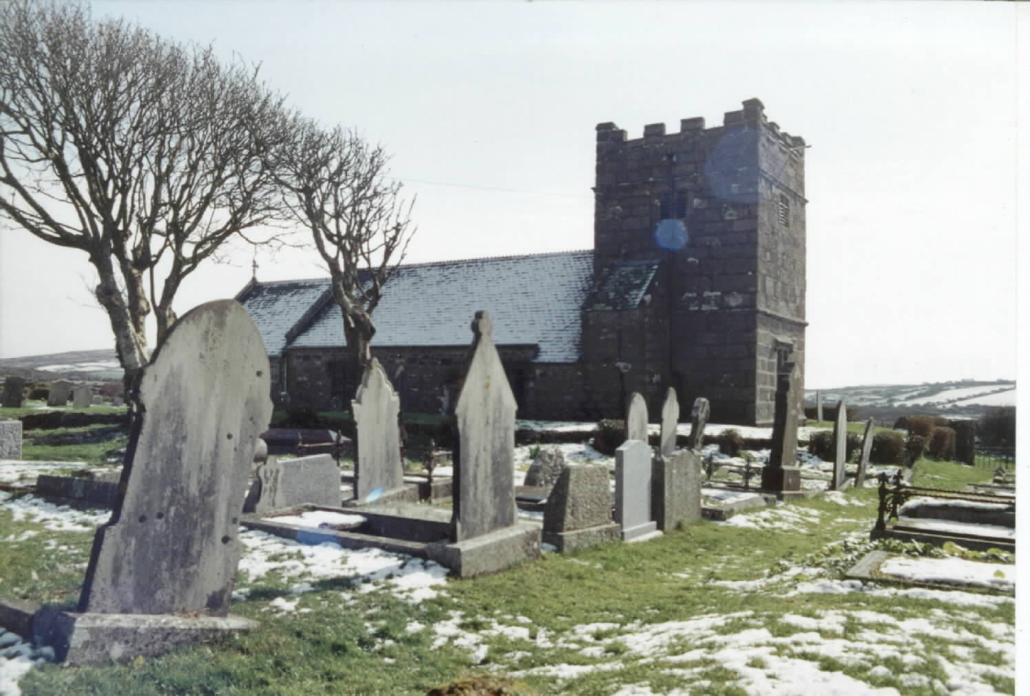
Kessel Grave St Laudus Church
Photos John Coles
But
our route is a quieter one, as we seek the narrow lanes and hidden footpaths
used by Joan's Kestle family as they made their way to St Laudus Church, at Mabe.
This is not an easy route, and they crossed farm after farm to reach their
destination, this isolated church sitting on the side of a valley a good 25
minutes walk out of Mabe itself. When we arrive, the sun has set, and we creep
down a spooky avenue of dark green holly and yew to reach the church gate. We
can see why it was that this had a stone seat each side, and a central plinth of
granite to rest coffins on after a long walk from the surrounding farms.
In the freezing gloom, we search for Kestle graves, finding several from the
1930's and an 1890 double grave containing just the one inscription to Eliza
Kessel, who died December 30th 1890 aged 58 years. And so, as the bats fly
around us, and the Argal Reservoir in the valley below gives the church a
picture-book setting, we head for home - past the great granite quarries that
supplied the stone for London Bridge (which now sits - I believe - in the middle
of the Arizona desert) and the huge Asda store, owned by the even bigger Walmart
chain in the USA.
John
Coles, appreciating the beauty and peace of Mabe, and the prospect of a
cup of a hot coffee at Asda!


There
surely cannot be a more Cornish sounding name than Gilly Gabben! Anna
and I were asked to find this wonderful sounding place by Hazel Persson, who
told us that her folks had come from there, as well as Traboe, near Mawgan in
Meneage.
We start this virtual tour with a look at the origin of the names (because, as
we've found so often, Cornish names generally describe the setting of a place or
homestead). Gilly Gabben sounds at first like one of those wonderful sort of
'dialect' names made up by comedians on the TV to get a laugh. But this is a
place which really does exist, and even has an Industrial Estate named after it!
The definitive book on Cornish Place Names by O J Padel, tells us that the name
means 'Little Crest of the Grove' and so we harness the great warhorse from
Arthur's stable, and set off at a steady trot to St Mawgan in Meneage.
We'd have got there faster if we'd had a tragedy at sea, because we're finding
ourselves galloping along the great flat runway of HMS Seahawk (otherwise known
as Royal Naval Air Station Culdrose) from which the great big air sea rescue
helicopters fly hundreds of miles across the Atlantic Ocean to rescue stranded
mariners.
And just over the razor wire fence at the end of the main runway is a little
group of three houses, at Gilly Gabben. And - sure enough - these houses (two of
which are converted from barns) sit at the crest of a grove of trees!!!
![]()
Today, the setting can still seem rural enough, until a major alert fills the air with the rumble of huge engines, or the roar of tourist cars heading for the public viewing area around the corner.
In the distance, instead of a bland view of marshy moorland or green fields, we
can see the huge bowls of the satellite dishes at Goonhilly Earth Station, and
the graceful sweep of massive blades at a new wind farm silhuetted against the
sky. Instead of the flat fields between us and Helston we see the bright rows of
landing lights, the control tower, vast
dark green hangars, and surreal radar domes, like giant golf balls waiting for a
giant to take his swing.
And so we head down into the heartland of The Lizard, this great southern
peninsula of Cornwall which is so different to the rest of this special land.
Here, the landscape, the geology, and the plants are in total contrast, with
some plants and rocks only found here within a few square miles.
We're heading for Traboe, probably named from the 'Farmstead or Homestead' of a
Saint. Surely this must be a more rural spot, away from the noise and technology
of our modern age, as we head into this rural and unspoilt countryside of great
marshy moors, willow, heather, and bog?
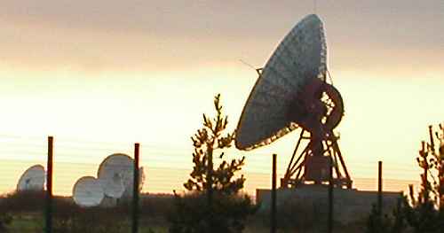
But
ahead of us looms one of the most 'Hi Tech' locations you could ever find on our
globe - the giant satellite dishes of Goonhilly Earth Station. This surreal
sight was the home of 'Telstar' through which the first grainy transatlantic
images of moonshots and presidential assasinations were brought to our Cornish
TV screens, but today it is probably the most advanced civil telecommunications
hub in the world, filtering and
transmitting messages (including this email) from most of the world's continents
through a vast array of undersea fibre optic cables, and huge satellite dishes.
And just across the road from this astonishing place we spot an old cast-iron
Cornish Signpost, pointing to Traboe. The signpost is bent and twisted, glinting
in the sun which is setting behind the great dishes to the west. The willow and
marsh grass of Goonhilly Downs is shining a rich warm red, and the signpost
invites us deeper into a maze of old lanes traversing the marshy ground.
Traboe is a delight, a group of old cottages, a farmshop, and New Inn Farmhouse
set around a village-green of humps and bumps and clumps of marshgrass. Traboe
Cottage appears to be up for sale (although it is hard to tell, because in this
sleepy-hollow of a settlement, the real-estate agent's board has fallen over,
and no-one has picked it up).
The former inn is a picturesque reminder of a time gone by, whilst around the
bend at the bottom of the Green, a new art gallery (in a modernised cottage)
signals the influx of 'new money' into Cornwall.
But our greatest treasure lies around the corner, as we gallop with increasing
excitement along a lane covered in mud and cow dung.
![]()
"Never mind the Dog - Beware of the Owner" says the sign on the beatifully dressed (carved) granite gateposts at the entrance to Traboe Farm. Sycamore trees and high walls shelter and hide this wonderful old farmhouse. The deep and silent lane will soon resonate to the vibrancy of smell and colour of the white bell-like flowers of wild leek, followed by the bright orange of Montbrecia.
But for now, the farmhouse holds its secrets closed behind the walls protected by its owner (and his dog) and our view up the ancient granite yard reveals a farm which once employed many workers, and was at the centre of a thriving economy which earned the funds to build great granite barns, granaries, and stables.
![]()
Today,
this is a picturesque sight which obviously still earns a good living in this
sheltered valley alongside the great moorlands of Goonhilly. But just imagine it
a hundred or more years ago, before the tractor made ploughing and yard scraping
easy.
Imagine it before modern agricultural methods fed large herds through the
winter. Imagine it before the pig was killed on the farm, salted in the great
granite trough, or smoked in the ingle-nook fireplace, so that the meat could be
eaten through the winter.
And
so it is, that on this virtual tour through the heart of a very special part of
Cornwall, we've seen the contrasts of Cornwall today, from the age of
telecommunications to the age of the affluent incomer. From the ability to make
rescues far out to sea from this isolated southerly point, to the ageless cycle
of the farmer meeting the demands of the changing seasons. Because from Gilly
Gabben to Traboe really IS the story of Cornwall.
John Coles, enjoying the marvel of modern communication, alongside the
comfort of his medieval fireplace in Cornwall.
All Photo's by John Coles

It
was Wesley who (quite unintentionally) almost destroyed the power of the
Anglican Church in Cornwall... and it was the power of Cornwall that (quite
accidentally) almost destroyed Wesley at Lelant.
The accident happened when he was travelling in a coach across the wide expanse
of the mudflats of The Saltings, in the upper reaches of the Hayle Estuary. Like
all travellers moving along the north coast towards St Ives, he had taken the
'short cut' across the estuary at low tide, crossing from Hayle on the Eastern
bank, to Lelant on the Western shore.
But like many before (and many since) he and his coachman had underestimated the
power of the sea to roll the tide across this 'short cut' in a matter of
moments. Precious moments in which the sand would turn to quicksand, before the
sheer depth of water and rush of tidal currents swept the poor unfortunate away.
And it is not just the power of the sea which inundates at Lelant. This is a
landscape, village and parish which is dominated by sand-dunes (known here in
Cornwall by their old Cornish name 'Towans') which extend from Carbis Bay,
through Lelant and Phillack, as far as Godrevy Point, at the Eastern extremity
of St Ives Bay.
This fine sand has created massive sand storms in the past, and just as the
Methodist, Wesley, was almost inundated by the sea, the Anglican vicar of St Uny
Lelant only escaped the sand which completely buried his Vicarage by climbing
out through a window!
So what do we see from the back of our Arthurian Charger?
Lelant is another of those tiny and compact landscapes of contrasts that so
typify Cornwall. Look down with me from the craggy granite Iron Age fortress on
the top of Trencrom Hill. To the south is Mount's Bay, below us a landscape of
pocket-hankerchief fields, and below us to the north stretches Lelant Parish,
ending in the broad sweep of the curve of St Ives Bay, with St Ives itself to
the left (western) end, and Phillack to the right.
In the very centre of this panorama is the V shaped (no, not that 'V.....') inlet of Hayle Estuary, with the church of St Uny Lelant on the furthermost left hand end, and the old explosives works on the opposite shore to the right.

Postcard in GP's collection
Lelant itself is bypassed or sped-through by most tourists today, unless they
enjoy one of the most beautiful train journeys in Cornwall, when they travel
right along the edge of the the Hayle Estuary towards St Ives, the cottages of
Lelant glimpsed on their left and The Saltings (often with flocks of exotic
migrant birds, or the spectacular resident Herons fishing in the fast-running
tide) on their right.
But the old village is lovely, giving a real feel of Old Cornwall as the road
wends its way towards St Ives, with a traditional baker's shop on a side turning
leading to unspoilt cottages, set among lanes rich with overhanging trees.

Postcard in GP's collection
The church itself must have the most beautiful and peaceful setting in Cornwall, a little out of the village and overlooking the old harbour of Hayle across the estuary. One hundred and fifty years ago this was a busy view, bustling with shipping. Hayle was the world centre for the production of the great steam engines that powered mines worldwide, pumped water from the re-claimed low lands of Holland, and provided the water supply for great cities such as London and Birmingham.
Today, the railway viaduct is gently sinking in the mud, the estuary has silted
up, the great foundries at Copperhouse and Foundry have been virtually
obliterated, the estuary has silted to the point where the only boats are tiny
fishing craft, and the only real reminders of the busy industrial past are the
occasional black blocks of 'scoria' copper slag built into a wall.
Blackened spars of sunken work-boats now sink gently in the mud and silt
alongside the estuary, and the braver surfers seek out the quiet sandy beach of
'Porth Kidney Sands' beyond the church - the only beach that I know in Cornwall
which seems to be full of the treacherous spiny shells of Spider Crabs!
Inland, the parish meanders through some of the most picturesque small lanes I
know, into a dream world of tiny cottages, rich greenery, and sub-tropical
plants such as palms and acanthus, before winding imperceptibly up to the tiny
car park hidden among the blackthorn and gorse on the side of Trencrom Hill.
And so it is here that we tether the Arthurian Charger to a bush, push our way
through the overgrown scrub, and suddenly find ourselves on the windswept top of
the hill where we started. But this time, as we look down on the landscape, we
see the history of Phillack and Lelant rolling before our eyes.
Iron Age chieftains defending their people and their flocks on this great hill.
Celtic Saints landing on the shores of Lelant and Hayle, bringing the Christian
message from Ireland and Wales. Mine captains sinking shafts in the shifting
sands of the great Towans between us and the sea as fortunes are spent on buying
steam engines, and fortunes are lost as the prospect proves elusive, and the
engines are sold at auction.

Postcard in GP's collection
Smoke,
flames, and acrid toxic fumes rise from the furnaces and copper smelters around
the waterfront. Ships laden with coal and copper traverse the harbour. Then the
railway brings tourism, and the Towans are covered with chalet homes, caravans
and park homes, golf courses and dog walkers. Surfers discover the wonderful
waves generated along the superb sands, and the declining and silted harbour
seeks new life as property developers move in.
But - apart from the single track railway, and some new housing which has
'filled in the gaps' - Lelant has changed little over the centuries, and I
suspect that if a relieved John Wesley were to kneel in prayers of thanksgiving
for a safe crossing of The Saltings, the sight before his eyes would be much the
same now, as it was some 250 years ago... although he might be surprised to hear
Carols being sung in the original Cornish
language (once again, after a break of some 400 years), in the Church of St Uny!
John Coles, thankful for the modern road around the head of the estuary!

Nine Maidens Stone Circle
Wendron
is a parish which sprawls across a dramatic and beautiful landscape. The largest
parish in Cornwall until 1865, it doesn't even have a real 'village' at it's
heart, and even the 'Churchtown' is barely more than four or five buildings. And
yet, it's a landscape which encompasses so many of the elements of Cornwall, and
which cannot be found anywhere else in Britain.
For those of you used to landscapes where you have to drive for hundreds of
miles before anything changes, the contrasts within Wendron parish can be a real
shock - just as it must have been a shock for Ann Berry's RICHARDS family, when
they left here for America, and found that you had to travel hundreds of miles
before anything looked different.
Mining and Marshland, Granite and Ghosts, Saints and Superstition form the
backbone of this tour, as we follow the main road (a winding lane in most
places) from Helston through to the heights of Four Lanes.
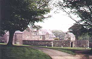
Right on the southern edge of this varied parish is Trenethick Barton. When I
first visited this, it was set in splendid isolation, hidden at the end of a
tree-girt lane. A gem in the Cornish countryside. One of the only 'Defensive'
houses in Cornwall, surrounded by a high wall, and guarded by a gatehouse. A
house 'modernised' around 1550, about 40 years before the Spanish burnt down
Mousehole.
I had gone there to record a radio feature with a man who was opposed to what
the future held for this house, but he failed in his opposition, and today the
view from the ancient mansion is not of fields, but of bright streetlighting,
and the modern houses of suburban sprawl - a complete contrast with the quiet
calm of the ancient house.
But the fields and footpaths that lead from the back of this house, lead us into
one of the core industries of Wendron. Rich ore lodes mirror the dual paths of
road and river, as we follow a row of old mines and mining remains northwards.
But we're diverting off the to the west to cross the river at Coverack Bridges,
in order to dip down into a little hidden valley to Pascoe's granite quarry. It
is here that some of the finest Cornish granite is polished and shaped on high
precision machines by skilled masons, and the ancient skills of letter cutting
in this hard rock can still be seen (if we
ask nicely enough). The rock is full of beauty, but to see a huge slab laying on
a polishing machine, as the cutting head moves over the mirror-wet glistening
surface, is a remarkable experience.

Back onto the road, and we've come to the church, set in a little group of
essentials: church, school and pub (and very little else). This church is the
only one I know of in Cornwall to have the Parish Room (for meetings of the
worthy!) set above the Lych gate into the churchyard. What a challenge...
someone is bound to tell of three more like this!.
Onwards to the bottom of the valley and a turn to Poldark Mine, (renamed for the
tourists, to capitalise on the famous books and TV series). But for those with
mining in the blood, this is the best chance of finding out what life was really
like underground.

Take the 'toughest' tour (if you feel able) and travel down tortuous
passageways, steep inclines, and gaze down into bottomless depths - wondering
how it was that men could work on the end of ropes or chains, or from slippery
wooden ladders, with water constantly raining down on them, and guided only by
candlelight. And yet, back here around 170 years ago, that is just what 900 men
did, walking back home across the fields, tired, wet and hungry.
Leave here and turn into the wild country, and you can end up in sodden bog in
the flatter lands around the meandering River Cober, and the wilds of Porkellis
Moor, with the remains of more mines and their engine houses hidden amongst
willow and marsh grass. How miners survived beyond the age of 25 in such
conditions is a miracle. But few tourists see this corner of Cornwall, and it is
an unspoilt gem, with pretty cottages, and hidden chapels which gathered their
congregations of hundreds singing lustily on
Sundays.
Back to the main road, and after passing through the delights of Burras (a tiny
bridge, over a tiny stream surrounded by picture-postcard cottages and yet
another chapel (there used to be 7 Methodist Chapels in Wendron!) we start to
head up-hill.
Here, as we ride on our virtual charger, flying above the tumbling granite walls
each side of the road, we can glance across fields to the right of us, where
among the sheep grazing in this picturesque landscape of small green fields
hedged with granite, tumbled heaps of stone and ruined engine houses trace the
frantic investment of men, courage and machinery to drag wealth from the ground,
and - way below us to the left - the Christmas Tree illuminated at the top of
the headframe of South Crofty Mine at the centre of the great conurbation of
Camborne, Tuckingmill, Pool and Redruth, with the sea beyond in the distance.
On the slopes below us lies Troon, and we can spy David Oates assembling his
merry band of annual carollers. Ahead lies the huge bulk of Carn Brea, with some
of the finest mining remains in Cornwall, and hopes that - one day soon - this
incredible legacy of endeavour will be recognised as a World Heritage Site.
But before we leave, I promised you: Superstitions - the strongly held belief in
the power of apparitions such as headless horsemen, and ghosts rising from the
grave. Before the age of streetlighting and modern high power torches, the
shadowy figures of the darkest nights must have seemed overpoweringly real. The
sheer tiredness of the homeward bound miner, the rising mist, the shadows cast
by a clump of furse, the occasional flare of marsh gas may well have played
their part here in this isolated landscape... but for Parson Jago of Wendron,
they were real, and he became famous throughout Cornwall for his powers of
excorcism, in which he could be aided by a demon servant, summoned (says
Hamilton Jenkin) by striking the ground with his whip.
And... Saints: for it was in contrast to the awe created by the whip-wielding
Jago, that a certain Canon Doble of Wendron brought together as much scholarship
as he could, to find the real people in our ancient past, who had become the
'Saints' so often represented in our place names.
But we'll finish with some fun! For despite the toughness of life, and the fear
of the supernatural, our miners and farmers used to elect a 'Mock Mayor',
poking fun at the hypocrisy and pomposity of their 'elders and betters'. And at
Four Lanes, at the end of our Virtual Tour, the victim would have his face
blackened, and have to stand 'rounds' at the pubs, as well as holding a 'Cuckle's
(Cuckolds) Court'.
"Wendron Feast and Cuckle's Court,
"Come every man and stand his quart!"
Cheers! John (raising a glass of fine Tinner's Ale, in Cornwall
I've
got a real problem with Ludgvan, because our friend Gail Chellew asked
specifically if we could reach Upper Chellew. Well, sorry to say, not so far...
the Virtual Arthurian Charger ran out of puff, and we didn't have enough hay to
feed it, so watch this space!!!
Now there aren't many places in the world - let alone in the tiny confines of
Cornwall - that can lay claim to two great people who have changed our
understanding of the world. And yet, the tiny hillside village of Ludgvan can do
just that!
We've crossed from the lovely village and fascinating mining landscape of
Goldsithney, galloped across Tregurtha Downs and the Marazion Marshes, and leapt
with a single bound the modern A30 trunk road from Hayle to Penzance, and the
Inter City railway from Penzance to London! Wow! (As my lamented friend and late
list-member Bob Vail from Florida would have said).
As we maker our way up an old lane through fields of early daffodils, we pass
the bland corrugated metal shed which houses one of the most advanced
horticultural processing plants in Cornwall. Here, the machinery can be
processing early daffodils one moment, early potatoes (Oh, the taste of a fresh
Cornish 'spud'!!!) the next, beautiful white Cornish Cauliflower (or 'Brocs' as
we insist on calling them here) the next month, and finishing the
season with the wondrous smell of strawberries.
The fields here are heavily cultivated, in total contrast to those we've seen
around St Just or Goldsithney. Often covered in vast acres / hectares of plastic
sheeting, they produce some of the earliest (and most valuable) crops in the
whole of Britain.
But our horse is making its way up an old lane, cut deep into the landscape,
that predates any of this modern intensification, and we arrive in the twisting
centre of a stone village set high on a hillside above the awe-inspiring
panorama of Mount's Bay.
This is a view barely seen from the lane, but enter one of the cottages on the
southern side of the village and we look upon a dramatic landscape, encompassing
The Lizard to our left, and then (as we swing our gaze to the right) the
incredibly romantic St Michael's Mount, Mount's Bay, Long Rock, Penzance, Newlyn
(with it's coloured lights set all around the harbour of the busiest
fishing port in Cornwall), and there, just on the horizon, the lights of
Mousehole.

Postcard in GP's collection
But
250 years before electricity lit up this view for us, Dr William Borlase was the
Rector (of chief priest) of this parish. It was he who recognised, discovered
and uncovered, who dug, collected and published, the importance of the
prehistoric heritage of Cornwall. It was he who recognised that Cornwall had a
greater collection of such remnants of our past than anywhere else in Britain,
and it was he he did so much to save these priceless relics from the ravages of
a ploughman or stock farmer erecting new boundaries.
Today, we watch the '3 day excavations' of 'Time Team' on the TV, and marvel at
what they achieve... and yet simultaniously criticise the excavations of
antiquarians such as William Borlase, who cut sections through countless tombs
to collect the priceless historic records they contained before the tombs were
destroyed, or the stone robbed.
Borlase was brought up where we started these tours - at Pendeen Manor, near
St Just - but spent most of his life in Ludgvan.
Sir Humphrey Davy, on the other hand, was born in Ludgvan, but went on to become
one of the most famous scientists in the history of the world. Look in any major
reference book, and this Cornishman will be there. Maybe because he became
President of the Royal Society, maybe because he discovered sodium.
But perhaps - most importantly - Sir Humphrey will live on because he invented
the Miner's Safety Lamp, which enabled miners world wide to work in areas of
explosive gases.
As we untether our Charger, we could continue across on these narrow lanes to
see the ancient hill-top village of Chysauster, or down across hills and valleys
to discover Gail's location. But that can wait for another day (because the sun
is setting) so we are quickly heading down the hill to the gift shops, to buy a
reprodution Safety Lamp (which is almost certainly made in China).
John Coles, standing in admiration of humble folk who changed the world.
A Tour of St Hillary & Goldsithney
For
Corinne, the wonderfully named Goldsithney has a real resonance. Her folks had
property at 'The Gears' some 200 years ago, and thus it is that we set out in
search of this curiously named settlement.
Now I know that someone is going to tell me the obvious, and point to a property
that I've been past many times. (That is life), but try as I might, I couldn't
find 'The Gears'.
Goldsithney has nothing to do with Gold, but everything to do with mining! Not
only is the village surrounded by mines, but they infest the very core of this
lovely village, full of a gorgeous mixture of elegant Victorian houses, and
humble miners cottages, built in terraced rows of solid granite.
It is a sort of 'one horse village', based around a solid main street with
little rows of houses squeezed in and running off at angles. It's in St Hilary
Parish, but the church is 20 minutes walk from the village, set in isolation on
the edge of fields and woods (and our friend, Howard Curnow, who joined us at
the Reality Party in Tintagel, and who is known to Cornish Societies worldwide)
lives in its shadow.
This is said to be a haunted village, and among it's ghosts is that of the
Reverend Cole (no relation that I know of) who is said to haunt the vicarage
gardens (I'll have to ask Howard if he's met my namesake recently).
And more modern ghosts echo around this church, because 70 or 80 years ago, it
was the scene of riots against the 'high church' aspects of the Anglican faith,
and protestors stormed in, smashing and trashing the interior, and even more
recently the author Denys Val Baker lived here with his large (and somewhat
Bohemian family) - enough high spirits to enliven any ghost!
But you can just see the church from the village, and wonder at why it has a
short, stumpy, spire. Why? Well because. But almost every other church in
Cornwall has a square tower, topped with a pinnacle at each corner!
But this village is all about mining. Around must be the remains of several
hundred mineshafts, and dozens of mines. Mines like Fanny Adela, Helena, Janey,
Perran and Neptune. Friendship and Florence, Owen Vean and Nanturres.
But we are barely a mile (1.5kms) from the south coast, where fishing and mining
took turn and turn about. Hence The Tinners Arms pub once had a verse that
greeted those who stepped through the door:
'Come all good Cornish boys, walk in,
'Here's a brandy, rum and shrub, and gin.
'You can't do less than drink success'
'To Copper, Fish, and Tin!
And so, as dusk once again falls this evening, on this New Year's Day of 2003,
join with me as we look out at the landscape that surrounds us. Mining remains
are to be seen down almost every lane. Many now flattened over, and only a few
shadows left.
But as we look westwards, below us stretch some of the wettest mines in
Cornwall, and some of the grandest engine houses! The flat plain of Tregurtha
Downs held real wealth tied up in soft, difficult and boggy ground. Big engines
pumped and pumped, and fortunes were made. William
Husband's pneumatic stamps at Tregurtha Downs, St. Hilary, were declared by the
manager in 1892 'to be the most efficient stamps in existence'
In the distance is the hillside village of Ludgvan, horses graze on the flat
plain below us (which probably still contains some rich lodes), and gradually
some of the engine houses are themselves seizing a new life converted into
homes, re-roofed and re-pointed, stonework cleaned and lights gleaming once
again from the windows.
But tonight, we're heading back through the village. Past 'The Trevelyan Arms',
past the homemade pickled onions for sale outside a tiny cottage, past Linden
Cottage (brightly decorated with fishing floats and cascades of star-like
Christmas lights), and past 'The Crown' flying the English flag of St George in
contrast to this most Cornish of villages!
Onwards, through winding lanes, deep valleys rich with twisted Cornish oak
trees, full of mystical Cornish magic, and into the village of Townshend, where
we turn left and head across a flat, high plateau. Away to our left are the
ancient hills and hill forts of West Penwith, Trencrom Hill, Trink Hill, and
here - in the Parish of St Erth, down a long lane which ends at the head of a
tiny stream running down to the Hayle River - is Gear Farm.
Is this the place we seek, or is our answer over among those ancient hills to
the West, where we can find The Gears in Morvah Parish?
Who knows? Another Family History Mystery to be solved in 2003?
John Coles, waiting in anticipation in Cornwall.

To see more pictures of Morvah by this artist click here
For
Gloria Clarkson, the coastal strip around Morvah holds endless fascination. She
has never seen it, and cannot imagine it. And yet this magical strip of
coastline (which even includes the Pagan 'Wicca Pool') is the essence of what
makes Cornwall such a special place, and holds the key to her own ancestry.
For me, this just had to be the place to start our 'Virtual Tours' because it is
where my heart lies, and where the key to understanding the fascination of
Cornwall lies buried.
Somewhere around 6,000 years ago this land was first settled, and as our virtual
Arthurian Charger gallops across the sky, and back through the centuries, we'll
see just how much those ancient people have left their mark on the landscape.
And so... cast aside the everyday pressures, and any concept of 'distance' that
you may have, because this is the landscape of West Penwith, where a mile (about
1.5 kms) can take an hour or more to walk, and where the view from any high
point can focus on the ocean both to the North and the South of Cornwall.
Picture the ocean on the North Coast. Deep, deep, deep sea, a rich dark green
ocean frothed with 'white horses' driving in on to dark Basalt and Granite
cliffs 300 feet (90 metres) high. Almost nowhere to land a boat. A coastal path
struggles along the cliff top... now used by walkers, but originally used by
Cornish Wreckers and the dreaded Excise Men. But this is no easy walk, and it is
reckoned to be one of the toughest sections of the
coastal path, with deep ravines to clamber up and down, huge rocks to scramble
over, sections of bog to navigate.
Giant headlands cut by the waves stick out into the ocean. Today, a few humps
and bumps, but - look carefully - the same kind of defences as Tintagel Island,
but here at Bosigran the simple defences are clearly linked to the Iron Age of
3,000 years ago. And around Bosigran Farm are the remains of well established
villages, built before the time of Christ, but showing that these fields were
cultivated at least a hundred generations before our own (more modern) family
history, and that the pattern of settlement we see spread below us dates back to
a time we cannot even imagine.
Clinging on to the edge of this historic cultivated strip is the modern coastal
road. But this is no modern road. It twists and turns, it is only wide enough
for one car at a time (as our friend Ann Tumser knows only too well, since a
white-van driver finished our trip along this very road in devastating style).
Granite walls frame the road, granite walls delineate the field boundaries,
granite forms the gate-posts, and granite forms the walls of the tiny cottages,
picturesque farmyards, and more substantial farmhouses that are built hugging
the road, as if afraid to stay away from this thin strand of communication. Farm
houses and settlements such as Keigwin, Trevowhan, Rosemergy, Bosigran, where a
tiny group of houses and cottages is all that
remains of once thriving communities.
As we soar over the top of these solid stone houses, with their roof slates
bonded together with a film of cement to resist the fierce Atlantic gales, we
head into a wild landscape heading up into the hills. Huge granite outcrops, and
a rich growth of heather, bracken (fern), and gorse hide the power and richness
of this landscape.
Here the field boundaries vanish, and wilderness takes over as walking even a
few yards become a nightmare as we tumble over buried stones, crash into deep
ravines, risk a fatal fall down a deep, deep, mine-shaft. For it is on these
heights (looking down like an aerial photograph at the landscape of cliffs, tiny
fields, the coastal road, and the settlements below) that we realise the reasons
that people settled here, worked and died here.
They settled because of the defensive possibilities and sheltered richness of
this far west land, and then because of the tin in the ground beneath our feet.
Thousands of years before the birth of Christ they farmed here, taking advantage
of the warm Gulf Stream that brought early crops. Then they discovered tin and
'streamed' this from the surface of the land (much as gold prospectors did 150
years ago), and built fortresses to guard and
protect it. Fortresses such as Chun Castle, built of concentric rings of stone
walls 2,300 years ago, designed to guard the wealth of tin ore before it was
shipped from St Michael's Mount or Hayle. As centruies wore on, they exhausted
these early surface deposites washed from the land, and dug deeper and deeper
into the hard, hard rock which made the Cornish miner famous world wide.

Keigwin Farm Landscape photo JC
This remarkable fortress of Chun sits in ruins just above Gloria's ancestral
home at Keigwin Farm, and next to it, commanding the landscape from a
birds-eye-view some 600 feet (200 metres) above the sea sparkling below us, is a
chambered tomb, like a giant stone mushroom, made of vertical granite slabs
supporting a 'roof' of unimaginable weight, heaved into place to bury the Leader
who commanded this landscape around 6,000 years ago.
This would have been a Pagan ceremony, performed by a people who worshipped the
seasons, the sun, the moon, and the stars. So thus it is, that even today, the
hold of Paganism is still strong in this isolated landscape, and remembered in
names like Wicca Pool, cut into the deep cliffs just below us.

St Just Square. Photo JC
For
Gina Francis, Corinne Thompson, Jan Davis and all with roots in the farthest
West of Cornwall, St Just in Penwith is a fascinating town.
This is the farthest West town in mainland Britain, the last stopping-off place
before you reach the beauty of Sennen and fall off the cliffs of Land's End. It
is a town of some 'faded grandeur' where the Cornwall your forefathers left
behind still comes starkly to life in a real 'in your face' way.
We arrive at dusk, as the festive lights around the delightful Square are
switched on. The big Christmas Tree glows cheerfully, the shop windows of
Warrens the Bakers glow warmly with hand-baked loaves and trays of pasties, the
last 'lunchtime' customers spill unsteadilly onto the pavement from the grand
Wellington Hotel, and the more homely old Star Inn (which still has a granite
'mounting block' so you can mount your horse).
The Square is (of course) a sort of Cornish contradiction, because it is really
more of a triangle! Ho hum, but still a centre of this amazing little town,
humming with life.
In reality (sorry, diverging from virtuality for a moment) we drive to the town
car park and tether our Arthurian charger against the bottle bank. Here is 'in
your face' modern Cornwall. Starkly ugly concrete social housing, built when
this was still a genuine mining community just a couple of decades ago. But here
in this most beautiful part of Cornwall, the ugliness of this local authority
construction is still a shock, although a stark
reminder that this is one of the poorest parts of Britain.
Next door to these concrete monstrosities are the narrow streets of he
Nineteenth Century equivalent. Tiny 'back-to-back' terraced stone and brick
built cottages huddled together on the coastal roads towards Cott Valley and
Cape Cornwall. Nowadays, these are either 'holiday homes' for the wealthy, or
lived in by the poorer local folk, but they are a reminder of the days when this
was a bustling community creating wealth in the mines which ran deep under the
sea.
All around us, within walking distance along the cliffs, are the mines which
made this community wealthy, and created the jobs that created these densely
packed industrial homes here, miles from anywhere, in one of the most remote
areas of Britain.

Levant Mine Morrab Collection
Botallack,
Boscaswell, Geevor, Levant.
At Levant you can still stare down through an iron grid into the main shaft
which led to workings under the ocean where the miners could hear the waves
moving boulders on the ocean floor, and where death was the inevitable
consequence when the 'man-engine' broke one fateful day in 1919 killing 31
miners as the great 12 inch square timbers crashed one upon another down the
shaft.
At
Geevor, you can still squeeze through ancient mine workings near the surface, or
stand in disbelief at the closure just a few short years ago, as the guide hands
you a jar of refined tin ore produced within recent living memory rock from
vastly deeper underground workings by refining on modern 'shaking tables' in a
mill of corrugated iron sheet, rattling as the ocean storms howl around outside.
In the grass-green valleys heading to the sea from St Just you can marvel at the
wealth of ruined mining remains, as the realisation dawns that 'this' was a
giant wheel-pit, powering crushers, and that 'this' was an adit leading deep
into the hard Penwith rock, or that 'this' pile of lighting-struck ruins once
held a huge 'state of the art' steam engine. Because now all that remains are
jagged walls of giant granite boulders, lightning-blasted brick chimneys,
covered in the almost jungle-like growth of these lush valleys.
Back in St Just itself, we marvel at the rejuvenation since this has recently
become a town of artists - forced further west by the rapidly rising prices in
St Ives, which has become suddenly trendy since the spectacular success of the
'Tate of the West' gallery.
St Just Plen an Gwary from the south west
We
marvel at the huge Methodist Chapel - a testament to the power that Wesley had
among this mining community. We marvel at the beautifully preserved Plain an
Gwarry (the 'Playing Place') just next to the Town Clock - a testament to the
Medieval origins of this resilient town six or seven hundred years ago, and
which just this last year resounded to a stunning re-enactment by local people
of the Medieval Mystery Plays.
And this leads us to explore the humble stone cottages and tiny churchyard
surrounding the Parish Church. None of the names we seek can be found here. No
grave stones for Hawkins, Stephens, Hicks, Grenfell, Tresize, or even Warren.
Sadly, not even any that we can find for the Gibson family. Sadly and ironically
because (like so many rural carpenters) they were also the local undertakers,
making their coffins to order from hard-to-find boards of three-quarters-inch
thick (20mm) Cornish Elm, hand sawn in the local saw-pit which has long
vanished, just as most of the Cornish Elm since the influx of disease over 20
years ago.
But (if you've read this far) you'll see a dresser covered in Cornish Pewter
on the web site pages created by George for these Virtual Tours. And that
dresser was made by me from Cornish Elm coffin boards!
John Coles, in Love with the contrasts of Cornwall.

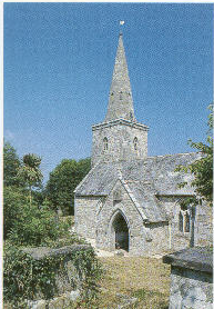
We're going to ST. NEWLYN EAST on the first of these (if the Beasts steer in the right direction) partly because Chris Uphill has earned the first tour for all the work she put into the party last year, and partly because it's a place that hardly ever gets mentioned, and it's a delight! Our sleigh is taking to the crisp, clear, air of Cornwall on a wonderful moonlit night... the stars are shining brightly, and we can quite clearly see the landscape as we lift off from alongside the East Wheal Rose engine house, about 1 mile (1.6 km) south of St Newlyn East. This is dramatic! This is - in fact - the biggest engine house in Cornwall, and at the time your gggrandparents were thinking of leaving Cornwall, Chris, it was said to be the biggest silver-lead mine in the UK, and it was also the scene of one of the worst mining disasters in Cornwall. In 1846, when more than a thousand local people worked here, there was a sudden and torrential rainstorm at lunchtime. The deluge was so severe, like a tropical monsoon, that the great steam pumps couldn't cope, and the water poured in a torrent down the shafts, killing 39 miners. But despite the huge size of the mine and its underground workings, this huge engine house looks out of place in a surreal landscape... unlike the engine houses around Geevor and Pendeen, or those which surround Camborne and Redruth... this huge and handsome stone building stands all alone, alongside a barren sloping landscape, because some ten years ago this historic site was buried under thousands of tons of garbage as a 'landfill' site.
But we can just spy the gleaming metal rails of the Lappa Valley Railway glinting in the moonlight, running along the old trackbed that linked this little corner of history with Treffrye's famous railway line and harbour at Newquay. Ah... (glug, this Mead tastes good!) there's Newquay away to the North of us, the lights of the modern discos and entertainment complexes illuminating the night sky (This is the modern Newquay, the Cornwall sought by young people from all over the country as they come down with their surfboards for the finest waves in Europe). But our sleigh is heading towards a smaller glow of orange coloured street lights, which illuminate the delights of St Newlyn East. But as we swoop in low over the village, we find a community that - perhaps sadly - reflects the transition of Cornwall. Our eyes are drawn to the huge stone chapel, a tribute to the effect that John Wesley had on this isolated community. But the door is nailed closed, security fencing surrounds the elaborate carving and pinnacles, and a large 'For Sale' sign adorns the wall. Around the corner, a similar sight greets our bewildered eyes when we spot the delightful old village school - now closed, and up for sale, while along the road another (smaller) chapel has already been converted into a house. But we cheer up as we circle the virtually unchanged church-yard which lies at the hub of the village - quite literally, for this is a raised, circular, churchyard, indicating that this site is (at least) of Pagan origins, dating back long before St Newlyna planted her staff here (where it grew into a famous fig tree). And the traditional heart of St Newlyn East is still based here in the village - we spy the smart red and white shop-front of Mr George's traditional butchers shop, the Pheasant Inn (where we can here the buzz of merry conversation, and voices lifted in the singing of Christmas tunes). The post office still survives, and Sampson's Garage still looks after the local cars, vans and tractors. We're flying on, diverting down the narrow lane that winds down into tree lined valleys of hidden Cornwall to the delights of Trerice (this was a long-time home of the famous ARUNDELL family, and was built in 1571).

The moonlight is reflected off the hundreds of panes of hand-made glass in the massive window of the Great Hall, and we can only imagine the Christmas Parties of the past as folk gathered around the huge fireplace, listening to the minstrels in the hidden gallery above. But we are now heading back to the real heart of the village again, as the beasts drag us through the biting cold of the night air. And wow - the village hasn't lost its school - it has a brand new one! and almost opposite, we're about to land, because almost the last house in the village, at the end of a terrace of workers stone built houses, is a man offering us sherry and mince pies in a garden full of a display of Christmas lights which almost rivals those on display in the 'other' Newlyn - the fishing port on the South Coast, where the fishing trawlers are bedecked with lights, and the ice-house resembles a fairy-tale palace!

West from Madron Carn By Steve Slimm
Tonight I've hitched up the virtual sleigh for Joy Dean, and anyone else who'd like a magical ride around Madron and Gulval, on the hillsides above Mount's Bay. As we soar into the air from the heliport at Eastern Green (luckily, the helicopter that flies to the Isles of Scilly has been put back in its box for the night) we can see Gulval Church standing up proud on the hillside above us and to our right... it has a huge illuminated cross on the tower, shining like a beacon across Mount's Bay... but we're heading out above the housing estates north of Penzance, to the fascinating settlement around Madron. Built around a sort of crossroads pattern the village sprawls out below us, a real mix of housing styles, with Victorian houses, and buildings such as the Institute, scattered among much older stone cottages. The most curious thing is that the church here is the 'mother' church of the much bigger Penzance, a mile or so down the road, but it can claim to have relics of almost all periods over the past 600 years.

Madron Well Morrab Collection
But we're heading away from the attractions of a pre-christmas drink at the pub, along a narrow track north west out of the village to the Holy Well of St Madron... according to legend, the good Saint was martyred and his body buried near the well, but although this may seem like a Christian site, the truth is stranger. For Madron Well is an important site in that curious relationship between the ancient Pagan life, and the later Christian faith which - in many cases - came to take over the same sites for churches, and the same festivals and feast days. The pagan ways - based on the natural world around us - still features in much of Cornish life, for many people, especially here in the far west, and even after the Wesleyan services here in the past, people used to throw bent pins into the water, as the siingle folk of the village watched for a sign of a wedding to be. Even today, as we look down, Madron Well is one of those sites still held to be so powerful that 'votive offerings' of pieces of rag flutter from bushes all around...

Madron Well photo GP
....the other place where I seen this is the equally mysterious and powerful setting of ancient carved mazes, in Rocky Valley, near Tintagel (waay up in the North of Cornwall). But whatever your belief, it was nearly 400 years ago that a Bishop of Exeter (which then controlled Cornwall) was to see for himself a miracle, as John Trelille dipped himself in the water of the well, slept on the boggy ground around the well, and was cured of paralysis that had crippled him for 16 years! But we're heading off at speed now, for the bright lights of Gulval. Bright lights, and Gulval, don't seem to go together somehow... if, like me, you've followed the twisty St Ives / Penzance road through between high walls and the backs of terraced houses for the past 30 years. But - sure enough - Gulval has got the bright lights, with a huge "Merry Christmas' sign outside the post office (the sign is as big as a house!) and strings of lights along the fronts of the cottages.

We're following a quieter road now, to find the Church, which looks so dominating of the landscape when you look up from Mounts Bay... and here it is, again (like St Buryan, and St Newlyn East) in a circular churchyard, with a road running right around it... and as we hover over the roof, we hear the strains of a 'full house' for a service of 'Nine Lessons and Carols' tonight. Most of the houses now are little more than a hundred years old, and most of them look as if any connection with humble working folk was a long time ago. The old village forge is now a house, and indeed, the 'Gulval Institute' (where the working folk would have educated themselves after a hard day in the horticultural fields of early potatoes and fruit around here) has been converted. Originally erected by 'Richard Foster BOLITHO of Ponsandane 1895' this is now the 'Coldstreamer Inn' although through the windows we can spy no merry crowds of drinkers, because it looks more like an expensive restaurant. But as we head back down the hill to the industrial yards at the back of Eastern Green, we marvel at the spread of Mounts Bay below and around us... the lights spreading from the Lizard on our left, round the curve of the bay to Penlee Point, at Mousehole, on our right. The lights of Penzance, and Newlyn, of Long Rock and Marazion, twinkle in the dark, the moon reflects off the waves, and the floodlit St Michael's Mount seems to hover in a dark sea. And far out on that sea are the lights of a small fishing boat, chugging back into harbour for Christmas. John Coles (C.I.P.)

We are about to go back in time, to a time before history was written down, a time when our ancestors lived a life we still don't understand. It is early morning... Dawn is breaking, on a crisp frosty landscape in far West Cornwall. Aboard the magic air-borne sleigh are Kerrie and Corinne, who have joined me to see the land of their ancestry. We have just taken to the air from a stone circle - appropriately for a Christmas Party, the Merry Maidens, just to the south of St Buryan - and we're heading at fantastic speed across the tops of the narrow lanes and stone 'hedges' (granite walls topped with gorse bushes) towards the tower of St Buryan Church. The quietly grazing cattle below mislead us into thinking that this is a part of Cornwall where nothing exciting has ever happened... just a few miles from Lands End, and a plateauted landscape of fields and farms, fields and farms. But this is - in fact - a dramatic landscape, where at least 5,000 years of human life have left their mark, as we'll constantly see as we fly towards Uny Lelant!
The Merry Maidens stone circle was built during the Bronze Age (around 5,000 years ago) but nearly 1,100 years ago a great battle was fought here - the last great battle between the English and the Cornish, and the little river which runs down to Lamorna ran red with blood. King Athalstan won - for it was Cornish blood that filled the stream - but he founded a College of Canons at St Buryan, and (to cut a long story short) St Buryan ran it's own religious affairs (ignoring the Bishops of Exeter) until 1867. But like St Newlyn East, the churchyard is almost circular, surrounded by the village of granite cottages - indicating that this could be a much older site. As we fly across this lovely village, folks are starting to wake, getting into their cars to drive the winding lane to Penzance for work or shopping... I'm glad we're air-borne, because this lane is lined with massive granite boulders dragged from the land to create the landscape of small fields. This means that some bits of the lane are wide and fast... and other bits are narrow. But the local folk drive as if they are all wide and fast! Below is now we can see Boscawen Un, an impressive stone circle - again from the Bronze Age, and also known as the Nine Maidens (just to be confusing, because I think I can see 19 stones in the circle!).

In 1928, the Gorseth of the Bards of Cornwall was founded here, although this morning we can't see any blue robed bards, just a few sheep and cattle! The farms here have hardly changed since Corinne's folks left in 1849. And history repeats itself, because just as 150 years ago when her MADDERNS left for Australia, when prices plummeted and the tiny fields couldn't provide a living, so today, as Cornish farmers have suffered blow after blow from falling prices, failed potato crops ruined by blight, and animal diseases which have ruined many! But now we are heading towards Sancreed parish, and Kerrie is jumping up in her seat (sit down, Kerrie - or my German Pointer 'Gemma' will get all excited too, and try and jump overboard!)

More ancient relics! (no, not you, Kerrie) but the village settlement of Carn Euny, which contains one of the finest 'Fogous' in Cornwall (ask me after Christmas), and a bit further on, the ancient grave site (and castle) at Caer Bran - this is even older, dating back to the Stone Age, and this sort of elaborate stone lined grave is only found here in Penwith and on the Isles of Scilly. But what is fantastic here, as the sun rises revealing the landscape of Cornwall as it gets bigger and wider to the east, is the view! We are almost on the rooftop of Cornwall, with Mount's Bay stretched out behind us, and the sea ahead as the helicopter takes Christmas tourists across to the Isles of Scilly. We're going to try and follow the path trodden by George GILBERT across to Lelant. Today, he'd drive down that twisty lane towards Drift Reservoir, down to Penzance, around that modern bypass you can see over there in the distance, then up through Crowlas and Canonstown to Lelant. But I think he walked, across this amazing ancient landscape. He walked along footpaths that we can still walk today.

He walked through this landscape of tiny fields (whose boundaries were established 2,000 years before the settlement of Australia or America) through Newbridge, and across the northern part of Madron parish (below us now), across past the ancient standing stone near Ding Dong Mine, and Carfury, then dropped down into the river valley at Newmill. Then, he forded the stream on those stepping stones, climbed the other side of the valley, walking on past the stone hut circles and ancient fields around Boscreege, up to the barren path which goes across the wild, windswept, hilltops to the south of Chysauster - we can just see this village settlement of stone enclosures, built around the time of Christ - before heading down into the pretty little village of Nancledra, and then - through those tiny twisting lanes, full of sub tropical plants - past tin mines and spoil heaps, before he climbed that fantastic hill we can see ahead of us. And yes! The Beasts of Bodmin Moor have landed us, on top of Trencrom Hill... a magnificent setting!

The sun is really breaking through the early morning mist, the huge granite outcrops of the hill are gleaming gold, the hollows in the rocks where our ancestors ground their corn looking like black circles, while away to the east we can see the fields and farms, the hills and valleys of the rest of Cornwall. But most spectacularly, if we look to the South, we see the magnificent sweep of Mounts Bay, dominated by the sight of St Michaels Mount, almost all in shadow, a black cone rising from the water but with a golden edge as the sun strikes. As as we turn to the north, the fields spread out below us, and beyond is the landscape and seascape of St Ives Bay... this time dominated by the lighthouse at Godrevy, and the parish of Uny Lelant. But Trencrom is yet another hill-fort, built on this hilltop over 2,000 years ago just because it seemed to command the world... and it is (as George Gilbert and our Beasts have realised), a fantastic place to work out life's problems! So George sat here, ate his bread, onion and bit of cheese with his penknife, had a drink of his cider, and pondered. Now - as it happens - Gggranfer Gilbert had come from the only parish in Penwith without a sea-coast. But he did like a drop of brandy! "Now THAT," he said to himself, "That looks like a good place to find a good woman, and a good bit o' smuggling!" And so he set off down the hillside, and never looked back!
Merry Christmas! John Coles in Cornwall.
More of Les St Clair's photo's here
A Tour of Crowan & Helston
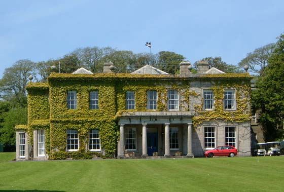
Clowance House.
Hi
Folks, days after the party I'm catching a late hike on Rudolf's back to give
that promised virtual tour of Helston for Ann and Susan - both back in
California, but I'm sure they'll manage a virtual wizz across the ocean for this
one!
One of the great delights and curiosities of Cornwall is the way that beauty and
elegance lives side by side with what was once squalor and industry... at
Pendarves Wood, the estate of the Pendarves Family sat in isolation among the
vast spoil heaps, smoke and fumes and surface works of neighbouring mines,
and as we zoom overhead, hanging on to Rudolf's neck (wishing that reindeer had
more of a mane!) we're passing over the little churchtown of Crowan, and the
estate of the St Aubyn family at Clowance... beautiful
parkland, (now a time share village) surrounded by a high brick wall.... and
beyond the brickwall were the mines which created the wealth which funded the
leisurely lifestyle within that wall. The spoil heaps of Horsedowns have - in
the main - been 'restored' in recent years, and shafts filled in or capped, and
marked by ugly concrete stumps... sometimes with the shaft name on a metal
plate, but more often not, because the plates can be easily wrenched off. This
'restoration' - which has also happened in other areas - has angered me, because
it has done so much to destroy the industrial heritage, as well as the very
special and specific wildlife heritage of these 'toxic' sites, which often
support a flora only found here.
But 'Flora' is a nice way of getting from the mines of Horsedowns, across in a
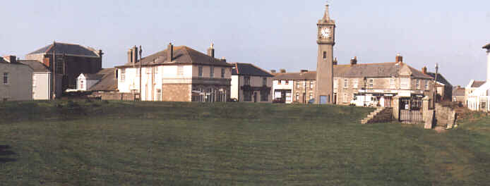
slight diversion to the west across Great Wheal Vor, and back into Helston...
second borough in Cornwall to receive a Royal Charter back in 1201, and an
elegant town of wide streets and affluent houses which was a 'stannary' town
where the tin from mines to the north, south, east and west was assayed and
stamped as pure

Rudolf
is setting us down here at the bottom of the wonderfully named and very elegant
'Coinagehall Street' - this is the main street of the town, with a park at the
southern end, and a crossroads at the top end with the Guildhall, where the
elegantly clad Midday Dancers (the finest of Helston folk!) set out on Flora
Day, 8th. May. every year.
But today, the streets are full of bustling crowds.. the 'sales' have already
started in the shops, the twinkling lights shine brighter and brighter as
evening falls, and the front of the Guildhall proclaims 'Merry Christmas' in
lights.
Everywhere in this most 'Cornish' of towns and in these delightful streets of
Helston is the sound of tinkling running water, running in rills down open
granite gullies - the streets are paved with granite 'sets' (mostly hidden now
under tarmac or blacktop) but this is a time of year of fantasy and imagination,
so we hear the sound of horses hooves and carriage wheels back in the year 1851,
as Schoolmaster William STEPHENS walks up past the Guildhall to his Commercial
School in Wendron Street. With Christmas out of the way, he is thinking now of
his forthcoming term... he has placed his adverts in the 'West Briton' and now
it is just a question of how many students will be signed on.

Wendron Street late 1800's:
But
where was that school? As we walk up now, in some ways the street - which is
getting steeper and more narrow, with more houses than shops - has hardly
changed. Do we turn with the schoolmaster into this double fronted 4 floor house
(now a lawyers office)? Do we turn into this courtyard where now the Helston
Packet is produced? Do we turn through these iron gates, which lead (today) into
a car park?
Pretty cottages line the street, and now that dusk has fallen we catch glimpses
through open curtains of tiny front rooms, beamed ceilings and small fireplaces
creating a warm winter glow. But these are rooms much too small for a school!
Up on the right is a converted chapel - now the 'Flora Centre' - where worship
has given way to a cafe, cinema and Indian Restaurant. Yards further up the road
is a new cottage, superbly matched in granite stonework with the old... but with
modern PVC windows.

Just
a few more doors up at number 61 is the birthplace of 'World Champion' bare
knuckle boxer, Robert Fitzsimons, born here in 1863 (so he wouldn't have been a
pupil) but with still a red painted post box set into the stone work of the
front of the
cottage... a hark back to the days when postage cost just one penny, because
this letter
box is over 100 years old, and has the initials 'VR' (Victoria Regina) cast into
it.
But, sorry Ann... although our imaginations have followed the schoolmaster, he
has disappeared into the gloom of the night, and - today at least - we've lost
trace of him, and his schoolhouse... perhaps, another day,a friendly local
historian can help us!
So, back onto Rudolf (who has obligingly galloped up to Godolphin Road to meet
us) and who now roars off along lanes he obviously knows... goodness, it is
bumpy on a reindeer at speed!
Clodgy Lane is where we hope to find the 1872 birthplace of Samuel Colmer
RICHARDS, but as we reach the top of Godolphin Road, my heart sinks. Here, at
the junction with Clodgy Lane, Redruth Road, and Falmouth Road, modern life has
imposed itself with a vengeange.
As we set off along Clodgy Lane, our hearts sink further. Even the friendly
Rudolf can't hide from us the fact that this is now the busy main 'ring road'
which carries traffic thundering around the ancient heart of Helston, bypassing
the inner town, but creating a racetrack of tyre depots, sports fields, giant
superstore, and the sprawl of a modern housing estate.
This is no longer a 'lane' and although the far end of it is our gateway to the
beautiful Lizard Peninsula, it is also the gateway to the vast modern airfield
where the 'search and rescue' helicopters of Royal Naval Air Station 'Culdrose'
take off, and the main runway almost meets the end of Clodgy Lane.
And then... suddenly... hidden by a tiny group of trees almost at the end of
this huge runway, and just past the massive sign board pointing to 'Flambards
Theme Park' (closed for the winter, its fairground rides just peaking through
the tree tops of the green valley below)... just hidden, is a tiny lane and two
old stone houses. We've almost missed them,
but Rudolf does a wheely should that be a hoofy??? round the roundabout
(almost
putting us in the cottage hospital on the other side of the road) and his hooves
gallop past the first of these stone buildings... two old cottages, boarded up,
with shattered windows looking blindly out on the dreams of past owners who have
started to build an extension, but no longer live here.
But Rudolf excitedly pawes the ground to direct our attention to the old stone
building next door, with new windows, neat lawns, and a sign on the gate 'The
Old Barn'.
Susan... the helicopters thunder overhead, the cries of happy holiday
makers must echo up here from the fairground below in the summer, the traffic
roars the other side of the trees, but here is the little oasis where - 128
years ago, your ancestor came into the world, and where today, a happy family
still lives! Happy New Year! John C. (who took the rest of his family on a
'real' tour after this to see the twinkling lights around the delightful harbour
of Mousehole, and woke up this morning to find that a white Christmas had
arrived, just a few days late!)

Folks, I thought the Virtual Party might like to join my celebration of a Real Cornish Christmas, as experienced by my family! Being the 'Night before Christmas Eve' this is Tom Bawcock's Eve in Mousehole, when 'Starry Gazey Pie' is eaten at the Ship Inn, and local folk celebrate the saviour of their village from starvation many centuries ago when Old Tom and his cat Mouzer set out after days of storms to catch fish for the village (this is the Mousehole equivelant of Thanksgiving Day, I guess). But first, on our way from Launceston (in the far East of Cornwall) to Mousehole (in the far West, an hour and a half away) we stopped off at Pendennis Castle, to join our musician friends in the celebration of a Cornish Christmas of centuries past. Dressed in period costume, the musicians and dancers of Pyba, and the singers of Kescana, made a pretty sight in the ancient Keep of the castle. For those of us planning 'DEHWELANS 2002 - The Cornish Homecoming' next May, the day was perfect... here we were, two days before Christmas, in bright sunlight, with clear blue skies, wonderful views all around us - and the strains of this evocative music spilling from the Keep. (The musicians and singers have made a wonderful CD of this, called 'Nadelik - A Cornish Christmas' which has been featured in the 'English Heritage' magazine)... but after a quick photo call, we headed off down the coast road through Helston, Breage, and Penzance, around the working harbour at Newlyn, and parked about a mile out of Mousehole. As we walked along the cliff edge sidewalk into the village, dusk was falling, and yet the famous illuminations (which fill the harbour, and spill up the 'bowl-like' hillside setting of this gem of a village) were still dark. Then, as we stood on the harbour wall, the sun sank, the sea changed colour from blue and silver to orange and gold, and the lights gradually came on, to the gasps of the crowds surrounding the harbour. Behind the harbour-side cottages and shops, pubs and restaurants, there is a maze of dark and narrow alley ways, steps, and narrow lanes that connect the different levels of this close-packed village. Houses seem to sit upon houses, and you can get lost quickly in this warren of byways in the dark. But the highlight of tonight was away from the crowds thronging the harbour, as we stood among a small group of local people in one of these narrow lanes. As the sounds of the drum and bagpipes grew louder, a huge procession of Mousehole children and their families joined us, each holding aloft a giant fish made of a cane frame covered in tissue paper. Inside each burned a candle, and the fish glowed a golden yellow in the dark lanes, casting a straw coloured glow on the excited faces of the children. In procession we went through the dark lanes and alleys, down narrow steps, until at last we reached the harbour to sing the song of the Mouzel Cat.... while over the sea wall, the waves washed against the barricades that stop the winter storms destroying precious fishing boats in the harbour, the gulls screamed at a small trawler returning to Newlyn, the Lizard Lighthouse flashed in the distance, and over on the rocky crags of St Clement's Isle, the curlews threw their plaintive cry into the night air. For me, a magical moment, when I was reminded of the very special qualities of Cornwall... a place where everything has a place, where natural beauty contrasts with reality, where the past mingles with the future, where the hardest of life mingles with the 'special' and where all are welcomed so long as they contribute, and 'give' rather than 'take'. John Coles, back home in his ancient house in Launceston.

"The first Big hill out of St Ives" (click to see more)
This is a Virtual Tour of Towednack, for Chris Uphill.
THE way to see Towednack is from the top of the highest hills around, and then walking down the myriad footpaths which honeycombe this big, scattered, parish until we reach the sea! So we're starting up on the heights of Trink Hill, only around 2 km inland from the sea due south of St Ives, but over 200 metres high (about 700 feet). Down below us stretches the vista with St Ives Bay (and Godrevy Lighthouse, way in the distance, sparkling white in the Aussie sun that arrived specially for the party) several ruined engine houses below us with scattered mine remains, Towednack church in the distance between Trendrine Hill and Rosewall Hill. We can see a landscape of tiny scattered fields hedged with rough granite, wildflowers poking out... even in the middle of winter, it is so mild down here that flowers still grow... with the wild hillsides with huge granite outcrops rising out of the landscape we are about to walk through. But watch your footing! This landscape is strewn with old mine shafts, many of them hidden in the dead bracken or under gorse bushes, and you're going to need something stronger than those party shoes! Down the hill we're just passing a nicely restored engine house... still up high though, and just feel that wind... as we head along the St Ives to Penzance road a few hundred yards to the Engine Inn, where I used to enjoy many a 'barley wine', and where we'll stop for a drop of refreshment... Now, we ought really to climb down the hill into Nancledra village of granite houses grouped around a stream in the valley bottom, with hills so steep my old Ford van could barely make it up in first gear, but instead we're going to set off down old lanes, and footpaths along old mine tracks towards the church...

Click for camping details
and eventually the sea. Watch out for the humps and bumps... we're passing through Durlo Mine and Giew Mine heading for Penderleath, where there is a big lake from surface workings hidden in amongst the willow trees - and look - frogspawn around the edge... a quick look at the massive remains of the 'stamps' next door, and then on down the track until we join the lane at the evocatively named 'Cold Harbour' (we could go along to our left to the wonderfully named 'Skillywadden' but we're just walking down a few hundred yards / metres to what looks like gates into a private house...

but NO! Up here in the wonderful little church at Towednack itself. A raised circular churchyard, (full of CURNOW headstones, BTW) and the moorland landscape (now very wet and marshy) of Beagletodn Downs) stretching out beyond. Quick - take some photos, this church is really isolated, and really picturesque, with a stunted tower resisting the gales that roar through this valley. It has (like most Cornish churches) been over restored by the Victorians, but you can still feel the power of the past in the 700 year old arches, and the font stood on an upside down font bowl which is even older. And, from the circular church yard, I would guess folks worshipped here long before Christianity, because this usually denotes a Christian 'takeover' of a 'Pagan' site. But we've still got a way to go, so out again, into that cold wind, past mill or mine ponds alongside the road as the lane heads between Rosewall Hill on the right, with it's mixture of prehistoric hut circles, ancient mines, and dramatic views, and the slightly 'gentler' Trendrine Hill on our left...

though the slopes towards the sea are just as steep, and the rocky outcrops just as massive. It's hard to imagine our ancestors living here, on these rocky slopes, and yet this is where 2,000 / 3,000 / 4,000... and even 5,000 years ago they were living and dying, leaving behind burial cairns on the hill tops, and scattered stones from their homesteads, and this part of Cornwall is where you feel the past most strongly. We cross the road - the dramatic road which winds it's way along the north coast from St Ives to St Just, heading for Trevega Wartha (just roll that name around your tongue and feel the ancient language) and - breathlessly - we're suddenly dropping down towards the flatter coastal area, the high hills above and behind us, but still way above sea level. Our ancient trackway is taking us through a maze of old mine workings... Trevega (working well into this century), Brea Consols, St Ives West... all with workings going right out to the cliff edge, because here we end out virtual tour, on Trevega Cliff, the dramatic rocky outcrop - like a little island - of The Carracks to our left, and Pen Enys point to our right...

Click to see more John Miller prints
oh, and look.. way down there in the sea, some fishing boats hauling in lobster pots or mackerel lines far out from St Ives, and a couple of seals staring up at us from the waves with those soft, dog like eyes! But I'm exhausted..., that was a tough walk, and if we're lucky we'll catch a lift from some late partygoers flying past! Incidentally, any ideas what mine Christopher Martin might have worked? Some of the mines in the area we've just explored: Tyringham / Rosewall / Bussow / Buzza / Providence West / Durlo / Giew / Goole Pellas / Ransom / St Ives Wheal Allen / Brea Consols / St Ives West / Trevega / Georgia Consols / Montague / Racer. Nadelik Lowen, John C.
Photos by Sandra Pritchard unless linked to web site