PANAMA -- Country Profile -- MAPS [p9 of 9]
| WHOs
|
PANAMA -- Country Profile -- MAPS [p9 of 9] |
|
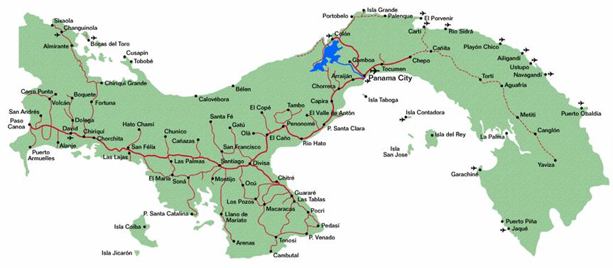
Cities, towns, highways, and major secondary roads of Panama
(Above map from American Embassy/USIS-Panama website)
|
| MAP OF PANAMA CITY, AMADOR, ALBROOK AND CLAYTON |
| A | Panama City (older part) | J | Albrook / J# Albrook Mall and Transport Terminal |
| B | Quarry Heights / Ancon Hill | K | K-E Corozal-East / K-W Corozal-West |
| C | Amador | L | Miraflores Locks |
| D | Causeway to Naos, Culebra, Perico, and Flamenco islands | M | Clayton |
| E | Bridge of the Americas | N | Site of new American Embassy at Clayton (since Sepember 2007) |
| F | Rodman | O | Friendship Highway / Camino de Amistad |
| G | Port of Balboa (Panama Ports Company) | P | Howard Base |
| H | Panama Canal channel | ||
| I | Albrook Airport |
For map of all former U.S. military bases in Panama go to Map of Military Bases in Panama
| This page last updated: May 30, 2009 |
| Site developed, owned and maintained by |
| William H. Ormsbee, Jr. |
| 1999 - 2009 |