

We love camping year round in Arizona. The Mogollon Rim is spectacular in the winter months. The elevation there is about 7200 feet. We have traveled to different parts of this Great State and would like to share with you some pictures of what we have seen. There are so many wonderful places to see it's hard to know where to start.
 |  |

 | This is our camper. We have gotten so much use out of it in the past 4 years. We have camped in the summer and in the winter. It can be cold, down to 16 degrees, but we find that with a heater and the stove it keeps it comfortable. |
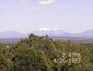 | A view from our property in Northwestern Arizona of San FranciscoPeaks. This was in April and they are still snow capped. |
 | You never know what you might see around the next bend. We found these just walking along the middle of the road going up Mingus Mountain on our way to Jerome. Arizona has alot of "Open Range" so you might see cattle all most any where. |
 |  |
This is Mingus Mountain. Most of the Mountain ranges were formed by volcanic eruptions or by earthquakes. Alot of the mountains are covered with volcanic lava rocks. This is one reason the mountains are so rugged looking.
 |  |
These are pictures of Stoneman Lake.This is just one of the many lakes. Arizona has some wonderful Lakes and some good fishing and recreation in and around these lakes.
 |  |
 | This is a Saguaro cactus, one of the most majestic of all the cacti in our state. They are found in the desert floor and in what is called the "High Desert". |
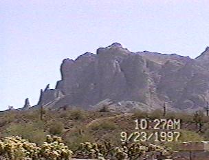 |  |
These are pictures of the Superstition Mountains. They are East of Phoenix and Apache Junction is at the base of them. These mountains are where the "Lost Dutchman" mine is supposed to be. No one has ever found any trace of the "Gold" that is alleged to be in these mountains. Thus the name, Superstition.
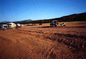 This is a picture of the "South Pasture" at Roosevelt Lake. We used to camp there before they built new camp areas and raised the level of the lake with a new Dam. You could camp and launch your boat right there.
Roosevelt is the largest of the three lakes that feed the Salt River, which is the water shed for Phoenix and the surrounding towns. The other 2 are "Apache Lake" and "Canyon Lake".
 |  |
These pictures show some of the lake. It is one of the best lakes for boating and fishing. It is not the most used lake, that would be Saguaro Lake. But it is one of the most beautiful lakes in the area.
 |  |
These are pictures we took from the boat on Roosevelt Lake. Again it is the biggest lake in the area, covering 27 miles long and 3 to 3 1/2 miles wide at the widest point.
|