The Trail Journal
of
 "Full Moon" and "Celestial Spirit"
July ~ 1995
The Priest Shelter (VA) to Fahnestock State Park (NY)
of
"Full Moon" and "Celestial Spirit"
July ~ 1995
The Priest Shelter (VA) to Fahnestock State Park (NY)
| July 1 | The Priest Shelter to Maupin Field Shelter | 13.6 miles |
Long downhill off of Priest Mountain into Waynesboro. Nice overlook over the valleys into Waynesboro. Not raining - finally! As we hit the road at the Tye River, a whole horde of ATC folks clamber out of their cars (they are attending the annual conference in nearby Harrisonburg,VA) enroute to a Northbound day hike. They graciously hand us some muffins to eat, which are devoured instantaneously!
Stop at Harpers Creek Shelter where you have to clamber over rocks in the stream to reach the shelter. Lunch here with the "Boots" and "Fathat". Others have taken a blueblaze (Mau-Har Trail) shortly before this to find a shorter approach to Maupin Field and to bypass Three Ridges.
As we climb over Three Ridges, "Full Moon" tries to decapitate his long time buddy on the Trail and in Life. "Celestial Spirit" is halfway to the Pearly Gates. As we climb a steep uphill, the top of "Full Moon's" pack brushes a heavy, dead, limb hanging in the branches above. Just seconds later, there is a loud crash directly behind him. As he turns to ponder this horrifying noise, his eyes alight on "Celestial" laying face down in the dirt with aforementioned heavy limb on top of her. Fortunately, she looks up with rather a dazed expression and say's "What was that??". Apparently, the limb struck the top of her pack, just missing her head, and driving her into the dirt. "Full Moon" is looking for cover about now. Just another day on the Trail!
Whoops - spoke too soon - as we approach Maupin Field, we can see a major storm brewing - roughly a 1/4 mile away, we start to feel the drops. "Celestial Spirit" breaks out into a run and I am close behind. Never thought we could move so fast with those packs on. We make it to the shelter with seconds to spare.
"Jefferson Boots", "Fathat", "Dog", "Boxcar", "Bald Eagle" are there. "Bald Eagle" has just come from Rustys. He decides to do some filming with his video  for the Trailsides show - don't think much of that will be printable! (turns out to be a correct assessment - though his name appears in the credits, I don't see a lot of footage - could have something to do with those "gross" hiker comments!)
Fetch water from the stream nearby - freezing cold - fingers practically fall off. P.S. We skip Rusty's - more of a place for the younger crowd to hang.
for the Trailsides show - don't think much of that will be printable! (turns out to be a correct assessment - though his name appears in the credits, I don't see a lot of footage - could have something to do with those "gross" hiker comments!)
Fetch water from the stream nearby - freezing cold - fingers practically fall off. P.S. We skip Rusty's - more of a place for the younger crowd to hang.
| July 2 | Maupin Field Shelter to Waynesboro | 18.1 miles |
Broke camp at 07:30. Sun is shining! Hiking with "Jefferson Boots" and "Fathat" for first few miles. We make the climb over Humpback rocks and as we descend the other side, find hordes of weekenders climbing up for the view. They look at us like we've come from outer space. The trail is muddy, rocky, and slippery coming off the top. A couple gives us two cans of Mountain Dew - ah, a Yogi!
When we hit the bottom, we do a short roadwalk to the Visitors Center where we thought they would have a coke machine and a phone - no luck on either. We lounge on the grass for a while and then head back to the trail for the final 5 miles into Rockfish Gap.
Crossing Mill Creek, shortly before the Paul Wolfe shelter, is quite an experience. Due to the heavy rains, there is no easy place to cross. "Full Moon" finally makes it across on very unsteady rocks and looks back to encourage "Celestial Spirit". She steps out, retreats, looks for another place to cross - there is none. Her encouraging husband suggests she can make it over in the same place he did. She insists this is not so, but he eventually convinces her.
Two steps out onto the rocks and down she goes. "Full Moon" knows he is in deep doo-doo now. Fortunately, there is are no other hikers around at this time, as the conversation takes a decidedly negative turn. "Full Moon" is pondering whether it is better to head out into the stream for a rescue or head for the hills. As he reaches her, he fully expects to be thrown headlong down stream, but fortunately "Celestial" is more concerned with getting her soaking wet body out of the river. As they reach the bank, the conversation intensifies and dire threats are mumbled. This is one of those "As soon as we hit Rockfish Gap, we're divorced" days. Fortunately, this is our worst trial and we are soon laughing about it at Paul Wolfe shelter.
We make it to Rockfish Gap and catch a hitch with an ex police officer to the Fire Station where we plan to pitch our tent. "Crusty", "Irish Rover", and "Dog" are there. Grabbed a shower and ate at the Tastee Freeze for dinner.
| July 3 | Waynesboro | 0 miles |
Got up early this morning and went to the Bank Machine for $$. Ate at Weasie's - $2 all you can eat pancakes, but pancakes were like lead (probably intentionally made that way). Made it to the P.O. for our 11th Maildrop. Washed our sleeping bags at the laundromat where they had a special extractor machine to get out excess water. Worked great - bags are renewed! Good thing - after two months on the trail, they were getting rather funky.
The fire station folks surprised us this p.m. with a tour of the station - quite interesting. Headed out for Chinese for dinner and to Kroger's for some groceries.
| July 4 | Waynesboro to Calf Mountain Shelter | 7.0 miles |
4th of July! We had thought we would be near Gettysburg at this time and had planned to tour the battlefield, but obviously we are behind our schedule! Headed to Outfitter at Rockfish Gap for a new pair of boots for "Full Moon". Bought a pair of Merrill Unitas - suede like finish - easy to break in. Fabiano Rios looked like layers were separating on sole - sent them back to Fletcher,NC to the Diamond Brand camping center there for repairs. They in turn send them on to the Cobbler in New Rochelle, NY for repairs and redelivery to me further down the trail.
Decide to head back into town and grab some eats before hitting the trail. Finally get a hitch out of town to the trail with a girl and a couple of other kids who were quitting the trail. Started to hike around 4 pm. Shortly, we divert off to the trail to go down and register at the entrance station to get our backpacking permit - then back to the trail. Aggravating. Next 240 miles of trail maintained by PATC , one of the largest hiking clubs in America, founded in 1927.
As we reach the summit of Bear Den Mountain, we are surprised by a collection of old tractor seats planted into the ground - totally incongruous with the landscape, but then so are the radio and TV towers here. However, they do make a nice rest spot for beautiful views.
We finally reach the shelter around 8 p.m. where we find "Meterman", "Sprout", "Florida","Southpaw","Bald Eagle", and "Blister". We hear fireworks but don't see any.
| July 5 | Calf Mountain to Skyline Dr. M.P. 92.4 | 6.5 miles |
Hit the trail around 9 a.m. Cross Jarman Gap in about a mile where "Full Moon" gets into long winded conversation with tourist about his motor home. Another of our fantasies - hit the open road in our motor home and just travel till we're broke. (Well, we're working hard on the last part of that equation anyway!) .
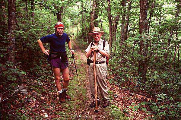 We turn Northwards again and shortly up the trail, "Full Moon" notices an older gentlemen approaching in khaki pants and shirt carrying a hiking pole. Somewhat surprised to see someone this early on the trail and heading southbound, he is even more surprised as he does a double take and realizes it is his father!
We knew that he and Mark's Mom had planned to meet us in the Shenandoahs but not for a few more days. Well, they arrived early, and using Wingfoot's Handbook, decided to check out the fire station in Waynesboro to see if we might be there. In the process, they bumped into the "Jefferson Boots", who told them where we would probably be on the trail that day. Talk about a surprise! Unfortunately, for my father, due to my long winded motor home stories, he was probably forced to hike an extra mile southbound to find us.
We hike Northbound with my Dad (who is 83) to milepost 93.4 where my mom was waiting for us with the car. She was about ready to send out a search party I believe! It was such an incredible experience to be on the trail with my Dad - a kind of bridging of the generations, so to speak, and an experience I will never forget.
We decided to call it quits for the day and return to Waynesboro and spend some time with the folks. Went to Shoney's for lunch where again "mass quantities" were consumed, somewhat to the embarassment of my folks probably. Stayed the night at the Skyline Motel in Rockfish Gap. Went to the movies to see "Bridges of Madison County" and off to the Tastee Freeze for more treats.
| July 6 | Skyline Dr. M.P. 92.4 to Loft Mtn.Campground | 13.9 miles |
Dad was psyched to hit the trail again, so throwing our packs in the car and taking the tops of our Dana packs as fanny packs, we head off for our first day of "slackpacking". He does the first five miles with us and then we come to the car, where Mom is devouring a book on polar bears I had been reading on my hike. Dad is quickly finding out the importance of having enough toe room in his boots as the front of his toes are getting clobbered. Just as we reach the car, a heavy rain and hail break out - whew, close one that time! After a break for lunch, Janet and I head on and agree to meet the folks at Loft Mtn.Campground.
We run into "Sprout", "Bald Eagle", "Florida", and "Blister" at the campground. "Bald Eagle" is filming some more unviewable documentaries. We decide to head back into town with the folks for more grub and hot showers. Went to the Western Sizzler for AYCE buffett.
| July 7 | Loft Mtn. to Swift Run Gap | 17.5 miles |
Eat breakfast at Howard Johnson's next to motel and then head for the trail. Dad's feet are hurting too much for a long hike today, so he agrees to meet us later on by hiking in off the trailhead. We're looking forward to a hard, fast day without packs. It is such a different experience to not have 40-50 lbs on your back! You can actually look around a bit without the fear that you are going to fall on your face! We quickly begin to realize what great shape we're in. There was a time when 5 miles on a day hike would wear us out. Now after 17.5, we're feeling great!
We stop at Pinefield Hut for a lunch break (nice little hut across a stream) and hike on. We meet Mark's Dad briefly and hike with him for about a mile. They head off to Big Meadows Lodge to secure a room for the evening and we continue on. We come out of the woods around 5 p.m. and head for the lodge and hot showers and dinner. Is this living or what?? Though we always felt a bit guilty about slacking, this wonderful respite is beginning to change our minds!
We spread out our belongings back in the lodge and decide on some things that we can maybe send back with the folks. Mark's mom has made us some sheets she sewed together and we are going to try those and send the sleeping bags back home. Also dump some of our heavier long underwear. During the night "Full Moon" awakes and says "Janet, listen!" Sure enough, we hear the sound of little teeth chewing! Upon waking in the morning, there is a hole in our food bag! Can you believe it? We have to get to a nice lodge before the mice get into our food! Unbelievable!
| July 8 | Swift Run Gap to Bearfence Mtn. Hut | 8.9 miles |
We enjoy breakfast at the Lodge with the folks, then talk for a while with "Chia" and "Kersten" who also stayed there. We do some laundry, mend some clothes and get our packs ready, then head off to Big Meadows Wayside for some lunch. We finally make it to the trail around 3 p.m. to do 9 miles. Say goodbye to the folks - couldn't convince them to stay around any longer! It has been a great 3 days though and was sure a nice break!
Packs feel like they weigh a ton! We pass Lewis Mountain Campground and stop in to pick up a few snacks before heading on to Bearfence Mountain Hut. We run into "Lone Wolf", "Scare Bear", and "Wrong Weather", who are all staying in a cabin at the Campground.
We sneak up on "Allen" and "Dog" at Bearfence in a vain attempt to scare them. Surprised them anyway! During then night we hear a commotion outside and figure a bear is going after our food on the bear pole. Everyone scrambles outside, only to find a racoon perched on top of the pole. We scare it off, then "Dog" demonstrates some incredible agility as he scales the bear pole and throws our food bags down to us (our attempts to retrieve them with the long pole provided has proven to be in vain!). We haul them into the shelter and resolve to be eaten by bears before the coon gets them.
It is pitch dark out when suddenly I see beedy little eyes appearing some 5-10 feet in front of me. That ol' coon is coming after the food! I find a rock in the shelter and wing it at him and he takes off - amazingly, he does not return. "Dog's" shins are bothering him badly and he is going to get off the trail - too many big miles too soon.
| July 9 | Bearfence Mtn. Hut to Rock Spring Hut | 11.4 miles |
Start up Bearfence Mtn. Take the blue blazed side trail to the summit, but not much in the way of views. Run into a Sierra Club group from Washington,D.C. out for a day hike. Today is "Lunch Day" at Big Meadows, so we have a mission! We have a leisurely hike to the Wayside arriving around noon where we find "Allen" already sitting down for lunch. After a meal of cheeseburgers,fries,drinks, and blueberry pie w/ ice cream, we're ready to hike?
Actually, not quite ready. We lounge around outside on the grass for a while with Allen, then he decides to hike on. We have finally made up our minds that it is going to be impossible to make it to Katahdin by Oct. 15th at the rate we're hiking. We decide that we will have to jump from Harpers Ferry to Delaware Water Gap and after summiting Katahdin in Maine, we will come back to Delaware Water Gap and hike southbound in to Harpers Ferry to finish our hike. This has been a very tough decision for us - there is no way we want to jump, but finally decide we have no choice, so we spend some time checking out bus schedules between Harpers Ferry and Delaware Water Gap, all to no avail. We lounge around for a while longer, make some phone calls, answer tourist questions and finally around 5 p.m., we head off making it to Rock Springs Hut by 8 p.m.
"Allen", "Happy Hiker", and a couple from Panama City, Fl out hiking for the week, are there. Had enjoyable evening shooting the breeze and rocking on the porch swing - a first for shelters! Nice looking cabin nearby which is available for rent for groups.It rains during the night and we freeze without our sleeping bags. Figures. Also sent our fleece home, so we are one shivering pair tonight!
| July 10 | Rock Spring Hut to Pass Mtn. Hut | 15.1 miles |
Hit the trail around 8:30 heading for Skyland and lunch. Boy, you can eat in style on this section of the AT! Makes it nice, cause you need only carry minimum food through the park. Of course, it is not particularly cheap this way either! Found "Allen" and "Happy Hiker" at Skyland. "Allen" had made it for breakfast and after some minor arm twisting, we convinced him that lunch would be good for him! "Celestial" takes advantage of the bathrooms to wash her hair.
Reached Pinnacles campground around 4 p.m. and I wash my hair! Get a picture of a bluebird sitting on one of the trail signs. Heading towards Mary Rock - reach there around 6:50. Beautiful views from up here, but very hazy today. Lots of loose rock on the downhill from here. Feet are screaming bad. "Celestial" screams as a ruffed grouse explodes from the side of the trail.
We take a break at Thornton Gap - too late for dinner at Panorama. Finally reach Pass Mtn. Hut at 8:30 after a long side trail to the shelter. "Allen", "Happy Hiker" and a family who is out for a week's hike are there. We sleep upstairs in the shelter. Janet spends the evening hollering at "Allen" to quit snoring, with little success!
| July 11 | Pass Mtn. Hut to Gravel Springs Hut | 13.1 miles |
Got started around 9. Hiking towards Elkwallow where we got a double cheeseburger, fries, Mystic Strawberry Kiwi drink, Big coke, Root Beer Float, and drank some pineapple orange Kool-Aid.
We run into "Raven" (Ernst Banfield) here who we noticed singing a song to an elderly couple as we came out of the woods. Tall bearded guy - weren't sure what to make of him. As we were sitting on the picnic bench, he strolled up and started talking to us. Turned out to be a marvelous guy. Had hiked the trail in '85 with his wife "Sunshine" who later died of cancer at 52. He sang us a song accompanied by his guitar he had recorded about the trail entitled "Northbound AT". A great song describing the entire trail - a must hear if you've hiked the trail and will certainly inspire you , if you haven't! (The "live" performance is better than the tape, especially when accompanied by guitar, but what else would you expect?) The tape can be ordered from the ATC in Harpers Ferry. As we hit the trail, "Raven" sang a song to get us going. This was quite a spectacle as all the tourists sat there gaping. A great memory - one of the best on the trail.
We finally get back on the trail around 4 p.m. to do our next 6 miles.Up and down, up and down! Reached next shelter around 7:30. "Happy Hiker" there, "Allen" has moved on to the next shelter and we will not see him again. He will be missed - doesn't seem the same without him in the shelter to yell at for snoring! We start eating dinner as dusk approaches and apparently someone else wants dinner too! "Celestial" suddenly notices a bear strolling towards the bear pole! Seeing the pole empty, he takes a look at us and  starts heading towards us. Panic is beginning to set in, when he suddenly stops and saunters off. Whew! Privy visits during the night were not very relaxing after that!
It is here that we read a note from "Invisible Woman", who has hiked in to this shelter to leave a note to all her friends saying that she has to get off the trail, due to a stress fracture in her hip. We are really saddened to hear this, as she has become a good friend and like "Allen" will be missed.
| July 12 | Gravel Springs Hut to Front Royal | 13.3 miles |
Well, today is the last day in the Shenandoahs - interesting how the trail changes as you pass the final sign announcing you're departing from the park. We've enjoyed the trails in the Park, especially those in the South end, but it is a long green tunnel for sure. Many hikers elect to walk the road thru the hike to get better views, but we've been here before, so elected to stay on the trail. Stopped at Tom Floyd Wayside for lunch (beautiful shelter) and then headed on towards the road leading into Front Royal.
As we got to the road , saw "Four F" alighting from a car and getting ready to hike Northbound. We in turn, started looking for a hitch into town , from a road that has a lot of very fast traffic. Finally, we see a car slowing from a high rate of speed - it passes us, pulls over in the gravel and almost flips. We look at each other and wonder, do we really want this? We approach the car to find a young girl crying her heart out. She asks us if we want a ride - we thought this was so bizarre, we couldn't resist. Turns out she has had a fight with her Dad and says she would never pick up hitchhikers, but since she is mad and defiant, she decided to pick us up. Guess we're kind of glad she had that fight!
Stayed at the City Manor Motel and had a nice room. Ate dinner at La Fiesta down the street and had Mexican (no joke!). Did our laundry, picked up groceries from KMart. Tonight a "Full Moon" (the real thing) glowed in a huge orange ball above the motel.
| July 13 | Front Royal to Manassas Gap Shelter | 10.8 miles |
Catch a ride back to the trail with a nice Indian lady who runs the motel, after a breakfast at the Fox Diner (1955 - Janet's year of birth!) just around the corner. Old time decor -reminded Janet of her Dad's diner back in Michigan City , Indiana when she was growing up.  Hot, very hot as we hit the trail at noon- temps around 95 degrees. Ugh.
Fortunately, we stumble across a number of places where we find wineberries growing and pluck these mild tasting fruit off their stems in great quantities. They make for a great treat! Thought they were thimbleberries, but after reading descriptions of how sour thimbleberries are, finally came across a clue that they are actually wineberries.
We hit the Molly Denton shelter after 5.3 miles where we take a break and enjoy one of the showplace shelters on the trail - complete with shower and picnic area! Awesome - too bad we need to make up more miles, so we head on to a much more dismal shelter - Manassas Gap.
We hit Manassas Gap around 8 p.m. and find that we are the only ones there. Enjoying the solitude until we spot a huge wolf spider  crawling across the shelter wall, just as we are preparing to go to sleep. Then we lose sight of him! Spend most of the night wondering if we are going to get eaten.
| July 14 | Manassas Gap Shelter to Rod Hollow Shelter | 13.6 miles |
We broke camp early for us (7:30), hoping to beat the heat of the day. Stop after 4 1/2 miles at Dick's Dome shelter for a lunch break. Trail has been nice today - humidity is high though. Dick's Dome is a 12 foot geodesic dome structure, built in 1989 - fairly small, covered with tarpaper - looks kind of trashy actually. We read in the shelter log that there is a copperhead underneath the shelter. Gee, time to go.
We grab water from the stream in front of the shelter and head back up the trail. As "Full Moon" gets about 100 yds from the shelter, he hears a tremendous crashing in the brush and looks up to see a large black rump charging away through the brush - thankfully heading the other direction, although moments later, he realizes it is going the same way the trail is headed! But we don't see it again, so survived another day!
We reach VA 50 (Ashby Gap) - hoping that maybe Papa Nick's restaurant has reopened, but alas, it is not to be. Shortly before the gap, we pass a small sign indicating that George Washington had laid out the rock wall we are passing by and later helped survey this part of the country. We take a break at the gap and "Lone Wolf" passes us. I believe this is his 4th thruhike of the trail. We try to get water from a house, but no one is home, so we continue on. Bloody hot out. We make it to Rod Hollow by 4 p.m. and call it quits. A "shower" of sorts is there and we get a chance to take a minibath and wash our hair. "Lone Wolf" is tenting nearby - seems like a good guy.
| July 15 | Rod Hollow Shelter to Bears Den Hostel | 9.7 miles |
The plan is to hike to the Blackburn Center today. We break camp this morning at 8:00 and quickly discover that it is going to be cherry hot today! Some 4 1/2 miles down the trail "Full Moon" starts to boil over - his face looking redder than his bandana. As he climbs a hill, his legs give out and he sits down in the trail. We are down to only a bit of water now - no breeze whatsoever - heat index around 120. Danger time! "Full Moon " sips a bit of water - it is warm - pours a bit on his head - feels like an icicle. This is not good.
After resting for about 1/2 hour, he regains his strength, gets his pack back on and we start climbing again - fortunately the summit is not far away, as he is getting worse by the minute. As we descend the other side, we hear water running and soon we reach a beautiful flowing stream - there is a God! We guzzle gallons and practically lay in the stream for a good half hour. We hike on again and pass two Boy Scout leaders and about 5 kids out for a hike with packs on - they look miserable - they must be crazier than we are! Those kids will probably be ruined for backpacking forever. Scout leaders - don't take them out in horrible conditions!
We finally reach the Sam Moore shelter where we run into "Four F". We are both exhausted, so stay at the shelter for about 2 1/2 hours while drinking tons of water and praying for a breeze. We have decided by now that there is no way we're going to reach the Blackburn Center, so we set our sites on the Bears Den Hostel, roughly 3 miles away. We head out again and it is only a matter of minutes before it feels like we have not rested at all. It feels like we are hiking and hiking and hiking..... We can't believe we haven't found the hostel yet - we pull out our maps and wonder if we've passed it - we're getting worried, cause we are about totally done in . We are ready to lay on the trail and scream. Finally, about a 1/2 mile later, we hit the sign for the hostel. We almost fall down and kiss the sign.
As we get there, we find "Bald Eagle" also looking like he has died. He points the way to the sign-in point, where we discover they have Ben and Jerry's Ice Cream! Oh, yes Baby! This is a neat place to stay, originally built in the 30's, this quartzite "castle" is now owned by the ATC and is now an American Youth Hostel building. $10 for ATC members. Nice little camp store there - very nice staff. We consume MASS QUANTITIES OF LIQUID REFRESHMENTS!
We discover that some of the staff work at ATC hdqtrs. in Harpers Ferry and will take our packs to the Headquarters so that we can slackpack into Harpers Ferry.. Boy, you didn't have to offer that twice!
| July 16 | Bears Den Hostel to Harpers Ferry | 19.6 miles |
We're off at 8:30 after having spent a wonderful night in the hostel. During the night, we saw lightning streaking across the sky, but no rain. Must have been heat lightning. As we lay in bed with the ceiling fans going, it reminds "Celestial Spirit" of her childhood days in the hot summers of Indiana sleeping on sheets with the hum of the fan lulling one to sleep.
We have our fanny packs on and bagels with Peanut Butter and honey for lunch and plenty of water, so we are psyched for the hike to Harpers Ferry. We stop at the Blackburn Center for a moment and cool down. The caretaker shows up, but it appears she is burnt out from a summer of Thru-hikers and is rather unfriendly, so we head on down the trail. "Bald Eagle", "Four F", "Country" and the "Vermont Trio" are also at Blackburn taking a break.
Trail levels out some, but rocks are everywhere - feet are starting to woof big time. Two miles out of HF, "Meterman" and "Bald Eagle" pass us. We finally reach US 340 and a van stops and offers us a ride , right to the front door of the AYH hostel in Sandy Hook! They had passed us, decided that we looked like we needed a ride and a mile down the road , turned around and came back to get us. We sit in the back seat next to their little daughter and wonder if she will faint soon from our pleasant aroma. She is very nice and pretends not to notice.
We settle in at the hostel (nice place - another fantasy begins to develop - let's run a AYH hostel!) and then head over to Cindy Dee's for dinner, where we run into "Meterman".We run see "Orville" there who we had met earlier on the trail - he has been at the hostel a while. Started hiking into Maryland and then just lost his drive, missed his girlfriend and the warm waters of Florida and was giving it up to go back home. He claims he burned himself out going too many big miles in the beginning.
| July 17 | Harpers Ferry (Youth Hostel) | 0 miles |
Left the hostel around 10 this morning and had a hell of a time finding the trail to head into HF. Finally we get on the C&O bikepath and that's the trail into HF. We walked thru the historic area briefly and saw "Scavenger". Wonder how he got here? We reach the Hdqtrs, where we spend several hours. Get a chance to meet Jean Cashin, ran into "Raven" again and picked up our 12th Mail Drop. and have our pictures taken for the photo album there. We try to work out some arrangements to get a ride to Delaware Water Gap. After grabbing some lunch, we catch a ride with Melissa who works at ATC back to Sandy Hook.
We manage to arrange a ride to Harrisburg,PA tomorrow from John Hess who lives across from the hostel - will cost us $75. Hopefully, we will be able to hitch from there.
| July 18 | Harpers Ferry - jumped to Delaware Water Gap | 0 miles |
Caught a ride with John in the morning back to Hdqtrs, picked up a copy of Raven's tape, went to the PO and then headed out around 10. Had John let us off at US81 and US83 where we hoped to hitch off the on ramp. As he dropped us off at the gas station, the owner came out and wanted to know what we were doing , so we told him. He then told us he didn't want us on his property - real nice fellow.
So we lugged our packs to the gas station right next door and dropped them there and the guy there even let us put them inside for safe keeping while we grabbed something to eat. We spent the next two hours trying to hitch - no luck, van after van passing us with plenty of room. We grew frustrated and retreated to the Burger King to regroup. Back on the Interstate, we spend another two hours with only one nibble - two guys smoking dope, stoned out of their minds and looking vaguely like serial killers stop to offer us a ride. Despite our desperation, we are not that desperate! State Trooper pulled up just to remind us that we couldn't hitch off the interstate itself.
We retreat once again to the gas station , where we decide that a shuttle will be just as cheap as a bus, by the time we stay in a motel, take a taxi to the bus station, etc. So we start calling names off the ATC shuttle list and finally find a guy who will pick us up around 9 and take us to our destination, for the small sum of $125. We groan, but decide to go for it. In the meantime, in an attempt to put a more positive spin on this rather woeful situation, we head off to the Sandwichman, which turns out to be this incredible deli with the largest sandwich I have ever seen, called the "Utopia for 2". Best damn sandwich we have ever had and has everyone in the place staring in amazement at it. The guy preparing it has never made one, so has to go find the owner to show him how. Apparently they don't make a lot of these, as even the cooks are marveling over this creation. It has to be a good 5-6" high. Love this thru-hiker appetite. In much better spirits, we head back to the gas station.
Our shuttle man picks us up and turns out to be a real nice guy, who has hiked parts of the trail before. After a long drive, we hit the Presbyterian church hostel in Delaware Water Gap at midnight. Stumbling thru the room over other hikers, we collapse on some bunks and pass out. Quite a day!
| July 19 | Delaware Water Gap | 0 miles |
Got up this morning and headed down to the Diner for breakfast - Belgian Waffles.eggs,coffee. Yum. Over to the outfitter for some new insoles, seam seal,etc. Then off to the bakery for pastries - "Full Moon's" passion in life. Back to the hostel where we meet some new hikers - "Robo", "Rainman", and "Howie-O". Put new tips on our Leki poles and waterproofed our boots again (for what good it does!)
One positive thing has come out of this jump to the Gap - we run into hikers again who we met very early on and were hiking much faster than we were, so it is like ol' home week! Ran into "Chameleon", "Tortoise", "Freebird". Met "Downhill" , a southbound section hiker, who was quite kind and went thru our Databook marking all of the good water sources northbound. Ate dinner with him at the Deer Head Inn, where food was only fair and the waitress was a ditz. Our plans are to head out early and skip the Thursday night potluck dinner put on by the church members for all the thru-hikers.
| July 20 | Delaware Water Gap | 0 miles |
Got up this morning and after a short debate and some arm twisting by fellow hikers, gave in and decided to stay for the Thursday night potluck (a wise choice, it turns out). We grab a shuttle to Stroudsburg with a bunch of other hikers, take in a movie (Apollo 13), stroll around town, eat some more food and then head back to the hostel.
Upon our arrival back at the Hostel, we run into an Associate Editor from Outside magazine and his photographer.They are doing an article on the trail. We have our photos taken with one of the Vermont Trio and hope to see it in the magazine but this does not turn out to be the case. The notorious blue and yellow blazing, mega eating thru-hiker, "Bjourn" becomes central focus of article, much to the disgust of most hikers.
Ran into "Fox and Hounds" who we had met way back at the Fontana "Hilton" and "Wild Goose" (from Rainbow Springs). Good to see old faces again and funny to see their expressions as recognition dawns upon them. Notice that the "Vermont Trio" have mysteriously shown up again - suspect they have yellow blazed here. Saw "CR" again. Lot of hikers we discover have yellow blazed it (caught a ride) into Delaware Water Gap, skipping the last 30 miles of the trail. "CR" has not.
It is Thursday night and the night for the big dinner has arrived! The church members set up long tables and some 30-40 hikers sit down to an enormous pot luck dinner. "Celestial Spirit" even has her plate of food photographed by "Outside" magazine. It is a great time and we are glad we have stayed over - another trail experience that will be long remembered! Helps to make up for skipping Woodshole.
| July 21 | Delaware Water Gap to Catfish Fire Tower | 12.6 miles |
Rose early as it looked like rain and we didn't want to get caught with a wet tent. Ate breakfast at the diner again (oh, those poor credit cards!) and headed out over the Delaware River bridge at 8:30, a very long bridge with a narrow footpath for hikers. Kind of a rush when semis come hurtling by. We stop at the visitor center for a short break and talk for a while with a young group of canoers.
As we start our climb, we discover what PA must have been like - nothing but rocks and painful rocks at that, plus we haven't hiked in 4 days - our longest time off of the trail. We pass two Trail Maintainers who are out looking for a bear named "Sophie", wearing a radio collar. Heel is bothering me - has started some weeks back and isn't letting up.
We stop at Sunfish Pond for a while, which is beautiful and quiet today, unlike most weekends when apparently there are hordes of people. Run into "Scribe" and "Snap" here. Moseying on, we come to Catfish Fire Tower, which although it does not show camping in the Data Book, is actually a great place to camp. There is a picnic table here and if you drop down into the woods, there are a couple of excellent tent sites. Thanks to southbounder "Downhill" for this tip.
| July 22 | Catfish Fire Tower to Brink Road Shelter | 11.9 miles |
Lots of rocks again today - taking their toll. Met a few dayhikers today from NJ and NY and took a break to talk with them about the AT. Made it to Brink Road Shelter around 5 p.m. Spent the night in the tent - too many mosquitos.
| July 23 | Brink Road Shelter to High Point S.P. | 18.0 miles |
Despite ailing heals and sore feet, we accomplish 18 miles today. Stop at Worthington Bakery before climbing Sunrise Mtn. Chowed down on a strawberry cheese danish, cherry turnover, Ocean Spray drink, large coffee - pretty tasty, although we were a bit disappointed in the bakery itself, as per Wingfoot's book, it was supposed to be a special place, but help inside was not very friendly and there wasn't much in the way of pastries.
As we sat outside gearing up for the next climb, a young lady came along with a van and offered to take our packs up to the top of Sunrise Mtn. and leave them there. That left us a bit skeptical, but she knew "Candyman" (formerly "Airborne") and "Chameleon" and had about 8 packs in the van, so we took the chance. This would save us 5 miles of hiking with a pack. So we made good time on our climb.
A bit of excitement near the top of Sunrise. Just as we are about to come out of the trees onto the summit, Janet hears a rattling noise near her boot and looks down to see a 4' Timber Rattler, hissing and rattling as it slides out on the trail towards her boot. She manages a quick jump and gets ahead of it and it slithers across the trail in front of me. Whew! Close call! At the summit, we crash out for about an hour and enjoy a nice lunch and are happy to see that our packs are really here! A few tourists wander up to catch the view from the nearby parking lot. We explain what the white blazes on the trees mean. We finally hoist the packs and head out the other side of the pavilion. Just as "Full Moon" steps off the pavilion, he hears that now familar hissing and rattling noise again and realizes he has almost stepped on our friend again, who has decided it would be nice to visit the pavilion and scare all the tourists and thru-hikers! How many lives do humans have?
We push on and think about stopping at Rutherford shelter - more rocks!. We look at the .4 mile straight down a hillside to Rutherford and decide to scrap that idea and head on to High Point State Park. So we continue the 2.5 miles to the State Park office, which is open till 11 p.m. and has our next mail drop. Rains briefly and the little orange newts are out in force on the trail - must have seen 30 in a 100 yards - hard to avoid stepping on them! When we reach the Park, the ranger lets us camp in a pavilion area near the entrance station which is great. Managed to talk the ranger into doing a MacDonald run for us around 10 for quarterpounders which we wolfed down and then felt sick.
Picked up our 13th Mail Drop here at the Park Office.
| July 24 | High Point S.P. to Pochuck Mtn. Shelter | 14.1 miles |
After sorting out our mail drop, we hit the trail around 10. Started hiking straight up the rocks with heavy packs - we're going to have to split up some more of these mail drops - they're just too heavy. We stop for a lunch break at High Point Shelter and read in the shelter log about a whole swarm of bees that have put a few hikers in the hospital. It's just down the trail a ways. The log suggests a shortcut, so we take it. Cross behind a lady's house - dog goes crazy - all the folks are sitting out in the yard - the lady is mad that we're going down her road- says she has notified the Park that the bees are no longer there and she's sick and tired of hikers coming down her road , getting her ugly dog stirred up. We sweet talk her a while and she finally calms down and we beat it down the road.
Pretty tough day today - lots of terrain changes (rocks,pastures, bogs, you name it). We were pretty whipped and still had 5 miles to go when we got to the road crossing to take one into Unionville. There we met Jan Adams who was waiting with cold beer for her husband "Mike the Engineer" (recently retired colonel from the Army and former Purdue civil engineering grad). Janet and I split a beer and hit the trail again - beer went right to the brain - felt woozy going up first hill, but it quickly wore off. Apparently, "Boone" and "Free to Go" have hoofed it into town to a bar, but they can handle it - they're big boys (literally).
Heading into the Wallkill River Valley now. Trail navigates around a large sod farm, which is a grueling road walk in the hot sun. As we head towards Pochuck Mtn., we cross Liberty Corners Road, where some wonderful, kind soul has installed a new water pump. Incredible pressure, incredible delicious cold water. We drink till we're sick. Looking at our map, we see that the terrain doesn't look too bad ahead - wonder if it's right?
100 yards down the trail, we discover the map is lying. Long climb up to Pochuck , as "Celestial Spirit" nears the shelter, she sees "Full Moon" doing a strange dance on the trail. He is being attacked by big ugly horseflies and they are nipping him. We are now entering bad fly territory! We make it into shelter where we pitch our tent. "Boone" and "Free to Go" are there after having consumed some mass quantities of beer.
| July 25 | Pochuck Mtn. Shelter to County Road 565 (Apple Valley Inn) | 2.8 miles |
Wet tent to deal with in the a.m, as it rained just hard enough to get everything wet. We're now off in search of County Road 565, where we plan to hoof it down the road to the Apple Valley Inn in Glenwood for some much needed R&R. Straight up hill out of the shelter and lots of rocks to clamber over - humidity is intense -we are sweating like dogs, dogs with heavy packs! And the flies are vicious again. I have now learned to stop trying to murder them with my bandana. Instead, I stop, wait till they move from the back of my knees to the front of my knees, then swat them hard with my hand till they drop - then stomp on them. These things need a nuclear bomb to kill them! I send 11 to the Happy Hunting grounds in the first hour of the hike - then decide this constant stopping will not get us to Maine and I surrender. We finally hit the road about 10:15 and hoof the mile down to the Inn.
What a great place - big white house built in 1831 with wrap around porches up and down, gazebo, swimming pool in back yard. Dinner,breakfast included - laundry done. Room to ourselves - bliss! Great deli across the road, P.O. next door. Hoofed it down there for lunch where we gobbled down ham and cheese sandwiches, chips, cokes, baked beans, fruit salad - hubba bubba! "Wild Goose", "Snow Leopard","Tortoise","Mike the Engineer" are also there.
Around 7:30, we sit down to a dinner of wine, pot roast, mashed potatoes, corn cassserole, fresh green and yellow beans, and ice cream for dessert (cookies and cream and butter pecan - oh,yeh!) After a really pleasant evening of just talking, we hit the sack at 11:30. It was a smart move to hike short miles today and get in here early to really enjoy the Inn fully - highly recommended place to stay - but you had better call from Delaware Water Gap to make reservations as Mitzi has limited availability.
| July 26 | Ct. Rd. 565 to Wawayanda Shelter | 10.2 miles |
Delicious French Toast (made with a crushed Corn Flake topping) for breakfast. We hoof it down to the P.O. to send some of our Mail Drop ahead to Bear Mountain ,NY to lighten the load. Before we leave, Mitzi takes pictures of everyone for her scrapbook and makes each person write a poem - not one of our specialities, to say the least! Mitzi's husband is taking everyone back to the trail in his van, so I sling my pack over one arm and lug it out to the van (a mistake I will soon discover). We decide to go back to where we got off the trail, even though it will mean a long road walk eventually. But we let Mitzi's husband take our packs on to Wawayanda State Park where we will retrieve them later. Another slack - my god, we're getting lazier as we get in better shape! But the heat is a killer, so we don't feel too bad about this decision. Others skip the road walk and head further north for the trail. "Snow Leopard" wisely knows a good thing when he sees it and gets the owner to take him to Waywanda Shelter so that he can slackpack back to the Inn and stay another night! Boy, is that tempting!
We stop at the crossing of NJ94 and the trail and hoof it down to Haven Hill Farm, a fruit and vegetable stand, for drinks and ice cream and pastries before heading up Wawayanda Mountain. Wawayanda wasn't bad, the trail maintainers had put in a number of steps to make the climb up easier. Thank you Trail Maintainers! Passed "Snow Leopard" on his way back to the Inn - almost turned around and went with him! But,on to the State Park, where we pick up our packs, make some phone calls ("Full Moon" is trying to get his podiatrist to ship him his orthotics which he had returned earlier due to cracking - finally got that message across). Went to Wawayanda shelter to crash with "Grandpa Al". Slept in the tent due to bad bugs.
| July 27 | Wawayanda Shelter to Wildcat Shelter | 12.0 miles |
Another incredibly hot and humid day today. What's new? Got some water from the ranger office before heading out. Walking along a lot of ridges today with very little shade - you can see the heat radiating off of them. We cross the NJ/NY state line ( a white line painted on the trail with NY on one side and NJ lettered on the other side). We can see Greenwood Lake in the distance, but our appreciation is somewhat dampened by the rivers of sweat pouring off of us, so we hurry on hoping the trail will disappear back into the woods.
We reach NY 17A and are out of water and way too hot. We stumble onto the road and fling up our thumbs. Shortly a young college girl stops and gives us a lift into Bellvale and the deli there. We hang out there for 2 hours consuming mass quantities of liquids and regaling the young kids in the store with stories of our hike. They are stupified that we have hiked all the way from Georgia (probably think we're stupid, too!)Store owner came out and talked to us - was very nice.
We catch a ride back to the trail from someone stopping at the store - feeling much better now. Trail starts off nice, but then it gets rough as we run into the Cats Rocks. There is a blue blaze around it and I suggest to "Celestial" that it might be a wise idea to go that way. She goes that way, while I decide to go over the top of the Rocks - pretty wild hike - you fall from up here and you're vulture bait. Glad to clamber down and continue on. Reach Wildcat Shelter and find "Grandpa Al" there. Nice pump down from the shelter for water. It's starting to rain again and the temps drop - ah, never thought I would be happy to see it rain again! A delicious cool breeze whistles through the shelter as he crash for the night.
| July 28 | Wildcat Shelter to East Mombasha Rd. | 6.7 miles |
Hit the trail at 8:00. Humidity starts to pick up again. We could hear sirens in the distance and we later discover that the storms had been particularly bad in Fort Montgomery last night. "Full Moon's" ribs are bothering him some this a.m. and they start to get worse from carrying his pack. He thinks he has hurt his back, when he slung it over his shoulder to carry it out to the van at Apple Valley Inn. After a few miles of hiking, "Celestial" lets out a blood curdling scream and starts dancing around on the trail - I figure she has been bit by a snake, but thankfully it is not the case, but rather a yellow jacket most likely. She says it burns like fire (and still has the scar to this day to prove it!). We hike 5 miles to West Mombasha Road and then hang a left to road walk down to Poppy's deli to try out the "best grinders on the Trail".
As "Full Moon " takes his pack off to set it down on the picnic table, he feels something pop in his back or ribs - extremely painful and it is hard to breathe. He hobbles into the deli (can't pass out before getting food!) and we devour a truly great "Hero" sandwich. They were huge - it was amazing to watch "Celestial" consume this thing. Meanwhile "Full Moon's" back is stiffening and he can barely get out of the seat. We realize we have a problem. After some discussion, we decide that we are going to have to get off the trail for a few days, so now we have to figure out how to get to Fort Montgomery or to Bear Mountain. As luck would have it, there is an older gentleman there with whom we strike up a discourse which eventually leads to the bad back problem (rather sneaky, I'm afraid). He volunteers to take us the 30 miles to Bear Mountain and we are ecstatic. Hitching in the north is not particularly easy and not a whole lot of traffic passes by Poppy's deli!
We are not happy about this decision as we realize we are missing some 23 miles of the trail, but maybe we can backtrack and pick it up. Right now, we don't know what the back problem will be like and decide to play it conservatively. Our retiree takes us into town and drives us to different motels while we search for fellow hikers in the hope to split a room with them. We offer to pay him for his gas, but he refuses. It was truly a Gift to find him in the Deli that day! After not finding any hikers, we end up at the Bear Mountain Bridge Motel, which is a charming little place run by two very nice people. They run us down to the P.O. in Bear Mountain (which is worth visiting), where we plan to pick up our 14th Mail drop , which was food we had shipped ahead from Apple Valley. Unfortunately, our box has not yet arrived.
We know "Wild Goose" is in town so we check at the Hotel Thayer (West Point's big fancy hotel), where we know he is supposed to be meeting his wife, but he has not checked in yet. We're not sure how "Full Moon" will be feeling in the morning so we're not sure yet what we are going to do. The Bear Mountain Bridge Motel is also booked for tomorrow , so we are going to have to move, further complicating matters. We know "Mike the Engineer" is supposed to be in town, but not sure if he wants to share a room. Guess we will find out.
| July 29 | Bear Mountain, N.Y. | 0 miles |
Checked with the P.O.. They have our mail drop. The owner's wife gives us a lift to pick it up and then takes us to the Trading Post Motel where we have learned from "Walking Man", that "Mike the Engineer" and "Wild Goose" may be staying there. They are quite generous and invite us to stay in the room , which is a blessing since the room from the night before cost us $48. "Full Moon's" back is still bothering him, so we must stay another day. "Wild Goose" is going off to the Hotel Thayer to spend the night with his wife (can't understand that - when he could stay with us and inhale that hiker aroma?). His son Brett stays with us, along with "Tortoise".
Wild Goose takes us into West Point for laundry chores and we take the opportunity to visit the West Point Visitor's Center. That night, we head over to the Trading Post Restaurant for dinner with "Mike", where we devour Prime Rib and turkey pot pies. Good food! Nice view of the bridge from their outdoor dining spot.
| July 30 | Bear Mountain, N.Y to Peekskill,NY | 6.6 miles |
We head out to MacDonalds's for breakfast and then Wild Goose takes "Mike" and Brett and us to U.S. 9 and NY 403 for a 6 mile slack back into town. This way, I can get some miles in while my back recovers some more. It is starting to slowly feel better. Beautiful hike, sunny, but not too humid. Back into town, we cross the Bear Mountain Bridge and head into the park and past the lake. The park is crammed full of Blacks and Hispanics enjoying a beautiful day and cooking very tasty looking foods (I know, I know, that is all we think about!). We stop for a look into the Lodge - looks great from the outside, not that impressive on the inside. In the fancy dining room are where we find all the white folks. Strange contrast to the beach scene, but I will refrain from philosophizing on that.
We hoof it back to the motel and take some showers and then head back again to the restaurant with "Mike". Saw "Snow Leopard" again , fresh from his two day stay at the Apple Valley Inn! "Wild Goose" and Brett take Karen back to the Airport. "Wild Goose" plans to jump to Katahdin and hike Southbound.
| July 31 | Peekskill,NY to Fahnestock State Park | 14.4 miles |
We get up early and are picked up by Wild Goose around 7 to head for MacDonalds. He gives us a mini driving tour of the West Point campus - beautiful views of the Hudson. It's neat to see the parade ground, which I've read so much about in books. He then runs us by the P.O. and then off to the trail. Sure was nice of him to give us a lift around as walking to each of these tiny little towns would take too long.
"Full Moon" feels good today. We make the decision to head on North rather than to go back and do the missed section. This is the first time we have missed a section of trail, but knowing it was not intentional and knowing that we were starting to get off our schedule once again, we decide that it is better to come back and do this section thru the Lemon Squeezer later. Still, this is a very difficult decision to make and one that bugs us for some time.
On our hike towards Fahnestock, we run into "Eric the Red", "Maggie" and "Nitesprite"(whom we first saw way back in GA on our 2nd day out!). She has lost a lot of weight and she barely recognizes us, as I have lost 32 lbs and Janet has lost 15. After a 1/2 hour of catching up, we head on to Dennytown Rd, where there is a water pump and we wash our hair and "Full Moon" scrubs that growing beard! He has not shaven since hitting the trail. The trail is nice today, the weather cooler, yet "Full Moon's" left heel is hurting a lot - must be falling apart!. We make it to NY 301 where there is a beautiful lake. After trying to hitch for some time, we start hoofing it down to Fahnestock State Park. When we're almost there, some Park employees pick us up and take us the rest of the way, which sure beats roadwalking! "Mike the Engineer" was there and hadn't had any luck hitching either. Nice place to camp - got a hot shower, put up the tent and enjoyed the evening. Another month has passed!
 Back to AT Journal Page
| On to August Journal | Back to AT Interview Page |