
Jointly responsible for restoring and preserving this area as a sanctuary for critical natural resources:
|
County of San Diego Department of Parks and Recreation http://www.co.san-diego.ca.us/cnty/cntydepts/community/parks |
State of California Department of Fish and Game |
(picture--Welcome to...)
San Elijo is home to an exceptional number of plants and animals. Within its 885 acres are six plant communities: costal stand, salt marsh, freshwater marsh, riparian scrub, coastal sage scrub, and mixed chaparral.
A wide variety of flora and fauna include:
The three miles of trails are a favorite of hikers, joggers, birdwatchers, and nature photographers.
(map)
I found the Nature Center Site (not yet built! but at least a parking lot off the busy road) and walked the Self-Guided Nature Trail. The trail had nice markers explaining the flora and fauna.
(pictures along the Nature trail--overview)
Along the western border of the lagoon, Hwy. 101 as well as the railroad, parallel the Pacific Ocean beach.
(amtrak picture across lagoon from nature trail)
Amtrak runs may San Diegans each day, but their passing doesn't seem to bother the water fowl at all.
The caretaker told me how to find the southern (Rios Ave.) access. He pointed to the 'grey condos' across the lagoon (two pictures back) and said, "that's where the entrance is located." I drove down Hwy. 101 and counted two stoplights past the West Basin, turned left to Rios, then followed it to the end and parked. The walk stared with an access road above the basin with a nice overview, including more passing San Diegan trains.
(picture of San elijo Laboon sign)
The daisies along the road down to the water level were nearly 5 feet tall and enjoying this early April sunshine.
(3 pictures of daisies)
The brochure for the Reserve had a nice "Birds of San Elijo Lagoon" legend:
(birds ID shot)
Mallards are familiar enough for me to identify with my Indiana background and a male and female were watching a nest on the spit of land that jutted into the lagoon and included a freshwater pond in the middle in which the Mallard may have been watching his reflection.
(Mallard pic)
This concluded my morning portion of the Lagoon walk, but I returned in the afternoon...wanting to enjoy more of the rural atmosphere.
I believe I saw (p)
In the afternoon, I looked for, unsuccessfully, the El Camino Real access point. Disappointed, I returned to the Interstate and traveled south of the lagoon and found the Santa Carina access point to the East Basin. When I passed the Flood Control Dike on Manchester Avenue, I noticed it was closed because of a lot of water behind the dike and overflowing the dike. I found no access at the exit of the Interstate like I expected...there was a deep flow of water between the east and west basins as it flowed under the Interstate.
When I reached the Santa Carina entrance, the trail was on a slightly sloping hillside down to the lagoon. Quite a walk down sandy trails which were erroded from earlier rains. Finally the trail reached a sandy delta that disappeared into willow trees. Through the willows heading west, water soon appeared with ducks. I continued westward and reached the burm on which the Interstate was built. As I looked back east over the marsh, I saw the biggest bird of the day, a Great Egret.
A few runners passed on the level trail along the Interstate. I reached the bridge and crossed under it to the west side where I had to walk back south then down to water level and the trail there.
About 5:30, I decided I should start back to the car before dark. I retraced my route with the sun setting slowly behind my back. Ducks still formed circles in the water while searching for food (p). The Great Egret still stood in the same place, watching for a passing fish. The low light made the lagoon take on a new appearance. I wondered how it would change after dark, if it would be more tranquil, or judging from the racoon and fox or coyote tracks, if it would be more fearful for those down the food chain a notch or two.
As I reached the car, a young boy and his dog were entering the reserve for a walk. The boy held the leash, the dog ran free...greater crimes had been committed.
It had been a good walk and it was all I had expected it to be.
Back at the beach house
I had time to read the brochure on the Lagoon. I learned that these coastal wetlands are used by waterfowl and shorebirds as breeding sites and as rest stops and refueling stations on their long migration routes.
However, 90 percent of coastal wetlands have been destroyed since 1850.
This is an estuary. Twice a day, incoming tides cover much of the land and vegitation with salt water. As the cycle continues and the tide ebbs, either mudflats are exposed (summer) or fresh water from rain-fed creeks (winter) replaces the salt water.
Berms built to support two highways (5 and 101) and a railroad have severly altered the tidal flows. This has resulted in a buildup of sediment in the lagoon and inhibits the lifegiving exchange of tidal waters.. It has also robbed the beach of a natural source of new sand.


The County Parks Department took the responsibility to open the lagoon mouth to restore the natural tidal flows and the health of the estuary.
I understand that some hikers have even seen a red-necked stickman
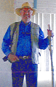
along the trails at spring break. He is said to have gone overboard in collecting driftwood walking sticks

The next day I found another lagoon, closer to our timeshare, Buena Vista Lagoon and Ecological Reserve, just north of Carlsbad.