|
This
province is located in the upper part of the Ithmus of Kra. The
Bilauktaung Mountain Range seperating Thailand and Burma has
partitioned a wider tract of land to Burma leaving a very narrow
strip for Prachuap Khiri Khan. The local population subsist on
pineapple farmimg and fishing. Hua Hin is the most notable town
in this province while the rest of the coastline is dotted with
several low key resorts.
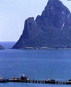 |
The solid
mountain that guards the entrance to Ao Prachuap. Khao Hin Thern is a
hill with many fascinating rock formations.
Ao Prachuap
itself is a long bay, a ring of 8 kilometers long. Its
sheer size, at any point on the bay, the spot offers
uninterupted panoramic views of the fishing community and
the jugged mountains.
|
| The
tempting white sands of the deserted beaches. The sea
here is not so good for swimming. |
 |
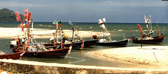
| Away from
the main fishing community, smaller coastal boats ply
their trade along the shore. |
 |
The
sandy beaches is abruptly ended on the northern edge by a sparse
mangrove forest. The shoreline continues outwards towards these
mountains.
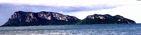 |
Looking
off shore, the karsts hills seem to "pop" out
from the northern sea. |
 |
Sam Roi
Yot National Park is 58 kilometers from Hua Hin and
occupies land of 98 square kilometers. The terrain is
that of high limestone mountains and wide marshlands. The
park is noted for its fauna- resident animals. Then also
for migratory birds as it lies in the path of the East
Asian and Australia flight path. Over 300 resident and
migratory birds are recorded. |
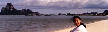
This
is the scene from Hua Hin, a drastic change from the outback.
 |
For a long
time this stretch of beaches are playground to nearby
Bangkok rich and famous. The hotels unanimously promote
an air of upmarketness as compared to the touristy
Pattaya. |
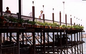
| Rows of
seafood restaurants serve meals in elegance enviroment. In uniform, this row
of restarants at the sea front have open air dining areas
on platforms built into the sea.
|
 |
There
are still other interesting facts about Prachuap Khiri Khan
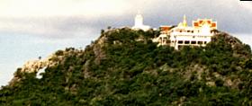 |
This is
Wat Thammikaram on top of Mirror Mountain or Khao Chong
Krajok |
Mirror
Tunnel Mountain is named after the hole [on the left end] through
the side of the mountain. This openning manifest an impression of
a mirror that is reflecting a view from the sky.
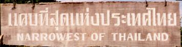 |
A special
park is prepared to mark this place as the narrowest part
of the Kingdom. |
Many
exteme corners of Thailand are formally marked and this place is
one of them. Between the Gulf of Thailand and Myammar border this
part of the country is only 12 kilometers wide.
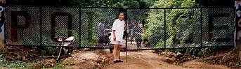
| The police
outpost at the border, the Burmese side is now under
Yangon control. Previously the Karen rebels were active. |
 |
Not
many people would venture into the low hills at the Burmese
border, reports of dramatic waterfalls is hard to come by.
However there is a small waterfall for those who needed forested
Park!
| Name of Waterfall |
Its
Location
|
Link |
|
|
South of Provincial
capital in Thap Sakae |
|
|