Mountains
Some of Europe's most imposing
mountains border France to the southeast and southwest. East of the Massif Central, beyond
the Rhone-Saone corridor, the linear folded ridges of the Jura mountain range give way to
the Alps. In France, the Alps begin at the Mediterranean, where they are called the
Maritime Alps, and extend northward before turning east and entering Switzerland and
northern Italy. The French Alps, though high, rugged, and complex, were heavily glaciated,
particularly in their northern section. As a result, they have broad valleys and provide
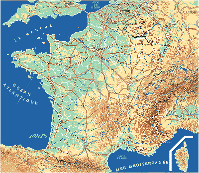
relatively easy access deep into the range's interior.Below is a map of the physical
relief of France:
 |
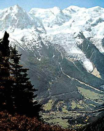 Above:Left background of Mont Blanc;Europe's highest peak. |
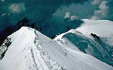 |
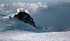
This are the summits of Mont -Blanc, 4807m. The regular route , which follows the Bosses ridge, is extremely popular in summer, as it can be seen from the well-marked trail. The Vallot hut, pictured on the right photograph, can be spotted on the rocks at the right of the first picture. This emergency shelter has saved more lives than any other, but it is unfortunately badly littered by people attempting the regular route.
The North Side The South Side Eastern Side Western
side
The Pyrenees Mountains, which rise between France and Spain, are not as high as the Alps, but in some ways they are more impressive. The Pyrenees were formed from a single block of the Earth's crust, thrust upward with the steeper face toward France. They were only slightly glaciated, and so are less accessible than the Alps. Only a few difficult passes cut through the central portions of this range.

The Basque country of France lies in the Pyrenees Mountains, which separate France and Spain.
Pic de Vignemale, which has a height of 10,820 feet (3,298 meters), is the highest peak in the French Pyrenees, but elevations exceed 11,000 feet (3,350 meters) on the Spanish side. East of the Rhone River, the Mediterranean coast is rough and indented where the Alps extend to the sea. West of the Rhone the broad, fertile plain of Languedoc extends southward from outlying formations of the Massif Central.
