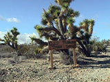
View of Gold Basin - travelling North on Glenns Hideout Road - Feb '98 
|
Glenns Hideout Rd, an extension of Antares Rd, continues on to Lake Meade 
|
| View of Gold Basin - travelling North on Glenns Hideout Road - Feb '98
|
Glenns Hideout Rd, an extension of Antares Rd, continues on to Lake Meade
|
All .JPG file images taken by Bolidechaser with a Sony Mavica MVC-F7
As a result of the recent interest in the Gold Basin "fossil" strewn field (Baalke, 1998) on the Mailing List and at Tucson, this page was intended to be a travelers guide to the Gold Basin site. But after my return from my reconnaissance trip, I found an e-mail from Dr. David Kring requesting that I avoid the site in order to maintain its scientific integrity. Earlier, I had requested detailed information from Dr. Kring in an e-mail, but I went on a job-related trip before I got his reply. After I finished my work, I took a side trip to recon Gold Basin. While at Gold Basin, I encountered numerous prospectors. Not only did I run into the Desert Gold Diggers of Tucson (prospecting for gold), but I also encountered other clubs from Utah and Washington! All this activity on a weekday with a serious threat of rain. Come the weekends in May, they'll need a parking lot and a shuttle for all the "prospectors".
So, why did I post this web site? Well, it's because the cat's out of the bag and the horses are out of the barn. I've come to the conclusion that anything I may do will not make the situation any worse, and that it will soon be time for the primary field workers to come up with a plan of action before the scientific integrity of the field IS compromised. Understand, I have no interest in working my way into another groups publication. I'm just another nameless volunteer. But the best thing that I can do now, is to convey the following requests from the official investigators:
Should you find yourself at Gold Basin, and should you be "lucky" enough to find a meteorite -
1.) Determine the location as accurately as possible. The use of a GPS receiver would indicate that a serious effort is being made by the finder to help the investigators in this task. Otherwise, take sightings with a compass.
2.) Note the depth of the find. Note the type of surface, e.g., sand, gravel, grus, stream alluvium, talus, etc. If possible, photograph the spot.
3.) Note whether the specimen has fusion crust. How much? Did it undergo spaulation? These determinations are important to the investigators. Keep specimens dry. In order to determine total mass, each find will need to undergo drying in a vacuum chamber before being measured.
4.) Report all finds and the above information, as soon as possible, to:
Professor Jim Kriegh,
mail: 40 E Calle Concordia, Oro Valley, Arizona 85737
phone: (520) 297-4161
fax: (520) 297-4161 (same as above)
email: JKriegh@email.msn.com.
5.) Don't Trespass - Be aware of private property. As of this writing, the property owners in the Gold Basin - White Elephant Wash area have an arrangement with only the original field researchers, regarding ownership of all meteorite finds. Final determination of ownership will be made by:
Dr. David Kring, Senior Reseach Associate, Lunar and Planetary Laboratory, The University of Arizona, Tucson, Arziona 85721
Phone: (520) 621-2024
Fax: (520) 621-6783
kring@lpl.arizona.edu
REFERENCES:
Ron Baalke's original posting on the Mailing List
Meteoritical Society Bulletin No. 82
Jim Kriegh's response to a "Gold Basin Hunt" as posted on the Mailing List
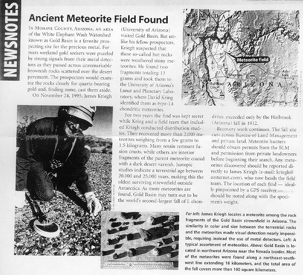
An article about Jim Kriegh entitled "Ancient Meteorite Field Found" as published in the Sky & Telescope magazine's NEWSNOTES section.
UPDATED REFERENCES:
| Gold Basin (1st Recon) Trip - Image Album |  |
| The pictures on
this page take several minutes to download over a modem line. If
you don't want to wait, jump ahead to the Image Album
to see the images enlarged and descriptions in sequence. After viewing my album, you can return
to this page and review an image and its accompanying description by clicking on the thumbnails below. |
|
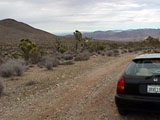
| On the road to Gold Basin, South of Meadview, AZ |      
|
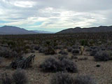
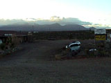
| Gold prospectors have set up camp right at the centroid for the strewn field |
|
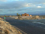
| Nearest "civilization" is Ken's Pizza Parlor and Canyons End Motel in Meadview, Arizona |
|
Purchased "sample" of Gold Basin (L4) meteorite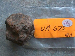 This specimen, along with the Univ. of Arizona identification label, was purchased from R.A. Langheinrich Meteorites. Although I too, have a concern with dealer advertising on the Mailing List, I would be a hypocrite, if I were to say there could be any other way to notify me, make contact, purchase and deliver from Tucson the specimen in the time frame before my trip. Having the specimen greatly increased my chances of making a find. The fact that I didn't make a find was more a result of insufficient time (weather) and the conscientious work of Jim Kriegh's prospectors club. Click HERE or on the above image, in order to see close-up images of the above specimen's regmaglypts and chondrules! |
Had I found one, it may have looked like this! This image exaggerates the whiteness in the granite gneiss which predominantaly underlies the Gold Basin area. In real life the desert pavement is a more uniform brown color, and if I were to close my eyes, and throw down my sample meteorite - no exaggeration, I would need my metal detector to find it again. Locally, the alluvium comprises numerous rock types, more than you would expect for a basin of such limited areal extent. The explanation becomes apparent where the bedrock has come close to the surface to form, what is called, a pediment. In these cases the overlying alluvium is a monolithologic talus, or is actually grus, but only locally, clearly changing lithology over short distances. This thin veneer of alluvium overlying ore-bearing bedrock is what attracts the numerous placer prospectors to this area. |
 |
 |
 |
 TRIPOD