|
BUSS: Kenduskeag Stream Canal
| |||
|
Hazard Level: 4 | Main Tunnel Clearance: 3-4'? | Tidal Coverage: YES | Known # of Tunnels: 4? |
| Hazards: Obstacles; Slippery Surfaces; Falling; Head Injury; Biological Waste; Encounters | |||
| Construction Materials: Brick, concrete, granite blocks, corregated steel pipe, clay pipe(?) | |||
|
The Kenduskeag Stream canal is easy to find, it runs right through downtown Bangor. We never really thought of it as a place for a UE expedition until we noticed that at low tide there are sidewalks along some parts of the canal. The canal is sort "Y" shaped, or shaped like a giant tuning fork. The end of the canal that empties out into the river would be the lower end of the "Y", the upper ends of the "Y" are separated by city parks and join back together where the canal starts by the bridge on Franklin St.
There are several ways to get into the canal, the first (and maybe the most legal) is to enter it by canoe or kayak, put in from the city docks just a ways away from the mouth of the stream.. or to put in further up the stream and paddle down to the canal. There are several ways (ways that do not involve climbing down a granite wall, or tossing some rope off a bridge and sliding down) to get into the canal by foot at low tide but expect to get your feet wet or maybe to fall in. The dryest way is to enter the mouth of the canal on the east side. Both ends of the upstream branches of the canal are fairly easy to enter on foot at low tide. We most often use the side closest to Hammond Street... there is a parking lot next to the bridge on Franklin St, a small foot brigde leads from the parking lot to a building next to the canal. The place with the small foot bridge going to a building has a rocky area under it that leads down a rocky bank and into the canal. Some of the rocks are loose so be careful. There are no sidewalks in this part of the canal but following close to the wall on the right, it is possible to keep your feet fairly dry. After a short distance a small ledge about four to six inches wide emerges... then more larger rocks and it becomes increasingly easier to keep dry feet. Then comes the section with the sidewalk, that part goes almost all the way out to the river. When the tide is really low, its possible in some places to cross to the other side of the canal by hopping across on some rocks. In the lower end of the canal there are sidewalks on both sides. Tunnels? All the tunnels are under the bridges. There are two that we know of, one is under the State Street bridge; the other is under the Franklin Street bridge on the side facing Harlow Street. We have not yet explored the one under Franklin but it looks like it's made of clay, and smells rather foul. The tunnel under State is short but has an interesting feature.. It goes in at a steep angle for twenty to thirty feet then levels off at a small manhole room. The tunnel continues on for a short distance, going through another manhole room, and then ends in another small manhole room. This manhole room is sort of rectangular with a large rusted metal trapdoor like contraption on one wall. Nothing is known to us of what lies beyond the trap door. There are other places in the canal which would lead one to think there are tunnels present... under some of the bridges, about seven feet up the wall are square holes where a block of granite is missing.. these just have some small pipes and maybe a dead pigeon or two in them. There are also two "stormwater & sewage overflow" tunnels near each side of the mouth of the canal. On the west side is Tunnel #6 and on the east bank is Tunnel #7. Tunnel #6 is only accessible at the lowest of low tide. It goes in for a short ways before coming to a 5'x3' overflow release gate. running water can be heard behind it. Tunnel #7 on the east bank is also only accessible at low tide. Above it, well above the high tide line, is a crawlable corregated steel pipe. Both of these tunnels on the east bank have yet to be explored. Some "interesting" things have been found in the canal... tons of shopping carts, a smashed telephone, a beat up fencing sword, oddly shaped chunks of metal, sand dollars and crab parts (these things do not make it this far up the river on their own), a plastic phallus, books, etc... |
|||
| Arial Photograph of canal with drains mapped in red, "sidewalks" mapped in yellow, and entry points mapped in green. |
 This way to main index. | ||
|
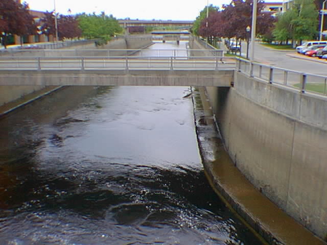
Photo looking downstream from one of the bridges on State Street. A good picture to see the sidewalks that are down there. the tide gets lower than it is in these pictures... and a little higher than the brownish stains on the walls of the canal. | |||
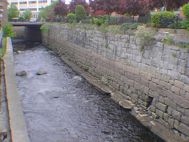
| Photo looking up stream from the same bridge. Thats not a tunnel on the right, just a spot where a few granite blocks fell out. | |||
| Photo of part of the overflow gate inside the tunnel near the State St bridge in downtown. In such tight quarters, this is the best angle we could get of the large trapdoor. | |||
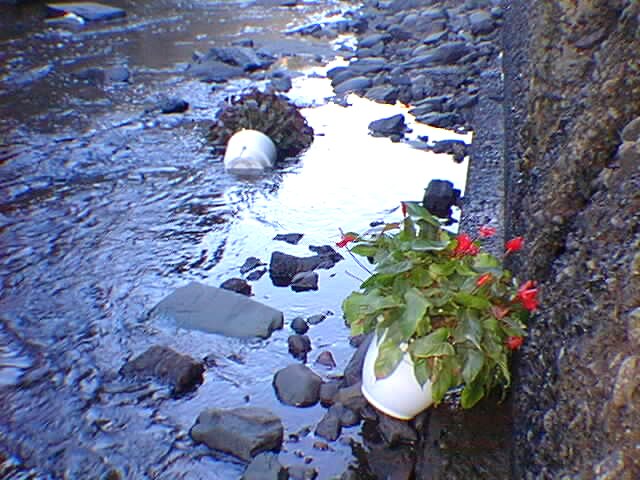
| Photo of two plantpots with flowers that someone left here in the canal. This is not the right way to water plants. They become submerged when the tide comes in, then back up for air at low tide. | |||
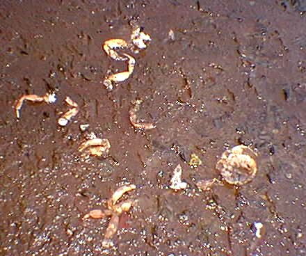
| Photo of the afore mentioned crab parts that we found. also in the area were two sand dollars and a sea shell. | |||
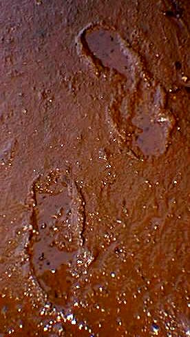
| Photo of footprints we found in the mud. Someone must have been down walking in the canal just a few hours before us, since footprints would likely be washed away by the tide. We were able to follow these most of the way from the river to state street, but they only seemed to go one way. | |||