Scenery
Around The Blue Ribbon Mine
This is
looking west from the highest part of the mine.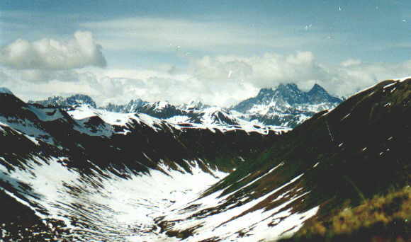 That
glacier-carved valley curving to the right is the upper Peters
Creek valley. Behind those black spires lies Mt. Foraker, which
is covered by clouds in this photo. If you walk up the valley and
over the divide, into the Bear Creek valley, you will be on the
southern boundary of Denali National Park, about 6 miles away.
That
glacier-carved valley curving to the right is the upper Peters
Creek valley. Behind those black spires lies Mt. Foraker, which
is covered by clouds in this photo. If you walk up the valley and
over the divide, into the Bear Creek valley, you will be on the
southern boundary of Denali National Park, about 6 miles away.

This
is a view of the area from the Petersville Recreational Mining
Area. That's Denali (aka Mt. McKinley) in the center, and the
Blue Ribbon Mine is on the green mountain at the extreme left
edge of the photo. Denali State Park is about 5 miles to the
north.