
Abandoned & Little-Known Airfields:
California: Mojave Area
© 2002, © 2016 by Paul Freeman. Revised 2/22/16.
This site covers airfields in all 50 states: Click here for the site's main menu.
____________________________________________________
Please consider a financial contribution to support the continued growth & operation of this site.
Boron AF Plant #72 Airfield (revised 12/4/14) - Cuddeback Dry Lake Landing Strip (revised 10/15/15)
Harper Dry Lake Airfield (revised 12/4/14) - Myer Field (revised 2/22/16) - Mojave Inyo Airport (revised 10/15/15)
____________________________________________________
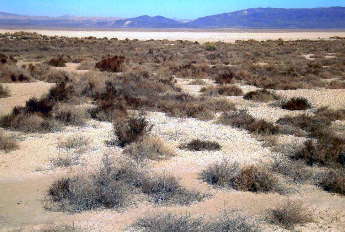
Harper Dry Lake Airfield, Lockhart, CA
35.042, -117.336 (Northeast of Edwards AFB, CA)
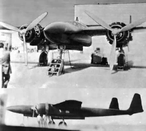
A pair of (heavily retouched) circa 1943-44 photos of the Hughes D-2,
with the air conditioned Harper Lake hangar in the background.
The man in the suit at left may be Howard Hughes.
This dry lakebed in the Mojave Desert was the site of secret flight test programs
conducted by the Hughes & Northrop aircraft companies during the 1940s,
including the historic first flight by an American rocket-propelled aircraft.
When Howard Hughes' secret D-2 prototype was ready for final assembly in May 1943,
it was relocated from Hughes' Culver City facility to Harper Lake,
where a hangar & other installations had been constructed to conduct a flight test program in secret.
In characteristic fashion, Howard Hughes himself began the D-2's flight test program on 6/20/43.
However, after only a few brief hops, it was clear that high control forces were a problem,
and modifications commenced to the planes wing, ailerons, and flaps.
When Hughes flew the D-2 again on 8/2/43, the modifications proved insufficient to correct the control issues.
The wooden airplane remained in its air conditioned, humidity controlled wooden hangar
until it was destroyed on 11/11/44 by a fire that was said to have been sparked by a lightning strike.
However, it has been reported that the fire was not accidental,
and it has also been reported that Hughes tried to intentionally damage the troublesome D-2 during earlier taxi tests
so that he could start over with a fresh design.
Hughes reportedly made sure that all evidence of the D-2 project disappeared from the site
including ashes, charred pieces of wood & metal, foundations, utility lines & other structures –
all hauled to a secret burial site somewhere out on the desert.
Hughes eventually went on to develop a larger, higher-performance evolution of the D-2, known as the D-5.
Under the military designation of XF-11,
it would eventually be built & flown from the Hughes Culver City facility.

An undated (circa 1940s) photo of the Northrop MX-324 in flight, possibly taken at Harper Dry Lake.
Another chapter in the history of Harper Dry Lake involved the diminutive Northrop MX-334 flying wing.
The MX-324 had first been flown as a glider at nearby Muroc Army Airfield in late 1943 & early 1944.
At which point Northrop technicians installed a 427-pound Aerojet rocket motor in the squat, tailless aircraft.
The motor nozzle, protruding through the trailing edge of the thin wing,
was the only outward evidence of the engine's presence,
although the actual motor, 4 pressure tanks, 2 propellant tanks, and hydraulic & electric control equipment were carefully fitted into the wing.
One of the considerations in the design of this airplane was protection of the pilot
from the mono-ethylaniline fuel & red fuming nitric acid oxidizer.
The fuel tank was installed on one side of the pilot & the oxidizer tank on the other side.
A heavy neoprene curtain was installed on each side of the pilot to protect him from any rupture of tanks or lines.
Beginning on June 20, 1944, exhaustive ground tests of the rocket motor were conducted at Harper Dry Lake,
culminating in taxi tests on the desert floor by Harry Crosby.
By the evening of July 4, the craft & Crosby were ready for their momentous flight.
Finally, almost 3 years after the successful maiden flight of the German Me 163,
Harry Crosby eased himself into the prone position in the cramped cockpit of the MX-324.
With his head resting in a special sling behind the large glass windshield,
Crosby had a clear view of the long tow line & the P-38 Lightning that was to tow him up to release altitude
off the cracked, dry surface of Harper Dry Lake.
Early in the morning of July 5, 1944, P-38 pilot Martin Smith' towed Crosby
and his strange-looking craft over the dry lake at about 8,000'.
Crosby tripped the towline release, braced himself in the narrow confines of the cockpit,
and pressed the propulsion trigger on the control stick.
Ignition of the 200-pound thrust Aerojet XCAL-200 rocket motor produced remarkable acceleration.
America's belated entry into the era of rocket-powered flight had been made.
A short flight of over 4 minutes ended with a gentle landing on the dry lake bed.
Following Crosby's July 5th flight, other powered flights of the Rocket Wing were conducted.
Some of these featured the early use of telemetry to transmit flight test data by radio to ground-based recorders.
Despite the progress in the test program, however, the lack of more powerful rocket engines
and a redirection of priorities resulted in termination of the project.
Ron Most recalled, “I grew up in the Harper Dry Lake area on a alfalfa ranch & the runways [shown] are our dirt strips we used for our airplanes.
The Howard Hughes Hangar was on the lakebed.”
Harper Lake was eventually the location of the Solar Electric Generating System 8 & 9,
the largest output commercial solar power plant in the world, generating around 160 megawatts at its peak.
This plant was built on top of the remains of the aircraft R&D area at Harper Lake,
which included facilities owned by Hughes & Northrop.
No aeronautical chart depictions have been located of any airfield at Harper Dry Lake.

The 1986 USGS topo map depicted two runways, labeled simply as “Landing Strip”,
on the southwest side of Harper Dry Lake.
No buildings were depicted in the immediate vicinity of the runways.
The specific location of the former Hughes hangar has not been determined.
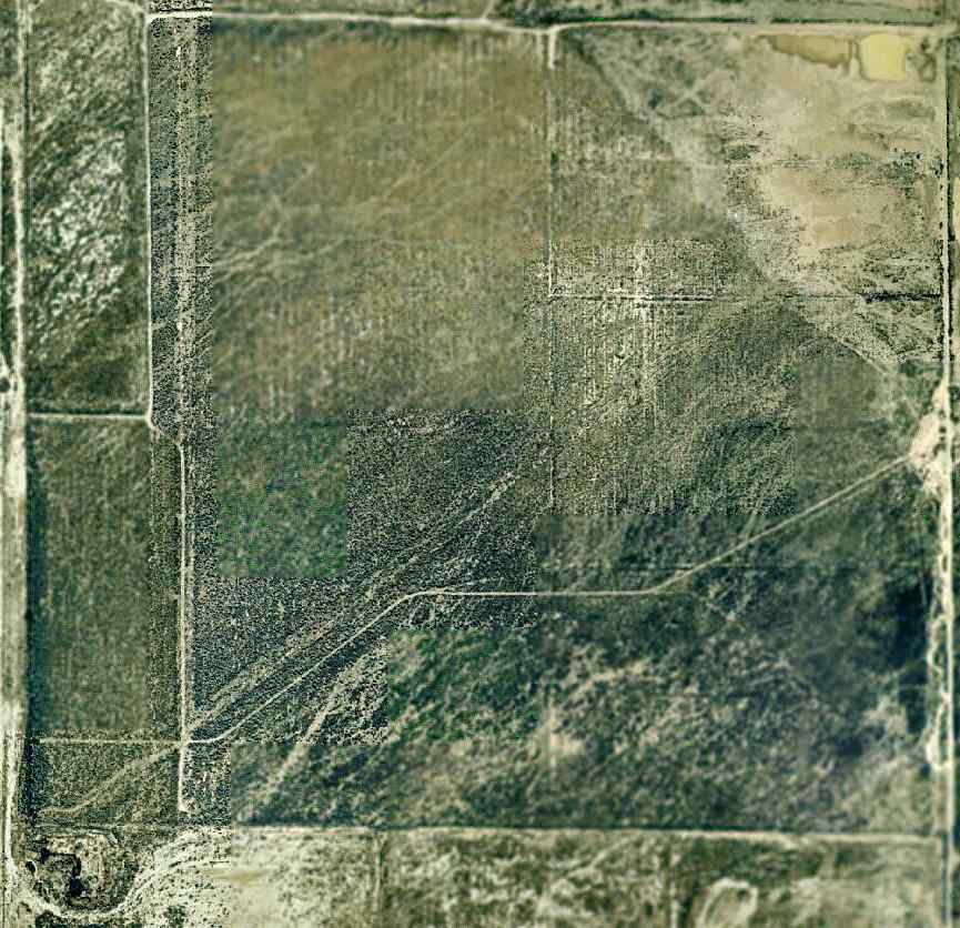
A circa 2005 aerial photo depicted the remains of the 2 runways on the southwestern edge of Harper Dry Lake.
No trace of any buildings were recognizable.
An 11/8/11 photo by W.T. Chambers of a possible hangar site at Harper Lake.

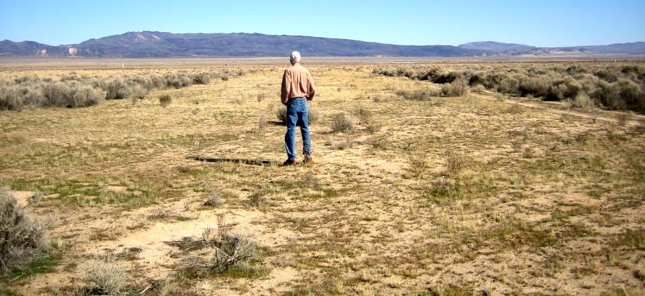
A 2012 aerial view by Ron Most of the possible foundation of the Howard Hughes hangar at Harper Lake.
Ron reported, “The remains of the foundation can still be seen from the air.”
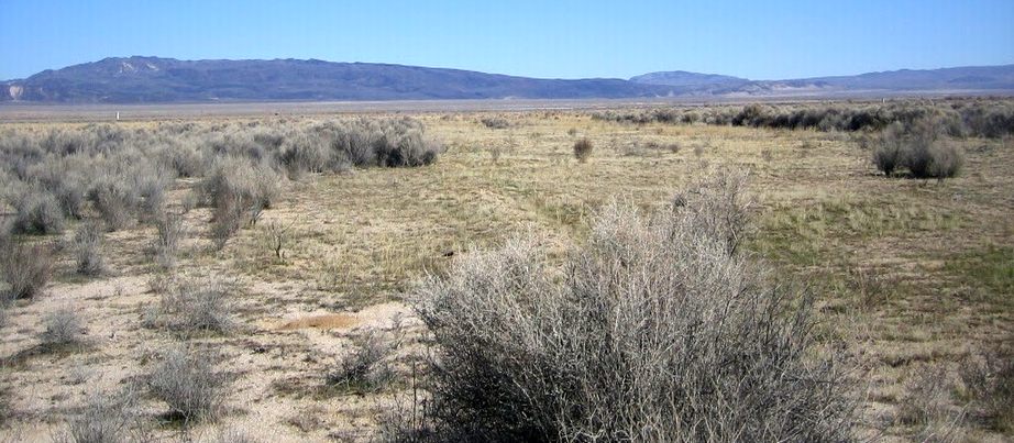
An 11/28/14 photo by Francis Blake looking northeast at the back (south) side of the Harper Lake hangar site looking out toward the lakebed.
Francis Blake reported, “I found much evidence, small items, of the burned hangar.”

An 11/28/14 photo by Francis Blake at Harper Lake of “a pad for an above-ground storage tank on the east side of the site.”
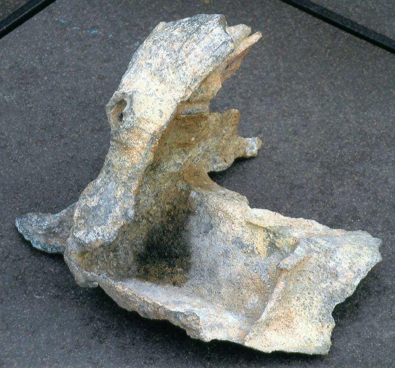
A 12/1/14 photo by Francis Blake of the remains of a possible aircraft part he found at Harper Lake, “maybe even a piece of the D-2.”
Francis reported, “After a toothbrush cleaning, some numbers &/or letters appeared.”
The site of the Harper Dry Lake Airfield is located northwest of the intersection of Lockhart Road & Harper Lake Road.
____________________________________________________
35.04, -118.162 (Northwest of Edwards AFB, CA)

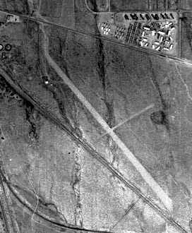
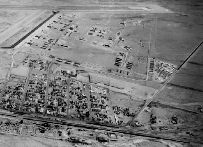
A 1950 aerial view looking west, showing Myer Field at the right side (courtesy of Frank Stubbings, via Bob Alvis).
Myer Field was location along the southern edge of the town of Mojave.
It was apparently built at some point between 1949-52,
as it was not depicted on the 1949 Los Angeles Sectional Chart (according to Chris Kennedy).
The earliest depiction which has been located of Meyer Field was a 1950 aerial view (courtesy of Frank Stubbings, via Bob Alvis).
It depicted Meyer Field as having 2 unpaved runways, with 2 small hangars at the northwest corner.
A 1952 aerial view (courtesy of Kevin Hamilton) depicted Meyer Field as having 2 unpaved runways,
with a small building on the northwest west side.
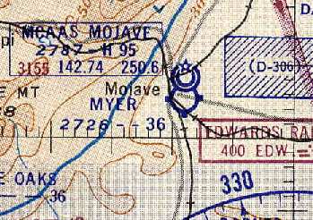
The earliest aeronautical chart depiction of Myer Field which has been located
was on the 1954 Mojave Desert World Aeronautical Chart (courtesy of Chris Kennedy).
It depicted Myer Field as having a 3,600' unpaved runway.
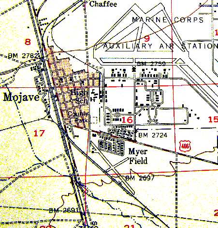
The 1956 USGS topo map (courtesy of Scott O'Donnell) depicted Myer Field as having two runways,
with the longest being a 4,600' northwest/southeast runway.
It also depicted the proximity of Meyer Field to Mojave MCAAS (the present-day Mojave Airport), at the top-right.
Jon Karkow sent in the following observations in 2003:
"Harry Myer built the field.
He had a Beech Staggerwing, and his wife, Pearl, who had all the money, flew an Ercoupe.
Pearl operated a motel that was on the east side of Sierra Highway where the Oak Creek Overpass is now,
just south of Kieffe & Sons Ford.
The airport operated until about the mid-1950s."
A late-1950s aerial view looking northeast at the town of Mojave,
with the runways of the MCAAS Mojave visible at the top left.
A single runway of Myer Field, along with a hangar, are barely visible at the bottom-right.
Photo from the collection of Kathy Hansen, courtesy of Jon Karkow.
A 1972 USGS aerial view depicted Myer Field as having two unpaved runways,
with a hangar on the northwest side, and another further southeast.
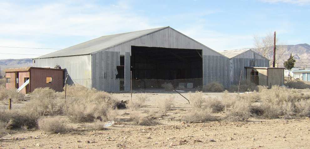
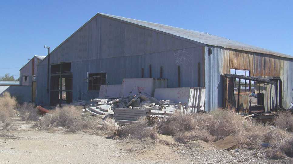
A 2003 photo by Jon Karkow of an abandoned hangar from the former Myer Field.
The hangar "is located at the south end of Myer Road,
which would have been at the west end of the runway.
The hangar is now abandoned & surrounded by a chain link fence.
It is of steel construction with corrugated steel siding.
The area east of the hangar was dug up in 2002 to create a drainage containment pond for the town,
totally obliterating remaining traces of the runway [on the west side of the site]."
A 2007 photo of an abandoned hangar from the former Myer Field.
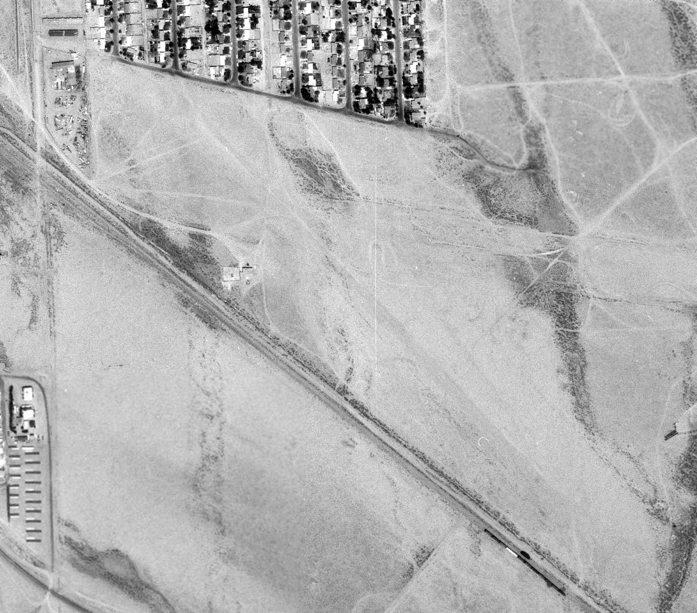
A 2013 aerial view showed the former hangar remained standing on the northwest side of the Myer Field site.

A 2015 aerial view looking south at the site of Myer Field showed the hangar on the northwest side (bottom-right) had been removed at some point between 2013-2015, with only the foundation remaining.
A drainage containment pond had covered the western portion of the former runways,
but traces of the northwest/southeast runway were still visible on the center & east sides of the site.
____________________________________________________
Mojave Inyo Airport, Mojave, CA
35.05, -118.17 (Northwest of Edwards AFB, CA)

A 1972 USGS aerial photo of the site of Mojave Inyo Airport (with the later Mojave Airport visible at top-right).
Photo of the airfield while open has not been located.
The Mojave Inyo Airport was a small airfield which was located within the town of Mojave.
Its date of construction is unknown, but according to Jon Karkow,
Mojave Inyo Airport predated the Mojave-Kern Airport (which was built in 1935, and is still in use today as Mojave Airport).
Apparently the Mojave Inyo Airport closed when the larger Mojave-Kern Airport was built adjacent to it to the east,
as only the Mojave-Kern Airport was depicted by the 1939 Sectional Chart,
and nothing of the Mojave Inyo Airport was visible in a late 1950s aerial photo of Mojave (courtesy of Jon Karkow).

A 2003 photo by Jon Karkow of a former hangar from the Mojave Inyo Airport,
which still stands (amazingly after more than 70 years) at 2037 Inyo Street.
In Karkow's words, "It is now used as a storage building for the adjacent house.
The hangar is of wood construction with corrugated steel siding.
I talked with several longtime residents & they all say that the airstrip ran along what is now Inyo Street.
This seems a little odd since it means that an aircraft departing to the west,
into the usual prevailing wind, would have to fly right over the town at low altitude."
A 2013 aerial photo shows no recognizable trace of Mojave Inyo Airport.
____________________________________________________
Cuddeback Dry Lake Landing Strip, Atolia, CA
35.28, -117.397 (Northeast of Edwards AFB, CA)
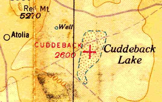
Cuddeback Airfield, as depicted on the June 1940 LA Sectional Chart (courtesy of Chris Kennedy).
According to Jim Flint, “The lake was named for Leon Cuddeback, an early desert aviator & contemporary of Pancho Barnes.”
The date of establishment of the Cuddeback Lake airfield has not been determined.
The earliest reference to the field which has been located
was in The Airport Directory Company's 1937 Airports Directory (courtesy of Bob Rambo).
It described Cuddeback Lake Airport as a civil airport,
with a 15,840' x 5,280' (more than 3 miles long) clay landing area.
The June 1940 LA Sectional Chart (courtesy of Chris Kennedy)
depicted “Cuddeback” as an auxiliary airfield located in the middle of Cuddeback (Dry) Lake.
The Cuddeback Airfield was apparently abandoned at some point between 1940-45,
as the airfield was not depicted at all on the 1945 or 1949 LA Sectional Charts (according to Chris Kennedy).
Former fighter pilot Jim Flint recalled, “When based at Nellis AFB in 1959
I did a low-level, simulated nuke mission that ended up with Cuddeback as the target.
I remember at the time the Navy at China Lake NAS controlled the range
and I had to call them on the 500-knot run in & get permission to drop a 25-lb practice bomb. It actually worked.”
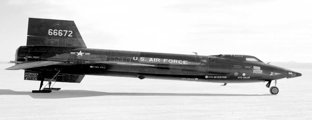
A 1962 NASA photo of the X-15-3 on a lakebed.
Cuddeback Dry Lake eventually reused as one of the designated emergency landing sites
for the X-15 rocket plane.
A database of space launch sites includes entries for "Cuddeback Dry Lake"
and "Cuddeback Dry Lake Drop Zone" (southeast of the lake)
as having been used by NASA/USAF from 1959-67.

A 1967 photo of the remains of X-15-3 at the Cuddeback Lake crash site.
It had entered a Mach 5 spin,
and crashed northwest of Cuddeback Lake, killing pilot Mike Adams.
No airfield at Cuddeback was depicted on the 1967 LA Sectional Chart (according to Chris Kennedy).
The site was labeled "Cuddeback Lake Air Force Range" on the 1969 USGS topo map.
In the 1960s-70s, the "Cuddeback Air to Ground Gunnery Range" was operated by personnel from George AFB,
who would be flown up to Cuddeback for a week at a time in Huey helicopters.
Bob Alvis reported that "I was at Cuddeback for a few years in the 1970's.
The air field was not advised [for landing] due to the mission statement.
Bombing & strafing by the 35th Tactical Fighter Wing & various combat squadrons pretty much chewed it up,
but on a regular basis O-2s from Ontario AF Reserve would come up
and do Forward Air Control type operations, marking targets for the Thuds & F-4s.
A few times the O-2s would land but that's about it.
The base during my time had two scoring towers, a motor pool barn, a small chow hall, and a small ops section.
Base of our operations was George AFB."
"Two fun facts about the place:
They had more sidewinder snakes than I have ever seen in the desert.
We felt that the rodents that called the base home multiplied so fast that their was always plenty of "snake food".
About 1978 an F-4 from George was flying across the area
with a new video guided missile to test [a GBU-35/37 HOBO TV glide bomb?]
and for some reason the missile parted ways with its hard point & was never seen again."
The 3,100' long "Landing Strip" was depicted on the 1978 USGS topo map.
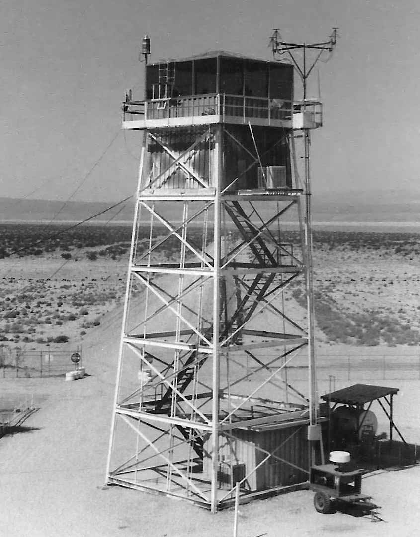
A 1983 photo by Mark Raymond “at the Cutback gunnery range. This is one of two scoring towers used while the range was in operation.
We were on site to erect a temporary tower so this one could be removed & relocated to a new range facility.”
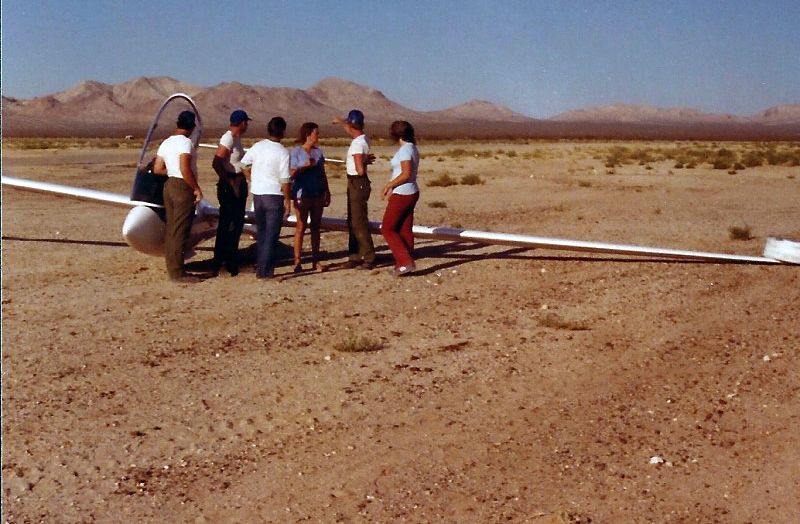
A June 1983 photo by Mark Raymond of a glider which landed at Cuddeback.
Mark recalled, “He was involved in some sort of event & lost altitude.
He said it was a bumpy landing & he almost hit a guy wire in the process.
We helped him dismantle & load the plane when his wife arrived.
He landed on a Saturday while the range was closed.
Our tower team was the only crew out there for the weekend.
We finished erecting our temporary tower later that week.”
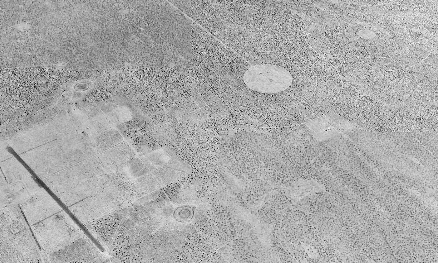
A 1994 USGS aerial view looking northwest at the Cuddeback Dry Lake Airfield, and the 4 target circles located to the north.
Former fighter pilot Jim Flint observed, “The old target circles never seem to fade.
The conventional range is a little less distinct but the dive bomb circles & the strafe lanes are still evident.
Pretty standard arrangement for the time.”
Darrin Smith reported in 2006, “I just flew out to Cuddeback today & landed.
I landed in the southwest portion, along the edge it was smooth.”

A 2014 aerial view looking northwest along the paved runway at Cuddeback,
showing several small buildings along the south side of the field.
Kurtis Clark reported, “Cuddeback Gunnery Range was given back to the Bureau of Land Management by the Air Force in 2012.”
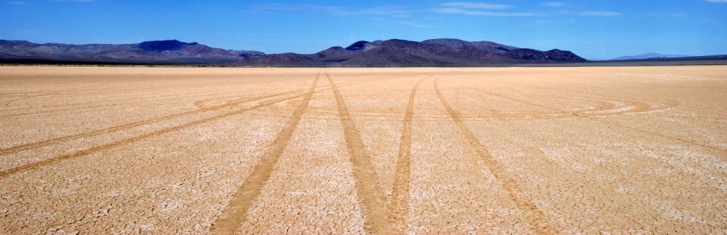
A 10/13/15 photo by Kurtis Clark of “Cuddeback Dry Lake surface looking north from approximately the center of the lake.
This surface is not as solid as some other lakes, such as El Mirage. Vehicles tear it up easily. Maybe that is why it was not used as an airfield for long.
There is a new gate installed across the road that heads east towards the runway.”
A 10/13/15 photo by Kurtis Clark of “some sort of visual target on the west side of the lake. Looking east; Cuddeback Lake is in the background.”
Cuddeback Dry Lake is located 12 miles east-southeast of Atolia, CA.
____________________________________________________
Boron Air Force Plant #72 Airfield, Boron, CA
35.054, -117.54 (Northeast of Edwards AFB, CA)
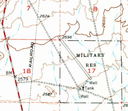
The 1954 USGS topo map depicted a single runway, labeled simply as “Military Res”.
Photo of the airfield while open has not been located.
This desert airfield is a conundrum.
The site was labeled "Military Res" on the 1954 USGS topo map,
which also depicted a 4,700' northwest/southeast runway.
Jeffrey Bell (Adjunct Professor of Planetary Science at the University of HI)
sent in the following hypothetical explanation about the purpose of the Boron "Air Force Plant #72".
"I believe the secret of this never-built facility is 'hidden in plain sight' -
Plant 72, had it been constructed, would have produced boron-based jet fuels for high-performance aircraft of the 1960s.
The use of boron compounds as jet & rocket fuels was a high-priority, top-secret program
in both the USAF & USN during the 1950s.
A whole family of High Energy Fuels were investigated: HEF-1 (ethyldiborane), HEF-2 (propylpentaborane),
HEF-3 (ethyldecaborane), HEF-4 (methyldecaborane), and HEF-5 (ethylacetylenedecaborane)."
Jeffrey continued, "The main appeal of these exotic fuels was that they gave about 140% of the energy of JP-4 per unit weight & volume.
A side benefit (not mentioned in any discussion I have read)
is that boron-6 is a great absorber of neutrons, so a nuclear-powered airplane
could use big tanks of borane compounds around the reactor as primary neutron shielding.
If the reactor failed, the boranes could be used as get-home fuel.
The B-70 design was originally predicated on using the J93-GE-5 engine
with HEF-3 in the afterburners fed from separate fuel tanks.
Later, the intent was to shift to HEF-4 which could be used in the main burners as well.
The BOMARC missile program also considered shifting to HEF in its ramjets.
The Navy also made elaborate plans to store HEF or "zip" fuel on carriers."
Jeffrey continued, "These fuels turned out to have some disadvantages:
they were very expensive to make, left solid deposits in tailpipes,
and were extremely toxic, even worse that the rocket fuels of this era.
The whole program was canceled in 1959
and the XB-70 reverted to a new high-energy kerosene fuel called JP-6.
By converting one of the two bomb bays into a fuel tank the original range goal could be met with JP-6."
Jeffrey continued, "So I suspect that Air Force Plant #72 would have been a chemical plant,
producing HEF-3 and/or HEF-4 from the abundant deposits of borax in the Mojave dry lakes.
The location near Edwards would be ideal to supply XB-70 or Nuclear Bomber test operations
without having to truck the deadly brew through populated areas.
And a leak at the plant would not produce a Bhopal-type disaster.
The land was probably reserved in 1957-59
and found its way onto maps, where obsolete & never-finished facilities seem to have an infinite life."
Jeffrey added that "Most of this info was cribbed from an appendix
in 'WarbirdTech Vol. 34' by the indispensable Dennis Jenkins."
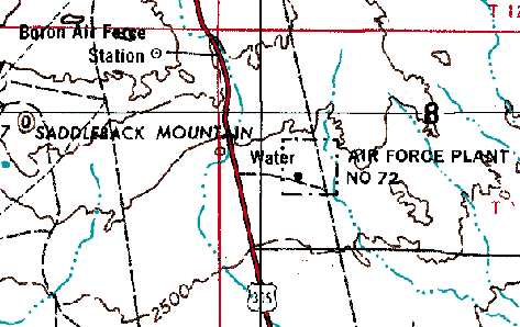
The 1969 USGS topo map did not depict the runway, but a square outline labeled “Air Force Plant #72”.
The "Air Force Plant" designation is baffling,
as there is no sign of any kind of industrial infrastructure at the site - nothing except the runway & a lot of desert.

USGS aerial photo 1994.
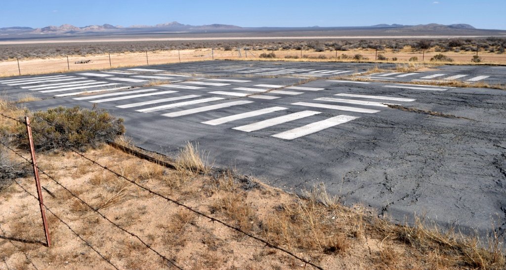
A 2002 photo by Jon Vanover, looking north along the Boron runway.
Jon reported, “The runway appears to be older than the fences & roads
as they overlap the runway at the north & south ends.
Along the east side there is a road that runs north
& is lined with the bottoms of cut down utility poles.
Several fences along the way but no clues to what this place was."
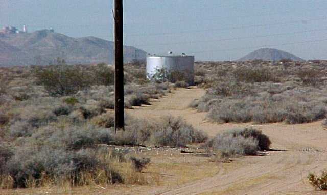
A 2002 photo by Jon Vanover of the water tank at Boron.
Jon confirmed that the only thing at the site "is a dirt field, water tank & pump building.”
The Boron Air Force Station, an early-warning radar installation,
was located 4 miles northwest, on the opposite side of Route 395.
The Air Force Station operated from 1952-75,
and the site is now used by an FAA radar.
It is possible that the runway at "Plant #72" was built to support the nearby radar station,
as there are some other examples of this being done (like the runway at Cape Charles AFS, VA).
But it is also possible that the runway was built to support the planned (but never built) "Air Force Plant".
The dates of construction & closure of this airfield are just as baffling as everything else about it.
Although the Boron Airfield was depicted on the 1973 & 1976 USGS topo maps,
no airfield at all (not even an abandoned airfield)
was depicted at this location on aeronautical charts from 1944, 1949, 1964, 1967, or 1998.
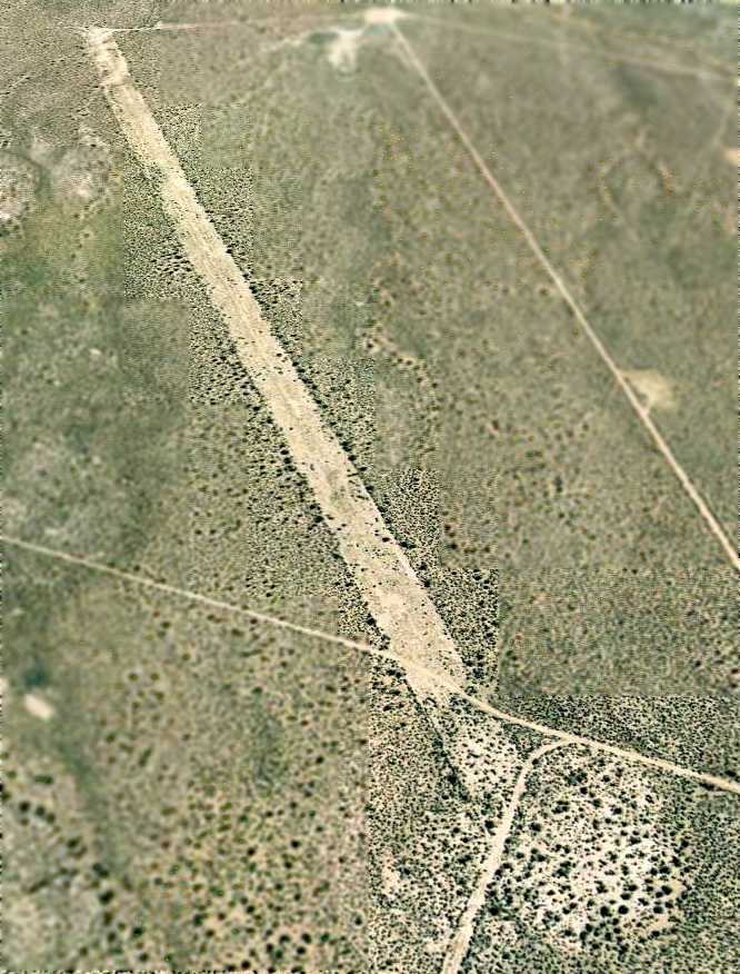
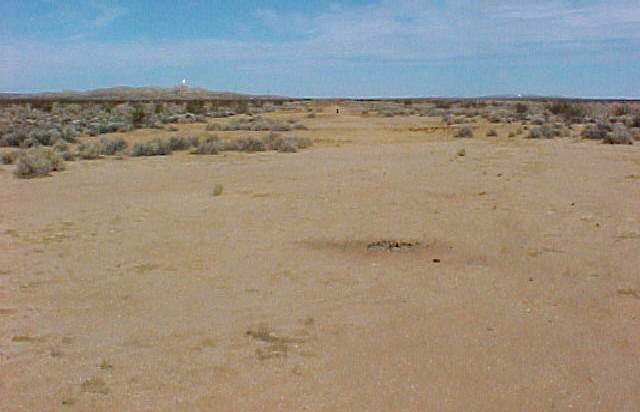
A 1/30/06 aerial view looking southeast along the abandoned Boron runway.
Boron Air Force Plant #72 is located southeast of the intersection of Route 395 & Palmetto Street,
four miles north of Kramer Junction.
Thanks to Jon Vanover for pointing out the Boron Airfield.
____________________________________________________
Since this site was first put on the web in 1999, its popularity has grown tremendously.
That has caused it to often exceed bandwidth limitations
set by the company which I pay to host it on the web.
If the total quantity of material on this site is to continue to grow,
it will require ever-increasing funding to pay its expenses.
Therefore, I request financial contributions from site visitors,
to help defray the increasing costs of the site
and ensure that it continues to be available & to grow.
What would you pay for a good aviation magazine, or a good aviation book?
Please consider a donation of an equivalent amount, at the least.
This site is not supported by commercial advertising –
it is purely supported by donations.
If you enjoy the site, and would like to make a financial contribution,
you
may use a credit card via
![]() ,
using one of 2 methods:
,
using one of 2 methods:
To make a one-time donation of an amount of your choice:
Or you can sign up for a $10 monthly subscription to help support the site on an ongoing basis:
Or if you prefer to contact me directly concerning a contribution (for a mailing address to send a check),
please contact me at: paulandterryfreeman@gmail.com
If you enjoy this web site, please support it with a financial contribution.
This site covers airfields in all 50 states.