Abandoned & Little-Known Airfields:
Eastern Iowa
© 2003, © 2016 by Paul Freeman. Revised 9/15/16.
This site covers airfields in all 50 states: Click here for the site's main menu.
____________________________________________________
Please consider a financial contribution to support the continued growth & operation of this site.
Cedar Rapids Municipal Airport (original location) / Hunter Field (revised 8/16/15) - Cram Field (revised 1/16/16)
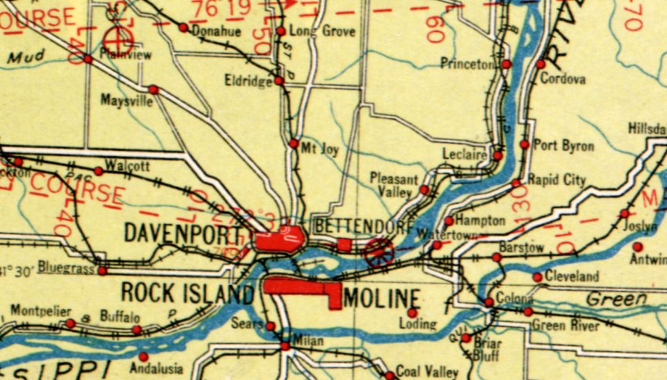
Davenport Airport (original location) / Angoair Airport / Bettendorf Airport (revised 9/15/16) - Dodge Airport (revised 1/20/16) - John Deere Airfield (revised 7/22/16)
McBride Field (revised 1/20/16) - North Landing Field / Morningstar Field (revised 9/15/16) - Wallace Field (added 1/20/16)
____________________________________________________
41.524, -90.491 (East of Des Moines, IA)
Wallace Field, as depicted on the 1924 Chicago – Iowa City Aeronautical Strip Map (courtesy of Marty Santic).
According to an article by Mary Speer entitled “Lighting the Way for Modern Aviation at Wallace Field” from the 5/23/99 Quad City Times (courtesy of Marty Santic),
“Nearly 80 years ago, a dark-haried young pilot named Frank Wallace found a spot where he & other Quad City aviators
could take off & land safely in their bi-winged Curtiss JN 'Jennies' & other aeroplanes.
The flat grassy tract between the Mississippi River & State Street east of downtown Bettendorf
he reasoned was superior to the dirt strip surrounded by hazardous trees at Davenport’s Suburban Island,
now Credit Island where the early birdmen first tested their wings. Others agreed.
On 12/22/1919, the Davenport Democrat & Leader announced Bettendorf was getting a big airfield & flying school.
It was named Wallace Field.”
Mary continued, “Wallace Field was a full service general aviation facility.
It offered fuel, maintenance, airplane rides & flying lessons.
Mail was flown to Wallace Field, which was part of the U.S. Army Airways System for many years.
Other attractions were airshows, the first of which was held in late spring of 1920.
At the first show, people lined the field to watch Frank & his younger brother, Fred,
wearing goggles, fur-lined helmets participating in aerial derring-do.
Also entertaining the crowd were parachutist Joe Smith & Al Lilley, who climbed from one plane into another while in mid-air.”
Mary continued, “Aviation in the years before Charles Lindbergh’s NY-to-Paris flight wasn’t the safest occupation.
Planes using Wallace Field often conked out, forcing pilots to ditch in the river.
Frank Wallace was seriously injured while giving flying lessons to Edwin Bettendorf in late 1920.
The plane, flying at 4,500' went into a spin & crashed.
Suffering a broken leg & other injuries, Wallace told a reporter:
'The accident simply shows you can fall from a long way up in the air & live to try it again.'”
The earliest dated depiction which has been located of Wallace Field was on the 1924 Chicago – Iowa City Aeronautical Strip Map (courtesy of Marty Santic).
According to an article by Mary Speer entitled “Lighting the Way for Modern Aviation at Wallace Field” from the 5/23/99 Quad City Times (courtesy of Marty Santic),
“By 1924, Wallace Field sported 7 hangars, an office, a workshop, aircraft parts sales & 2 fueling stations.
Newspaper headlines that year blared the news of an eloping couple taking off from the field & Glen Romkey landing a seaplane on the river.”

A circa 1919-36 advertisement for The Brierly School of Flight at Wallace Field (courtesy of Marty Santic).

A circa 1919-36 advertisement for The Iowa Flying School at Wallace Field (courtesy of Marty Santic).
Mary continued, “In 1926, Frank Wallace gave flying lessons to a young Davenporter named Don Luscombe, who didn’t like wind in his face but loved flying.
After losing his first airplane in the Mississippi River, Luscombe envisioned the 'perfect' small airplane.
It would have an enclosed cockpit, where pilot & passenger could chat without fighting the roar of the wind.
They also could smoke cigarettes & wore straw hats.
His sketch of such the airplane excited Frank Wallace, who provided space to set up a mockup.
Central States Aero Company was organized in October 1928, and Clayton Folkerts, a Dubuque, IA mechanic, was hired to build what became known as the Monocoupe.
The original Monocoupe was a small apple-green plane featuring a single overhead wing designed by Fred Wallace.
After it passed its initial test flight at the Quad City Airport, orders poured in.
Production was moved from Wallace Field to a tabernacle building formerly used by the Bettendorf Presbyterian Church.”

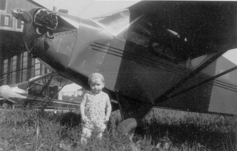
A circa 1919-36 photo of several Curtiss Jenny biplanes in front of hangars at Wallace Field (courtesy of Marty Santic).

A circa 1919-36 photo of a biplane (model undetermined) in front of hangars at Wallace Field (courtesy of Marty Santic).

The last aeronautical chart depiction which has been located of Wallace Field was on the 1929 Chicago – Iowa City Aeronautical Strip Map.
Interestingly, it depicted Wallace Field as a military airfield, presumably due to Wallace Field's usage as part of the Army Airmail system.
Wallace Field was no longer depicted at all on the 1934 Des Moines Sectional Chart.
According to an article by Mary Speer entitled “Lighting the Way for Modern Aviation at Wallace Field” from the 5/23/99 Quad City Times (courtesy of Marty Santic),
“Wallace Field closed in 1936, the victim of financial problems & lack of room for expansion.”
A 1937 aerial photo showed no recognizable trace of Wallace Field.
According to an article by Mary Speer entitled “Lighting the Way for Modern Aviation at Wallace Field” from the 5/23/99 Quad City Times (courtesy of Marty Santic),
“The hangars, used in later years by the Bettendorf Boating Club were blown away by a gale in the late 1950s.
Living on Pointe Mississippi, at the time, Frank Wallace watched them go.
'There go a lot of memories', he commented wryly.”
A 2015 aerial view showed no recognizable trace remaining of Wallace Field.
The site of Wallace Field is located southwest of the intersection of Depot Street & 31st Street.
Thanks to Marty Santic for pointing out this airfield.
____________________________________________________
North Landing Field / Morningstar Field (Y76), Des Moines, IA
41.654, -93.641 (North of Downtown Des Moines, IA)

An undated aerial view looking south at North Landing Field from the 1952 IA Airport Directory (courtesy of Lee Corbin).
This small general aviation airport was not yet depicted on a 1938 aerial photo nor on the May 1950 Des Moines Sectional Chart.
According to its FAA Airport/Facility Directory data, North Landing Field was established in January 1952.
The earliest depiction which has been located of North Landing Field was a 1955 aerial photo.
It depicted North Landing Field as having a single unpaved north/south runway, with a number of small buildings on the northeast side.
The earliest photo which is available of North Landing Field
was an undated aerial view looking south from the 1952 IA Airport Directory (courtesy of Lee Corbin).
It depicted North Landing Field as having a single unpaved north/south runway, with a number of small T-hangars & light aircraft on the northeast side.

The earliest aeronautical chart depiction which has been locate of North Landing Field was on the May 1955 Des Moines Sectional Chart.
It depicted North as a private airfield with a 2,000' unpaved runway.

The 1956 USGS topo map depicted North Landing Field as having a single unpaved north/south runway, with 6 small buildings on the northeast side.
The 1962 Des Moines Sectional Chart depicted North as having a 2,000' unpaved runway.

The September 1975 Des Moines Sectional Chart (courtesy of Chris Kennedy)
depicted North as having a 2,400' unpaved runway.
Keven Grove recalled, “I took my first flight off this field in a Aeronca Champ at a early age as my mother sat & knitted nervously during my flight lesson nearly 35 years ago”, circa 1980.

A 1990 aerial view looking southeast depicted North as having a singe unpaved north/south runway, with a large number of individual hangars to the northwest.
Seven light single-engine aircraft were visible parked outside as well.
A 2000 aerial view showed the adjacent land use which would eventually spell the end for this small airport -
a gravel mining pond had been constructed adjacent to the west side of the airfield.
A 2009 aerial photo showed the gravel mining pond had extended to the western edge of the runway.
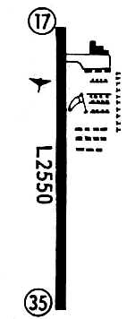
At some point between 1975-2009, North Landing Field had been renamed Morningstar Field,
as that is how it was labeled on the 2009 Omaha Sectional Chart.
According to Keven Grove, “The Morningstar family owned the land & I think the airfield was on the north portion of it.”
A 2010 aerial photo showed that the runway had been relocated to the eastern side of the property, away from the expanding gravel mining operations to the west.
Keven Grove observed, “The mine was nice enough to allow the airfield to remain a few more years by relocating the runway until they were on its threshold as well.”

A circa 2010 aerial view looking north depicted the large number of individual hangars at Morningstar Field,
along with the runway which had been relocated to the east side of the property.
There were no aircraft visible outside.

The last photo which has been located showing aircraft at Morningstar Field was a 9/14/12 aerial view looking southeast.
Three light single-engine aircraft were visible parked outside the hangars.
The land use which would eventually spell the end for this small airport was visible on the right side - a gravel mining pond.

A 2013 photo of Morningstar Field.
In 2013, the FAA Airport/Facility Directory described Morningstar Field as having a single 2,333' turf Runway 18/36,
listed the owner as Martin Benskin, and the manager as Dave Kalwishky.
It was said to have a total of 56 based aircraft, and to conduct an average of 54 takeoffs or landings per day.
A 2013 news item reported on the closing of Morningstar Field:
“Morningstar Field has operated north of Interstate-35/80 & east of the Des Moines River for about 60 years.
The owner has leased the land to a nearby gravel company, which plans to use the land for mining.
The airport will be closed at the end of this month.
Morningstar Field is a grass strip with hangars where private pilots kept small aircraft.
It had about 40 airplanes housed at the field until pilots learned of the upcoming closure & began relocating to other airports.”

A 10/15/14 aerial view looking southeast shows the gravel mining pond further encroaching on the site of Morningstar Field,
but the runway & most of the hangars remained intact.

An 11/11/14 photo by Keven Grove at the site of Morningstar Field, showing “the only hangar salvaged for reconstruction. It took us one month to remove, just barely staying ahead of the wrecking crew.”

An 11/28/14 aerial view by Keven Grove looking southeast at the site of Morningstar Field, showing the hangars & runway.

A 12/21/14 photo by Keven Grove of the remains of Morningstar Field, showing “the club house where members gathered for coffee every Saturday morning for over 60 years.”

Showing that you can't always trust aeronautical charts, Morningstar Field was still depicted on the 2015 Sectional Chart,
more than 2 years after its closure.
Keven Grove reported in 2016, “Morningstar may still be on the charts but is officially closed as a mining company has literally 'undermined the operation'.
I bought the nicest hangar of nearly 50 from the field & was the last out.
Very sad to the area aviation community.”
The site of Morningstar Field is located northwest of the intersection of Northwest 6th Drive & Interstate 80.
Thanks to Kevin Grove for pointing out this airfield.
____________________________________________________
41.555, -90.605 (East of Des Moines, IA)

Cram Field, as depicted on the September 1934 Des Moines Sectional Chart.
According to the Quad Cities Online, “Cram Field Davenport Municipal Airport was dedicated on Armistice Day, 1928
in honor of Ralph Cram, editor of the Davenport Democrat & Leader newspaper.”
On 11/13/28 a Davenport newspaper described the airport: "Ten years ago a cow pasture, today one of the best airports in the central west.
Developed from a modest start approximately 10 years ago, the city today has a modern airport located within the corporate limits on Division Street Road.
Rock-surfaces runways total nearly a mile in length & there is a large hangar (another was built and dedicated in 1929),
office building also containing a repair shop & instruction room for student pilots, refueling & restaurant facilities on the grounds.
The field is equipped for night landings, and was used by the United States Army during the time the Air Corps flew the mail.”
A gasoline pump at the field advertised Mobilgas.
The earliest depiction which has been located of Cram Field was on the September 1934 Des Moines Sectional Chart,
which depicted Cram as a commercial/municipal airport.

A 1930s aerial view looking east at Cram Field.
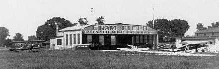
A 1930s photo of several planes in front of a hangar labeled “Cram Field”.
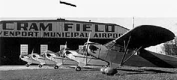
A 1930s photo of a row of Piper J-3 Cubs in front of a hangar labeled “Cram Field”.
A 1936 photo of Donald Clayton in front of a Piper J-3 Cub at Cram Field.

A 1937 USDA aerial view depicted Cram Field as having 2 perpendicular runways, and a few small hangars on the east side.

A 10/5/45 USDA aerial view depicted Cram Field as having 2 perpendicular paved runways, of which the pavement appeared quite deteriorated, along with 2 unpaved runways.
A large number of light aircraft were parked near the buildings on the east side.

An undated photo of the Cram Field administration building.

A 1940s aerial view looking northeast depicted a large number of aircraft parked around the hangar & other buildings on the east side of Cram Field.
The December 1948 Des Moines Sectional Chart (courtesy of Chris Kennedy) depicted Cram as having a 2,100' unpaved runway.
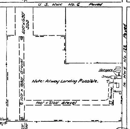
The 1948 IA Airport Directory depicted Cram Field as having 2 gravel runways, with hangars, a shop, and an office on the east side.
According to a historical marker, Cram Field operated until 1949.

The last aeronautical chart depiction which has been located of Cram Field was on the May 1950 Des Moines Sectional Chart,
which depicted Cram as having a 2,200' unpaved runway.
Cram Field was no longer listed among active airfields in the 1952 IA Airport Directory (courtesy of Lee Corbin).

The last depiction which has been located of Cram Field was on the 1953 USGS topo map.
It depicted Cram as having a single unpaved east/west runway, with several buildings on the northeast side.

The 4/22/03 unveiling of a historical marker commemorating Cram Field.

A 5/20/12 aerial view showed no trace remaining of Cram Field.
The site of Cram Field is located southwest of the intersection of West Kimberly Road & North Division Street.
____________________________________________________
McBride Field (7IA3), Cedar Rapids, IA
42.065, -91.635 (Northeast of Downtown Cedar Rapids, IA)

McBride Airport, as depicted on the April 1965 Des Moines Sectional Chart.
McBride Airport was not yet depicted on the June 1960 Des Moines Sectional Chart.
According to an article entitled “After 50 Years, McBride Airport has Landed its Last Plane” in the 5/11/12 Gazette (courtesy of Timothy Williamson),
in 1961 Melvin McBride “began leveling the farm field in the family since the 1920s.
He would shape a 2,400-foot, 150-foot wide east-west grass runway, have the hangar built
and relocate an old service station/cafe from near Marion’s Highway 13 to serve as the office.
Although planes would test the field the following summer, the airport didn’t officially open until 10/14/62.”
The earliest depiction which has been located of McBride Airport was on the April 1965 Des Moines Sectional Chart,
which depicted McBride as having a 2,200' unpaved runway.

The 1967 USGS topo map depicted “McBride Landing Strip” as having a single unpaved northwest/southeast runway, with 3 small buildings.
McBride Airport was not yet depicted in the 1968 Flight Guide (courtesy of Bob Levittan).

The earliest photo which has been located of McBride Field was an undated photo of airport founder Melvin McBride holding a sign for McBride Field,
with 2 Ercoupes in the background.
According to an article entitled “After 50 Years, McBride Airport has Landed its Last Plane” in the 5/11/12 Gazette (courtesy of Timothy Williamson),
airport founder Melvin McBride “died in 1972.”
McBride Field's FAA Airport/Facility Directory data gave an activation date of 9/73.
Perhaps that was the date at which it eventually became officially registered with the FAA?
According to an article entitled “After 50 Years, McBride Airport has Landed its Last Plane” in the 5/11/12 Gazette (courtesy of Timothy Williamson),
Ivan McBride “would solo on this field at age 19 [in 1974] (in the family’s 1952 Piper Tri-pacer).
For a time Ivan & his family - wife, Lyn, and their children, Leanna, Sarah, and Calvin - operated the airport.
Other managers included John Tibben & Perry Walton.
Through the years, McBride Airport has been home base to flying clubs like Cloud 9 & Mercury.
Regular nightly flights used to leave here for Chicago for Bank of Iowa Computer Service.
During a 3-day period in 1983, more than 700 planes landed here as it was designated the official airport for the nearby Farm Progress Show.”

A 3/27/90 aerial view looking west at McBride Field showed a single northwest/southeast grass runway, and office & hangar on the south side, with 3 light aircraft,
and 2 T-hangars on the east side.

An undated aerial view looking southeast at McBride Field, showing a dozen light aircraft on the field.

A circa 2008-2012 aerial view looking west at McBride's hangar & office, sadly devoid of any planes on the field.

The 2010 USGS topo map depicted McBride Field as having a single northwest/southeast runway.

An 8/11/11 aerial view looking west at McBride Field showed a single light aircraft tucked onto the very southern edge of the airport property.

The last aeronautical chart depiction which has been located of the McBride Airport
was on the September 1975 Des Moines Sectional Chart (courtesy of Chris Kennedy).
It depicted Dodge as having a single 2,500' paved runway.
As of 2012, McBride Field's FAA Airport/Facility Directory data described it as having a single 2,120' turf Runway 12/30, “in good condition”.
It listed the owner & manager as Ivan McBride,
said the airport had a total of 9 single-engine aircraft based on the field,
and that the airport conducted an average of 31 takeoffs or landings per week.

A 2012 photo of Ivan McBride, son of the airport founder, in front of the McBride Field hangar.
According to an article entitled “After 50 Years, McBride Airport has Landed its Last Plane” in the 5/11/12 Gazette (courtesy of Timothy Williamson),
“Church bells ring in the distance as the sun shines brightly overhead and a breeze ripples through the grass landing strip at McBride Airport. It would be a great day to fly.
But, gaze through a window of the metal-sided hangar & the only airplane inside is a skinless fuselage.
No windsock flits above the nearby administration building to indicate the wind direction.
Once the bells stop, the silence seems as if it will last forever.”
“Shutting it down is not easy for me,” says Ivan McBride, whose late father, Melvin, founded the airport half a century ago.
But, with increasingly expensive liability insurance, it was time.
“I’m not going to plow up the rest of the runway until we hit October 14,” says Ivan,
symbolically hitting the 50-year mark even though the last plane left a couple of weeks earlier & the airstrip would officially close May 10.
With churches popping up around the airport along the C Avenue Extension north of Cedar Rapids,
some people speculated the 80 acres would be sold for another church or development.
But no - it will be farmed by Ivan’s son, Calvin, 19, (an agriculture student at Iowa State University) just as his grandfather had once farmed it.
“There’s no question this airport defined my career and my life,” Ivan McBride said in 2012.
“I met a lot of people, made a lot of friends, as a result of this little airport.”
With yet another small general aviation forced to close because of the increasing price of liability insurance,
why is this not viewed as a crisis in general aviation?
Why aren't our aviation lobbying organizations making this a mission,
to ensure that general aviation has a future?
McBride Field is located northeast of the intersection of C Avenue Northeast & Robbins Road.
____________________________________________________
41.685, -93.715 (Northwest of Des Moines, IA)
Dodge Airport, as depicted on the May 1942 Des Moines Sectional Chart (courtesy of Chris Kennedy).
This general aviation airport was evidently established at some point between 1941-42,
as it was not yet depicted on a 1938 aerial photo,
nor depicted on the May 1941 Des Moines Sectional Chart (according to Chris Kennedy).
The earliest depiction which has been located of Dodge Airport
was on the May 1942 Des Moines Sectional Chart (courtesy of Chris Kennedy).
It depicted Dodge as a commercial/municipal airport.

The earliest photo which has been located of Dodge Airport was a 9/25/43 aerial view looking north
from the 1945 AAF Airfield Directory (courtesy of Scott Murdock).
It depicted “Dodge Airways Inc.” as having 3 grass runways, with a few small buildings on the northeast side.
The 1945 AAF Airfield Directory (courtesy of Scott Murdock) described the “Dodge Airways Inc.” airfield
as a 72 acre irregularly-shaped property having 3 grass runways, the longest being a 2,687' north/south strip.
The field was said to have 2 hangars (the largest being a 100' x 80' metal structure),
and to be owned & operated by private interests.
The December 1948 Des Moines Sectional Chart (courtesy of Chris Kennedy)
depicted Dodge as having a 2,700' unpaved runway.

The 1948 Iowa Airport Directory (courtesy of Chris Kennedy)
depicted Dodge Field as having 4 turf runways, with the longest being the 2,687' north/south & east/west strips.
An office, shop, and hangars were depicted on the northeast side.
The operator was listed as Central Airways Inc.,
and the operator was listed as Morris Kahn.

An undated aerial view looking north from the 1952 IA Airport Directory (courtesy of Chris Kennedy)
depicted Dodge Field as having 2 turf runways, with the longest being the 2,600' north/south strips.
The other 2 runways had evidently been abandoned at some point between 1948-52.
Several hangars & light planes were visible on the northeast side.
The operator was listed as Central Airways Inc.,
and the operator was listed as H.K. Meyer.
A 1955 aerial photo depicted several light aircraft parked around the hangars at the northeast end of the field,
which had a single unpaved north/south runway.
In contrast to the 1952 directory photo, there was no sign of any other runways.
The May 1955 Des Moines Sectional Chart depicted Dodge Airport as having a 2,500' unpaved runway.

The 1956 USGS topo map depicted Dodge Airport as having only a single unpaved north/south runway,
with several buildings on the northeast side.
Dan Roth recalled, “I learned to fly on Dodge Field, a grass strip, in the early 1960s.”
The 1965 Des Moines Sectional Chart (courtesy of Chris Kennedy)
depicted Dodge as having a 2,800' unpaved runway.
Barry Chrenen recalled, “The runway at Dodge Field was paved by 1969.
I learned to fly in 1969 at Iowa Aviation, my first flight was in February of 1969.”
Ray Rusek recalled, “At one time my flying club had a plane based there in the 1960s & probably the 1970s.”

An undated aerial view looking northeast at Dodge Airport, from the 1970 IA Airport Directory (courtesy of Mark Martin).
The directory described Dodge as having a single 2,500' paved Runway 17/35,
and a large number of hangars & some light aircraft were pictured at the northeast corner of the property.
The operator was listed as Iowa Aviation Inc., and the manager was listed as John Brown.
The 1971 Flight Guide (courtesy of Chris Kennedy) depicted Dodge as having a single 2,550' paved Runway 17/35,
with a ramp & a large number of small hangars at the northeast corner.

A circa 1971-72 aerial view of Dodge Airport (courtesy of Steven Witmer)
depicted a total of 7 light single-engine aircraft parked amongst the numerous small hangars.

A May 1972 photo by Mark Martin of a Cessna 177 Cardinal at Dodge Field.

An April 17, 1972 aerial view by Mark Martin looking south at Dodge Airport from final approach to Runway 17,
with another Cessna just departing.

The 1976 USGS topo map depicted Dodge Airport as having a single unpaved north/south runway,
which contradicts the 1971 depiction.
Was the runway pavement removed between 1971-76?
The last aeronautical chart depiction which has been located of the Dodge Airport
was on the September 1975 Des Moines Sectional Chart (courtesy of Chris Kennedy).
It depicted Dodge as having a single 2,500' paved runway.
Steven Witmer (Planning Assistant for the City of Johnston's Community Development Department) reported,
“In 1976, Pioneer received site plan approval from the City of Johnston to construct a corn research facility adjacent to the west side of the Dodge Airport property.
Notes in the file state that the research facility would be located to the west of Dodge Airport, but don’t indicate if the airport was still in use at the time or not.”
Dodge Airport was evidently closed by 1976,
as it was no longer listed among active airfields in the 1976 AOPA Airport Directory (according to Chris Kennedy).
The former Dodge Airport was depicted as an abandoned airfield on the March 1977 Des Moines Sectional Chart (according to Chris Kennedy).
Steven Witmer reported, “In 1982 the City of Johnston approved a site plan expanding the Pioneer facility onto the Dodge Airport property
(which Pioneer owned by that time, though the file does not indicate when they acquired it)
with notes on the plans that Pioneer intended to demolish the remaining Dodge Airport buildings as soon as possible because they were in poor condition.
The approved site plans themselves had revision dates going back to as early as March 1981,
so presumably Pioneer had acquired the Dodge Airport property by that time.
So it is safe to say that Dodge Airport had definitely ceased operation by no later than early 1981 and presumably earlier,
and the remaining buildings were demolished in the early 1980s.”
The 2000 USGS aerial photo showed that a complex of buildings (Pioneer?) had been built to the northwest of the former airport.
The runway was no longer even perceptible.
The hangars had been removed, but their foundations were still recognizable.

A circa 2006 aerial view showed that the runway had been removed, and was no longer even discernible.
Foundations of the hangars were still perceptible, but less obvious than in the 2000 photo.
Steven Witmer reported in 2010, “The 2006 aerial photo shows the current Pioneer research facility as it stands today at the site.”
The site of Dodge Airport is located southwest of the intersection of Northwest 70th Avenue & North Glen Drive.
____________________________________________________
Davenport Airport (original location) / Angoair Airport / Bettendorf Airport, Bettendorf, IA
41.55, -90.51 (East of Des Moines, IA)

The original Davenport Airport, as depicted on the December 1948 Des Moines Sectional Chart (courtesy of Chris Kennedy).
No airport was yet depicted at this location on the December 1946 Des Moines Sectional Chart.
Former B-29 navigator Robert Parmele founded the Bettendorf Airport in 1947 & launched Agonair Service.
Under Parmele's management, the airport's services included flight instruction, charter flights & aircraft repair.
He also manufactured & sold a navigation tool called the Parmele Navigator,
which helped pilots plot a course using a large wall chart.
Parmele manufactured these in a small shop at the airport.
The earliest depiction which has been located of the airport
was on the December 1948 Des Moines Sectional Chart (courtesy of Chris Kennedy).
The chart depicted “Davenport” as having an 1,800' unpaved runway.

The earliest photo which has been located of Davenport Airport was a 1951 aerial view.
It depicted the field as having two unpaved runways, with several hangars on the southeast corner.

An undated aerial view looking south at Davenport Air Park from the 1952 IA Airport Directory (courtesy of Lee Corbin)
depicted the field as having 2 unpaved runways, with 2 small hangars & a few light aircraft on the southeast corner.

The field was evidently renamed “Angoair Airport” at some point between 1948-53,
as that is how it was labeled on the 1953 USGS topo map (courtesy of Ron Plante).
It depicted Angoair Airport as having 2 unpaved runways, with 3 small buildings on the southeast side of the field.
John Jesse learned to fly at Angoair in 1953, and recalled that about 20 planes were based there.
He thought the 2 sod runways were the 2,400' Runway 15/31 & 1,800' Runway 18/36.
John added that there were 2 hangars at the south end of Runway 18/36.
Steve Frushour recalled, “The old Angoair Airport... My brother & I used to play there in 1957-58.
We would ride our bikes down to the airport & play for hours in a couple old (junked) airplanes that sat beside the hangar.
We became friends with the owner. There were at least 2 old airplane hulks there
and my brother & I used to spend hours and hours flying against the Germans (in our minds).
One of the planes had 2 seats in tandem and we would flip a coin to see who got to be in the front seat.”

The last photo which has been located of Angoair Airport was a 1960 aerial view (courtesy of Ron Plante).
Ron noted the encroachment from housing developments that led to the closing of the field.

The airport was evidently renamed Bettendorf Airport at some point between 1953-60,
as that is how it was labeled on the June 1960 Des Moines Sectional Chart.
It depicted Bettedorf Airport as having a 2,500' unpaved runway.
The Bettendorf Airport closed in 1963.
Airport founder Robert Parmele said the surrounding area was getting built up with houses & there was no room for expansion.
He moved Bettendorf Airport's operations to the Davenport Municipal Airport the following year.
Bettendorf Airport was no longer depicted on the April 1965 Des Moines Sectional Chart.

The outline of the former runways at Bettendorf Airport,
superimposed by Ron Plante over the 1994 USGS aerial photo.
No trace remains of the runways, as mostly residential development has covered the once-open fields.
Avalon Drive overlays the alignment of the former Runway 18/36,
while Runway 15/31 has been replaced by Spruce Hills Drive & residential streets.

Two January 2006 photos by Ron Plante of the front & back of the hangar which still stands at the site of Bettendorf Airport.
Ron Plante reported in 2006 that “The former hangar was most recently used as a veterinary clinic, but is now empty.
From the front, its past use is hidden by renovation work, but from the back there's no doubt it was once a hangar.”
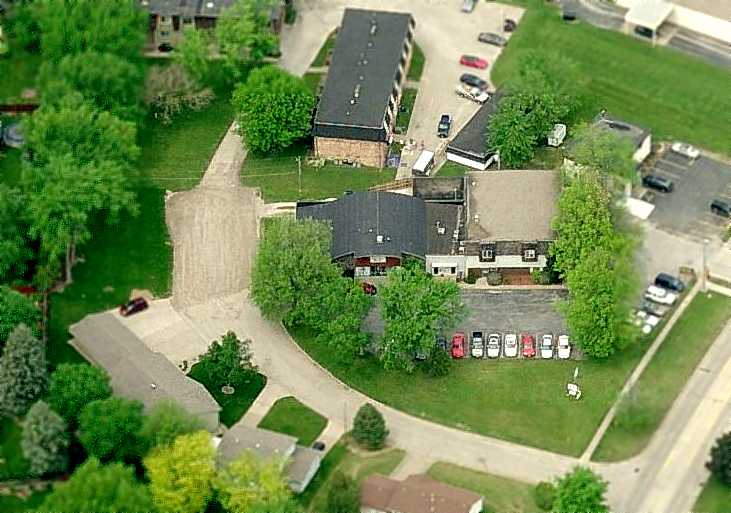
A circa 2006 aerial view looking north at the former hangar which still stands at the site of Bettendorf Airport.
The site of Bettendorf Airport is located west of the intersection of Spruce Hills Drive & 18th Street.
Thanks to Ron Plante for pointing out this airfield.
____________________________________________________
Cedar Rapids Municipal Airport (original location) / Hunter Field, Cedar Rapids, IA
41.93, -91.66 (East of Des Moines, IA)
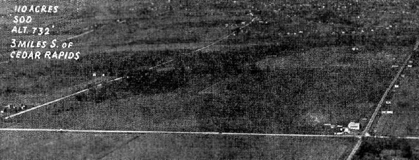
An undated aerial view of the original Cedar Cedar Rapids Municipal Airport,
from The Airport Directory Company's 1933 Airport Directory (courtesy of Chris Kennedy).
The first Cedar Rapids Airport was located 3 miles south of the center of the town,
on the west side of the main north/south highway.
According to the Linn County Historical Society,
when military pilot Dan Hunter came home to Cedar Rapids from the First World War,
he was determined to launch a career as a civilian pilot.
However, Cedar Rapids lacked an airport.
Hunter acquired a surplus warplane and spent the early 1920s as a stunt flyer,
operating Hunter’s Flying Circus from a pasture
In 1924, he moved his one-man aviation service to farmland just north of Highway 30.
Hunter rented the property from the Chamber of Commerce (& later the City of Cedar Rapids)
and ran the airport under the name of Cedar Rapids Airways.
The airport had a dirt runway that was relatively short & lined by trees,
so its early use was limited by weather conditions & the availability of daylight.
Despite the field’s drawbacks, Boeing Air Transport, which later merged into United Airlines,
signed up to route its new air mail service through Cedar Rapids, with the first flight arriving on July 10, 1928.
Passengers could ride in cramped quarters (with the mail) to Chicago for the princely sum of $21,
provided they brought their own lunch, thermos, and cotton for their ears.
The earliest depiction which has been located of the original Cedar Cedar Rapids Municipal Airport
was in The Airport Directory Company's 1933 Airport Directory (courtesy of Chris Kennedy).
It described Cedar Rapids as a commercial airport, consisting of a 110-acre triangular sod field,
measuring 2,640' x 2,200' x 2,800'.
The photo depicted the field simply as an open grass field,
with a hangar in the southeast corner (which was said to have “Cedar Rapids Airport” painted on the roof).
The operator was listed as Cedar Rapids Airways Inc.,
and the manager was listed as D.F. Hunter.

An undated (circa 1930s?) aerial view looking northeast at Hunter Field,
from a historical display inside the Cedar Rapids Municipal Airport (2006 photo by Paul Freeman).
The field was depicted as having 4 unpaved runways,
with a cluster of buildings in the southeast corner.
Dan Hunter, local businessmen, and the city gradually made improvements to the field,
with service sometimes being cut off for a time as upgrades were made to accommodate newer, larger planes.

The earliest chart depiction which has been located of the original Cedar Cedar Rapids Municipal Airport
was on the June 1937 Des Moines Sectional Chart (courtesy of Chris Kennedy).
It depicted Cedar Rapids as a commercial/municipal field.
The Airport Directory Company's 1937 Airport Directory (courtesy of Bob Rambo)
described Cedar Rapids Municipal as consisting of a 140-acre irregularly-shaped sod field,
having 4 crushed-rock runways, with the longest being a 2,000' northeast/southwest strip.

A 1937-39 USDA aerial photo of Cedar Rapids Municipal Airport (from the IA Geographic Map Server, via Chris Kennedy).
It depicted the field as having 4 runways, with a small cluster of buildings on the southeast side of the field.
In 1939, Jim Wathan, a former student of Dan Hunter, went to work for Hunter as a flight instructor.
The Airport Directory Company's 1939 Airport Directory (courtesy of Chris Kennedy)
described Cedar Rapids Municipal as consisting of a 140-acre irregularly-shaped sod field,
having 4 crushed-rock runways, with the longest being a 2,250' northwest/southeast strip.
In the late 1930s, as the specter of war grew, the government stepped up its efforts to train civilian pilots,
and Cedar Rapids Municipal was used for this purpose.
When war broke out, the field served as a base for a War Training Service pilot program at Coe College
that was one of the largest in the Midwest.
At one time, there were as many as 70 instructors & 300 students in the program.
Christopher Hall recalled, “My grandfather, Harold Hall, was a flight instructor at Hunter Field during & after WWII.”
In 1944, Wathan & Hunter went into business together, forming a partnership that lasted until 1952.
At some point between 1937-44, the airport was evidently renamed Hunter Field,
as that is how it was labeled on the March 1944 Des Moines Sectional Chart (courtesy of Chris Kennedy).
After the war, former soldiers, taking advantage of the G. I. Bill,
flocked in droves to flight training at Cedar Rapids Municipal Airport.
Due to limitations when conducting flight operations in bad weather at the relatively small Hunter Field,
a larger Cedar Rapids Airport was established in 1947 a few miles to the southwest.
But Hunter Field continued to operate as a general aviation airport for at least another decade.

The 1948 Iowa Airport Directory (courtesy of Chris Kennedy)
depicted Hunter Field as having 4 gravel & turf runways,
with the longest being the 2,640' Runway 4/22.
Buildings were depicted on the south & southeast sides of the field.
The field was said to offer repairs, hangars, tiedowns, flight instruction, and charter.
The operator was listed as Hunter Flying Service Inc., and the manager was listed as Jim Wathan.

An undated (circa late 1940s?) photo of Paul Orrick in front of a Lockheed at Hunter Airport.
Christopher Hall recalled, “My grandfather, Harold Hall... went to work for Jim Wathan as Vice President of Wathan Flying Service sometime in the 1950s.”

An undated aerial photo looking north at Hunter Field,
from the 1952 Iowa Airport Directory (courtesy of Chris Kennedy).
It depicted several light planes along the south side of the field.
It described the field as having 4 gravel runways,
with the longest being the 2,700' northeast/southwest strip.
The operator was listed as Hunter Flying Service Inc.,
and the manager was listed as Jim Wathan.

The last depiction which has been located of the original Cedar Cedar Rapids Municipal Airport
was on the June 1955 Des Moines Sectional Chart (courtesy of Chris Kennedy).
It depicted Hunter Field as having a 2,700' unpaved runway.
The last directory listing which has been located of Hunter Field
was in the 1957-58 Aviation Week Airport Directory (according to Chris Kennedy).
Dan Hunter retired in 1958 & sold his land for industrial development.
Hunter Field no longer depicted on the June 1959 Des Moines Sectional Chart (according to Chris Kennedy).

An undated (circa 1950s?) aerial photo looking northwest at Hunter Field (courtesy of Matthew Jangelis).
A hangar was painted with “Hunter Field” on its roof, but there were no aircraft visible on the field, and at least one building had been removed,
so possibly this photo was after the airport had already closed.

A circa 1964 aerial view of the site of Hunter Field (courtesy of Tom Farland).
Tom observed, “Some of the airfield buildings still remained -
at the time, I recall you could still make out the word 'HUNTER' on the roof of the hangar.
The runways were still visible to a certain extent.
CRANDIC Railway spur had been run down from the north & the first factory was under construction.”
Hunter Field no longer depicted on the 1967 USGS topo map.
No trace of the former Hunter Field was recognizable in the 1990 USGS aerial photo -
the site had been covered over by commercial buildings.
As of 2003, the site of Hunter Field was occupied by Midland Forge & the Gazette Printing Plant
(according to the Linn County Historical Society).

The alignment of the 4 runways from Hunter Field were superimposed by Chris Kennedy over a 2006 aerial view of the site of the airport.

A 2015 photo by Tom Farland of a diorama of Hunter Field.
Tom reported, “My wife & I were cruising some antique shops in Marion, IA, and stumbled upon a diorama of Hunter Airport (Cedar Rapids).
I would estimate it is about 5' x 5'. Very detailed, as if a model railroader made it. It's in a case, enclosed under plexiglass.”
The site of Hunter Field is located northwest of the intersection of Highway 30 & Bowling Street SW.
____________________________________________________
John Deere Dubuque Tractor Works Airfield, Sageville, IA
42.575, -90.71 (North of Dubuque, IA)

The John Deere Airfield, as depicted on the November 1976 Chicago Sectional Chart (courtesy of Chris Kennedy).
This private airfield was apparently built for the use of the John Deere Dubuque Works, which is just to the east of the airfield.
The Deere Landing Strip was apparently built at some point between 1971-76,
as it was not yet depicted on a 1957 aerial photo, the May 1971 Chicago Sectional Chart (according to Chris Kennedy),
or the 1972 USGS topo map.
The earliest reference to the field which has been located
was in the 1976 AOPA Airport Directory (courtesy of Chris Kennedy).
It described the " John Deere Dubuque Tractor Works" Airfield
as a private airfield having a single 4,000' concrete runway 14/32.
The earliest depiction of the Deere airfield which has been located
was on the November 1976 Chicago Sectional Chart (courtesy of Chris Kennedy).

The May 1977 Chicago Sectional Chart (courtesy of Chris Kennedy)
depicted Deere as a private airfield having a single 4,000' paved runway.

The earliest photo which has been located of the Deere Airfield was a 5/2/78 USGS aerial view,
which depicted the field as having a paved northwest/southeast runway.

"Deere Landing Strip", as depicted on the 1984 USGS topo map.

As of the 1994 USGS aerial photo, the Deere airfield consisted of a single 4,200' paved runway,
with an unusual complement of 4 turn-around loops.
The runway was not marked with closed runway symbols,
so the airfield may still have been in use as of 1994.
A single building sat to the east of the runway,
but it was not apparent if this was a hangar.

A 2002 aerial photo of the Deere airfield, from the Iowa Geographic Map Server (via Chris Kennedy).
The Deere Landing Strip was apparently closed at some point between 1994-2002,
as the airfield was clearly marked with several closed runway "X" symbols in the above 2002 aerial photo.
A new paved area had also been added adjacent to the northwest side of the runway,
with a fairly large building within it.
The airfield was not depicted at all (even as an abandoned airfield) on 2003 aeronautical charts,
and no airfield at the site was listed in the 2003 Airport Facility Directory.

A 4/30/09 aerial view looking south shows the Deere Landing Strip remained intact.

A 5/17/11 aerial view looking north by Nick Paxton shows the Deere Landing Strip remained intact.

A 7/20/16 aerial view looking southeast at Deere Landing Strip taken by a very lucky Ron Plante
from the bombardier compartment of the restored Boeing B-29 Superfortress bomber FiFi.”
The site of the Deere Landing Strip is located north of the intersection of Route 52 & Route 386.
____________________________________________________
Since this site was first put on the web in 1999, its popularity has grown tremendously.
That has caused it to often exceed bandwidth limitations
set by the company which I pay to host it on the web.
If the total quantity of material on this site is to continue to grow,
it will require ever-increasing funding to pay its expenses.
Therefore, I request financial contributions from site visitors,
to help defray the increasing costs of the site
and ensure that it continues to be available & to grow.
What would you pay for a good aviation magazine, or a good aviation book?
Please consider a donation of an equivalent amount, at the least.
This site is not supported by commercial advertising –
it is purely supported by donations.
If you enjoy the site, and would like to make a financial contribution,
you
may use a credit card via
![]() ,
using one of 2 methods:
,
using one of 2 methods:
To make a one-time donation of an amount of your choice:
Or you can sign up for a $10 monthly subscription to help support the site on an ongoing basis:
Or if you prefer to contact me directly concerning a contribution (for a mailing address to send a check),
please contact me at: paulandterryfreeman@gmail.com
If you enjoy this web site, please support it with a financial contribution.
please contact me at: paulandterryfreeman@gmail.com
If you enjoy this web site, please support it with a financial contribution.
____________________________________________________
This site covers airfields in all 50 states.