Abandoned & Little-Known Airfields:
Southwestern Louisiana
© 2002, © 2016 by Paul Freeman. Revised 6/18/16.
This site covers airfields in all 50 states: Click here for the site's main menu.
____________________________________________________
Please consider a financial contribution to support the continued growth & operation of this site.
Louisiana Flyers Airport / East Lake Charles Airport (revised 8/22/15) - McFillen Airpark (revised 6/18/16)
____________________________________________________
McFillen Airpark, Lake Charles, LA
30.22, -93.22 (West of New Orleans, LA)

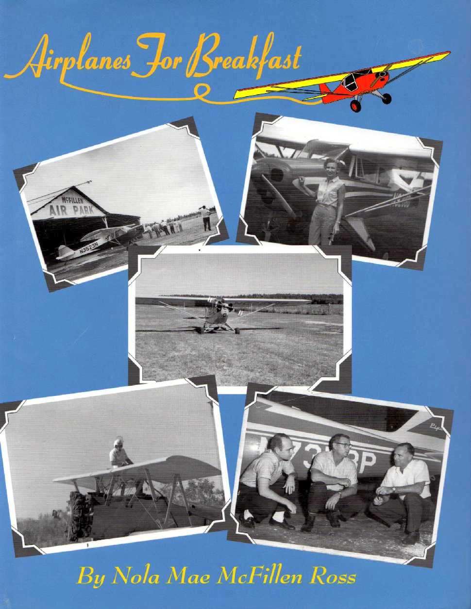
Scenes of McFillen Airpark on the cover of Nola Mae McFillen Ross's book “Airplanes For Breakfast”.
According to airport founder Nola Mae McFillen Ross's book “Airplanes For Breakfast”,
McFillen Airpark was built between 1943-45.
However, McFillen Airpark was not yet depicted on the February 1955 Beaumont Sectional Chart.
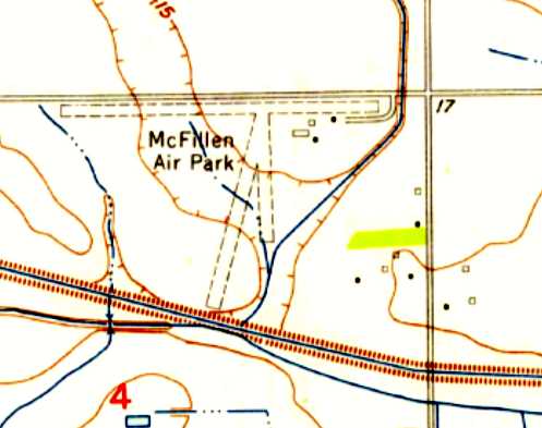
The earliest topo map depiction which has been located of McFillen Airpark was on the 1955 USGS topo map.
It depicted the airpark as having 3 unpaved runways, the longest being an east/west strip along the northern boundary of the property,
and 4 small buildings on the northeast side.

The earliest aeronautical chart depiction which has been located of McFillen Airpark was on the February 1960 Beaumont Sectional Chart.
It depicted McFillen as having a 2,400' unpaved runway.

The 1968 Flight Guide (courtesy of Robert Levittan) depicted McFillen Air Park as having a single unpaved 2,520' Runway 17/35,
with 1 small building on the northeast corner of the field.
The 1980 USGS topo map still depicted McFillen as having 3 unpaved runways.
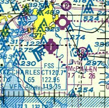
The last aeronautical chart depiction which has been located of McFillen Airpark was on the 1985 New Orleans Sectional Chart.
McFillen had evidently gained a paved runway at some point between 1980-85,
as it depicted the field as having a single 2,600' paved north/south runway.
Nola Mae McFillen Ross wrote in her book “Airplanes For Breakfast”,
“Problems with product liability, followed by lawsuits became unbelievable.
The new breed of pilots seemed to have been educated in filing lawsuits.
We were among those at the wrong end of a lawsuit, though not our fault.
It contributed greatly toward our going out of business.
The bottom fell out of the business & at the same time I was discovering that Ross was rapidly rolling into an Alzheimer world.
So on 12/31/85 I closed the doors for the last time on a business that had grown
from a little J3 Cub to a million dollar Cheyenne & affected thousands of lives in Louisiana.”
The 1990 USGS topo map depicted McFillen Air Park as having a single unpaved north/south runway.
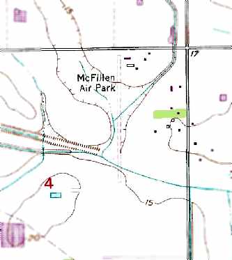
The 1996 USGS topo map depicted McFillen Air Park as having a single unpaved north/south runway,
with 5 small buildings on the northeast corner of the field.
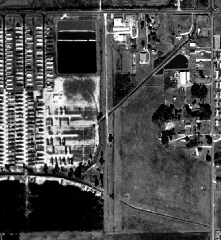
The 1998 USGS aerial view still showed the remains of the whole length of the McFillen runway,
and also showed the hangars remained standing,
although commercial buildings had been added to the site.
In 2000 Nola Mae McFillen Ross wrote in her book “Airplanes For Breakfast”,
“Today the old airport is the home of an automobile shop & an oilfield tool company.
One hangar, the first we ever built, still has the name McFillen Air Park written on the front,
faded but still alive as if testifying to better days.”
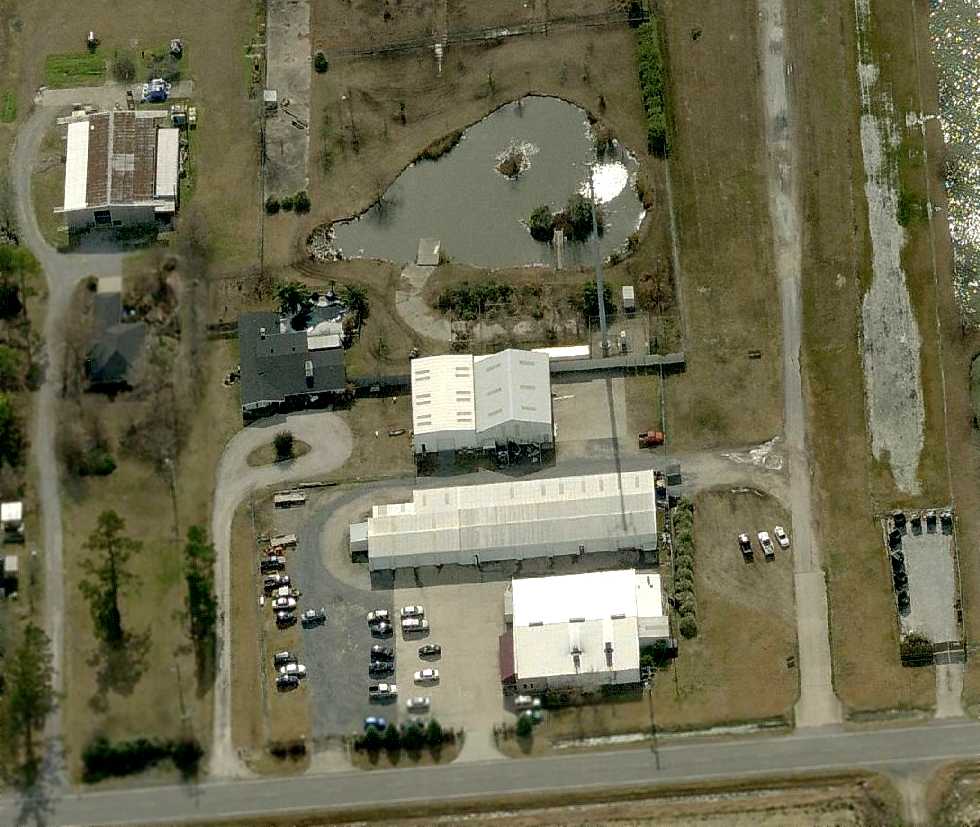
A circa 2010 aerial view looking south showed the remains of the McFillen runway, along with the hangars that remained standing.
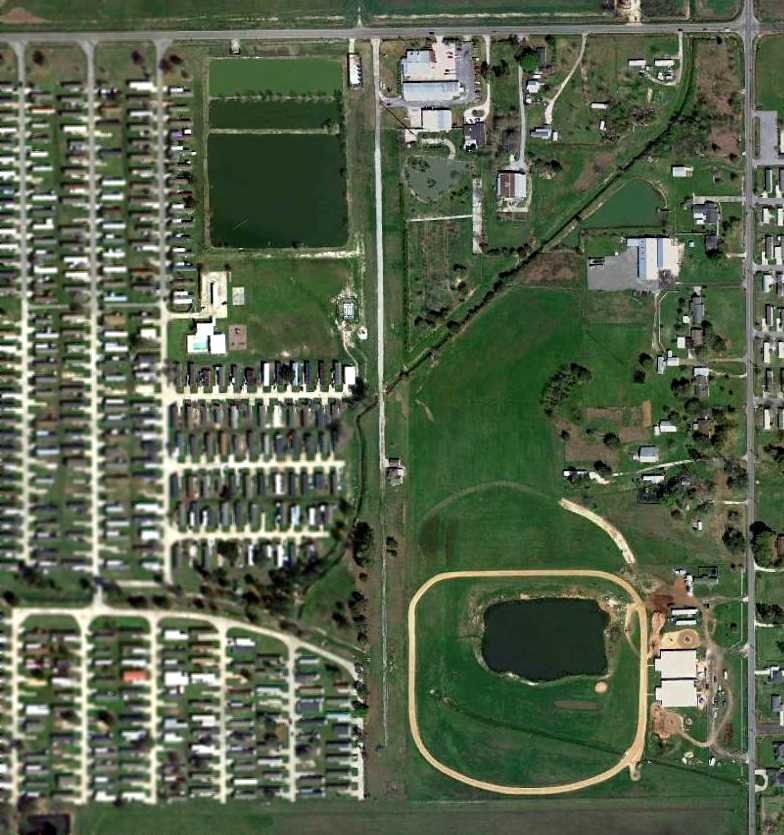
A 3/4/12 aerial view showed the remains of the McFillen runway, along with the hangars that remained standing.
The site of McFillen Airpark is located southwest of the intersection of Gauthier Road & Tom Hebert Road.
____________________________________________________
Louisiana Flyers Airport / East Lake Charles Airport (4R5), Lake Charles, LA
30.22 North / 93.14 West (West of New Orleans, LA)
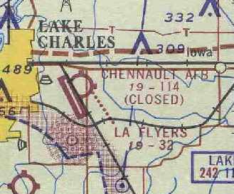
Louisiana Flyers Airport, as depicted on the September 1964 Beaumont Sectional Chart (courtesy of Chris Kennedy).
This little grass airfield coexisted with the much-larger Lake Charles AFB / Chenault AFB
which was located directly adjacent to it to the west.
Various incarnations of a Lake Charles Airport & Lake Charles AAF
existed to the west side of this property during WW2.
At some point after WW2, a single grass runway was constructed on the east side of the much-larger military field.
The 1953 Aviation Week Airport Directory (courtesy of David Brooks)
described the “Lake Charles Airport” as a municipal field with a 3,000' unpaved runway.
The remarks said “Use with caution when wet. If unusable use Lake Charles AFB with fee.”
Lawrence Dugas recalled, “I learned to fly on the grass strip in Lake Charles in 1957.
I was stationed at Chennault AFB until 1960.
There was a flying club there for the men in the Air Force.
Louisiana Flyers operated there & Ray Lambert had a maintenance shop there
and did work for McFillian who was the Piper dealer & operated a Fixed Base Operator at South Lake Charles.
I worked as a mechanic helper with Ray for about three years.”
Louisiana Flyers Airport was not depicted on the February 1960 Beaumont Sectional Chart
noe listed among active airfields in the 1963 AOPA Airport Directory (according to Chris Kennedy).
The adjacent Chennault AFB was closed in 1963.
The Aerodromes table on the September 1964 Beaumont Sectional Chart (courtesy of Chris Kennedy)
described the Louisiana Flyers Airport as having a single 3,240' turf runway.
The adjacent Chenault AFB had been closed by that point.
It was apparently renamed "East Lake Charles" Airport at some point in the next 3 years,
as that is how it was listed in the 1967 AOPA Airport Directory (courtesy of Chris Kennedy).
It described the field as having a single 3,000' sod Runway 15/33,
and said that it was operated by Louisiana Flyers Inc. & Lambert Aircraft Service.
The field was said to offer charter, tiedowns, fuel, and repairs.
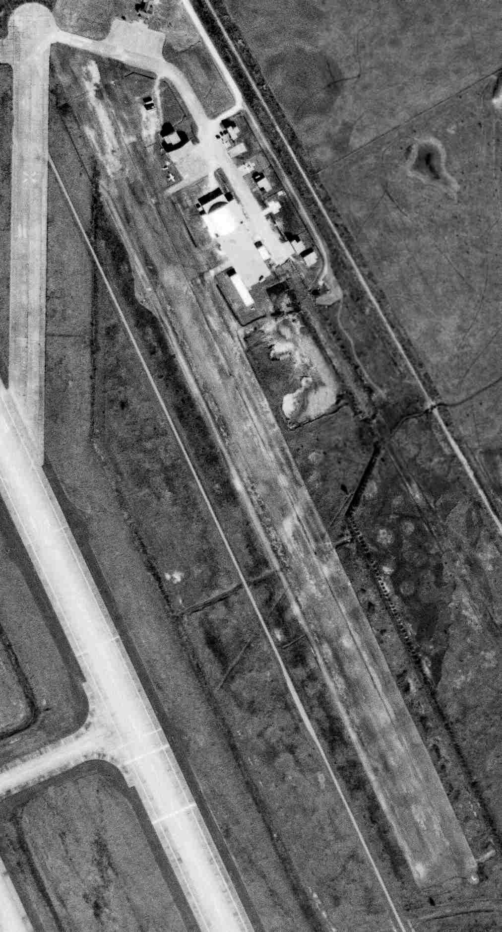
The only photo which has been located showing aircraft at East Lake Charles Airport was a 12/3/67 USGS aerial photo,
which depicted one single-engine aircraft parked near the hangars.
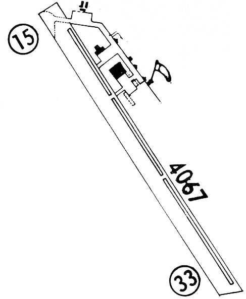
The 1968 Flight Guide (courtesy of Robert Levittan) depicted East Lake Charles as having a single unpaved 4,067' Runway 15/33.
A parallel taxiway on the east side led to a ramp at the northeast corner of the field with several small buildings.
Tim Bertrand recalled, “East Lake Charles Airport... I was a line boy there from 1972-78.
I learned to fly there & got my private, instrument, multi-engine & commercial ratings there.
It was named Louisiana Flyers flight school. There was also a crop-dusting company there which I also worked for named Louisiana Flyers.
The runway was actually 5,000' long'; I used to mow it. The south 2,000' were unusable a lot because it was low & stayed wet a lot.”

The runway at East Lake Charles has apparently been lengthened somewhat at some point within the next 12 years,
as the 1979 Flight Guide (courtesy of Chris Kennedy) depicted the field as having a single 3,850' Runway 15/33.
A parallel taxiway on the east side led to a ramp at the northeast corner of the field,
with a total of 9 small buildings (hangars?).
Tim Bertrand recalled, “The businesses left there in approximately 1980-82.
The parish took it over but continued leasing hangar space to people with airplanes.”
East Lake Charles was still listed as an active airport in the 1982 AOPA Airport Directory (courtesy of Ed Drury).
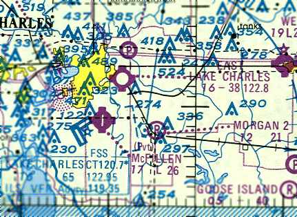
The last aeronautical chart depiction of East Lake Charles Airport which has been located
was on the 1985 LA Aeronautical Chart (courtesy of Jed Keck).
It depicted East Lake Charles as having a 3,800' unpaved runway.
Tim Bertrand recalled, “I kept my airplane, Rans S7 there from 1995-98, for a $25/month charge.”
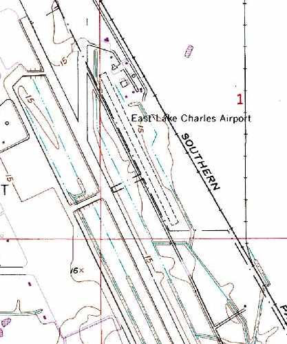
The 1996 USGS topo map still depicted East Lake Charles Airport,
adjacent to the runway of the reopened Chenault Field,
but that does not necessarily indicate it was still open at that point.
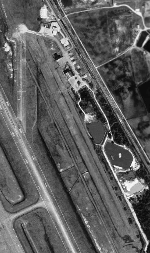
As seen in the 1998 USGS aerial photo,
the grass runway of East Lake Charles Airport still remained intact,
as well as the group of small hangars at the northeast corner of the field.
But there was no indication that the field was still open at that point.
Tim Bertrand recalled, “After 1998 they slowly moved everyone out, demolished the hangars & later the runway, and used it for parish operations.
I literally cried when that happened - I had grew up at that little airport & it meant a lot to me.”
The East Lake Charles Airport was no longer listed among active airfields in the 2000 AOPA Airport Directory.
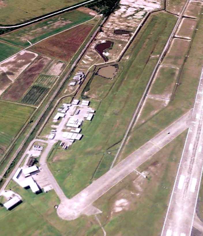
A 5/18/09 aerial view looking southeast showed the grass runway of East Lake Charles Airport still remained intact.
It appeared as if at least one of the former hangars remained standing,
while others had been removed, with their locations used to store trailers.
The site of East Lake Charles Airport is located east of Chenault Field's main runway,
and west of the Southern Pacific Railroad tracks.
____________________________________________________
Since this site was first put on the web in 1999, its popularity has grown tremendously.
That has caused it to often exceed bandwidth limitations
set by the company which I pay to host it on the web.
If the total quantity of material on this site is to continue to grow,
it will require ever-increasing funding to pay its expenses.
Therefore, I request financial contributions from site visitors,
to help defray the increasing costs of the site
and ensure that it continues to be available & to grow.
What would you pay for a good aviation magazine, or a good aviation book?
Please consider a donation of an equivalent amount, at the least.
This site is not supported by commercial advertising –
it is purely supported by donations.
If you enjoy the site, and would like to make a financial contribution,
you
may use a credit card via
![]() ,
using one of 2 methods:
,
using one of 2 methods:
To make a one-time donation of an amount of your choice:
Or you can sign up for a $10 monthly subscription to help support the site on an ongoing basis:
Or if you prefer to contact me directly concerning a contribution (for a mailing address to send a check),
please contact me at: paulandterryfreeman@gmail.com
If you enjoy this web site, please support it with a financial contribution.
please contact me at: paulandterryfreeman@gmail.com
If you enjoy this web site, please support it with a financial contribution.
____________________________________________________
This site covers airfields in all 50 states.