Abandoned & Little-Known Airfields:
Ohio: Northeast Ohio
© 2002, © 2016 by Paul Freeman. Revised 11/13/16.
This site covers airfields in all 50 states: Click here for the site's main menu.
____________________________________________________
Please consider a financial contribution to support the continued growth & operation of this site.
Mills Airport (added 7/11/16) - Southern Airways Airport / Boardman Air Park (added 8/18/16) - Youngstown Executive Airport (revised 11/13/16)
____________________________________________________
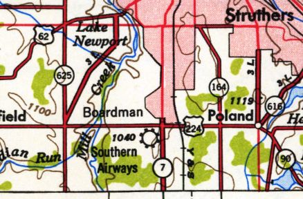
Southern Airways Airport / Boardman Air Park, Boardman, OH
41.02, -80.684 (Southeast of Cleveland, OH)
Southern Airways Airport, as depicted on the 1950 USGS topo map.
The earliest depiction which has been located of Southern Airways Airport was on the 1950 USGS topo map.
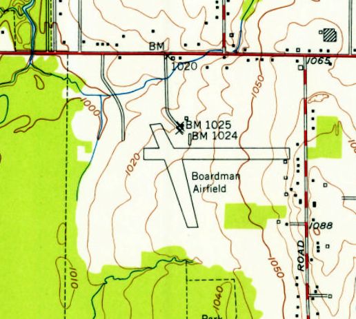
The 1951 USGS topo map depicted the airfield under a different name: Boardman Airfield.
It depicted the field as having 2 runways, with 2 small buildings just northeast of the runway intersection.
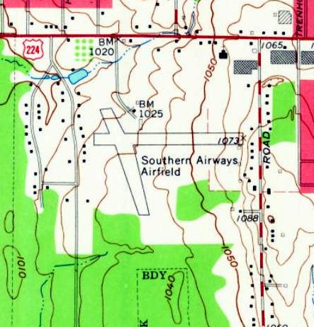
The 1963 USGS topo map depicted the airfield in the same physical configuration, but once again with the name of Southern Airways Airfield.

The earliest aeronautical chart depiction which has been located of Southern Airways Airport
was on the 1965 Cleveland Sectional Chart (courtesy of Chris Kennedy).
It depicted Southern Airways Airport as having a 2,600' unpaved runway.
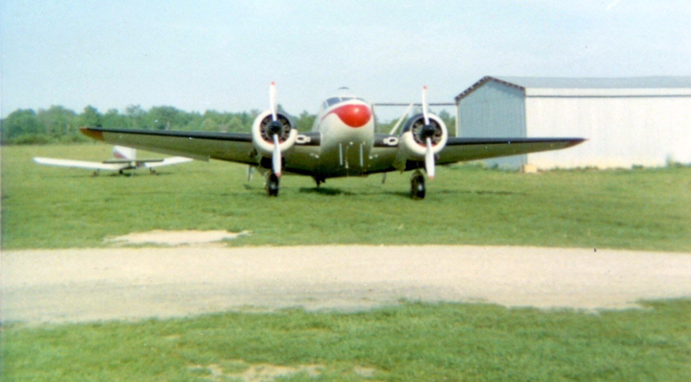
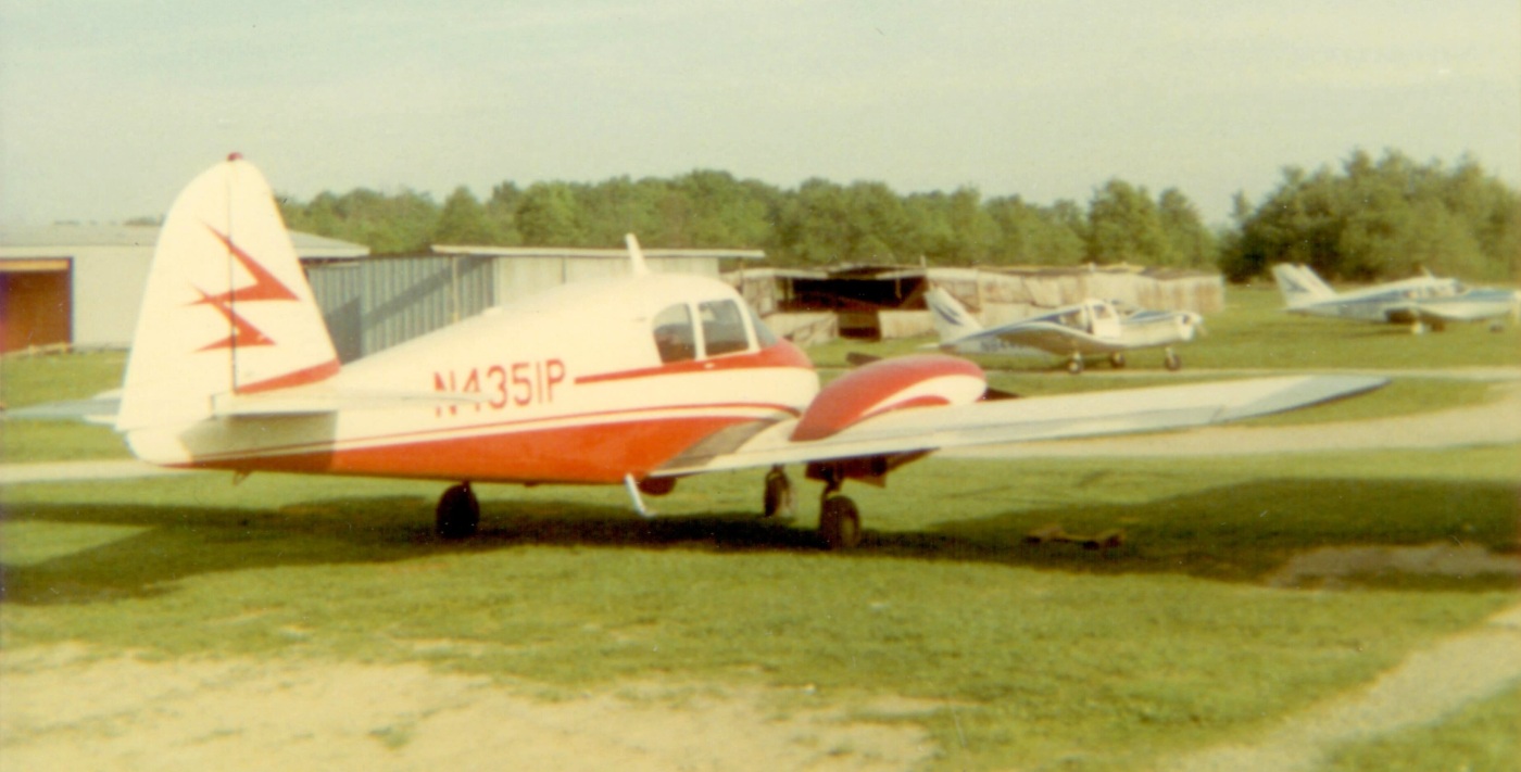
A circa late 1960s / early 1970s photo by Jim Croasmun of a Beech 18 in front of a Piper & some hangars at what appears to be Boardman Air Park.
Jim recalled, “The pictures were taken when a friend & I rode our bicycles out to a grass strip, and stood there hanging on the fence watching takeoffs & landings.
While I can't say with absolute certainty, I think it's very likely that we'd bicycled to Boardman Air Park.”
A circa late 1960s / early 1970s photo by Jim Croasmun of a Piper Apache, some other Pipers & several hangars at what appears to be Boardman Air Park.
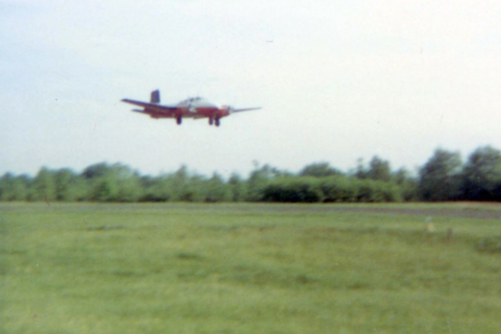
A circa late 1960s / early 1970s photo by Jim Croasmun of a Beech Twin Bonanza taking off or landing at what appears to be Boardman Air Park.
The last aeronautical chart depiction which has been located of Baordman Air Park was on the May 1970 Cleveland Sectional Chart.
It depicted Boardman as having a 2,600' unpaved runway.
Boardman Air Park was evidently closed at some point between 1970-79,
as the 1979 USGS topo map had an odd depiction – a neighborhood of new streets & houses was depicted over the site of the airport,
but the label “Boardman Air Park” was still superimposed over the new streets.
A 1994 aerial view showed no trace remaining of Boardman Air Park.
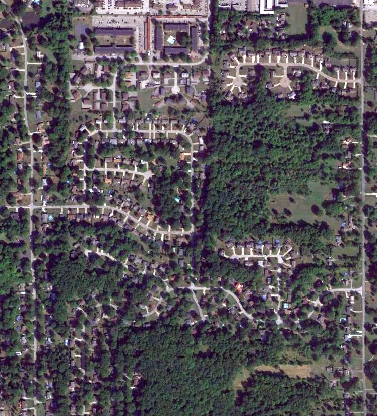
A 2015 aerial view showed no trace remaining of Boardman Air Park.
The site of Broadman Air Park is located south of the intersection of Broadman-Canfield Road & West Boulevard.
Thanks to Jim Croasmun for pointing out this airfield.
____________________________________________________
Mills Airport (7E3), Mantua, OH
41.238, -81.254 (East of Cleveland, OH)
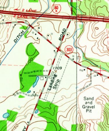
Mills Airport was depicted on the 1960 USGS topo map as a single unpaved northeast/southwest runway, labeled simply as “Landing Strip”.
According to its FAA Airport/Facility Directory data, Mills Airport was activated in October 1953.
The earliest depiction which has been located of Mills Airport was on the 1960 USGS topo map.
It depicted a single unpaved northeast/southwest runway, labeled simply as “Landing Strip”,
along with a single small building along the west side.
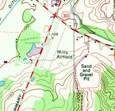
The 1970 USGS topo map depicted “Mills Airfield” as having a single unpaved northeast/southwest runway
along with a single small building along the west side.

The earliest photo which has been located of Mills Airport was a 1994 USGS aerial view looking northwest.
Although the runway appeared distinct & maintained, there were no aircraft visible, nor any other indication of recent aviation usage.
As of July 2011, Mills Airport's FAA Airport/Facility Directory data described it as conducting an average of 20 takeoffs or landings per week.

Mills Airport had evidently been abandoned by 2015, as the runway was planted with crops.
As of 2016, Mills Airport's FAA Airport/Facility Directory data described it as having a single 2,640' turf Runway 3/21, “in good condition”.
It was said to have a total of 10 single-engine aircraft based on the field,
and the owner & manager were listed as Larry & Alvin Mills.
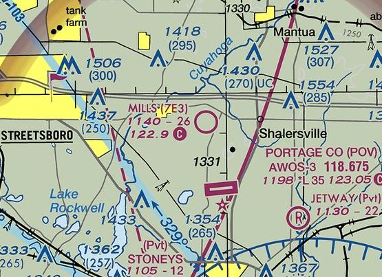
The 2016 Terminal Aeronautical Chart continued to depict Mills Airport as a public-use airfield,
even though it was no longer suitable for aircraft operations by that point.
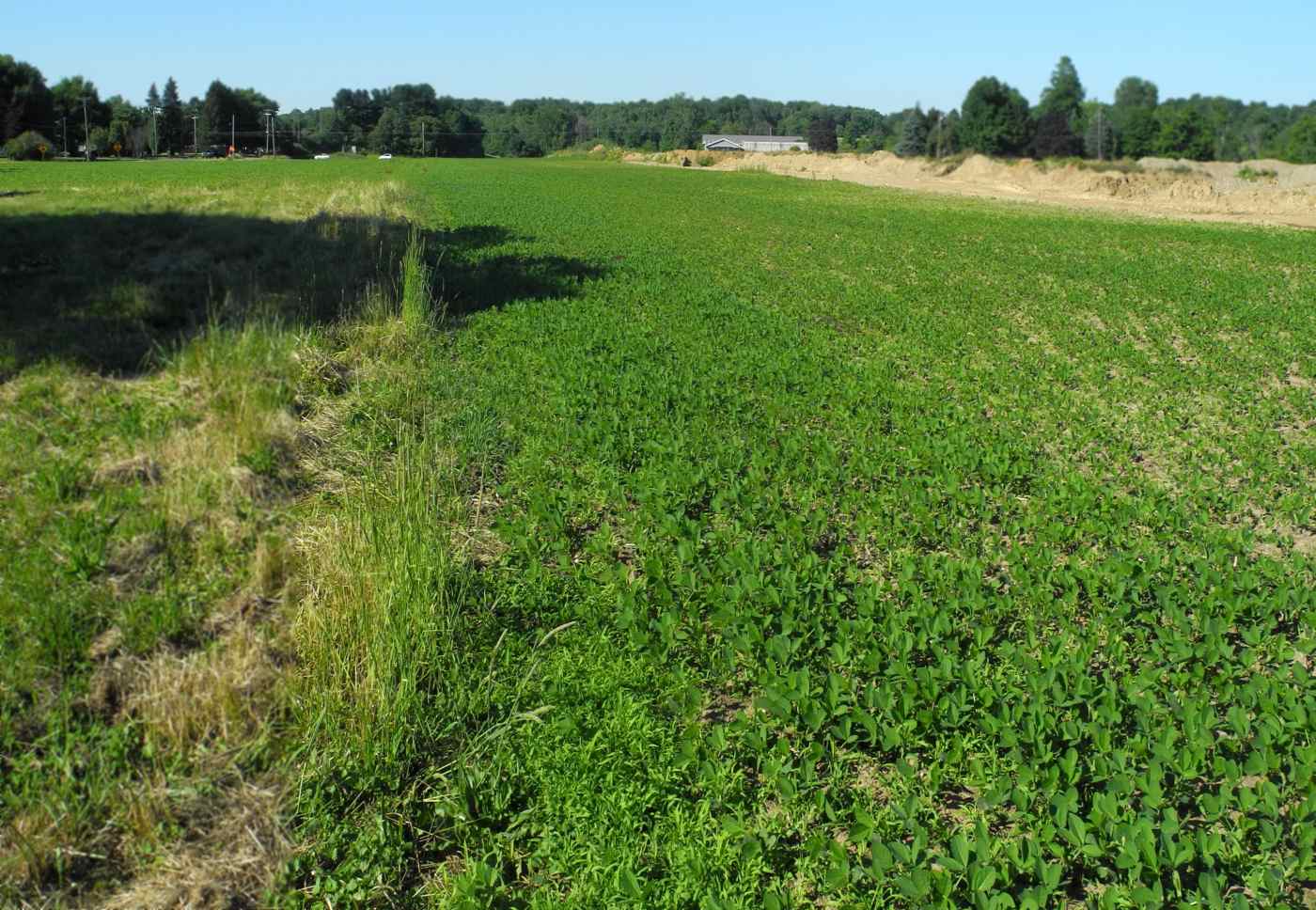
A 6/24/16 photo by Randy Coller looking along the former runway of Mills Airport.
Randy reported, “I talked to the owner - he thought the airport had been abandoned officially years ago.
Apparently no one did the proper paperwork to abandon the airport as the FAA still shows it on the charts.
The runway is planted in soybeans, with a gravel quarry adjacent. The airport is not suitable for aircraft.”
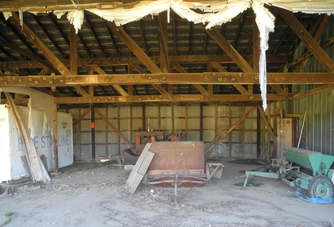
A 6/24/16 photo by Randy Coller of the interior of the Mills Airport hangar. Randy reported, “The hangar is vacant.”
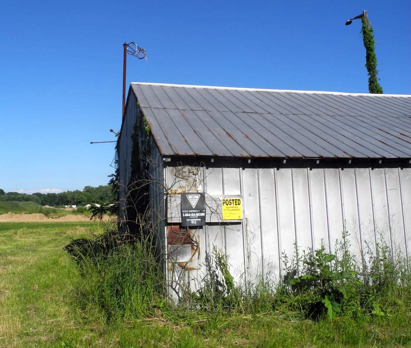
A 6/24/16 photo by Randy Coller of an abandoned Mills Airport hangar. Note the windsock frame on top, and the AOPA Airport Watch sign on the side.
Mills Airport is located southeast of the intersection of Infirmary Road & Ritchfield Hudson Road.
Thanks to Randy Coller for pointing out this airfield.
____________________________________________________
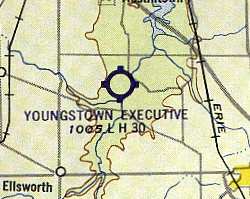
Youngstown Executive Airport (06G), Youngstown, OH
41.06, -80.83 (Southeast of Cleveland, OH)
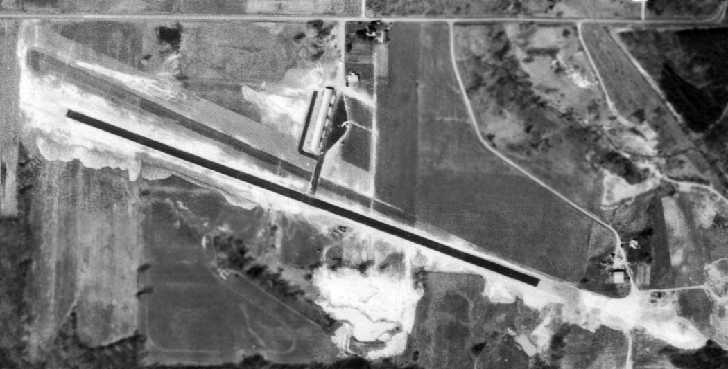
Youngstown Executive Airport, as depicted not long after its construction on a 4/21/62 USGS aerial photo.
This small general aviation airport was apparently built at some point between 1960-62,
as it was not depicted on the 1960 Cleveland Local Aeronautical Chart (courtesy of Mike Keefe).
The earliest depiction which has been located of Youngstown Executive Airport was on a 4/21/62 USGS aerial photo.
The field appeared to be newly-completed, with a single asphalt northwest/southeast runway,
and an asphalt taxiway leading to a hangar on the north side, and a ramp on which were visible 3 aircraft.
The earliest aeronautical chart depiction which has been located of Youngstown Executive Airport
was on the 1963 Cleveland Local Aeronautical Chart (courtesy of Mike Keefe).
The Aerodromes table on the chart described the field as having a single 3,000' asphalt runway.

The 1963 USGS topo map depicted Youngstown Executive Airport
as having a single paved northwest/southeast runway & 3 small buildings on the north side.
The runway at Youngstown Executive was apparently lengthened within the next 2 years,
as the 1965 Cleveland Sectional Chart (courtesy of Chris Kennedy)
described the field as having a single 4,200' asphalt runway.
The 1966 OH Airport Directory (courtesy of Chris Kennedy)
depicted 2 rows of T-hangars on the north side of the runway,
as well as a new hangar & administration building.
Scott Tanner recalled, “Youngstown Executive Airport... I worked as a line boy at the airport around 1970.
It was run by Frank Corby, and his brother Mario. Some of the names I remember are Ray Penny, Scott Rapp, Jack Wilson, Scott Cory.
I took flying lessons there. I have lots of good memories from those days like watching the drag races & calling the tower when a plane was about to land.
One time, I even got to run the tug down the track on a Saturday night.
I don't remember my time but I'm sure it was a record for the slowest ever 1/4 mile ever.”
The last aeronautical chart depiction which has been located of Youngstown Executive Airport was on the May 1970 Cleveland Sectional Chart.
It depicted Youngstown Executive as having a 4,200' paved northwest/southeast runway.
Jay McMurray recalled of Youngstown Executive Airport, "I started flying there in 1973
and worked as a 'Lineboy' fueling airplanes that summer.
We closed for the races on weekend nights.
The field was also used for a lot of cargo flights. Beech 18's were common.
I used to work till sundown & hop on a Beech 18 or some other lighter twin
and fly all night with the cargo pilot flying Packard Electric car parts
around to the various cities making cars: Oshawa Canada, Detroit, Andersen Indiana etc."

A flight simulation scenery re-creation looking northeast at Youngstown Executive Airport by Richard Finley.
Dan Anthony recalled, “I took my first flight lessons out of Youngstown Executive Airport
and was one of the 'line boys' from about 1973-75.
With my employee discount my hourly rate for a Cessna 150 or 152 & the instructor
was about $15 but I was making only minimum wage ($1.65 / hour at the time).
The airport was a Cessna Dealer & sold many new Cessnas
that ended up getting leased back into the flight training program.
One nice thing about taking lessons at this airport was there were always new airplanes to fly.
As a line boy one of my jobs was to clean & wax the airplanes.
The instructors liked when I scheduled a lesson because the plane I scheduled for myself
was pulled from the line & cleaned spotless just prior to my lesson, I made sure of that!”
Dan continued, “They also had a thriving charter service with a Cessna 421 (Golden Eagle),
a C-410, C-310s, Piper Navaho and the Beech 18s.
The Beeches were used as freight haulers & passenger planes
(as a line boy I was required to load & unload the freight & install/remove the seats).
They had a very active A&P shop to maintain the fleet of training aircraft
and the private planes hangared on the field as well as many that would fly in for their maintenance needs.
They also had an active radio shop.”
Dan continued, “During my time there they had an annual Fly-In
and planes from all over the country would drop in.
At the Fly-In the training fleet was used to give 'penny-a-pound' rides to anyone that wanted a ride in a small plane.
We had a bathroom scale & the person would step on & get weighed
and we collected a Penney for every pound & off they went.”
Dan continued, “The drag-racing that was every Friday & Saturday Night during the racing season...
One of my jobs was to work the radios once the FBO’s daytime staff left.
The pilots based at 06G didn’t like the fact that the airport closed for drag racing
and many would takeoff just prior to race time & then buzz the runway or interrupt the racing by landing.
One of the charter pilots would often take the B-18 down
and blow the racing timing lights or the 'Christmas tree' & starter shack over
with his prop-wash & run-up prior to a late evening take-off.
Because of these intentional pilot-induced delays the race sponsors hired an off-duty, uniformed police officer
to operate the radios & 'talk' to any pilot that wanted to land or takeoff.”
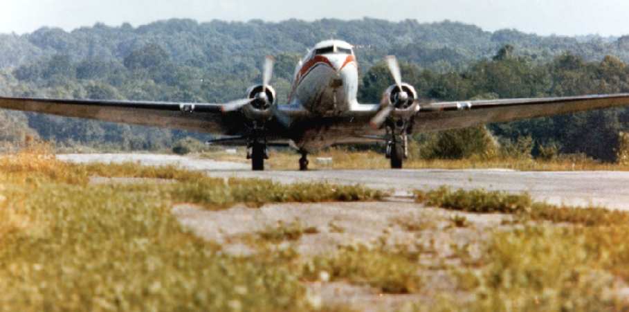
A 1978 photo by Charles Brasile (used by permission) of a Douglas DC-3 of Mannion Air Charter departing Youngstown Executive Airport.
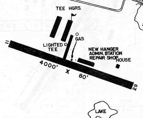
The 1982 AOPA Airport Directory (courtesy of Ed Drury)
described Youngstown Executive as having a single 4,155' asphalt Runway 11/29.
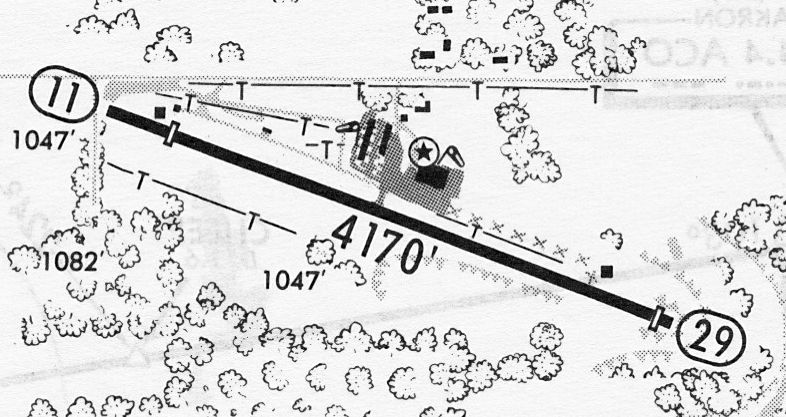
A 6/21/85 airport directory (courtesy of John Kielhofer) depicted Youngstown Executive Airport
as having a 4,170' paved Runway 11/29, and a ramp 4 buildings on the north side.
Dan Anthony recalled, “The large hangar to the right of the FBO building...
This hangar & most of the airplanes inside & tied-down all over the airport
were destroyed by a tornado sometime in the mid 1980s.
Shortly after that the FBO folded & then the rest of the place fell apart.”
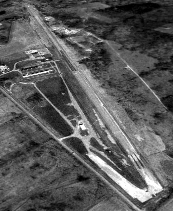
A 4/20/94 USGS aerial view looking southeast showed Youngstown Executive to consist of a single paved 4,100' runway & some small hangars.
A small middle portion of the runway appeared to have been recently repaved, possibly for radio-controlled model aircraft flights.
Only 1 (or possibly 2) aircraft were visible on the field.
Youngstown Executive was evidently closed (for reasons unknown) at some point between 1994-2002,
as it was depicted as an abandoned airfield on 2002 aeronautical charts.
The rows of T-hangars were still standing in a 2005 aerial photo,
but had been removed by the time of a 2006 aerial photo.

A circa 2001-2005 aerial view looking north at Youngstown Executive Airport,
showing that the hangars & runway remain in fine condition.
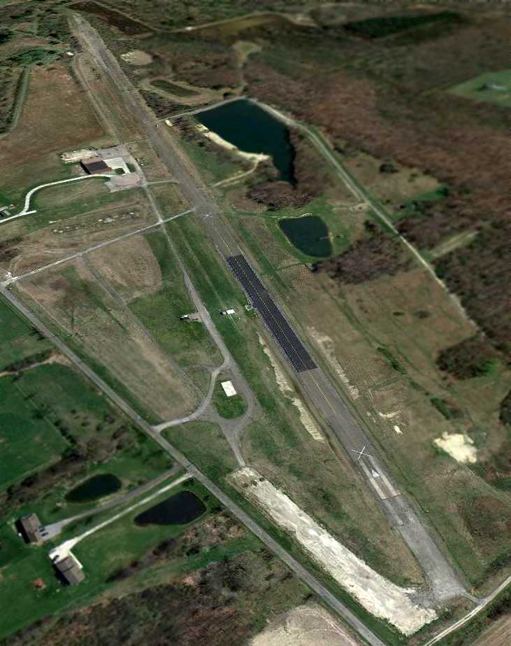
A 4/6/12 aerial view looking southeast showed Youngstown Executive to remain mostly intact, with the exception of the removed T-hangars.
In contrast to the 1994 photo, a different portion of the runway (further west) has been recently repaved, for radio-controlled model aircraft flights.
Kevin Marstellar reported in 2013, “My radio-controlled model aircraft club - The Nighthawks -
now uses the airstrip which we 'rent' from Allison Brothers who owns the property now.
Full-scale aircraft still do occasionally use it - but very rarely.
We have an annual Father's Day event where a local medevac helicopter usually comes & is available to check out.
We also host several other large RC events where a couple people will fly their full-scale planes in.”
In the words of Gene Zeigler, "Much aviation history in Northeast Ohio is lost
and very few of these facts have been recorded for the future generations to know about."
____________________________________________________
Since this site was first put on the web in 1999, its popularity has grown tremendously.
That has caused it to often exceed bandwidth limitations
set by the company which I pay to host it on the web.
If the total quantity of material on this site is to continue to grow,
it will require ever-increasing funding to pay its expenses.
Therefore, I request financial contributions from site visitors,
to help defray the increasing costs of the site
and ensure that it continues to be available & to grow.
What would you pay for a good aviation magazine, or a good aviation book?
Please consider a donation of an equivalent amount, at the least.
This site is not supported by commercial advertising –
it is purely supported by donations.
If you enjoy the site, and would like to make a financial contribution,
you
may use a credit card via
![]() ,
using one of 2 methods:
,
using one of 2 methods:
To make a one-time donation of an amount of your choice:
Or you can sign up for a $10 monthly subscription to help support the site on an ongoing basis:
Or if you prefer to contact me directly concerning a contribution (for a mailing address to send a check),
please contact me at: paulandterryfreeman@gmail.com
If you enjoy this web site, please support it with a financial contribution.
please contact me at: paulandterryfreeman@gmail.com
If you enjoy this web site, please support it with a financial contribution.
____________________________________________________
This site covers airfields in all 50 states.