|
|
|
|
1.1 Overview of the Bear Creek Project The Bear Creek Basin is the
major waterway in the Redmond, Woodinville, and Sammamish Plateau regions near
Lake Washington in Western Washington. Within the rather large Bear Creek Basin
are three not-as-important sub-basins: Bear Creek, Cottage Lake, and the Evans
Creek system of creeks. The City of Redmond, the City of Woodinville, King
County and Snohomish County all share in the responsibilities of maintaining a
healthy ecosystem throughout the Basin. Although the cities
of Redmond and Woodinville, and for that matter all of those unincorporated
people do not rely on the Bear Creek Basin for their drinking water, the Bear
Creek Basin still has some importance in the grand scheme of things. Bear Creek
provides a habitat for a plethora of plant and animal species, among them the
prickly sculpin, the oyster mushroom, and the larvae of a small miniscule
beetle. More importantly, the “Taste of the Northwest” can be found within
the Bear Creek Basin. Yes, that’s right—salmon! Salmon are important to the
economy of King County and Western Washington, because without salmon we could
not make Washington State look as nice, and Slade Gordon could not claim to be
an ‘environmentalist.’ Salmon are in fact vitally important to the
ecosystem, because they are an indicator species in addition to the fact that
many species of salmon are currently labeled as endangered or threatened on the
Endangered Species Act, which means that if salmon weren’t important, the EPA
would hound our tails. The areas surrounding Bear and Cottage Creeks have undergone some major changes in the past decade. Really nice homes have sprung up, and huge golf courses and rich country clubs are polluting the once-backcountry atmosphere. Massive development now rules the land on both sides of Avondale, Union Hill, and Novelty Hill Roads, three major roads in the region. These developments have had an adverse impact on Bear Creek. The purpose of this study is to measure the water quality of Bear Creek and assess the overall health of the ecosystem. 1.2 History of Redmond & Bear Creek Redmond is
a wonderful suburb on the Eastside region in Western Washington. It is home to
some of the most prestigious high-tech firms in the nation, including a small,
little honest firm called Microsoft. Many articles and books have been written
about Redmond’s “local” history, including cheesy descriptions of the
‘pioneers’ of Redmond: Luke McRedmond and Warren Perrigo. This type of
history, however, has little significance to Bear Creek, and all one really
needs to know is that there were settlers, and they unfortunately survived. The
main industry in Redmond’s early days was the lumber industry. Here cheery
settlers chopped down large trees, oblivious to the fact that they were
destroying the habitat of many forest creatures. The City of Redmond was finally
incorporated on December 31, 1912 with only 303 residents. Redmond’s population
has remained relatively small. The city is not one of the largest cities in
Washington State (although it is the 16th largest), and is frequently
in the shadow of the more thriving, but just as equally snobby Bellevue. When
Redmond was incorporated only 303 residents knew what they were getting into. A
population table and graph is presented below.
Table 1.2.1
Population, Housing Units, and
Jobs in Redmond The main
reason why Redmond grew in the 1960s was the opening of the Evergreen Point
Floating Bridge in 1963, which enabled many people to commute into Seattle much
easier, especially to Boeing, the main employer in King County in the 1960s. Logging was
the area’s main source of income from Redmond’s pre-history (the turn of the
century) to around the 1940s, when new industries came of age. With the
Evergreen Bridge becoming accessible in the 1960s, Redmond fully became a
suburb, and had virtually no timber firms in the city. Redmond shares
in the prominent climate of the Puget Sound region, a temperate marine climate.
The weather is normally mild and comfortable, and contrary to popular belief, it
does not rain all the time in the Seattle region. A major factor contributing to
the climate of Puget Sound is the prevailing westerly wind that blows from the
Pacific Ocean. This wind brings warm, moist air towards the western lowlands, or
King County in this case. Although rain is a staple in Northwest life, Portland,
Boston, New York, Atlanta, and Miami all receive more rain annually than Seattle
and its suburbs receive.
Table 1.2.2
Climate Data for the City of Redmond Speaking of rain, there
is a wonderful little rain gauge located near the Sears (which offers great
sales on Craftsman tools) store in Overlake, a little area considered to be a
mix of Redmond and Bellevue. Here is the rain gauge data for
the 1999, climate year (as opposed to fiscal year and salmon year).
Table 1.2.3 Wonderful rain gauge data! 1.3 Geologic History of Bear Creek Redmond’s
variety of physical features is a
result of an active and recent geological activity. Important events in the
geological history include the recession of the Pacific Ocean, the emergence of
a coastline, continuous mountain building, and erosion at the hands
of glacial and volcanic activity. The
Mesozoic Era, which lasted from 230
million to 63 million years ago, was a time of mountain building, in which the
Cascade Range, located slightly east of Redmond, was formed. Duering the
Cenozoic Era, which began 63 million years ago and continues to post-Italian
Renaissance and post-World War II, depending on what history class you are in,
the regions around the Cascades experienced more significant geological changes,
which include siltation and volcanic action. Streams and rivers carried silt out
of the Cascades, depositing it in regions such as Redmond. Although lava flows
didn’t reach Redmond, volcanic ash from the eruptions in the cascades during
the Cenozoic era is found in the region’s soil.
Until
there were glaciers in Bear Creek, there was no glacial activity.
This “anteglacial” period is not characterized by the presence of
glaciers or glacier paraphernalia. Instead it is characterized by lightly to
moderately oxidized sand and gravel deposited by rivers and stream that were not
glacial in any way shape, or form. The non-glacial origin of this deposit is
inferred from the way it is not near glacial strata.
While
there were many distinct periods of glaciation in the Puget Sound area, the
glacial deposits in the Bear Creek area can be can be unequivocally traced to
only the most recent of these glacial advances: the Vashon stage of the Frasier
glaciation. This activity resulted
in deposits of recessional outwash, gravel, and sand, till (a concrete-like
mixture of clay, sand, gravel, laid down beneath the advancing sheet of ice),
and advance outwash, which is sand with rare gravel deposited early in the
glaciation by meltwater streams running in front of the advancing glacier.
This activity occurred 13,000 years ago, and formed Lake Sammamish in its
wake. It also left spillways of
sand and gravel which eventually came to form creeks such as Evan’s and
Patterson’s. Small kettle lakes
(lakes that result from an iceblock which lodges in the surface and then melts)
were also formed. Erosion from the
hills and organic material eventually filled in these small lakes with rich
deposits. 1.4 Development of Redmond
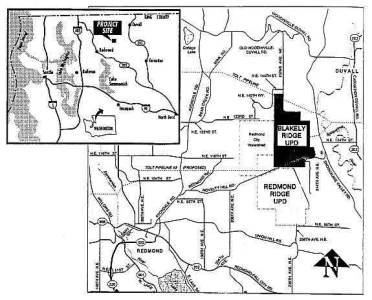
Redmond Ridge
is approved as a mixed-use, community within the Novelty Hill Area of the Bear
Creek Community. Owned by the Quadrant Corporation, the 1,046-acre site will
include: houses, employment, shops, parks and public utilities. Once completed,
Redmond Ridge will contain approximately 1,500 squalid hovels, 8.1 acres of
shrines to the god of commercialism, 128 acres of little cubicles where myopic
denizens scurry about like small rodents performing menials task after menial
task, 35 acres of “parks” (which really means waste dumping site), 584 acres
preserved in a native state (except for all the garbage), 15 miles of trails, a
fire station, an elementary school, water towers, and power substations. The
estimated time is around 7 to 20 years. The Blakely Ridge Urban
Planned Development is approved as a development within the Novelty Hill Area of
the Bear Creek Community. Owned by the Quadrant Corporation,
the 1,080-acre site will include up to 2,250 houses plus up to 200 “assisted
living units” , 14 acres of
retail and office space, 48 acres of “parks” (see above), an 18-hole public
golf course, complete with detrimental runoff, nitrates, and expensive snobby
country club filled with retirees, and 533 acres preserved in a native state.
The community will be limited to residents 55 years of age and older and will keep two undertakers on-site. The
“community,” or rather the “death camp” may take 7 to 20 years to build
completely. It is important to realize that the Bear Creek Basin has changed in the past hundred years. In fact, it is still changing. Because it is changing it is very necessary to test the Basin and write up the results so the health of the ecosystem can be determined. But never mind that…let’s just say that the region has changed. This is because the Eastside region has had a lot of growth recently. A sort of population explosion. Along with the incredibly rapid growth has come the greedy developer. The developer is normally seen in his corporate attire, jabbering incessantly on either a cell phone or a dictating machine. He is very busy and cannot tolerate people, namely citizen activists or ‘tree-hugging’ judges that would impede his developing and cost him money. Whenever the developer invades an area, the ecosystem shatters, plain and simple. Worse yet, the quality of life in a neighborhood also plummets, due to the developer’s comrades, like the pot-bellied construction worker who drives a bulldozer, spits on the soil, tosses cigarette butts everywhere, and is normally a balding, middle-aged hairy “macho” man. They are accompanied by perfectionist architects in neatly pressed polo shirts and designer jeans. These architects are rugged individuals, of course, and so are impelled to drive huge forest-green SUVs that pollute and tear up the earth, not to mention the fact that they get less than ten miles to the gallon. Finally, the worst of them all arrives: the real estate lady. The developer is not satisfied with destroying forests and dumping sediment into streams. No, he has to sell the homes that he builds for an exorbitant sum and pocket the money, preferably in a bank in Switzerland or the Cayman Islands. And to do this foul deed he relies on a squad of chirpy perfect realtors in plum power suits who would commit mass genocide if you would only buy that ‘darling’ little bungalow with a ‘spacious’ kitchen and ‘cozy’ basement for a ridiculously high price, but they like to call it a ‘bargain.’ 1.5 King County's Goal for Bear Creek (verbatim
from the “Return of the Kings” publication by King County) “Early
actions being proposed by King County include a comprehensive inventory of
immediate improvements to environmental standards and practices, enhanced
enforcement of existing regulations, habitat acquisition and restoration
projects, and their funding status. In addition, King County convened a
seven-member panel of scientists and ecologists to review and assess programs,
policies and regulations most relevant to the conservation of salmon (e.g.
development regulations, basin plans, wastewater treatment program). Following
its assessments, the panel worked with County department managers and policy
staff to prepare recommendations for specific actions or further analysis
directed toward improving protection of Chinook salmon. This
executive summary is an overview of “Return of the Kings,” the King County
response report to the proposed ESA listing. The report was submitted to the
National Marine Fisheries Services on March 16, 1999. Our
goals: Development
of the King County proposal was shaped by the need to address three primary
goals: (1)
To provide for the conservation of
threatened species and ecosystems upon which they depend. (2)
To afford King County and its cities
the predictability, and legal oproteactions neccesary to carry out the
responsibilites as a local general purpose government (3)
To encourage the long term recovery
of the species to sustainable levels” King
County has evidently decided to also follow the following goals set forth by the
NMFS: “In
guidance cited in the Coastal Salmon Conservation: Working Guidance for
Comprehensive Salmon Restoration Initiatives on the Pacific Coast (NOAA 1996),
the National Marine Fisheries Service describes the ecosystem approach in more
detail. In this guidance, NMFS provides these five principles for ecosystem
management that are central to salmon conservation: (1)
Maintain and restore natural
watershed processes that create habitat characteristics favorable to salmonids. (2)
Maintain habitats required by
salmonids during all life stages from embryos and alevins through adults. (3)
Maintain a well-dispersed network of
high-quality refugia to serve as centers of population expansion. (4)
Maintain connectivity between
high-quality habitats to allow for re-invasion and population expansion. (5)
Maintain genetic diversity. The
implication is clear: The conservation of salmon requires the conservation of
their ecosystems.” Witness
the astounding feat of reasoning accomplished by King County! To think, that
preserving an organism depends not upon talking about but preserving the place
where it lives—amazing! 1.6 Previous Assessment of Ecosystem Previous
assessments were mostly conducted under the goals of the Bear Creek Basin
plan’s recommendations for stewardship and monitoring. Evaluation activities
were conducted to ascertain the status of changes to the surface water
management. The types of monitoring activities that have been conducted in the
past included rain gauging, stream gauging, water temperature, channel cross
sections, channel morphology, sediment analysis, kokanee fish counts, amphibian
occurrence, permit activity, mussel monitoring, and storm water sampling. The
results of temperature monitoring showed that Cottage Lake Creek contributes the
coolest water to the basin (up to 5 degrees colder than Bear Creek.) In addition
the Bear Creek waters were shown to be 5-10 degrees colder than the Sammamish
River. This
supports the idea that Bear Creek could serve as a holding area for fish during
high temperature periods in the Sammamish River. Three key parameters measured
as part of the study include number of large pools, number of large woody debris
pieces and percent bank scour. Data was collected along successive 200-foot
sections for reaches ranging between 2,664 and 6,600 feet long; average values
for the three key parameters were calculated for each study reach. Aerial
photographs from 1992 were used to evaluate the quality of stream buffers within
and upstream. The accepted threshold of stream degradation occurs when ten
percent of a watershed becomes impervious. Above ten percent, damage to the
function of the stream system is demonstrable and irreversible.
|