|
- Area:30,365 sq km
- Area comparative:slightly smaller than Maryland
- Population:2,177,062 (2001 est.)
- Population Growth Rate:1.49% (2001 est.)
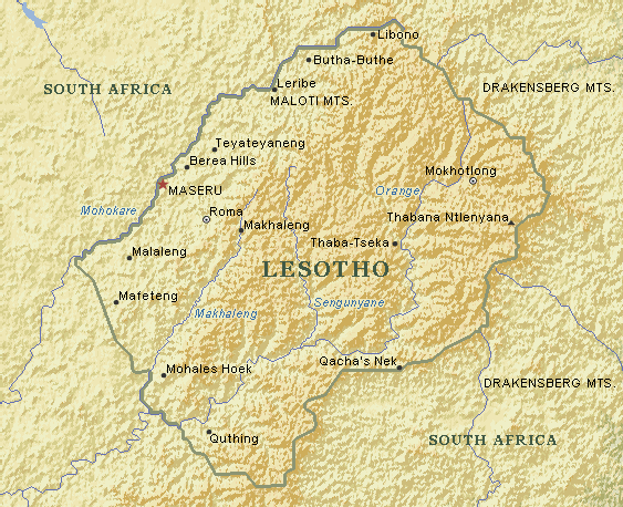
- Highest Point:Thabana Ntlenyana 3,482m
- Lowest Point:junction of the Orange and Makhaleng Rivers 1,400m
- Nationality: Noun:Mesotho (S), Basotho (P) Adjective:Basotho
- Offical Languages:English
- Government Type:Parliamentary consitutional monarchy
- Capital:Maseru
- Largest City:Maseru
|