Copyright by Lynn Mills All rights reserved
Bountiful High, Utah class of 58
A mystery lies beneath tons of earth on the shores of Washington state's Strait of San Juan De Fuca.
| In the wanning days of October, 2008 my wife, Carla and I were traveling to Port Townsend Washington which lies across from Western Canada on the Southern side of the Straight of San Juan De Fuca. Golden Popular trees lined both sides of the road as we neared the ferry terminal and historic downtown Port Townsend. It was named in 1792 by Captain Vancouver after his friend the Marquis of Townshend. There are many interesting Victorian homes and buildings in the town if your interested in architecture or if you like to browse the stores, the old town is dotted with unique individually owned shops. | 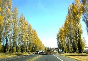 |
|
| As we left Port Townsend we were presented with a beautiful panoramic view of the Strait of San Juan De Fuca. Barely visible in this picture, looking North, on the spit of land jutting out into the strait, is the light house at Fort Warden State Park. The bluffs of Whidby Island can be seen extending across the entire width of the picture. Across the strait from Fort Warden on Whidby Island is Fort Casey. Going East from Casey and Warden is Fort Flaggler. These three bases were strategically placed triangularly so that their overlapping artillery could protect the straights and the crucial naval installations further up the strait and in Puget Sound, from enemy invasion during WW ll. For anyone traveling here a trip to Fort Flaggler should not be missed. The drive is enchanting and the romantic and scenic Mystery Bay which could well be the setting for a Nancy Drew or a Hardy Boys mystery is one of those off the beaten track places you will love. | 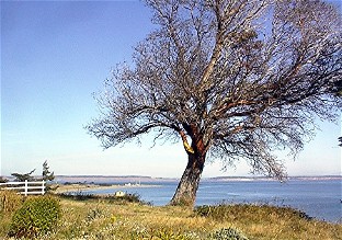 |
|
| Soon we arrived at our destination. Fort Warden State Park. The movie, "An Officer and a Gentleman" was filmed here. The Park consists of an upper level and a lower beach level. Standing on the bluff over looking the Strait you can watch the occasional large ship passing by. There are WW ll underground bunkers dotted all over the three parks. Some you can walk through and listen to your voice echo in the cement tunnels. Fort Casey has reinstalled artillery pieces that would rise up, fire and then duck down again behind a protective berm of earth and concrete. | 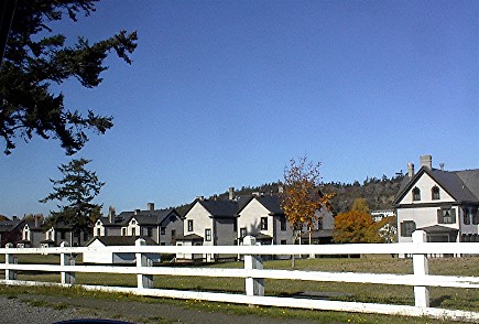 |
|
| As we descend to the beach we walk through waist high grasses. The path is gentle and easily navigated even by older folks like .... me, (speaking for myself and not my wife of course). | 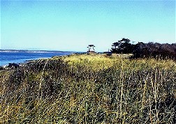 |
|
| Walking South we near the bluffs and approach a mystery. This picture looks South. The cliffs face west. Any Eastward approaching tsunami from the San Juan De Fuca Subduction zone to the west would crash into these bluffs head on. It is known that this subduction zone has produced earth quakes larger than 9.0 on the Ritcher scale, some even larger than the Indonesian quake that produced the disastrous tsunami of 2004. As tsunamis enter the narrowing straits the energy and height of the waves are greatly amplified so one might expect to find remnants of past tsunamis. | 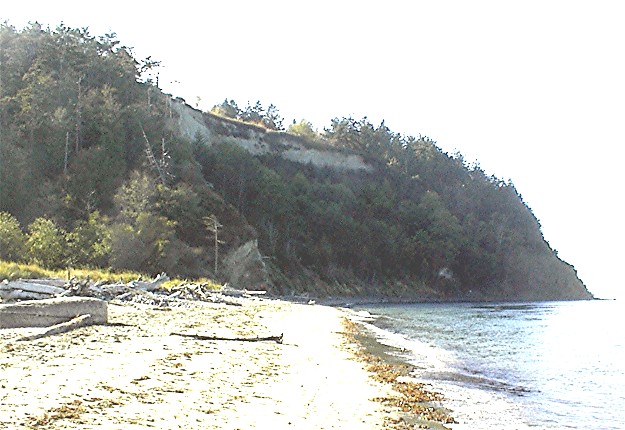 |
|
| Indeed
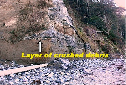
there may be such evidence. At the base of the cliffs is
a layer of crushed trees and tree limbs all piled on top of each other.
This layer continues for some
distance along the beach. It slopes slightly down until it disappears
below the beach level and appears to continue below the level of the
sea. High up the bluff and far above the debris level there are sea
shell eroding from the dirt. What forces created such destruction and
piled sea shells high above what must have at one time been forested
land standing above sea level. While panning for gold on the beaches of
the straits and also Puget Sound I have never seen this on any other
beaches. If it were land slide caused it should be as common as the
thousands of precipitous bluffs and cliffs through out the area where
erosion continually works to wear them all down. |
 |
|
| The arrow in this picture points to the debris layer near where it descends below the level of the beach. I would love to hear some expert opinions about whether this is evidence of a tsunami or simply a landslide that buried trees? |  |
|
| This is a piece of wood from the debris layer. It is so dense that it sinks like a rock in water. Notice the top left hand corner of the branch. That is where I sanded. It feels like ebony when you rub a finger over the sanded part. It is extremely hard. The dust from sanding is the same color as burnt umber but a little darker. If some one has access to carbon dating facilities it would be interesting to know when these trees were buried. | 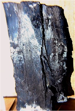 |
|
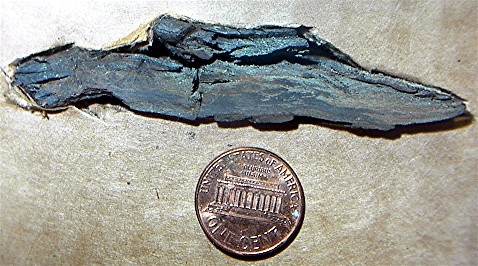
| This is an end on view of the
piece of tree limb shown in the previous picture. It
measures 7.5
cm (3")
wide and
1.75"cm .69" high. As you can see the limb has been
compressed under what must have been tremendous pressure from
7.5cm to only 1.75cm a loss of more than 70% of it's volume. All of the
dimensions of this piece are 15.24cm X 7.5cm X 1.75cm and it
weighs about 200 grams or barely under a half pound. I
partially sanded the end and it is so flattened that the tree rings are
no longer visible. I will look at it under a microscope and see if I
can see any rings and will update this page. Please
email me with your thoughts
wwindmills@comcast.net |
 |