(www.nitowns.com)
Belfast
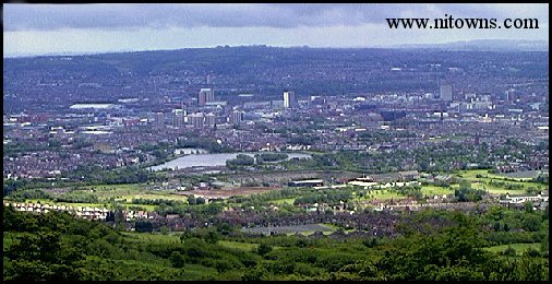
Views Over Belfast

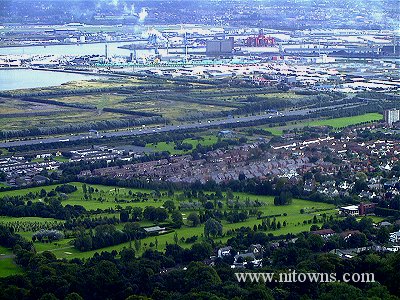
A southern view taken from the south side of the Cavehill

Green area: Fortwilliam golf course.
Road passing through middle: M2 motorway soon afterwards splitting into two motorways:North (M5) to join the shore road at whiteabbey and northwest (M2) for approx 20 miles towards Londonderry.
Upper area: Docks/Shipyard etc.
Land beyond the Docks: Co Down leading east to the Ards Peninsula where towns of Newtownards, Bangor, Donaghadee are situated, also south to such places as Downpatrick, Ballynahinch, Newcastle and the famous Mourne Mountains
The Shore road (near side of motorway) and the Antrim road ( closest in woodland area ) travel almost parallel to the motorway.
The land stretching from the shore road past the motorway to shoreline, has been a refuse dumping ground for many years, and in turn has reclaimed a lot of land from the sea, the motorway is built on this land.
The red structure in the docks area is a deep sea oil rig which I was told is here for repair.
Last Updated: October 28, 2005
Holidays In North & South Ireland
Contact
© Copyright 1999-2003
All Rights Reserved