(www.nitowns.com)

Portaferry, Co Down
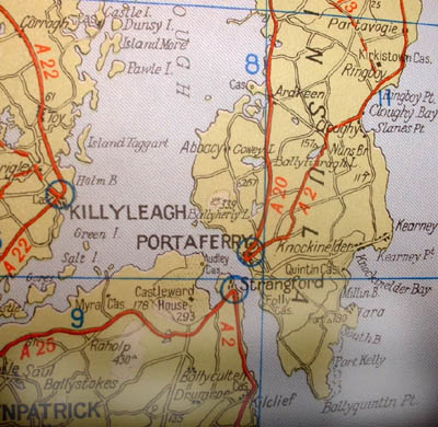
Portaferry sits on the sheltered west shore of the Ards peninsula at the narrow mouth of Strangford Lough, quite close to Ballyquintin Point which is at the tip, Portaferry is an important village for the people of the Ards peninsula saving them many land miles with its little roll-on roll-off ferry service to and from Strangford village. The water at the mouth of Strangford Lough is as deep as the English Channel between Dover-Calais. The rush of the tide is so strong here that the Norsemen called it "the place of the strange fiord", and this name has displaced the old Celtic name Louch Cuan. The lough, which is reputed 365 islands, is a perfect sanctuary for bird life.
The village is quite small with hilly, narrow streets borderd by colourful shops cafes etc. The old Portaferry Castle, built by William Le Savage (the great castle builders of Ards) is in the village. There are fine views from the sea-front across the lough and is very relaxing to sit here on a fine day watching the sailing boats and little ferry making their way back and forth from Strangford village, across the narrow mouth of the lough . Blackbank Hill, rising to 340 ft, and forming the higest point on the Ards peninsula, lies to the north of the town, giving good views of Strangford Lough and its narrow channel. Strangford Lough and the Irish sea around this area hold many shipwrecks which attract quite a few divers to the area. An excellent informative website has been created and lists vessels that went down over the years, just click here to have a look.
Places Of Intrest nearby:
National Trust properties at Castleward and Mount Stewart, Castle Espie Wildfowl and Wetlands Centre, Northern Ireland Aquarium, the monastic sites at Nendrum and Greyabbey.
A little History:
Of the 22 knights, with John de Courcy and his 300 picked men, made a swift invasion in January, 1177, by the Moyry into the ancient Kingdom Ulaidh, suprising King MacDunleavy and his army, and putting them to fight, only two succeeded in making anything like a permanent footing in East Ulster, de Mandeville in Delriada, and William le Savage in the Ards. The Savages became the great castle builders of Ards:their lineal decendants are still in the district and the ruins of Portaferry Castle, a great rectrangular fortress of the Savages, is in the demesne of the present representative of the family, Sir Roland Nugent. The old name for Portaferry is Ballyphilip.

Strangford Lough: Left, Irish Sea: Right
Portaferry is around 16 miles south of Newtownards, about 30 miles S-E of Belfast city and 45 miles S-E from Belfast International Airport.
*More information on photo pages*
You can visit "Killyleagh" by clicking its blue circle on the map.
Contact
Page created 14, November, 2002
© Copyright 1999-2003
All Rights Reserved