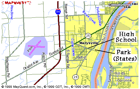
Located just south of Port Huron and just East (toward the water)
of the town of Marysville.
Directions from I-696 and I-94 interchange - Take I-94 East 37 miles
to exit #266 (Gratiot Connector/ M-25). Right (East) after exiting 1/2 mile
to Huron Blvd. Right on Huron Blvd and the High School is 3/4 mile on the left.
The park is another 1/4 mile on the left, just past the railroad tracks.
Approx Travel Time: 35 minutes.