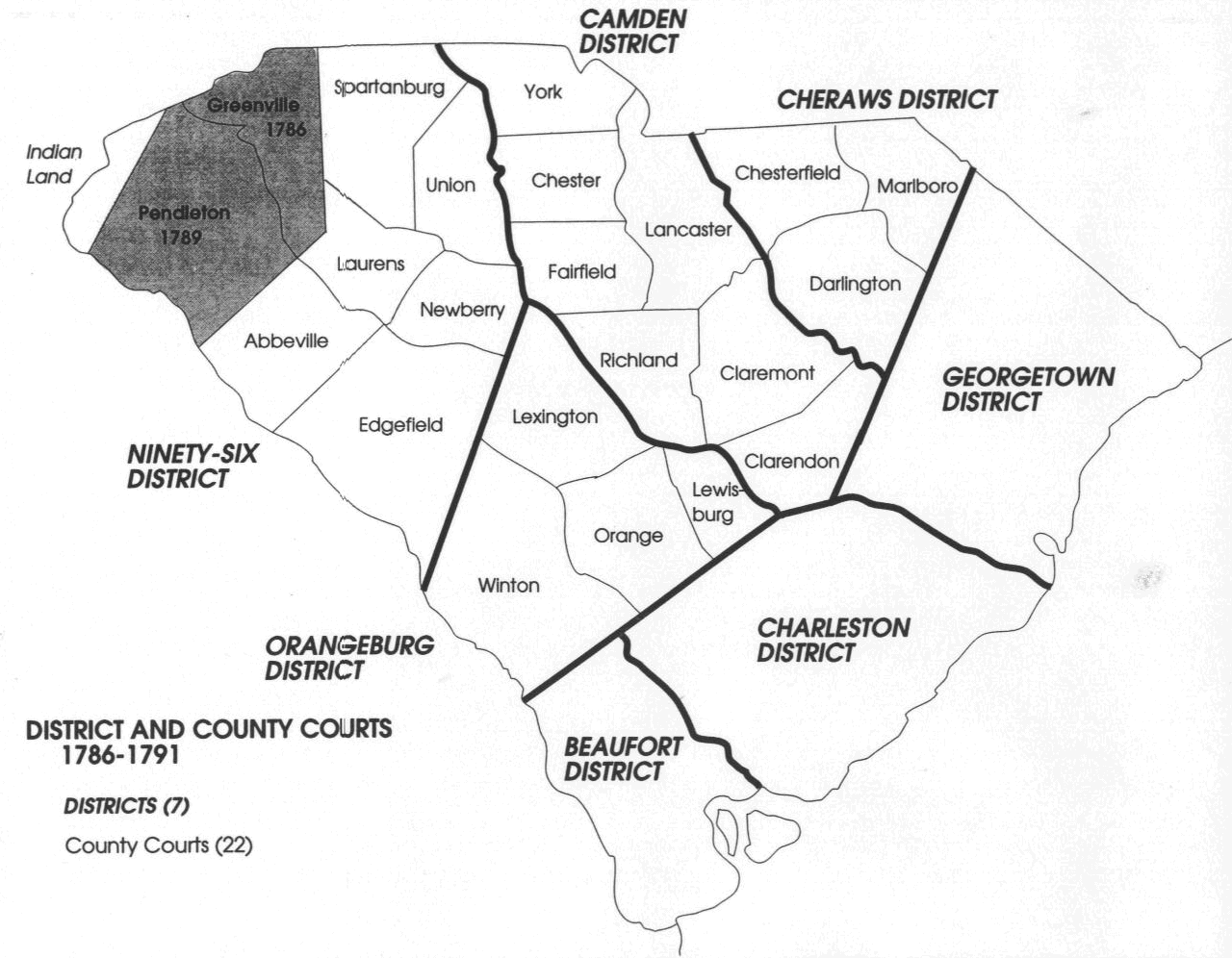
Political Boundaries of Post Revolutionary War South Carolina (1785-1791)
In 1785, the State of South Carolina laid out counties in each of the then existing Judicial Districts (districts established in 1769), and authorized them to keep deed records and other official documents which had previously only been kept in Charleston. A map of the South Carolina county and district court boundaries, during the period 1786-1791, is shown below. Greenville County, established in 1786, and Pendleton County, established in 1789, (shaded areas) were formed from lands ceded by the Cherokees in 1777.

![]()