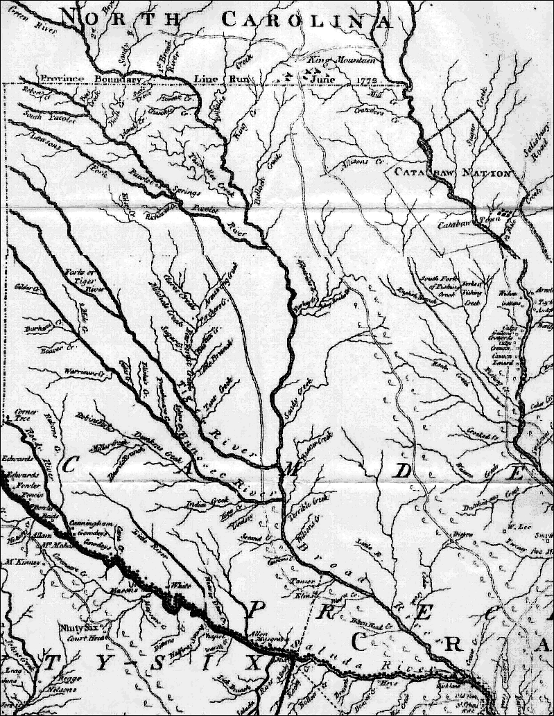
James Cook's Map of 1772
The James Cook map was prepared in 1772 and published in London in July 1773. This map is generally considered to be the most accurate map of the Province of South Carolina ever published during colonial times. It should be noted that much of the area north of the Tiger River was considered to lie within the Province of North Carolina until the official provincial boundary line was finally established by a survey run in June 1772 (see map). Accordingly, many patents to land lying in this area (including much land on Browns Creek) were granted by North Carolina in the years prior to 1772.
A digitized facsimile of a portion of Cook's Map is shown below, showing the area lying in the fork north of the Saluda River and west of the Broad River; this area contained a very heavy concentration of Loyalists during the Revolution.
Unfortunately, Browns Creek, the site of plantations owned by the Loyalists Zacharias Gibbs, David George, John Mayfield and Stephen Mayfield, is not shown on the map, but it lies in the area north of the Tiger River and south of the Pacolet River, on the west side of Broad River. Ninety Six Courthouse, site of the Siege of the British Fort at Ninety-Six in 1781, is shown in the lower left-hand corner of the map. Other areas shown on the map to take special note of are:
1) Fairforest Creek which flows into Tiger River from the north. The main plantation house of the noted Tory leader, Thomas Fletchall, was on this creek.
2) Thicketty Creek - Pacolet River - the area south of Thicketty Creek, north of Pacolet River and west of Broad River. Noted Whig, John Nuckolls, lived near a ford across Pacolet River called Grindal Shoals. Also, Tory leader, John Mayfield, owned a 100-acre tract of land in this area, directly adjacent to Broad River.

![]()