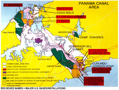
This section lists all the U.S. military property in Panama transferred to the government of Panama under the Panama Canal Treaty of 1977 from Treaty Day (October 1, 1979) to the last day of the 20-year transition (noon on December 31, 1999). This section also notes how the transferred properties are being or will be used by Panama. Such information (drawn from Panamanian and U.S. government sources and local news media reporting over time) is not yet complete since full conversion of many of the bases or facilities transferred is on-going or just getting underway with respect to the last transfers (in November and December 1999). Therefore, this section will be updated periodically as appropriate.
Much of the information in the following list is covered in summary form in related sections (Initial Treaty Implementation for the period 1979-1984 and Continued Treaty Implementation 1986-1999). More details on Panamanian use of some of the major transferred properties are provided in the section entitled Panama's Interoceanic Region Authority (ARI), the Panamanian agency charged with accepting, managing, and marketing the military properties upon transfer to Panama.
 |