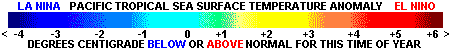
El Niño and La Niña effects worldwide, the International Forcasts
by Region, current Worldwide Sea Surface Temperatures (SST),
the current Sea Surface Temperature Anomalies (ANOM),
and El Niño-La Niña Text or Audio-Visual Instruction
including an on-line instantly graded quiz.
El Niño And La Niña Worldwide

Convert To Any Language Here

|| HOME | EL NINO-LA NINA TROPICAL STORMS WORLDWIDE EARTHQUAKE ACTIVITY | VOLCANO ACTIVITY |
UNITED STATES SATELLITE IMAGES | UNITED STATES RADAR IMAGES UNITED STATES LIGHTNING PROBABILITIES |

Department of Homeland Security
Current Threat Condition
Risk of Terrorist Attacks

Department of Homeland Security

More Information

 Last Updated - Summer 2008
El Niño Theme Sites

ENGLISH
SPANISH
PORTUGUESE

Sea Surface Temperature and Anomalies

WORLDWIDE SEA SURFACE TEMPERATURE (SST)
  

WORLDWIDE SST ANOMALIES (EL NINO-LA NINA)

Usefull Color Temperature Charts for the Above

Degrees Fahrenheit

Degrees Centigrade

Temperature Anomaly


International Forcasts by Region

Courtesy of
The International Research Institute for Climate Prediction
Lamont-Doherty Earth Observatory Columbia University
Regions Covered
Africa Asia Australia Europe Middle East North America
South America    Pacific Islands   Global   Global Extreme


What are "El Niño" and "La Niña"events?
They are like a pendulum of sea surface events swinging back and forth across the
equatorial Pacific Ocean. A warm-event "El Niño" followed by a cold-event "La Niña"
followed by another warm-event, followed by another cold-event...and on and on since
the Oceans formed, and hundreds of years of trade winds began to be recorded. Each
swing of this Pacific tropical weather pendulum usually takes somewhere between 3 and
5 years to complete. During 1998, the Earth experienced a very-very strong "El Niño"
warm-event. Toward the end of 1998 and the beginning of 1999, a "La Niña" cold event
began. How strong it will become or how long it will take to begin swinging
back has yet to be seen, but the prediction is...

The Current El Niño - La Niña Forecast Forum/Advisory And More


What is "normal"???
A workshop on "A Review of the Causes and Consequences of Cold Events: A La Niña Summit" was convened in Boulder, Colorado (USA) on 15-17 July 1998. Michael Glantz, Senior Scientist at the National Center for Atmospheric Research (NCAR) convened the workshop, and opened the La Niña Summit. He welcomed the 80 participants from 14 countries worldwide on behalf of the United Nations University (UNU), the UN Environment Programme (UNEP), NCAR, and the US National Science Foundation (NSF).

Two extracts from the 1998 La Niña Summit. The first extract...
A participant suggested that the issue of what constitutes normal is a psychological problem shared by individuals, sectors, as well as societies. It is not a scientific one. Further, it was suggested that in the US, there is considerable interest in climatic conditions that are considered to be unexpected or abnormal. That is why the media reports and societies take seriously such statements as "this is the biggest rainfall in six years", or "the warmest winter in ten years". People also tend to discount the past; that is, to forget previous anomalous weather and climate conditions (even fairly recent ones). They are, thus, more susceptible to react to conditions they perceive to be abnormal but which are, in fact, part of what they may have already experienced.
The second extract...
Key Points of "What Constitutes Normal"
1. Clearly, a definition is needed of what constitutes normal with respect to Sea Surface Temperatures (SST's) in the central and eastern Pacific in general, and what constitutes El Niño and La Niña.
2. "Normal" should not be defined simply as "average"; it should also include the extremes. La Niña conditions represent one facet of what might be considered "normal" in terms of expected climate conditions.
3. Even under normal conditions, extreme meteorological events such as droughts, floods and fires will occur at various locations around the globe.
4. In general, typical variations around the norm in tropical SSTs do not in general generate normal variations in impacts at distant locations.


El Niño and La Niña Instruction

From: The National Oceanic and Atmospheric Administration

 What is El Niño?
"El Niño" is a phenomenon, which occurs every few years at irregular intervals off of the Peruvian coast. This phenomenon has been occurring for thousands of years. It received its name from the local community due to the fact it usually occurs around the Christmas season, therefore "El Niño" or "The Child Jesus". At present an "El Niño" no longer describes just a local phenomenon but the changes in the circulation of the tropical Pacific and the global atmosphere. "El Niño" is part of the Southern Oscillation, a term used to describe the situation where the trade winds are weak and when the pressure is low over the eastern tropical Pacific and high over the western tropical Pacific. The local manifestation for the Peruvian coast occurs when surface water temperature off the coast increases and the thermocline (or the rapid change in the vertical temperature gradient) deepens by 100 meters or so.

It was believed that the increase in temperature killed the local fish populations, however studies in the 1970's and 80's indicate that the fish simply descend below the unusually warm surface layer. The absence of the fish in the upper layer dramatically decrease the fishing catch of local fishermen and contribute to the high mortality rate of the seabirds and sea lions. The increase of the temperature of the surface of the ocean in that location also increases the amount of evaporation, thereby putting more water vapor into the air. This increases the amount of precipitation and causes flooding and other related disasters.

During a normal non-Niño year up-welling occurs off the coast of Peru. Up-welling is the process in which water from deeper down in the ocean rises to the surface because the surface waters are pushed elsewhere, either by winds or a current. When up-welling occurs, colder, nutrient rich water comes to the surface and these areas are very productive, biologically speaking.

During an "El Niño" year the up-welling does not occur. There are three different explanations as to the possible cause of this.

First: The equator-bound coastal wind decreases. This decrease in the wind means that the surface water off the Peruvian coast does not get moved offshore, which means that the up-welling of cold, nutrient rich water does not occur. This would result in the sea surface temperature in the local area increasing abnormally during the summer (remember south of the Equator the summer is from December through February) due to the heating of the sun.

Second: The "front" between the warm, low-salinity water north of a line from the Galapagos to Ecuador and the cold, saltier water off the coast of Peru breaks down and allows water from the warm Gulf of Panama to flow south along the Peruvian coast.

Third: Due to stronger than normal southeast trade winds in the Pacific, warm water piles up in the western Pacific. Then, when the winds relax (or become weaker) the warm water sloshes back to the east. This warmer water moving back to the east strengthens the eastward North Equatorial Counter Current and the Equatorial Undercurrent, causing an increase in the warm upper water on the eastern side of the Pacific and thereby causing "El Niño".

Further studies seem to indicate that the last of these hypotheses (the third explanation) is the most important of the factors, although the second explanation is not insignificant. It is possible that more than one factor may contribute to "El Niño" on different occasions.

What is "La Niña"?
During "La Niña", the trade winds that prevail over the tropical Pacific are exceptionally strong and drive warm surface waters westward exposing cold, salty up-welled water to the surface in the central and eastern tropical Pacific. "La Niña" is also part of the Southern Oscillation. It is the phase when the pressure is low over the eastern tropical Pacific and high over the western tropical Pacific.

During "La Niña", the warm eastward North Equatorial Counter-Current relaxes while the cold westward South Equatorial Current is intensified. "La Niña" is often described as the opposite of "El Niño", however, it is not simply a matter of the same water sloshing back and forth across the Pacific. Both "La Niña" and "El Niño" are a coupled atmospheric-oceanic phenomenon.

Think you got it?? Take a quiz...
From the the Naval Postgraduate School, Dept of Oceanography


 El Niño and La Niña Quiz...Instantly Graded On-Line 


Recommended Links
The National Oceanic and Atmospheric Administration
El Niño/La Niña Homepage - NCEP Climate Prediction Center
El Niño/La Niña Homepage - National Oceanic and Atmospheric Administration

Return to Post 119 Homepage

| SITE MAP | LEGION INTERNET DIRECTORIES | POST LOCATION DIRECTORIES | TROPICAL STORMS WORLDWIDE |
HOME
CREATED AND MAINTAINED BY AMERICAN LEGION POST 119 GULFPORT MISSISSIPPI AS
A SERVICE TO THE AMERICAN LEGION COMMUNITY AND ALL VETERANS ORGANIZATIONS
EMAIL