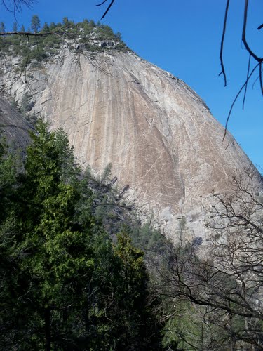
Close up of Bald Rock Dome taken on March 22, 2008.
We even thought so and we have been hiking this general area for decades.
We have seen Bald Rock Dome from Feather Falls Trail many times and always wanted to go there. It reminded us of the various granite monoliths and domes in Yosemite National Park.
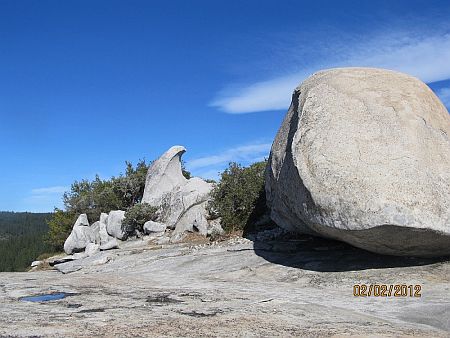
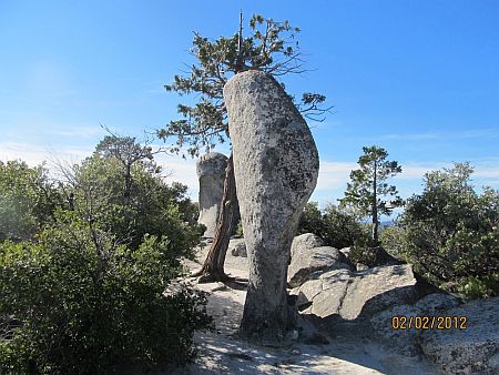
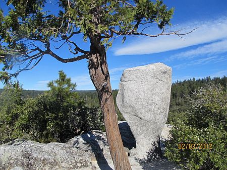
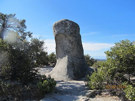
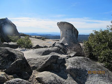
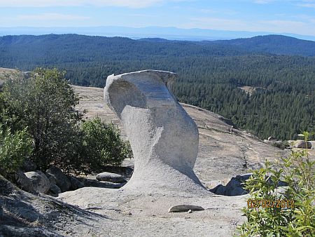
The two or three times we have visited Big Bald Rock we actually believed that we were, most probably, on top of the dome. It is very easy to get distracted by the wonderful rock formations at Big Bald Rock and not really take the time to try to locate the massive drop off into the canyon that you would expect to find at Bald Rock Dome. Big Bald Rock features many wind and water formed granite hoodoos that seem to defy logic. One even resembles a giant pre-historic bird.
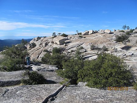
On February 2, 2012 we again visited Big Bald Rock. We looked things over better this time and after we returned from the hike we did more research on the internet and on some topographic maps. We found that Bald Rock Dome is located 2 miles north east of Big Bald Rock. We even discovered that there is a Little Bald Rock that is located almost exactly between the two other locations.
We will share some photos from that day on this website. We will also share several photos of Bald Rock Dome.
- Scott Roberts and Larry Matthews

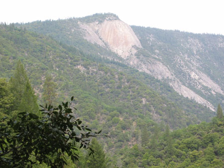
Bald Rock Dome from Feather Falls Trail on May 1, 2004.
There are those who, over the years, have claimed to have explored completely the four mile stretch of canyon that begins on the east from a bit downstream below Indian Creek and starts on the west just upstream from what is known as the Zinc Trail. However, there is no record of any man or group of men traversing the canyon at the bottom. The only records of such explorations indicate that they were completed with ropes and by making part of the journey, at least, at points high above the stream bed.
For more than 60 years, engineers dreamed of harnessing the Middle Fork as a source of power. Before that, other engineers saw the canyon as the possible route of a great transcontinental railroad.
But the deep, boulder strewn incision through the mountain of rock defied all attempts to penetrate its heart with even the most modern machines and equipment.
The towering, brooding mountain called Bald Rock was an object of dread to the ancient Indians who lived in the area before the white man came. They called it "U-I-NO" where a great monster lived. The legends of the tribe are filled with tales of adventurous redmen who journeyed into the canyon never to return. Early attempts by white men to explore the canyon at the foot of the mountain were made difficult because no Indian would dare to serve as a guide. The huge rock rises a sheer 3,000 feet from the stream. Across the canyon is another sheer granite formation giving the impression that one of the ancient gods, in a fit of anger, struck the top of the mountain with a mighty sword and cleaved it for all time. The V-shaped trough is filled with boulders, some of them so large that they cannot be scaled.
And through the gorge rushes the Middle Fork, tumbling over rapids and cascades, falling a sheer 30 feet or more at the foot of the rock and spotted with treacherous whirlpools and rapids that have forever prevented passage by man or beast.
- Thanks to Bill Talbitzer
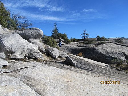
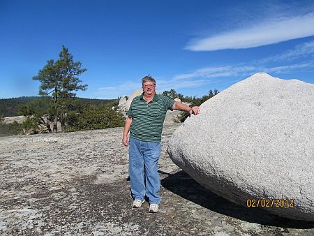
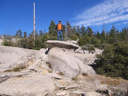
The following are the photos we took on Big Bald Rock. They show a variety of rock formations. There are many more that we did not take photos of. Scott and Larry are included in some of the photos - proving that even old guys can have a great experience hiking and stumbling over granite rocks on a beautiful day!
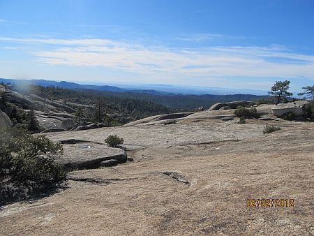
Looking southwest, Sutter Buttes can be seen in the distance.
Scott
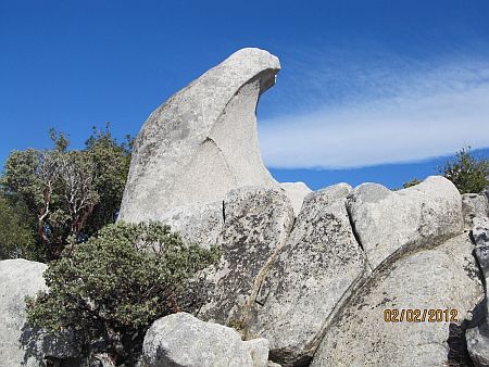
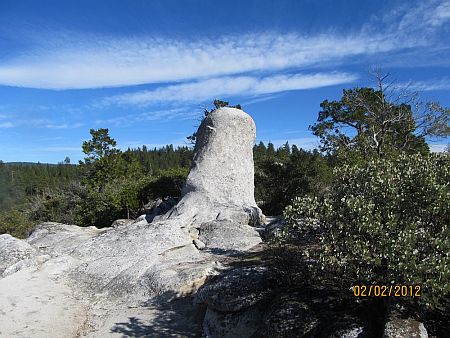
This rock looks just like......
.....a prehistoric bird.
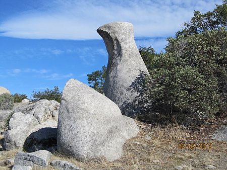
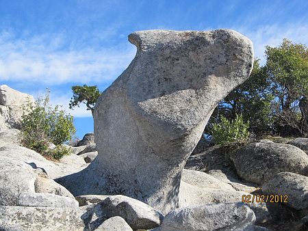
This delicate looking hoodoo looking west.
That same hoodoo looking east.
A frontal look at the prehistoric bird.
A gnarly looking hoodoo. Front.....
....and back.
Larry
Starting from the intersection of Oro Dam Blvd and Olive Highway in Oroville you go east on Olive Highway. Olive Highway becomes Highway 162. You head toward Berry Creek, crossing the New Bidwell Bar Bridge and the Canyon Creek Bridge on the way. Both bridges cross arms of Lake Oroville. Berry Creek is about 17 miles from Oroville. About a mile before Berry Creek you will turn right on Bald Rock Road. After about 5 miles you will come to the Bald Rock trailhead on the left side of the road. Turn in and park. You will be walking about a quarter of a mile through forest and then you will find yourself on the granite. Remember to note where the trail comes in to the granite area to make it easier to find the trail on your way out.
Larry Matthews

THIS IS A "LARRY" WEB SITE.
