The Wake of Sheltowee

part three
Since our last trip had ended so unexpectedly and abruptly, I figured we would head out again after the next series of Khenpo teachings, which were to be the first weekend in April. The weather would be warmer and we could begin on the south end this time, working north as the wildflowers and trees bloomed. In these dark times, the days spent together on the trail have effectively become a powerful form of retreat from the ruts of habitual action and perception. Excursions into the woods provide the Sangha with a crucible for the ongoing alchemy of transformative practice, a continuity of shared activity, an opening to deeper intimacy, a chance to simplify life for a period, to work on the business of sweating and merely seeing for much of the day, in relative solitude, while remaining in very direct relationship to the group, exploiting this chance to meditate the patterns of mind and the particularities of life together on the Path, which is a trail of another kind. The weekend of the retreat, the Khenpos had given us teachings on Avalokitesvara and the Six Syllable Mantra. Over and over again they stressed the importance of loving-kindness, of maintaining a joyful attitude and having a deep appreciation for the blessings and opportunities presented by this life. They live and breathe the spirit of gratitude they are pointing us to. This is the first time we have seen the Khenpos in a whole year, as they did not come to Tennessee last fall. To sit in their presence again is an incomparable blessing.
Dharma is essential wisdom regarding the relative and ultimate nature of phenomena and experience; lineage transmission of Dharma is a shortcut to realization that would take aeons to realize in the course of ordinary life. Through hearing and intelligent application, we can share in a higher realization than these bodyminds would have realized on their own. Ferinstance: If we were transported back into neolithic times, even if we could recall our 20th century experience, we would probably never be able to build a decent flying machine. Not knowing enough about making the parts or simply being under-industrialized, we would most likely never get too far off the ground. Every time you step on a jet, you are participating in a higher technology, afforded by the collective evolution of our knowledge and skills. Lineage blessing is the same thing in the spiritual dimension. As individuals who would not naturally share in such a profound realization, we are given this opportunity through the presence of the living guru and the lineage of transmission. It is an evolutionary shortcut to awakening in the same way that we could meet for tea tomorrow afternoon in Kyoto if we really wanted to.
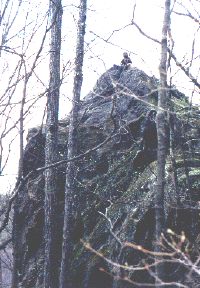
Early fog clears, we shower in the Pickett State Park campground and the journey begins. Prisoners in pumpkin suits hail us up with a wave as we walk by the area where they are unloading for a day's work. We acknowledge and return their greeting in silence. First stop at the park headquarters where the chubby lady behind the desk tells us nothing about trail conditions and we naively head out of the park loaded down with a week's provisions. My sons Ksana (12), Isa (14), daughter Zoe (18), Padma Tenkar (43), Padma Dechen (23), Chödön (24) and myself (43) move along the Hidden Passage Trail, through the shade of a large rockhouse, one of 2080 documented throughout 40,000 acres on the Cumberland Plateau of Kentucky and Tennessee. Most of these are found in the mixed mesophytic forests, (meaning there are conifers, Rhododendron and Mountain Laurel growing among the broadleaves). You will find them along the edges of many a gorge, and in places where bare rock is exposed throughout the oak-hickory forest regions of the uplands. In recent centuries, rockhouses have been used as dwellings and barns by lumbermen and local families, campsites by hikers, hunters and trappers, and shelters for whiskey stills.
 We
are barely on the trail for an hour when we stop at the triple rock shelves
of Crystal Falls. Right ankle momentarily flops and gives out a few times,
due to weight of pack/path angle combined with hill rising left and gorge
sloping right, for most of a hot day. This near-twisting will come back
to plague me near the end of the trip, but for now, there is nothing noticeable.
Vultures ride the thermals high over Thompson Creek. Unseasonably warm,
we stop for lunch in a small natural arbor. Handing over the water jug,
I direct Isa to the sound of the trickle. He attempts it but says there
is too much brush keeping him from the creek to fetch water. I say, okay,
I will do it, and he storms off angry to try again. Tenkar gets moody as
well in here; this all develops on the basis of very ordinary exchanges
in trying to cook lunch. Practice loving-kindness, maintain a joyful
attitude, appreciate the blessings and opportunities presented by this
life...
We
are barely on the trail for an hour when we stop at the triple rock shelves
of Crystal Falls. Right ankle momentarily flops and gives out a few times,
due to weight of pack/path angle combined with hill rising left and gorge
sloping right, for most of a hot day. This near-twisting will come back
to plague me near the end of the trip, but for now, there is nothing noticeable.
Vultures ride the thermals high over Thompson Creek. Unseasonably warm,
we stop for lunch in a small natural arbor. Handing over the water jug,
I direct Isa to the sound of the trickle. He attempts it but says there
is too much brush keeping him from the creek to fetch water. I say, okay,
I will do it, and he storms off angry to try again. Tenkar gets moody as
well in here; this all develops on the basis of very ordinary exchanges
in trying to cook lunch. Practice loving-kindness, maintain a joyful
attitude, appreciate the blessings and opportunities presented by this
life...
A huge grey-brown American Toad sits on the trailside gazing at the rocky hill above him. He's an American Toad. He's an American Toad. He's coming to your town, he'll help you party it down... Readjusted pins and straps on a few packs at a restop as it became obvious who needed what. Made camp near a beaver dam on Rock Creek. Today, I re-learned that Smooth Violets come in white and yellow besides a few shades of violet. Many sprouts of Elephant Ear Magnolia in the bottoms which look amazingly illegal. We dine on Jamaican Black Bean soup and once again sort Tenkar's mood. It has been said before: If we only knew just what it is that we wanted, we could probably attain it with a lot less energy than it takes to stay confused and mediocre.
Sky clears and we locate Ursa Major and Minor.
Tuesday April 6
1792: Benge and followers attack settlements near Holston. After killing 4 people, he leaves a declaration of war beside the bodies. A former friend to settlers, the murder of his great uncle, Old Tassel, by whites, turned his heart to war.Rain falls. The kids pack and take off early, I follow fifteen minutes behind and then Chödön and Dechen roll out a bit later. Early into the walk, I hoot to indicate my presence on the path and listen for the return calls. Dechen heard it echo from another direction and confused by this, interpreted the call to mean that they had possibly missed a turnoff to another path. So they backtracked to make sure they had not missed anything. When they finally met up with us and I heard what had happened, I said that it was not a very smart interpretation and walked on. Dechen and Chödön, still not sure of the direction of the path, crossed and recrossed the creek during this next interval, in an attempt to stay on the path. All of this doubt and confusion eventually led to an argument with Dechen over breakfast. She asks for money to hitch home, I refuse and say we are out here to be together. This is exactly why we are out here, not to get anywhere in particular.
1794: Benge, and gang continue their violence against European settlements. Today near Mendota, Virginia, they will attack several farms. After killing or capturing 13 members of the Livingstone families, Captain Benge leaves the area. Remaining members of the Livingstone families, and other local settlers pursue the raiders. Vincent Hobbs eventually catches up, shooting and killing Benge.
1862: Shiloh, a two day engagement in west Tennessee, the first big battle of the Civil War resulting in over 23,000 casualties; the bloodiest fighting in the history of the North American continent up until this date.
Don't be too hard on us. It is a complex world. And it takes real intensity to come to any kind of continuous recognition. We're programmed away from inner seeing altogether. Strength here is the ability to zero in on the object of negation; the deep-seated sense of an inherently existent-I and all its effectual and actual ramifications. Find the witness. Observe carefully. Meditate to recognize and establish natural equanimity. The only way you'll come to any kind of understanding is through seeing things clearly. So we prepare, allowing a view space and keeping an openness of mind and heart to know exactly what is to be obviated and transcended. To get in touch with all of this, disidentify with mindstream, ease your own passage. These are skilful means. Discover the ground so that demonic illusion and mundane moods cannot overcome joyful efforts.
Past the turn for the John Muir Trail, the blowdowns begin and we ponder the possibility that this tangle is a manifestation of our vibes. Grey squirrels, Cardinals, and as during the last walk through this area four years previous, patches of ground ravaged, rooted up in evidence of wild boar. Rounding a bend in the path I observe a Tom Turkey calmly leading his harem higher up into the Hemlocks growing on the bouldered slope. He was secure and none of the ladies got jumpy. They just took their time and followed Tom into some great camouflage where they were soon invisible. Further down we passed a group of young campers tenting by enormous grey boulders on the opposite bank. We hail each other and continue. The hammering of woodpeckers in the distance. Eyeing the road on the farside, assuming that the blowdowns ahead will end soon. A truck zips along the grade, no doubt bringing more cold beer to those kids by the boulder. Who wants to walk a road anyway? These blowdowns won't last forever. So we stick to the trail and navigate around the fallen trees which are becoming much more common. Another mile reveals a noisy crowd of kids on the other bank at Great Meadow Campground, a dozen colorful tents, some fishing happening, a few groups throwing balls, relaxing picnicking. Professor Jim said he saw one of them with a gun (probably a BB rifle) aim it across the river as if there was no one over here! Looks like another church group on Mountain Dew; incredibly animated and over-dressed considering we're all this far out in the woods on a Tuesday afternoon.
Many delicate snails on the trail today. Make camp on the banks of Little Turkey Branch before dark. As I go through the procedure, I notice how one's actions at the end of the day soon become rote. It is easier than thinking. Find a tree to rest the pack against for the night. Clear a level patch of ground, set up the tent, take the sleeping bags out of the packs and throw them in the tent. Unroll the foam pads around a central plaza where the stoves are set up to make a kitchen. And then dinner, which is usually well complemented by a great appetite, and you are free to eat as much as you want out here, knowing you will burn it all off before lunch tomorrow. Hook the fuel bottle to the stove, unfold the aluminum wind shields, get water, light the pilot, put the lid on, take the boots off, get the journal out.
Dinner is always a great part of the day, a true communion. There is
a real desire for the food and huddle together while it heats. Time to
rest, rub, talk, write, sit still and heal. Although it used to be part
of our routine back home, we have drifted over the last year and rarely
sit down to eat together. I usually eat right at the keyboard and the kids
are any number of places. It has become rare for us to spend this time
together, and to do so is a good thing. Tonight, its Minestrone soup. A
hot drink, an hour or so of talking, stargazing. Everyone is very tired.
Brush teeth. Cover the packs. Crawl into bed before nine.
Wednesday April 7
1864: Colonel John Chivington, Commander of the District of Colorado, reports to his supervisor, Major General Samuel Curtis, that Cheyennes have stolen 175 cattle from a ranch on the Smokey Hill stage coach route. An inquiry, conducted much later proved that no Indians were involved.Woke to the sound of Turkey wings, like the start-up noise of a hand-cranked diesel generator. Dechen finds a Turkey feather, I come upon an empty Box Turtle shell and then a live one whose shell had healed from an attack by a carnivore. Having already looked death in the face, we apparently didn't represent any kind of threat. He fearlessly held his position in the middle of the path as we respectfully stepped around him. Foamflowers in the moist soil where the sign marked the turn away from the Creek. The trail is just as difficult to negotiate as it was yesterday afternoon. We pass the turn for Gobbler's Arch where we had ascended in '95 and continue along the Creek so as to remain on the Sheltowee and explore the canyon that leads up Mark's Branch instead. We get into the general area of the drainage in question and still faced with innumerable fallen trees, are soon off trail following a series of blue flags, strips of plastic tape tied to trunks and branches which seemed to lead above most of the fallen trees around the creek, where the path probably lay. This was hopeful. Had the rangers flagged this area to get cleanup crews in? More likely, as Jim the Mad Professor later suggested, those blue tracers were probably fixed by some hunter going in to retrieve his Bambi. Dechen and I followed the blue strips as they led away from the creek and high above the slopes of Mark's Branch, until they seemed to lead straight up the hill and off into the sky. Then we lost faith that they were meant for us and worked back down toward the water, hoping to find an easy way through. We should have stuck with the blue strips, even if it was for removing game because it led up and out. Oh well. So we're busy pushing through the bush, glad we are not yet into bug season. We pass sixty year old stumps of huge American Chestnuts long hidden in the underbrush, four feet across. The valley was just starting to narrow and deepen beneath forty foot cliffs which trim the upper edges of the defile. From where we stood on the hillside, the path looked like it might be clearer along the creek. Still dreaming that rangers might have already been out here with chainsaws. A clear passage had to begin somewhere or other, no? Perhaps we had finally arrived at the improved section of the trail.
Crossing the creek, I pointed out a big Crayfish to Dechen as he was scurrying under a rock in very clear water. Found a nice sunny spot on the bank, and glad to drop the packs, we make breakfast by a massive sandstone boulder. Our little band is about to enter a section of trail which will seriously challenge our stamina and humor. First, grits and coffee. We really had no idea. At first, we tried to follow the turtle marked path which seemed to meander back and forth across the waters of Mark's Branch, but the density of downed timber demanded both incredible will and some skill to even make small gains. My walking stick inauspiciously broke in two while rapping it on dead branches before negotiating a squeeze. Depending on the thickness of the tangle before you, you might do one of three things; get down on your knees and crawl under, if there be space, attempt to make your way over the top, or twist and slide through the branches, which is never easy with a big external frame pack. If the dreadlock is simply too terrible to consider doing any of the above, you might moan and head uphill or downhill, and around it. This worked fairly well when we were moving along the banks of Rock Creek where the slope is gradual and generally wide; the trouble with the path along Mark's Branch is that uphill means up past boulders and straight through the tangle of rhododendron 'hells'; if you can get through, in order to get higher onto the slope. All this lateral movement and you might make a very little forward progress, but once you are up a ways, there are usually just as many challenging thickets of horizontal tree trunks within only a few yards, and of course, now you will have to negotiate these.
We even tried going up to the foot of the cliffs a few times, but this was no better; whether due to fallen trees or the seeming way along the base of the wall suddenly becoming much too steep and tangled as it rounded a corner or simply dropped away, perhaps giving rise to a spring at the base of the rock. Any chosen course would soon become impassable and demand a change of direction. Downhill may mean all the way into the creek and this would be more than welcome if a way up the creek itself were clear, but besides being a few yards below the trail and difficult to enter and leave, it is usually equally impassable with blowdowns from both sides forming a horrendous greenlock. In order not to lose the marked path, we would cross and recross the creek and zigzag up and down through the bush, always on the lookout for the little brown tin shields displaying a white turtle symbol, spray painted through a stencil which had been tacked to the trees every few hundred yards along the way. Although it was quite difficult to move through this terrain with big backpacks, I had at least one positive thought regarding such a mess; some of the wildlife in this narrow canyon was getting a chance to regenerate relatively undisturbed. An abundance of downed logs are great for salamanders, skinks, frogs, snakes and turtles, grouse, mole, mouse, fox and chipmunks. Wildlife use snags and downed logs for nesting, roosting, foraging, perching, or territorial displays. So it was a great environment for some of us, although those of us with backpacks found it exhausting and discouraging and after many hours, were still not making much progress.
We could no longer find any trace of the path. I sat down at one point and talked it over with Ksana, and we decided that it was futile to keep going up and down; we should try to get up and out. For a while now, the heights above us in this narrow canyon had been lined with an unbroken wall of thirty to forty foot cliffs on both sides making our exit in that direction impossible. We were getting to the point of which Boone had written, The aspect of these cliffs is so wild and horrid, that it is impossible to behold them without terror. Not that the cliffs themselves were terrifying; they were so steep that we could not even attempt them; it was their role as a barrier preventing us from exiting this timber tangled gash where the water and winds had conspired to play pick up sticks with eighty foot trees, which was fairly intimidating. Fortunately, a little ways further in, the high rocky forehead of the southern wall seemed to give way to the sky for a moment. So we patiently worked our way in that direction until I told everyone to stay put while I checked it out closer. The first such venture had led nowhere that we could have ascended. Now arriving for the second time at the cool base of the cliffs, there was clearly an opening slicing upward through the wall. It was too steep to climb the rock itself but a lot of dead wood had fallen over the edge from the forest on top and it seemed to offer a relatively stable organic tangle. I hooted, they came, and when they got up to the base of the rocks, we removed our packs and hand-chained them up across a few levels of dark moist sandstone draped in woody trash, before crawling up through it ourselves.
Earlier, when we believed in the path, we had planned on drawing water from the creek before getting up on the ridge, as there is none to be found up top, but in the course of this difficult morning, we had neglected to fill the jugs before our last pass through the creekbed. So, after chaining the packs up and crawling through holes in the brush pile, we set up for lunch on a little ledge, perhaps twenty five feet above the base of the cliffs. A pleasant sound led to the discovery of a trickle of clean water dropping from the rocks in the brush just below us. This was actually the same little stream that had carved our exit through these rocks over the last hundred thousand years. In setting up for lunch I noticed that the plunger on the pump for my stove was missing. Considering what we had just come through this morning, I was surprised that our losses were not greater. Apparently, most everything else was well tucked away. Chödön unpacked her stove and we used it for the remainder of the trip. While the water heated for Ramen, I climbed onto the top of the plateau a few yards above us. It was a thick sea of Mountain Laurel and underbrush. It actually looked worse than what we had just come out of in the valley and was nothing that I wanted to attempt. So I climbed back down, remained silent and looked forward to eating lunch. Fun of a different kind.
After soup and rest, I got restless, packed and started out early to
look for a way, telling the gang to wait until I hooted before following.
I slid off the ledge and crossed the depression offering water, gradually
ascending into the sun on the other side. I was now upon another finger
of the same ridge top, but this one was Laurel-free. After walking through
a few hundred yards of some ankle deep, evergreen ground cover, I spied
a white diamond on a tree. The foot trail was obvious and clear. I hooted
loud. They all came. We were very happy that part of the trail was over.
And that was how we escaped from a horrifically bad section of the Sheltowee
Trace. Another mile or two ahead, we broke again, lounging a few yards
from the outhouse which is somewhat of a shrine there on the highground
of Peter's Mountain. Here we again found a sign indicating the Sheltowee
Trace but there was a difference. On the post pointing in the direction
from which we had come, there was a photocopied message which had been
cheaply laminated and stapled to the wood. It read TRAIL CLOSED DUE TO
STORM DAMAGE. We pushed on and by sundown, were camped on a good fire road
which opens onto a flat section of ridgetop west of Hutt's Creek. We celebrated
our liberation with Tukpa (Tibetan noodle soup) and mocha and easily went
to sleep listening to a network of whipoorwills and the occasional hootfest
of a few owls. Obviously, the energy of spring.
Thursday April 8,
Pressing along ridgetop chert, red paint marking the BSF boundaries, a clearcut exposing rockhouses in a hollow to the left, white flowers of Sarvis Berry in bloom on tall grey trunks, like guys who think they're too tall trying hard to be friendly. The road begins to wash out as it heads down toward a drainage pipe and we stop to prepare coffee and grits on the sandy shoulder, a nearby zinc channeling a tributary of Punchencamp Branch. Old timer in a rusty Cherokee drives down the hill, opens his window and smiles.
How are you all doing?
We love it out here. Its beautiful.
Isn't it? I was brought up not far from here. Lived round here my whole life. (Looking over at the clearcut) It has changed a lot but I still love it. This is God's country. You all have fun now.
We put on hot water for coffee. Black-throated Green Warbler hops
around in the bush as it starts to drizzle. These little beauties are listed
as threatened in Kentucky. They do not seem to know about it as they flit
about. Onward... A few hours later, talking acidity and alkalinity, carbonic
acid and dendritic drainage in a circular little rockhouse right off the
path while it pours
like cow piss on a flat rock. The fellows working
in the clearcut go by in their pickups, windows fogged with condensation.
Jim, the Mad Proffessor, whom we would soon meet, rides with them. We stroll
past the metal detectives who are bored with old nails in the woods near
Stepping Rock, walk past the quarried red and yellow sandstone of the old
Bald Knob School where we had asked directions over three years ago, past
a couple of empty homes and on to the Winchester brothers garage where
we fill water from a hose.
Let it run a bit so it ain't warm, Charlie tells us. He was helping his brother set up fish-finding equipment in his new boat and talks with us as we fill jugs. He explains about the big tornado that came through and tells us that the paths will probably be impassable for awhile. Sometimes they let us go in and keep the timber we cut out, but they ain't allowed us to do that recently. Yâ'll want a cold sodey-pop? I'll bet that would be pretty good right about now, wouldn't it? We talked about the alternative routes before he decided to drive his towtruck down the hill, soon to return with his old station wagon. Hop in, I'll take you down. We load up and tie a few packs on top, delighted by the offer. He drives us down to the Yamacraw Bridge, pointing out the total destruction of the woods on Devil's Knob. There on a highpoint at a bend in the road, at a place where there are far more trees laying down than there are standing up, and this nearly to the horizon in every direction, was a well placed, tricolor sign indicating that the Sheltowee Trace crosses here. It would have made a great apocalyptic shot but Mr. Winchester was already going out of his way for us, so I did not ask him to stop. Unlike the damage I'd seen from recent storms back home in Tennessee, where the twister seemed to trace a path of sorts, nearly every tree for hundreds of acres across the entire hilltop here was snapped and down. This was all accomplished in a few seconds through raw power, the awesome violence of an instability in the winds. Charlie said there was nobody on the road at the time or they would very likely have been killed. Only a few thin specimens remained standing. Except for all the busted trunks ten feet off the ground, it looked like a clearcut where the wood had not been removed yet. We round a corner and pass a chained dog laying in the shade of a small rockhouse in someone's yard. A primeval doghouse. Less than five seconds later, we watched a small Coyote trot across the road in front of us, heading over into the tangle on the path.
We roll over the new cement bridge spanning Rock Creek. Mr. Winchester points out an old coal mine in the bank of the hill to our left and an old railway bridge crossing the BSF on our right. He went on to tell us how he had worked for the coal company until one time an unbalanced hopper full of coal fell off the flatbed and pinned him against the wall. The impact of nearly two tons crushed his pelvis, leaving him with a serious limp which led to an early retirement. After stopping to buy sodas, we got back in and he drove across the Yamacraw Bridge to the parking area where the Sheltowee Trace continues north along the east bank of the river. Tenkar points out Rue Anemone. We stood around while we sipped and talked for awhile. Charlie said it was great that I had the kids out here where they would learn about nature. He asked about their schooling. I told him they were home educated and he understood that. Better that way. There are quite a few folks doing that now. What with all the bad dope and crazy shootings, you're much better off keeping them home. They don't teach them about God anymore either. He went on to tell me that he used to go to school in the old Baldrock Schoolhouse, which we had walked by a few hours previous. Yeah, we used to begin every day saying the Pledge of Allegiance and some prayers. I told him that's how it was when I was in school too.
We all thank Mr. Winchester profusely before he drove back up into the
hills. Then the kids called a cab from the store to fetch Zoe's car from
Stearns. An hour later, a local woman in a van arrives, a single mom in
her early forties. You're lucky. They caught me before I started home
and I just got my two-way radio fixed this afternoon. She hands us
some papers on a clipboard and asks us to sign on the appropriate line.
For insurance purposes. We head up out of the BSF River valley through
the little hilltop towns of Stearns and Whitley City. Great view of the
hills on this stretch of the plateau. I've been working this job for
two months now...one of three female chauffeurs in this part of the state.
We like to get together for lunch when we can arrange it, like we did today.
Now that's kinda nice, but it doesn't happen often. We rode by a few
lumber yards, one that bought logs for staves and another on the other
side of the road which had a sign posted in a muddy parking lot which read
NOT BUYING LOGS. She pointed out a trailer that had been crushed by a tree
during the storm last winter. You don't reallyknow what youâre
getting into when you get a job like this. I have had to learn CPR and
all sorts of first aid... Most days you end up driving between 225 and
300 miles... She dropped us at the Stearns Ranger Station where we
had left the car on Sunday night. We hopped in and drove past the Stearns
Company Restaurant, Giftshop and Railroad Depot, a historical marker about
Princess Cornblossom, The Hilltop Store and gas, and then on down to the
Yamacraw Bridge parking area where we extracted some supplies, locked up
and threw the packs on. Now, finally, rain begins to fall. We only go about
a mile and it is soon dark. Tenkar slides in the mud right before we make
camp. Set up on a knob at the mouth of Lick Creek where the split pea soup
was unanimously declared fantastic.
Friday April 9
1865: Surrender at Appomatox Courthouse: General Lee tells his men; Go to your homes and resume your occupations. Obey the laws and become as good citizens as you were soldiers.Sunny morning. Many birds, Cooper's Hawk, a Kingfisher working the banks. As planned, Zoe and the boys leave for Tennessee after breakfast; she has work at the gym in the morning. Our first late start at ten. Crossing Lick, Negro and Cottonpatch Creeks. Unlike days at home which begin with meditation, out here, motion is the meditation. Very little conversation as we make our way downriver. Walking stick helps me row uphill and brake on the downside, an amazingly useful tool. I can't praise it highly enough. Very effective in helping redistribute weight and give you more stability altogether. Pack weighs over 40 pounds; tighten hip belt, roll easy, develop the days rhythm step by step, now sideways between rocks, now up and across them, skirting a mud puddle, holding this root, jumping the trickle, duck the branch, lean to the outside, flipping sticks and cobwebs out of the way with my staff. Breath and heartbeat continually modify to accomodate the load, eyebrows fill with sweat, reach for rag to wipe face before saltwater sting drips into the eyes.
Moving amidst the mossy trunks of giant Sweet Gum Trees (Liquidambar styraciflua) whose brown, burred balls litter the path. The second most important commercial hardwood behind the oaks, Gum wood is moderately hard and heavy, close-grained and used in making furniture, boxes, veneer, and cabinets. The thick sapwood (called Sap Gum) is white and the heartwood (called Red Gum) is pink or reddish; they are sold as two distinct woods. The name "sweetgum" originates from the sweet, gummy sap that is used as the base of salves, soaps, adhesives and tobacco flavoring. In the pharmaceutical trade the gum is called "copalm balm" or "liquidambar." Early settlers used it to treat skin troubles, diphtheria, dysentery and catarrh. The gum from a species native to Turkey, L. orientalis, is prized as an incense in Christian and Indian temples.
 I
used to think these trees were named because of the impossibility of splitting
a round; back in 1975 we were hired to clear some land on Drake's Lane
and replant it in pines, a task which seems to have become a standard practice
in this part of the world, replacing the rich biodiversity of hardwood
forests with a single species of pine. What can I say? Winter was cold
and the clothing was thin. And we got to keep the trees for firewood. More
than a few gums found their way into our woodpile and we quickly learned
to burn the rounds whole. Due to the nature of the grain, the wood basically
swallows an axe without cleaving, but as I was to discover, the gummy quality
is actually named after the gum which lies under the bark. This was originally
used as chewing gum and in medicines.
I
used to think these trees were named because of the impossibility of splitting
a round; back in 1975 we were hired to clear some land on Drake's Lane
and replant it in pines, a task which seems to have become a standard practice
in this part of the world, replacing the rich biodiversity of hardwood
forests with a single species of pine. What can I say? Winter was cold
and the clothing was thin. And we got to keep the trees for firewood. More
than a few gums found their way into our woodpile and we quickly learned
to burn the rounds whole. Due to the nature of the grain, the wood basically
swallows an axe without cleaving, but as I was to discover, the gummy quality
is actually named after the gum which lies under the bark. This was originally
used as chewing gum and in medicines.
Came across an old rock chimney, the kind which is put inside a house rather than on an outside wall so that it can vent fireplaces in two different rooms. Broke by a small creek and watched Forest Wolf Spiders climb across the packs as we lay in the sun. On to Alum Ford, a boat launch and picnic area where we ate lunch, across the river from an old alum mine. We set up at a picnic table, get water from the local brook, and everyone is soon at work in their journal. A young man from Tennessee drives by in a minivan. He has been camping and canoeing in the area with his family and kindly tells us of a nice rockhouse with a picnic table south of Yahoo Falls. Alright. We find it easily and call it an early day.
Rockhouse. A natural shelter. Temperatures inside are higher during winter and lower during summer, and the difference between monthly maximum and minimums is smaller, than those outside rockhouses. A naturally attractive place suggesting a transcendent interdependence, a Gaian overmind which miraculously accommodates even the meanest of creatures, even weak two-leggeds. Here now, as I write, the Blue heron, Diné God of the South, cries out as he passes overhead as he does each morning. In the shade of the ridge, on moist rockhouse floors, overhanging ledges, and solution pockets in sandstone rock faces, where the correct combination of shade, high moisture, cool temperatures, and high humidity provides appropriate conditions, lives the Cumberland sandwort, a perennial herb exclusive to this part of the world. A little white flower with five petals growing out of a grassy spreading base. Like so many other species, it is endangered directly and indirectly by human activities in and adjacent to its unique habitat. There are currently five known populations of Arenaria cumberlandensis, one in Kentucky and four in Tennessee. Tread easy around these magical places. Even nearby timber removal is a real threat insofar as a small increase in sunlight and subsequent alteration of the moisture conditions could easily lead to the disappearance of Sandwort from the area.
 Climbed
a 50 foot high boulder and got dizzy watching all the trees sway in the
wind as we passed a bag of dried pineapple. Small green dogwood flowers
in bloom. Redbuds in hot pink. Maples deep red, slowly unfolding their
shiny foliage. Still without leaves, Sarvis Berry blooming little white
flowers atop a thirty foot hightrunk. Purple Phlox scattered everywhere
through the woods. Monarch Butterfly wings veined like lapis spangled with
pure daylight. Pileated Woodpeckers sounding off, rotten Ginsberg's 'hindoo
maniac laughter'. A small Garter Snake on the path and a father King Snake
wrapped in the hollow of a tree. Pagan springtime visions. Cool water dripping
from the stone in the rear of the shelter. Here, we do not use our $100
water filters which are simply the techno-version of this natural purification
system. An old orange juice jug is placed under the trickle. We climb up
to some rocks overlooking the trail to sit in the sun and read from Thich
Nhat Han's Living Buddha, Living Christ;
Climbed
a 50 foot high boulder and got dizzy watching all the trees sway in the
wind as we passed a bag of dried pineapple. Small green dogwood flowers
in bloom. Redbuds in hot pink. Maples deep red, slowly unfolding their
shiny foliage. Still without leaves, Sarvis Berry blooming little white
flowers atop a thirty foot hightrunk. Purple Phlox scattered everywhere
through the woods. Monarch Butterfly wings veined like lapis spangled with
pure daylight. Pileated Woodpeckers sounding off, rotten Ginsberg's 'hindoo
maniac laughter'. A small Garter Snake on the path and a father King Snake
wrapped in the hollow of a tree. Pagan springtime visions. Cool water dripping
from the stone in the rear of the shelter. Here, we do not use our $100
water filters which are simply the techno-version of this natural purification
system. An old orange juice jug is placed under the trickle. We climb up
to some rocks overlooking the trail to sit in the sun and read from Thich
Nhat Han's Living Buddha, Living Christ;
To me, to practice with the sangha means to practice with those who are with you now and with those you love. It may not be a holy sangha, but if it moves in the direction of transformation, it is a real Sangha. We do not need a perfect or a Holy Sangha to practice. An imperfect Sangha is good enough. We can help build and improve the Sangha, step by step, encouraging each other.
Stopping to inspect a spread of rare Yellow Trout Lillies in the
grass to the side of the path. Enormous Tulip poplars populate the coves,
rising up through the crowd of Rhododendrons, up past the 300,000,000 year
old boulders of compressed seabed, slowly being devoured in organic greens
and rusts, whole trees rooting in the litter rising off their surfaces,
and on higher into the dark canopy of hemlock needles. 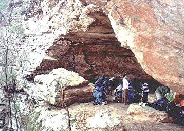 Sun
shines on the bark of these Tulip giants, still leafless although sporting
lime tips across countless hills. Cool shadow of the Hemlock canopy is
broken and great light floods down through the hole created by this ancient
broadleaf; same golden light floods the afternoon river canyon. A good
day, easing into Morrocan cous-cous for dinner. Slept below the rock and
watched Ursa Major spin; Mars high overhead at midnight.
Sun
shines on the bark of these Tulip giants, still leafless although sporting
lime tips across countless hills. Cool shadow of the Hemlock canopy is
broken and great light floods down through the hole created by this ancient
broadleaf; same golden light floods the afternoon river canyon. A good
day, easing into Morrocan cous-cous for dinner. Slept below the rock and
watched Ursa Major spin; Mars high overhead at midnight.
Saturday April 10
Sunny day. Dechen realizes she has been carrying a carton of soy-rice
blend since Zoe left, so we heat it and add honey before breaking camp.
The BSF here is at the same level as Lake Cumberland so there is no longer
any appreciable flow. The water is artificially lethargic and only coming
to life where it backs up into swimming holes like the one at the mouth
of Big Creek, a tributary on the east bank. Up the north fork of this drainage,
we take a long breakfast in green paradise, chant Vajrakilaya sadhana,
before Chödön bathes in the creek while we wait in the morning
sun. Onward. Blowdowns get thicker again as we move upstream. Steal another
moment to offer herbs in the coolness of a great dark rockhouse before
gravel track becomes the path of choice, allowing us to bypass the last
section of the actual trail which was virtually blocked by fallen trees.
Walked along the edge of a residential section of Flat Rock, crossed the
shiney tracks and Highway 27 to the Baptist Church picnic shed. We were
eating lunch there when an older man in shorts with an internal frame pack
approached. After he crosses the tracks, the highway and walks through
the church parking lot, he immediately asks -
Did anybody lose anything?
Yeah. She lost a monocular.
Damn. I wasn't going to say anything. That's a nice little tool. You wouldn't believe some of the equipment I have collected on trails... Here you go.
Considering the mess we'd come through in the last couple of hours,
we were fairly amazed he had found it. Somehow, despite all the ducking,
crawling and thrashing in the bush, it had fallen out once we were moving
on the gravel road. We spoke for awhile about the trail and he offered
us some fresh coffee. He had been behind us on and off since Pickett and
had naively wandered into the trials of Mark's Branch. He was in shorts,
and we could see many scratches and cuts on his legs. Professor Jim had
ascended out of the defile before we did and had to force his way through
that Mountain Laurel on the cliffs above in making his way to Peter's Mountain.
Once there, Jim had taken an alternative route after he realized there
was more storm damage than anybody had warned us about. He followed a horsetrail
down into the Big South Fork Valley and got on the Kentucky Trail to Yamacraw,
all of which was pleasantly clear. In his words,
I spent last night
at Princess Falls. Then I picked up your bootprints again this morning
and noticed they were getting pretty fresh. I thought, hey, I'm going to
meet these people soon...
Jim, the 'Mad Professor' from Indiana is 60, retired and often hikes alone. He was a schoolteacher and played trumpet in a polka band for 30 years. A few years ago, he was diagnosed with cancer and had recently divorced when he decided to retire, cash in his savings for some good equipment, and hit the trail. He has been going strong ever since, having been everywhere east and west that I knew of and quite a bit more. We take leave of Jim for the moment, knowing we will meet again and head down the road into the Kentucky afternoon. A few trains go through, loud and fast.
At the Stearns District Trailhead there was a man waiting in minivan
doing Bob Newhart. The windows were open and as we pass, he tells us his
wife and sister are down in there somewhere; "They're lost. I know
it. I dropped them off on the other end this morning and they should have
been here by now. They must be lost." He was in good spirits but
I doubted his conclusion. They had likely run into a long section of fallen
trees and decided to turn around and call a cab. Descend into the groove
where fire has taken down acres of pines and laurels since we have last
been here. We pitch the tent along the waters of Railroad Fork. Nearby,
a large rotten tree falls without a breeze and gets us looking around,
wondering whether we have camped in a dangerous place. The diesel locomotives
of the Norfolk South Railroad come through quite often, blowing the horn
loudly and thundering across the rails dragging five dozen cars or the
ridge parallelling Highway 27, above and to the west of us. The acoustics
of the prevailing wind in this hollow relative to the angle of the track
and train whistle make it sound as if the engines are only a few dozen
yards away. On the last trip here in '95, I made a footnote about walking
further down this path if you wanted a decent night's rest. Unheeded warning.
We were too tired to go further in any case. Everyone greets Jim as he
passes in the twilight zone. Lentil soup tastes incredibly good this evening.
If it was especially bad, I would have said so. It wasn't. Rain falls gently.
No sign of those ladies who got dropped off this morning on 700. Vague
impressions of roaring trains barreling through the night. Except for a
brief interlude to sit up and sip water, we are all too tired to wake until
morning.
Sunday April 11
 A
clear, sun-filled awakening. Further down Railroad and Barren Creeks. Steaming
along level passages that used to host the narrow-gauge rails hauling coal
out of here. Passed a small red-eyed Copperhead sunning himself on the
path. He refused to move and we cautiously walked by. A Ruffed Grouse saw
me and went about his business with dignity anyway, a few yards offtrail,.
He had no fear and I had no desire. A sleek black five-foot King Snake
slithered off the path as I approached. A group of horses with chubby weekend
riders pass as we breakfast in the shade. Another group renting from one
of the nearby stables have a couple of animals who get nervous at the site
of backpackers. One starts heading up into the steep woods above the path,
disregarding the rider who is being mashed in the branches. Dechen and
I move downhill and turn our backs. The animals are freaked at Chödön
who is uphill from them. She sits down beside a tree. One horse is rearing
and ready to stomp the alien. Whoa girl, take it easy! Eventually,
the riders calm them enough to pass without anyone getting hurt. A little
later, we are crossing a little creek when I slip on a rock. I know I am
going down and don't fight it. My hip gets bruised, and apparently I also
twisted some ligaments in my ankle, although this will not become evident
for several days.
A
clear, sun-filled awakening. Further down Railroad and Barren Creeks. Steaming
along level passages that used to host the narrow-gauge rails hauling coal
out of here. Passed a small red-eyed Copperhead sunning himself on the
path. He refused to move and we cautiously walked by. A Ruffed Grouse saw
me and went about his business with dignity anyway, a few yards offtrail,.
He had no fear and I had no desire. A sleek black five-foot King Snake
slithered off the path as I approached. A group of horses with chubby weekend
riders pass as we breakfast in the shade. Another group renting from one
of the nearby stables have a couple of animals who get nervous at the site
of backpackers. One starts heading up into the steep woods above the path,
disregarding the rider who is being mashed in the branches. Dechen and
I move downhill and turn our backs. The animals are freaked at Chödön
who is uphill from them. She sits down beside a tree. One horse is rearing
and ready to stomp the alien. Whoa girl, take it easy! Eventually,
the riders calm them enough to pass without anyone getting hurt. A little
later, we are crossing a little creek when I slip on a rock. I know I am
going down and don't fight it. My hip gets bruised, and apparently I also
twisted some ligaments in my ankle, although this will not become evident
for several days.
The woods get prettier the further we get in; the trees are healthy and thick down here, and the trail often runs in the shadows and bypasses many cool rockshelters. I am tempted to keep photgraphing trees but it is hard to get them to look as impressive as they do in this light. I wonder if there may even be a few Pre-columbian Hemlocks and Poplars in these groves. It would not surprise me. Eventually emerged onto 700 and crossed over into the next section of woods but the path was severely obstructed by downed trees, so we hoofed it along the blacktop for a bit until coming upon a shady lawn in a firebreak where we could eat lunch. A rusty pickup with rebel flag design sun visors stopsand an older hippy with his pretty girlfriend asked me-
Y'all wanna ride?We piled in to Scott and Rita's truck and they immediately connected with us, passing fine Kentucky delicacies out the back window. We never talked about just exactly where we were going; the general direction was right. Immediately, a Park Ranger crawls up behind us and stayed there until we pulled into a gas station, where Scott bought us a round of Mountain Dews and gave me that look which spoke volumes. Wouldn't it be nice not to have to feel hunted on your own turf? He got back in and drove us further across the ridges, cutting over the yellow lines through the curved bottoms to keep his speed up and finally turning out onto a gravelled forest road until the dust traced a u-turn on a hilltop junction, somewhere east of Beaver Creek Wilderness. He got out and said, "This should do it." He explained that he didn't want to drive any further because there were police down there and he didn't want to go through a vehicle search. But y'all won't have no probelm, you'll see them, they're all down the hill just a little ways. Who are they? The Rainbow People. Oh yeah? There's a gathering? Yeah, the Rainbow People are down there.Oh. I get it now. I pulled out the map, to find our location in two dimensions. He pointed to where we were.
Sure. How far you going?
Hell, I can probably get you most of the way there.
Can you easily get to Cumberland Falls from here? I wondered.We all had a good laugh over that and hopped back in as we drove down to the Falls. It is Sunday afternoon. The parking lot is crowded with visitors from all over; plates from Ohio, Tennessee, West Virginia, Indiana, Missouri... We limp into the picnic area and head for the most remote table. Dechen and Chödön take the orange jug to fetch water for dinner. A local biker family offers them sodas and sandwiches as they pass by. This clan has established themselves at the extreme far end of the picnic ground. This is their backyard. The elder in a leather cap and riding vest points out the bikes and riders on the road below us. "You see them?" It was hard not to. "Those are all my bikes. And those are my sons riding them." Cool. Big sister brings up some cold drinks and passes them around. Dad tells me how the Rangers brought in dope dogs and chased the Rainbow people off a while back, even though they'd cleaned up a section of the park that had been trashed for years. It don't make no sense. I had to agree. They wasn't hurting nobody. Then he told me he and his boys used to camp in some old miners cabins around here that they "knowed about ever since they was kids." They had used them to stay in when they went fishing out there. Now the rangers chase them out . It just don't make no fuckin'sense. Most of them people don't even know these hills.The boys see Dad talking with me and park the bikes. A few longhaired young men get off the bikes and come up to introduce themselves and talk. In the course of a few minutes, they tell me how they feel about the woods, motorcycles, some of these rangers, American freedom and what is ultimately fair. Mom died recently. Dad is understandably proud of his brood. Good people. The park quickly empties out after dark. You are not supposed to camp in the picnic area, but the official campground is over a mile away and costs $11. We throw down a tarp behind a boulder and prepare miso soup with tofu. Slept right there at the base of cliffs, just out of sight of the night patrolman. It was just as the bikers had told me. Aw hell, he'llcome through alright, but you're fine right here, cause he won't ever get out of his car...
Yeah, you're downstream from the Falls right now.
Where are you going from here?
Back near where I picked you all up.
Would you mind taking us back there?
Oh Sure. You mean you all are going to the Falls? Farout. I thought you were going to the Rainbow Gathering.
Monday April 12
1861: Civil war beginsOvercast. Coffee and fries in the cafeteria at the Falls. I am limping, but it does not seem serious. Today, I will only carry a small day pack but employ the walking stick just the same. We call home to find out that Zoe overheated and broke down soon after she left us on Friday and that her brother, Padma Sangdak, had come to pick her and the boys up. The car is at a garage south of Oneida and may need a head gasket. Ugh. Padma Gyatso is still packing at Turtle Hill and will not arrive until after dark. Wandered over to the Giftshop and found a few pages on Mr. Spratt's archeological site in a hardcover book on Kentucky Petroglyphs. Shared this with the ladies. Strolled upstream and crossed the stone bridge over the Cumberlandand, passed the road crews cutting back the brush. Walked up to the shed constructed by the Civilian Conservation Corps where Tsering and I had mistakenly climbed back in '95, and spent an hour at the river overlook before hobbling down to Eagle Falls. Gyatso arrives near dark, we sleep in the pay per night campground where everyone showers. By days end, the head feels cloudy and a bit dumb. What is that? Met Professor Jim again in the laundry and he invites me back to his camper where he turns me on to a good, $10 waterproof map of the BSF and points us to the Kentucky Trail.
1864- Nathan Bedford Forrest and the controversial massacre at Fort Pillow Tennessee
1987- Ksana my fifth child, a boy born in a loft overlooking Cape Cod Bay in Plymouth, Massachussetts
 He
did not have to talk long; I was easily sold on the idea. In looking closely
at our first seven days out, five of them had involved serious energy to
get around blowdowns. Further progress along the Sheltowee is seen as an
ominous endeavour due to a tornado the previous autumn and a blizzard which
hit over a year ago (2/98) downing thousands of conifers and blocking every
one of the paths and most of the roads in the area. As of the current writing
(6/99) many trails in Kentucky are still closed. According to very credible
reports, some sections require four men cutting and dragging for eight
full hours to clear a quarter mile of trail. By the time we hit Cumberland
Falls yesterday (65 miles north of Pickett by trail, a little better than
one third of our intended trek) native intelligence indicated that we should
abandon the Trace and redirect ourselves along trails that had already
been cleared. Jim could vouch for the alternative routes bypassing the
trashed sections of the Trace and informed us that ALL the trails in Big
South Fork were clear. He was heading back to Pickett to do the John Muir
Trail with some young friends from Louisiana. From this perspective, walking
the Kentucky Trail would accomplish something else I had not planned on
during this trip. It was the only major trail in the whole of the Big South
Fork that I had not yet been on. I bring the news of these changes in our
itenerary back to the tent. Everyone had showered while I was gone, but
there is very little energy being expressed here and we soon retire.
He
did not have to talk long; I was easily sold on the idea. In looking closely
at our first seven days out, five of them had involved serious energy to
get around blowdowns. Further progress along the Sheltowee is seen as an
ominous endeavour due to a tornado the previous autumn and a blizzard which
hit over a year ago (2/98) downing thousands of conifers and blocking every
one of the paths and most of the roads in the area. As of the current writing
(6/99) many trails in Kentucky are still closed. According to very credible
reports, some sections require four men cutting and dragging for eight
full hours to clear a quarter mile of trail. By the time we hit Cumberland
Falls yesterday (65 miles north of Pickett by trail, a little better than
one third of our intended trek) native intelligence indicated that we should
abandon the Trace and redirect ourselves along trails that had already
been cleared. Jim could vouch for the alternative routes bypassing the
trashed sections of the Trace and informed us that ALL the trails in Big
South Fork were clear. He was heading back to Pickett to do the John Muir
Trail with some young friends from Louisiana. From this perspective, walking
the Kentucky Trail would accomplish something else I had not planned on
during this trip. It was the only major trail in the whole of the Big South
Fork that I had not yet been on. I bring the news of these changes in our
itenerary back to the tent. Everyone had showered while I was gone, but
there is very little energy being expressed here and we soon retire.
Tuesday April 13
Woke after a crummy night on a sloping lawn in the campgrounds of Cumberland
Falls State Park. Dechen has poison ivy under her shoulder strap. It bugs
her and she is leaving but the communication around this has been poor.
I am the last to hear of her unilateral decision and this leaves us all
with a headful. As I sat looking at all the food, packs, and supplies spread
across the lawn, the external universe felt as disorderly and out of sorts
as the internal mindscape. I only had one good idea the whole morning:
remove everything from the car and load the packs in. Let the extra shit
sit here till we get dropped off on the trail. This was a very good
way to get the show on the road, a veritable brainstorm. Jenny drove us
all to the trailhead and then headed back to the campground where Dechen
waited with the extras. On the way down, we had stopped at the Stearns
Ranger Station and even tried to talk with one. At first no one answered
the door and we almost thought the place was closed. They eventually responded
and I told a ranger whose obsequiousness was rather strained, about the
condition of the trail. When I mentioned that there was a TRAIL CLOSED
sign at Peter's Mountain but none on the back end of Pickett which enters
the same territory from the other side, his reply was, "There may well
have been one there. Vandals often take the signs." But like Jim said,
"They
really don't know what the hell is happening out there." Recrossed
the Yamacraw bridge and headed south. Dropped off the road where Charlie
Winchester had pointed out the old concrete span that crosses BSF at Rock
Creek. Although no longer in use, at the time of its construction in 1907,
it was the biggest one in the south. There has been talk of rerouting the
Trace across this bridge and getting hikers off the road for the mile-plus
stretch that leads to Yamacraw Bridge. Yes on that. We hugged the bank
for a half mile and then forded Rock Creek, hopped over a brook called
Grassy and discovered the Kentucky Trail, signed with a red arrowhead pointing
down on a white square. Old Kentuck' follows the original narrow-gauge
tram beds carved into these hills about sixty years ago, winding across
the hills west of BSF. Pleasant camp in a Hemlock grove along Devil's Creek
after an 8.5 mile afternoon. It is wonderful to be walking on trails that
have been cleared. Liberating. My sincere thanks to all the folks who helped.
Some of the trees are huge in this hollow. From where we cook, if you look
a short distance upstream, to the opposite bank, you are seeing the foot
of the hill called Devil's Knob where less than a mile away and 400 feet
higher than our campsite, Charlie Winchester had shown us the worst tornado
damage I had seen in my life.
Wednesday April 14
1865: Lincoln shotOvercast. The forest is swelling with buds, quickly closing the canopy. My limp seems to be getting worse. Right foot does not push off well, but with the assistance of a walking stick I am still having to wait for my posse to catch up. Massive walls of sandstone rise from the top of the forested slope above us. A natural silence pervades throughout the River Valley as we leave the trail to cross a foot bridge high above the water. The thump of my walking stick and the Tara Mantra alone dominate space. I ask Chödön if she has ever seen Incident at Owl Creek Bridge. She says no. I'll tell you about it later. Two figures look at me from one of the buildings on the other side of the river. I wave but they do not wave back. Soon I will find out that they are two-dimensional museum cutouts and that there is no one here at all. We have arrived at the site of the old Blue Heron mine. Unlike much of recorded history and typical museums which focus on powerful individuals and cataclysmic events, the Blue Heron is about a way of life that has passed into yesterday without much commentary. We make our way to the picnic tables where we prepare grits and mocha, make use of their clean restrooms and sinks, call Sangdak at the pay phone and take a long look at the self-guiding museum. This was the site of a mining community established by the Stearns Coal and Lumber Company in 1937. Never having realized the profit they speculated might exist in the area, the Blue Heron community shut down permanently in 1962. Iron skeletons of the buildings have been reconstructed, including one of the first modern coal tipples, which is essentially an automated system of screens and collanders for grading and sorting coal before it is shipped to markets.
In the neighborhood where I grew up, in Queens New York, one of the taller structures in the area was a cluster of concrete silos sporting a neon coal company sign on top: VISCONTI BROS. Rails led to the place, ran right along the lot where they parked all the Good Humor trucks, but trains no longer operated on them. Different grades of coal would be stored in the various silos. Even when I was young, it was a place from another time, but this grading of stock is essentially the purpose for which the coal tipple was constructed.
A ranger arrived after awhile and spoke at length about the area, saying that towns like this were not unique, and that some of what happened here culturally was the shift from an economy of self-sufficiency to one of money. The company rented you a cabin, invariably painted white with green trim, and you could buy everything you needed at the company store. Convenient, eh? Miners had to buy their own tools, lanterns, and explosives. Men worked here who shared their family names with local creeks and towns. Strunk, Wilson, Ledbetter, Roundtree. During the 1980's, a scholar from a Kentucky University recorded interviews with many of the people who had worked at the mining camp and still live in the area. These have been edited and are available for playback at the various stations throughout the site. One woman, in speaking about the company store said-
Ya know that song "Iowe my soul to the company store?" Well, that's just about how it was...In the 1930's, sixteen tons would represent an extremely good day and fill about five of the little trams which were wheeled out of the mines across the bridge to the tipple by means of an electric engine. It was state of the art at the time. It was also incredbily noisey as the tipple would constantly be sorting coal and loading cars while trains came and went. If you had been assigned a good room, you could drill and blast and might load up to fifteen tons a day. This would have earned you around $10.
The church was built from the donations of the folks who wanted one. Sixty six hundred dollars were collected and the church bell was taken off the front of a locomotive. The exhibit included photos of folks being baptized by full immersion in the BSF and stated that they would sometimes baptize over thirty folks at a time. Some complained that the Sunday worship service, running two to three hours, was a trifle too long. One lady said people used to believe more in God and Heaven in those days than they do now; It was a tough life and they knew it was the only way they were going to get out of here! One old man was saying that this was the only church he'd ever knowed that did not pass around a collection plate. In truth, folks didn't have any money to give, so instead of making them feel bad about that, they just didnâ' pass around collection plates. In the Lutheran Church I attended while growing up, passing the offering plates was one of the best parts of the service, simply because we got to participate in a hands-on activity. The coal company built a school which was attended by kids in the local hills, even if their parents did not work at the mine. To try attending the next closest school in Whitley City meant you had to leave home at five in the morning and not return home till five at night, so the Blue Heron School allowed the kids more free time to be kids.
Recrossed the bridge and rejoined the Kentucky Trail as it heads back
up over the rocks and onto the rim of the plateau, high above the river.
Offered herbs at a wooden platform called Catwba Overlook, photographed
Devil's Jump, the site where some amphetamine-fueled military engineers
had proposed the construction of what would have been the largest dam in
eastern North America (500 ft.) and which would have destroyed much of
the natural sanctuary now known as the Big South Fork. The project was
on hold for forty years before it was finally rejected. Sidetracked to
the miniature Dick Gap Falls, inevitably pondering the origin of the name.
Possibly a local reference to Yabyum; with Yabgap and Dickyum offered as
possible cross-cultural variations. Past the King Cemetery where we ascended
out of the woods and surprised a couple who were raking leaves there. Little
wet out to be camping ain't it? Slept in the green fields near Ledbetter
Trailhead.
Thursday April 15
1777: Settlers in Boonesborough survive an attack by the Shawnees. The fortifications of the town will prove to be too much for the Indians to surmount. The Shawnee will return on July 4th.Passed the parked truck of a Turkey hunter, found a walking stick for Gyatso, the trail descended off the tableland and followed west along a pristine stretch of the Big South Fork past Oil Well Branch. A lush grassy field near the mouth of this creek hosts a sign which reads Beaty Oil Well 1818. I see nothing but a sign on a green lawn although I had seen some steel capped pipes a little further back on the trail. I am under the illusion that the sign is mistaken and they probably meant to carve 1881. It turns out that, quite by accident, this was the first commercial oil well drilled in the US and it happened in 1818. A man named Martin Beaty was drilling in hopes of striking salt water which he could evaporate for the salt. Instead, he struck oil. It overflowed from his well into the BSF. There were no combustion engines yet, and the only use for oil was in patent medicines. Beaty tried to make a dollar at this, but serious complaints about polluting the river from neighbors downstream convinced him to cap it. There were actually some folks who thought he had struck through the roof of the hell realms. The damn stuff even burned when you put a match to it!
A few hundred yards upstream from here we drop our packs on the path
and work down through the underbrush onto great carpets of moss covering
garage sized boulders. Morning prayers on the banks of the Flute (BSF).
Fruit bars, herbs and cold water. Kingfisher cackles and whizzes by, about
eight feet above the river. High sandstone cliffs of Cat Ridge to the west.
Up Troublesome Creek, through the soft green tunnel of shade along Cat
Ridge Road, down past the boulders to Difficulty Creek and up again onto
the next lobe. A small steel sign at trailside informs us we are crossing
the State Line, and we soon pitch tents at the dry base of cliffs in an
otherwise wet forest on a tributary above Burkes Branch; night of the new
moon.
Friday April 16
No Business Creek. Sun floods down this hollow. The body of an old Dodge
truck from the 1940's rusts by the trailside. Ruins of a small log cabin
in a clearing, sturdy rock walls edge a field. Some of the stones looks
quarried and must have taken four men to lift. The Eastern Redcedars have
established themselves here, suggesting the soil has been overworked .
Breakfasting on grits in the woods above the John Muir overlook, high winds
kept us in a protected, sunny area. Dry, pine needles cover trail as it
winds along the south edge of Chestnut Ridge at 1400 feet for most of the
day. My right foot is really bothering me now; I must have twisted some
ligaments in the ankle and it takes a while to warm up after breaks. Again, Tenkar offers to take my pack and
this time, I am too sore to say no. So we trade. Her pack feels like it
is stuffed with popcorn, feathers and balloons. Trailing behind, Chödön
arrives upset at one point, discouraged after not seeing anyone for two
hours, but I was reticent to break once my ankle had warmed up. Collect
water at a long dripping wall of rocks upstream of Alder Branch, lazing
on the mini-boardwalk in the sun as the jugs fill before crossing the asphalt
of Divide Road, pushing on past the bridge over the leafy excesses of Massey
Branch where we encounter the Rock Creek Loop and camp under the stars
on a patch of flat ground, graciously free of brush. A twelve mile day.
Lentil soup. Skies are incredibly clear and we sleep outside on the flat
top of the plateau where nothing but bare tree branches and an occasional
White Pine obstruct the starry view. Red planet rising with Virgo in the
east, while Venus and Saturn sink in the west. No town glows on the horizon.
a while to warm up after breaks. Again, Tenkar offers to take my pack and
this time, I am too sore to say no. So we trade. Her pack feels like it
is stuffed with popcorn, feathers and balloons. Trailing behind, Chödön
arrives upset at one point, discouraged after not seeing anyone for two
hours, but I was reticent to break once my ankle had warmed up. Collect
water at a long dripping wall of rocks upstream of Alder Branch, lazing
on the mini-boardwalk in the sun as the jugs fill before crossing the asphalt
of Divide Road, pushing on past the bridge over the leafy excesses of Massey
Branch where we encounter the Rock Creek Loop and camp under the stars
on a patch of flat ground, graciously free of brush. A twelve mile day.
Lentil soup. Skies are incredibly clear and we sleep outside on the flat
top of the plateau where nothing but bare tree branches and an occasional
White Pine obstruct the starry view. Red planet rising with Virgo in the
east, while Venus and Saturn sink in the west. No town glows on the horizon.
Saturday April 17
Good and strong, early darshan over coffee and burnt offerings soon after sunrise. I gave the map and instructions for the last five miles to Chödön and Gyatso. They will leave their backpacks at the trailhead where Tenkar and I sit with them. My foot had only gotten worse and I could barely limp the last mile to Blevins Cemetery. A nicely painted white sign there read: Blessed are they that mourn, for they shall be comforted. Many babies laid to rest, the majority marked only with a naturally flat slab of stone set upright, devoid of inscription. These seem among the oldest and dominate the clearing. In the early 1940's a couple lost two newborn males within seven months. Tenkar and I replaced the arrangement of flowers on the stone of a 16 year old boy who was buried only last year and was apparently very fond of fishing. Nearby are the remains of a man named Crabtree who lived to be 101. Bluets cover the field. This is a peaceful and naturally meditative place.
Chödön and Gyatso are working toward Pickett. Here they encounter the famous Railroad Tunnel. I have given them my camera and asked that they take a picture. In trying to figure out how to turn the thing on, Gyatso opens the back and exposes the film before quickly shutting it again. The camera automatically takes the opening as a signal to rewind to the beginning of the roll at which point Gyatso shoots a picture and thereby double-exposes the first shot as well.
Meanwhile, a local couple in an old pickup pull up, turn off the engine, ask me how I am doing and offer me a beer before leaving rather abruptly. Clouds begin to blow in. Tenkar and I move two Ridgerests into the sun, share food, talk, write and read until two young rangers arrive in a four-wheeler with Chödön in the backseat. They are happier than hell to have something to do that is this helpful. And I need a ride, so this is working out great. I limp over toward the backseat as they load the packs. The co-pilot is a descendant of the Slaven family who used to live down on Charit Creek. He tells us about how some of the local places got their names. Meat Cliff was where they used to hide their chops when Civil War soldiers were foraging. They would rip off anything they could find, so folks started stashing their goods up in that rockhouse... Meat Cliff? He's gotta be making this up. Where in hell is Meat Cliff ?I wonder, but decline to ask...... He goes on to pile on a generous second helping, talking about how effective and skilfull the old millers were at grinding any grade flour you might desire. They had mastered the art of the millstone... We arrive back at the Ranger Station in Pickett and continue to hang out telling stories. The driver, a young man obviously enthused with his new job, told a funny one about getting stuck way out in some part of the BSF overnight with nothing but wet shorts, hiking boots and a cigarette lighter. He also said that the Huckleberry type undergrowth covering much of the local plateau spreads by its root system and is essentially one giant plant, akin to Aspens out west and that some stands might have been established before the end of the last ice age, approximately 13,000 years ago. We thank them for the ride and wish them well before stepping outside. The grey van pulls into the park. Alright. Padma Sangdak has arrived with Padma Dechen.
Let us go to the hill and there, we will feast.