Hurricane Camille and it's effects on American Legion Posts along the Gulf of Mexico
coastlines of Alabama, Mississippi, Louisiana, and inland northward into Virginia.
Hurricane Camille & American Legion Posts - Part 4

Convert To Any Language Here
|  |   PART 1  |  PART 2  |  PART 3  |  PART 4  |  PART 5  |  HOMEPAGE  |  TROPICAL STORMS WORLDWIDE  |

This page contains maps and charts from Government
websites regarding the 1969 Hurricane named Camille.


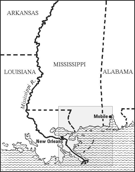
Mississippi and neighboring areas, with section of detail map (below) shaded.
Note: Text added. This map was on page 33 in the magazine. End of text added.

.
Detailed map of the area worst stricken. Economic disaster extended more than 50 miles inland to and beyond Lumberton, in the
in the western half of Mississippi. The Louisiana delta also felt the brunt of the storm. Flood and tide injured western Alabama.
Note: Text added. This map was also on page 33 in the magazine. End of text added.

Thank you for viewing the November 1969 article in the American
Legion Magazine titled "The Continuing Disaster on the Gulf Coast".

"The Continuing Disaster on the Gulf Coast"   Part 1
Camille Part 2
Camille Part 3
Camille Part 4
National Hurricane Center Camille Maps and Charts

| SITE MAP | LEGION INTERNET DIRECTORIES | POST LOCATION DIRECTORIES | TROPICAL STORMS WORLDWIDE |
HOME
CREATED AND MAINTAINED BY AMERICAN LEGION POST 119 GULFPORT MISSISSIPPI AS
A SERVICE TO THE AMERICAN LEGION COMMUNITY AND ALL VETERANS ORGANIZATIONS
EMAIL