|


SENIOR
MILITARY COMMANDS AND COMMANDERS AT QUARRY HEIGHTS
ANCON
HILL HISTORY - OCCUPANTS
|
Quarry
Heights -- History (Continued)
|
INTER-WAR
CONSTRUCTION ERA (1920-1938)
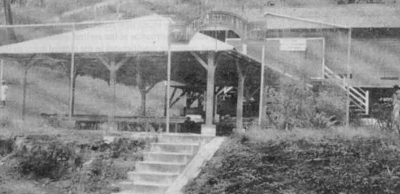
Frame buildings constructed
during this period (locations unknown) and demolished later included:
-- Military Police barracks
(below) constructed in
1921. No readily available records that indicate where it was located and
when it was demolished, but a map of Quarry Heights circa 1932 suggests it
could have been located on the lower part of Quarry Heights in what is
since 1990s Mi Pueblito complex representing three typical Panamanian
villages.
|
-- Medical station (below) constructed June 1936 (same comment as above
on the Military Police barracks).
Following the conclusion of
World War I, new construction at the Quarry Heights Military Reservation
was planned, and a number of new buildings were constructed, including
Building 153 (below), a Motion Picture Service Building, constructed in 1935
on the upper shelf of Quarry Heights. Later it housed Headquarters Command
and became known as the Chalet.
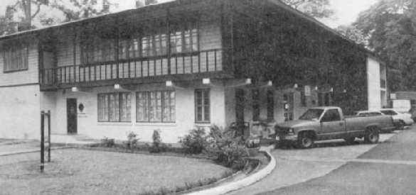
Building 150 (below) is assumed to
have been constructed some time in the mid-1930s, although no information is readily
available on its construction date. (Various uses of
this building later included the post library, later the Public
Affairs Directorate (street floor) in the 1980s until 1989, U.S. staff of the bi-national
Combined Board (upper floor) starting in Oct 1979, the Inspector General office, and
some of J-3/Operations sections 1989-1997.)
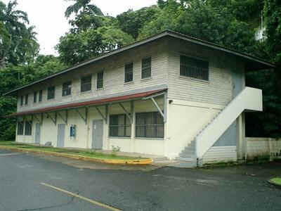
Bldg 150 as is in
2004. [Photo by Allan
Hawkins, Nov 2004]
Building 119, the
Quarry Heights Officers' Club and Bachelor Officers' Quarters, was
presumed built during this period. Originally constructed as Bachelor
Officers' Quarters, the facility has expanded over the years to become the
Officers' Club and Guest House.
By 1930, there were 39,469
U.S. citizens residing within the Panama Canal Zone. Of those, 10,470 were
associated with the Army. The population of Quarry Heights at that time
was 421 personnel.
WORLD WAR II CONSTRUCTION
ERA (1939-1946)
Immediately prior to the
United States' involvement in World War II, defense facilities were
constructed at nearly all installations on the Isthmus, including Quarry
Heights. In June 1939, Congress appropriated nearly $50 million in funding
for construction of several new installations, as well as new construction
at established posts in the Panama Canal Zone.
By 1941, with the
organization of the Caribbean Defense Command (from the Panama Canal
Department) and other increases in units, it became necessary to move some
of the staff and branch offices to other military bases, a practice which
continued through 1997.
Tunnel
| One of the most unique military
facilities in the previous Canal Zone was the Joint Operations
Tunnel located at Quarry Heights. In March 1940, Lieutenant General
Daniel Van Voorhis, Commanding General of the Panama Canal Department,
directed the construction of a bombproof shelter at Quarry Heights based on
the necessity for use in case of emergency and vital to the security of
important data. The Joint Command Post facility, completed by January
1942, was constructed under 200 feet of native porphyry rock, with the
entrance cut into the solid rock face of the old Ancon Quarry, and was
built of reinforced concrete at a cost of $400,000. The structure featured
a 269-foot by 52-foot main building and a 302-foot by 7˝ -foot tunnel.
The facility had since been used as a secure intelligence, communications,
and joint operations command post center for the unified command through
1997. |
.
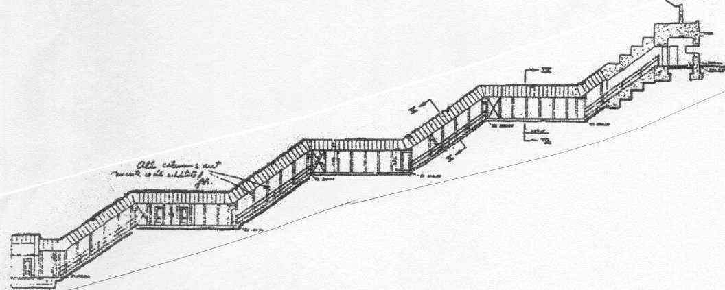
|
Diagram of the Tunnel -
beginning (left) at the entrance across from Building 88, proceeding back
through the main building, then through a tunnel with series of stairs
leading to the upper level of Quarry Heights. (See section on
Quarry Heights-New Uses for photos of interior parts of the tunnel since
transfer of Quarry Heights to Panama.) [From History of Quarry Heights
pamphlet] |
(The Panamanian newspaper El
Panamá América published a two-part history and description of the
tunnel (with photos inside the tunnel) in March 6 and 7, 2001, at http://www.elpanamaamerica.com.pa/archive/03062001/nation09.html
and http://www.elpanamaamerica.com.pa/archive/03072001/nation11.html
.)
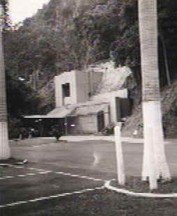
Front entrance across
the street facing Building 88 (headquarters building) |
|
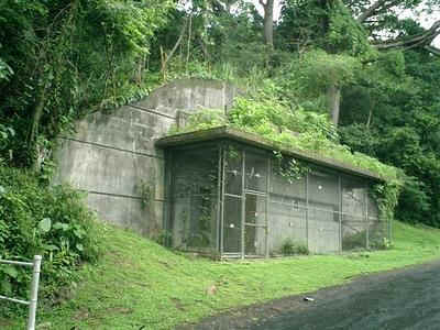
THE TUNNEL
Topside exit up
Ancon Hill (see right end of above diagram)
[Photo
by Allan Hawkins, 2004, used with permission]
|
|
|
In 1941, the War Department approved
construction of additional facilities:
-- A dugout under the north wing of the
Department Headquarters building,
-- Combined garage and chauffeurs'
quarters,
-- Widening the road from the Department
Headquarters building to the 4th of July Avenue and widening the road from
the same building to the post entrance,
-- A post headquarters and dispensary
building,
-- Temporary barracks and dining facility
for 120 men [see discussion and map below],
-- Barracks for Military Police (300 men)
[see photo below],
-- Engineer warehouse and recreation hall
for enlisted men [see discussion and map below].
By 1945, there were six enlisted men's
barracks with a total capacity of 896 men.
The locations and dates of the demolition
of those buildings are not readily available. However, there are
indications that at least some of the above facilities (if not all) were located in the
lower part of Quarry Heights next to the 4th of July Avenue (later renamed by
Panama as Avenida de los Martires or Martyrs Avenue). That part of
Quarry Heights, up to the top of the back gate (moved there from 4th of
July Avenue in September 1979), was transferred to Panama October 1, 1979,
and is now part of Mi Pueblito complex of replicas of typical Panamanian
village in the interior, Antillean, and Indian villages for tourists.
|
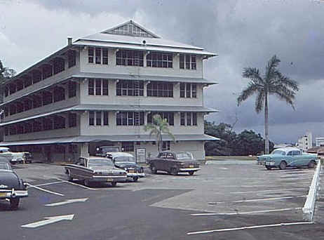
| Military Police/Enlisted
barracks (could have been building 164) constructed
on the lower part of Quarry Heights near Martyrs Avenue (formerly 4th
of July Avenue), which
housed Military Police and other enlisted personnel assigned to Quarry
Heights. According to Barry Roach, who took this photo in 1968,
the building was located on the right side after entering through the gate
off the 4th of July Avenue. Date of demolition of the barracks is
unknown, but before mid-1970s. That part of the post was transferred
to Panama October 1979.) [Photo used with permission of Barry Roach] |
|
Quarry Heights
Front Gate (early 1942 until August-September 1979) on lower part of Quarry
Heights next to 4th of July Avenue (renamed Martyrs Avenue in
1964). The gate was moved up the road to the backside of
Quarry Heights (present location) and redesignated the back gate
in September 1979 days before the transfer of this lower part of
Quarry Heights to Panama October 1, 1979 when the Panama
Canal Treaty of 1977 entered into force. |
| (Left Photo) Military
Policeman Don Destaffino at Front Gate in 1963 when the command was
known as the Caribbean Command. [Photo provided to WHO by
Don Destaffino] |
(Right Photo) Front
Gate in 1968. The buildings, seen in the background and to
the left of the entrance gate, were demolished some time
1969-1974. [Photo used with permission of Barry
Roach who took the photo] |
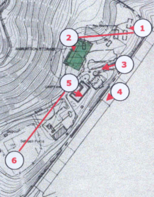
[Quarry
Heights Map - Attachment 5 To Annex A of the Agreement in the
Implementation of Article iV of the Panama Canal Treaty of 1977]
|
LOWER
LEVEL OF QUARRY HEIGHTS FACING 4TH OF JULY AVENUE (MARTYRS'
AVENUE) AND EL CHORRILLO SECTION OF PANAMA CITY 1
Likely site
of Military Police/Enlisted Barracks
-
probably building 164 (in above photo)
2
Building
159 later demolished in early 1970s
3 Quarry
Heights Front Gate (1942-1979)
4 4th
of July Avenue (renamed Martyrs Avenue January 1964) 5
Dining
facility; later Recreation Facility; later demolished.
The buildings shown on this
map on both sides of the gate had been demolished in the
1970s.
See Acknowledgments
for sources of personal information on this part of Quarry Heights
(until Oct 1979). Mi Pueblito replica of a typical Panamanian
village in the interior was constructed in the 1990s on the upper part of
this area (right side of the gate upon entering). Shortly
thereafter, replicas of Antillean-Caribbean and Indian villages
were constructed left of the gate (shown in the middle and lower
part with the map--all the area between 5
and 6), all designed for tourists, especially those
who could not travel to the interior parts of the country. |
<<preceding
page >>NEXT
PAGE
Site
developed, owned and maintained by
William
H. Ormsbee, Jr. 2005
|