coastlines of Alabama, Mississippi, Louisiana, and inland northward into Virginia.
|
|
| |
|
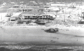
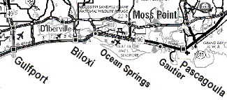
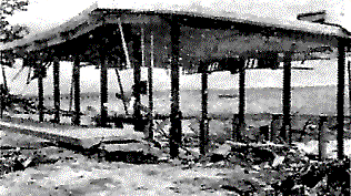
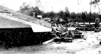
Nearby parts of Alabama will take long to recuperate from wind and water damage. To the East, the waterfront and flood damage was on a disaster scale running through Pascagoula and into Alabama, but, the wind force was not enough to cause great ruin beyond the coast. (Note: Text added. Two days
after Hurricane Camille had vented her incredible fury along
the ninety-mile stretch of Mississippi’s Gulf Coast, the
Mississippi Library Commission sent a team to the area to assess
the damage to public libraries and see what could be done to
help. |
||
|
But far inland, on the Louisiana
side, enormous damage, and in some places economic ruin extended
north for more than 50 miles. |
||
|
Beyond the reach of the great
wave, shells of buildings stood. Even if they were no longer
usable, they did not make such impressive photos. Thus the realization
that terrible damage extended far inland in the Western half
of the State was not readily grasped by Americans elsewhere.
Yet vast ruin stretched for an hour's drive inland due North
of Bay Saint Louis. All of Harrison County suffered "terrible
damage," Ralph Godwin told this magazine, and to the west
of Harrison County, all of Hancock County was badly damaged."
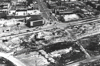
This is where some coastal towns were virtually destroyed. (Note: Text added. This picture shows the intersection of Mississippi Route 49 from the north through central Gulfport, and Route 90 the Beach Boulevard, running east and west along coastal Gulfport. This is the area in Gulfport where the World famous Mississippi Deep Sea Fishing Rodeo is held each year during the 4th of July Ceremonies along the Mississippi Gulf Coast. End of added text.) |
||
|
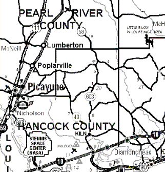
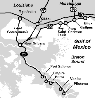
(Note: Map added.) Picayune,
well inland from the Coast in Pearl River County, up against
Louisiana, suffered extensive wind damage, as did Poplarville
some 30 miles inland. Lumberton is 50 miles inland from the Coast.
and suffered economic catastrophe. It is a center of an extensive
tree crop economy. At Lumberton, trees producing millions of
pounds of pecans were mostly uprooted, while the survivors stand
with split trunks, broken branches and other wounds open to disease
and insects. It was estimated that the pecan trees that could
be salvaged (from 10% to 40% in various stands) would need $50
apiece spent on them, and it would take five years to get the
next marketable pecan crop from them. Mostly little success,
for some use for the wood of their lost trees a month after the
terrible storm. In the Lumberton area, half of just one pine forest, representing 25 million board feet, was down. All told, six Mississippi tree-crop Counties suffered similarly, and the tung-oil industry reported "unsalvageable" because "all the trees are gone." Mississippi’s Coastal area shared with North Central Florida and some other Gulf areas, the United States growing of Oriental Tung Kernels, whose tung oil has numerous industrial uses, especially as a fast-drying ingredient in paints and varnishes. Forestry, now crippled in six Counties, had become Mississippi’s "number one industry." Tung Oil, now totally gone, had become southern Mississippi’s "biggest cash crop". |
||
|
What this less spectacular damage
means to the people affected, let alone the ravaging of the Coast,
led Goodwin to write in his magazine, "No story, no picture,
no TV, nothing, can give even an idea of the awful destruction,
the gruesomeness of the situation, or of the terrible need that
will exist, in my opinion, for at least a decade. I am still
shaky today, on September 8th. If you, and all Americans could spend two or three days as I have done this week riding up and down the full length, about 50 to 60 miles, you would be shaky too!" With the storm gone from the headlines, it may soon fade from memory elsewhere. As Goodwin noted, the plight of Camille’s victims stretches out for perhaps ten years. Their property disappeared at the same time their jobs or businesses did too, and on a scale that no picture, nothing, can even suggest. It may be 100,000 or 200,000 people who lost what they had and lost their way of life too. The "continuing disaster" cannot be photographed. It is economic ruin for the most prosperous part of the State. Ruin that looms ahead with no end yet in sight. |
| "Devotion to Mutual Helpfulness" |
This map shows the area from the Mississippi Gulf Coast to Buras an further south. The distance from Gulfport to New Orleans is about 80 miles, and the distance from New Orleans is also about another 80 miles. Much of the land from the County Route 23 marker to Buras is "grassy marshland". |
At it’s National Convention
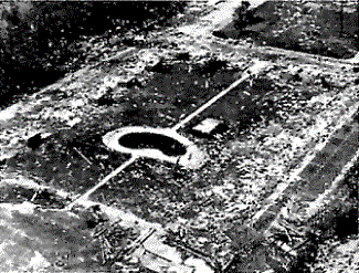
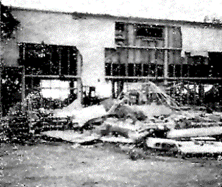
in Atlanta, the American Legion started a relief fund with the long-range plight of Camille’s victims in mind. The economic facts are almost indigestible. If the Legion should raise a half a million dollars nationally, which would be an excellent response to such an appeal, it would barley equal what local Legionnaires lost simply in damage to their Post Homes in Gulfport, Biloxi, Standard, and Bay Saint Louis in Mississippi…and Bogalusa and Buras in Louisiana. Buras, far down in Louisiana’s Delta area in Plaquemines Parish, got it as bad as any Mississippi city. Where the neat brick Legion Post Home in Buras once stood, there remained a sort of "saucer of wet sand" and a few chairs to show for it. The rest of Buras, after being tossed around on wind and wave, was left like a child leaves his toys after a temper tantrum.(Note: Text added. The map shows the area between Biloxi/Gulfport to southward to Buras, La. End of added text.) Our Preamble to The American Legion Constitution says it best, "…devotion to mutual helpfulness." This phrase is more than just mere words on paper; it’s our pledge of support to our distressed comrades. Since the early 1920’s, The American Legion has been actively involved in meeting the needs of both the community and individual Legion family members in the wake of disaster. Hurricanes, tornadoes, earthquakes, wildfires…The American Legion National Emergency Fund was born out of natural disasters to compassionately heal the wounds of catastrophe and help save their homes. A major disaster could happen to any Legionnaire in any town at anytime and make them homeless. The National Emergency Fund has provided over $3,000,000 in direct financial assistance to Legion family members and Posts. The National Emergency Fund has kept Posts from closing and enabled Legion family members to begin to rebuild their homes and their lives. |
