
"The
city of Phraya Rasda; broad-hearted citizens; delicious
roast pork; origin place of Para rubber; lovely Sri Trang
flower; beautiful coral reefs; charming sandy beach; and
wonderful waterfalls." This is a slogan that aptly
describes the salient points of Trang.
|

|
Perhaps the most luring
attraction for the foreigners are the beautiful
beaches in the off shores Islands. This is the
well known Ko Muk, an island with a hidden bay. |

|
|

|
The 3 mountain ranges, the
Khoa Na Dang and Khoa Noi Juji in the north and
the Khoa Bantah Mountain Range in the south
surround Trang.
The Khoa Bantah spans across
southern Trang in the Isthmus of Kra and trapping
the moisture coming in from the Andaman seas.
Heavy rainfalls rocky geology forces the rivers
to drop over cliffs. Trang can boast of having
numerous waterfalls along this range.
|
|
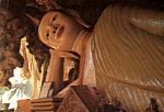
With karsts hills scattered
all over its Province and the temples that have
made their presence in the caves, Trang also
brings in local pilgrims and curious foreigners
to their places of worship. |
|
|

|
The
Province is proud to associated with the
endangered Dugong, the large marine mammal that
feeds on Sea weeds.
Between the
mangrove forest and the reef grows seaweed’s
that is good food for the Dugong. Scientists have
confirmed that this is the only place in the
world where they are breeding in natural
environment.
|
Focusing on waterfalls, those well
known in the province are :-
|
Waterfall Names |
Location |
Available ? |
|
|
Highway 4 Phattalung /Trang,
in Nayong |
Linked |
|
|
Along country road 4125, in
Yan Takao |
Linked |
|
|
Along country road 4125, in
Yan Takao |
Linked |
|
|
Along country road 4125, in
Yan Takao |
Linked |
|
|
Along country road 4125, in
Palien |
Linked |
|
|
Along country road 4125, in
Palien |
Linked |
|
|
Turn off country road 4125,
in Palien |
|
|
|
South of Ton Tok falls, in
Palien |
|
|
|
End of country Road 4046, in
Sikao |
|
|
|
Wang Wiset District |
Linked |
There are a
couple more falls, Pak Cham and Ton Klan in the district
of Huay Yot that we have not being able to verify.
The
Kachong Waterfall
This is a
stretch of rapids inside the Kachong National Park. The Park can
be easily reached and spotted as it lies beside the Highway 4
coming into town from Phattalung
|

|
While the
directional signs are prominent, the place well
publicized, don't be disappointed- Waterfall seekers! |
|
The Park
is a popular campsites among the locals.
The rapids and
cascades flowing through the Park add a tinge of
adventures to the campers.
|

|
|
The
dramatic Sai Rung Waterfall
|
| In the district of Yan Takao and
towards the foot of the Khao Bantad Mountain Range, the
first and the most beautiful fall is the Sai Rung
Waterfall. Today, getting to Sai Rung waterfall
is an easy and convenient undertaking. First travel along
Federal Route 4 from Phattalung to Trang.
 |
Coming
from Trang there will be signs advising visitors
of the 3 waterfalls. Then there is a turning into
a country road 4145 on the right side.
On this map
there are a total of 8 waterfalls in the 3
districts of Trang Province.
|
About 15
kilometers down this road, a turn off to the left into a
narrow but very beautifully paved road that meanders
through rubber estates. A couple of kilometers onwards
the estates ends and the road will be passing through
dense jungle area.
The road
leads to a car park with toilets and food vendors
The
waterfall is about 500 meters from the car park and
follow the path that goes over the shed and boulders. The
volume of water passing by the rapids also made it risky
to cross over to the opposite bank. There is trail on the
bank that leads right up to the pool at the bottom of the
fall.
 |
You will be greeted by this
magnificent vertical fall at a distance.
The water
flowing pass is absolutely clear and impressive.
|
| A deep and wide pool awaits
those who have made their way to this point.
This
photograph is not doing justice to the size,
height and the appearance of the Waterfall. It is
over 150 meters tall, broken into 2 drops.
|
 |
|
The Prai Sawan
Waterfalls
Travel along the same highway to Sai Rung
waterfall. Some 3 kilometers down the road these waterfalls are
there.
An important point of these waterfalls is
the forest that surrounds the vicinity. The name "PRai
Sawan" translated as Heavenly Forest speaks much for the
ambience.
| The smooth
rocky surface of the cliff wall and the water gliding
over them stirs up fantasies. |
 |
 |
This
waterfall is made up of a total of 7 cascades well spaced
out. Each falling 3 to 8 meters high. Most cascades are
however very gentle. |
The Lam Plok Waterfalls
In
the district of Yan Takao also nearing the boundary to Palien
district, a waterfall is already converted into Hydro-electric
dam
|

|
In this
rocky edge there were 7 cascades before the area was
dammed and flooded. |
|
However
deep into the pristine jungle and on the upper reaches of
the river there are cascades that remain undisturbed! |

|
The tallest fall
in Thailand - the Ton Te Waterfall
The
waterfall is located in a recreation area 46 kilometers from
Trang. This waterfall is officially measured at 320 meters tall.
|

|
Still on
Highway 4125 at one of the villages 35 kilometers after
turning in from Highway 4, prominent signage will direct
visitors to the recreation Park |
The very unique
Waterfalls -the Ton Tok waterfalls
This river with these waterfall draws its
water from the same basin as the Ton Te waterfalls that flow
westward. This river flow southwards.
Instead of a single large vertical
waterfall, this river reaches the plain after dropping 15 times.
Each fall vary in height of 10-20 meters.
| The
interesting fact of the falls here lies in the terrain.
At this waterfall, the rocky cliff appears to be in
layers. Then the rock in them break up into cubicle
boulders. |
 |
 |
Water is
gushing out in between the layers and overflowing from the
top. This is one of the lower fall at 10 meters tall. |
The
Roi Chan Pan
Wang Gourpools Waterfalls
This waterfall or a
series of many waterfalls is quite unusual. The waterfalls here
however do not fit the usual images of waterfalls most people
have in mind, large volume of water falling from tremendous
height. Literally translated "Roi Chan Phan Wang" means
"hundred level- thousand palaces". With such names you
can imagine the scenery surrounding the vicinity of this
waterfall.
 |
The Roy
Chan Phan Wang falls is a recent recognition with
potential as a recreation area and touristy destination.
In many parts of Thailand, the local rural folks is not
ready for a lifestyle that dwell into such fancies, but
more concern about their daily needs. |
It is located in
the Northeastern corner of Trang near the populated district of
Wang Visit, somewhat at the border between Trang and Krabi
provinces.
Accessible from the
left of a junction at Kuan Kun, a 3 kilometers combination
road/dirt track leads to the Fall.
Alternately, at one
junction in the Klongshee village along Highway 4, a direction
sign is now available to guide visitor to the area. Following
this way, the distance of 29 kilometers passes through
para-rubber estates and secondary forest.
 |
This is a
dirt road and visitors are advised to proceed on
motorcycles or off road vehicles. Most of the way is
unpaved but mainly shaded. |

The falls are made
up of fragments of a river that carry sediments down from the
limestone cliff. In dry weather, the slow flowing water will be
depositing these sediments to form "gour pools".
 |
On this
flat plain, the flow of water is dispersed and spread
over the limestone floor area. With each drop in height
there is a slow but continuous build up of calcium wall to
form small dams at the edges of these drops. |
Wet season will see
the water "overflowing" at the falls and the emerald
green color of the pool completes the special effects to the
whole area.
|
