NHC/TCP, United States Corps of Engineers, and archives from other Government sources.
|
|
| |
|
This page contains maps and
charts from Government websites regarding the 1969 Hurricane named Camille. |
|
|
| |
|
This page contains maps and
charts from Government websites regarding the 1969 Hurricane named Camille. |
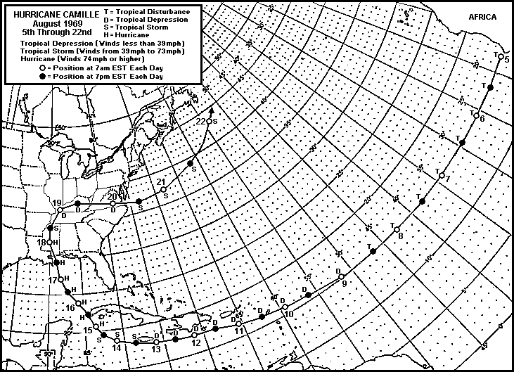
| The entire path of Hurricane Camille from the United States National Hurricane Center. |
 |
|
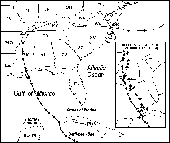
The map below, is another view
of the track of Hurricane Camille, excluding most of the track across the Atlantic Ocean to the United States. The insert shows the official "Forecast Displacement Error" from the National Hurricane Center. The definition of "Best Track" from the NHC Tropical Prediction Center is... "A subjectively smoothed representation of a tropical cyclone's location and intensity over its lifetime. The best track contains the cyclone's latitude, longitude, maximum sustained surface winds, and minimum sea-level pressure at 6-hourly intervals. Best track positions and intensities, which are based on a Post-Storm Assessment of all available data, may differ from values from values contained in storm advisories. They also generally will not reflect the erratic motion implied by connecting individual center fix positions." |
|
|
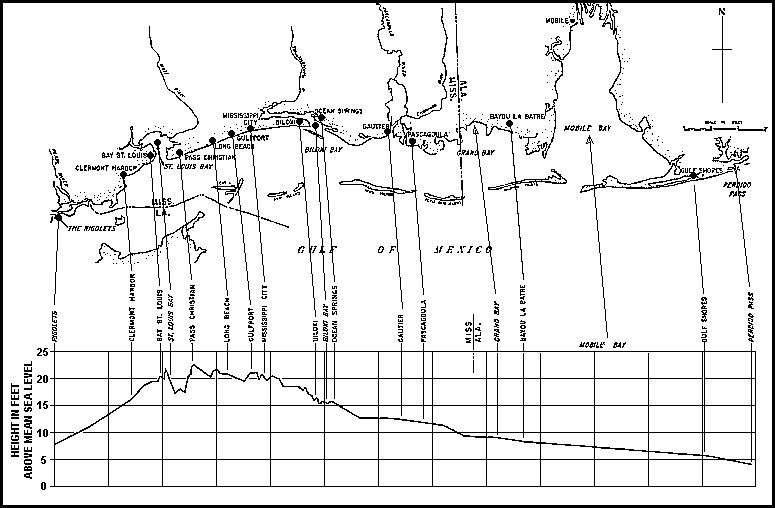
The High Water
Profile for the Alabama, Mississippi, and the upper Louisiana
Gulf Coast |
 |
|
|||||
|
|
|
|||
|
|||||
| | SITE MAP | LEGION INTERNET DIRECTORIES | POST LOCATION DIRECTORIES | TROPICAL STORMS WORLDWIDE | |
|
CREATED AND MAINTAINED BY
AMERICAN LEGION POST 119 GULFPORT MISSISSIPPI AS A SERVICE TO THE AMERICAN LEGION COMMUNITY AND ALL VETERANS ORGANIZATIONS |
|