
|
|
|

|
Intro to Glacier National Park Staying Safe in Glacier Life at Rising Sun: A Summer Spent in Glacier Intro to NW Montana Sights from Montana's Roads Lake McDonald Avalanche Lake Trail of the Cedars Fish Lake Howe Lake Going to the Sun Road and Logan Pass Hidden Lake Highline Trail Sunrift Gorge St. Mary Lake -Rising Sun -St. Mary Falls and Baring Falls -Sun Point -Otokomi Lake East Glacier and Two Medicine Scenic Point Running Eagle Falls (Trick Falls) Many Glacier and surrounding areas Belly River Cracker Lake Waterton Lakes Nat'l Park and Canada Cameron Falls Bear's Hump Red Rock Canyon and Blakiston Falls Police Outpost Lake Animals of Glacier Bear, Bighorn Sheep, Fox, Marmot, Mule Deer, Rocky Mountain Goat, Squirrels References and Links All photos and content are by Alicia Caouette except where stated otherwise. Unauthorized use or reproduction is strictly prohibited without expressed permission. Thanks. |
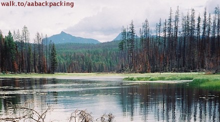 This is a sweet little trail, only maybe a mile and a half long (one way) on the far West side of Lake McDonald. It meanders through a bad burn that scorched quite a large area back in 1988 (and maybe again in 2003?). Even so, new green growth is springing up all throughout the area. Wildflowers and bright grasses make a nice contrast against the blackened trees. There are two lakes in this area, but come to think of it, I'm not sure if we hiked to both of them or simply stopped at the first one. Besides wandering through burnt forest, I seem to remember some marshy areas along the way as well – so bring a full bottle of bug repellent and some shoes that can get a bit muddy. 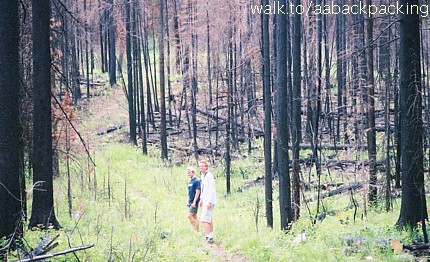 Howe Lake trailhead is quite out of the way from the main road, and this westernmost part of the park is one of the least-visited. If you're trying to avoid the crowds in mid-summer, this would be a hike to try. To get there from Glacier's West Entrance, turn Left (Northwest) onto Camas Road. Continue past signs marking the Apgar Visitor Center and turn Right onto the Inside North Fork Road towards Fish Creek Campground. The campground sits on Lake McDonald's Northwestern shore and would be a good basecamp for trails that climb Howe Ridge, along Lake McDonald, and on up to Rogers and Trout Lakes. To head for Howe Lake Trailhead, continue on the Inside North Fork Road (also called Glacier Route 7 on some maps) as it turns into a gravel route. Find a small parking area on the Left, and the trailhead to the Right. Note that several main park maps do not even show this trail. If your map is one that doesn't, it might help to know that the trail connects the road to the Howe Ridge trail by traversing almost directly east and west. 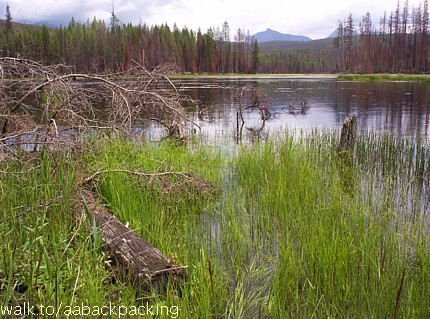
|
 Howe Lake