|
Intro to Glacier National Park

Staying Safe in Glacier

Life at Rising Sun:
A Summer Spent in Glacier

Intro to NW Montana

Sights from Montana's Roads

Lake McDonald
  Avalanche Lake
  Trail of the Cedars
  Fish Lake
  Howe Lake

Going to the Sun Road and Logan Pass
  Hidden Lake
  Highline Trail
  Sunrift Gorge
  St. Mary Lake
    -Rising Sun
    -St. Mary Falls and Baring Falls
    -Sun Point
    -Otokomi Lake

East Glacier and Two Medicine
  Scenic Point
  Running Eagle Falls (Trick Falls)

Many Glacier and surrounding areas
  Belly River
  Cracker Lake

Waterton Lakes Nat'l Park and Canada
  Cameron Falls
  Bear's Hump
  Red Rock Canyon and Blakiston Falls
  Police Outpost Lake

Animals of Glacier
  Bear, Bighorn Sheep,
  Fox, Marmot,
  Mule Deer, Rocky Mountain Goat,
  Squirrels

References and Links

All photos and content are by Alicia
Caouette except where stated otherwise.
Unauthorized use or reproduction is
strictly prohibited without expressed
permission.  Thanks.
|
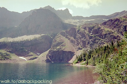
 Otokomi Lake
 
Difficulty: Moderate
Trail: 5.0 miles
Elevation gain: 1900 ft
Allow an afternoon
Ah, Otokomi. A lake, a word I couldn't pronounce for the first two weeks I was in Glacier (oh-toe-ko-me), and a chicken dish at Rising Sun's Two Dog Flats Grill. All summer I watched hikers begin this trail from the trailhead right outside my dorm room window, but it wasn't until August that I found my feet joining with theirs up the trail.
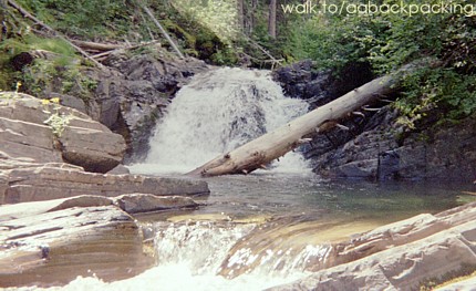
The hike itself gains 1900 feet in elevation, but spreads that gain out over 5.0 miles. My first "attempt" was before work one day. With only a few hours left until the dinner shift, the plan was to hike 45 minutes up and 45 minutes down. So an hour up the trail I reached some nice waterfalls where I took pictures and turned around. Thirty-five minutes and a face plant in the dirt later I was safe once more in my dorm room, ready for a shower, and some Neosporin...and maybe some Aspirin...
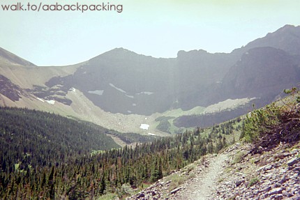
Two days later I was determined to defeat the trail that had ripped me up and see the lake that had once been so impossible to pronounce. This time I allowed myself the whole afternoon. (It ended up taking me 5 hours and 15 minutes round trip.) The way up is mostly among trees and at times follows close to Rose Creek, which it loosely parallels the whole way up. The last mile and a half or so passes over a large open scree field before dropping down to the campground and lake.
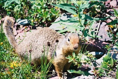
At the lake I met two men who I had served in the restaurant the day before. At the same time I met an older man who remembered seeing me at work as well. It was kinda fun to feel a bit of connection with people who were otherwise complete strangers. I even met a rather friendly squirrel.
The lake itself is small, but beautiful, with cliffs lining the far west end. It is snow-covered most years through June. Some of my co-workers hiked it in June and said they could hardly even see the lake at that time because of 2 feet or so of leftover snowpack.
|