Central Pacific Region tropical cyclone, alerts, warnings, advisories,
track graphics, and satellite images...24 hours a day yearlong.
Tropical Cyclones form over Oceans and are known as Tropical
Depressions, Tropical Storms, Hurricanes and Typhoons.
CENTRAL PACIFIC TROPICAL REGION

Convert To Any Language Here
|| TROPICAL REGION SELECT MAP | CENTRAL PACIFIC REGION | CENTRAL PACIFIC TROPICAL INFORMATION |
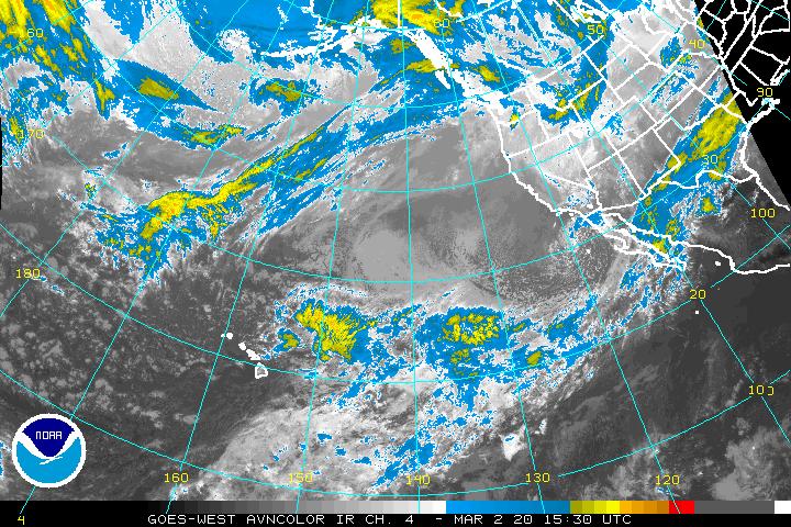
UNITED STATES SATELLITE IMAGES | UNITED STATES RADAR IMAGES UNITED STATES LIGHTNING STRIKES |

Department of Homeland Security
Current Threat Condition
Risk of Terrorist Attacks

Department of Homeland Security

More Information


Due to the destruction of our Post Home building by Hurricane Katrina we are now sharing
a building owned by the VFW Post 4526 15206 Dedaux Rd Gulfport MS 39503.
Phone Number depending on where you live 832-0017 or 228-832-0017 or 1-228-832-0017
American Legion Post 119 Is Requesting
Donations To Rebuild Our Post Home.
See below for Contact Information.

All communications with the Post, regarding donations to rebuild
our Post Home destroyed by Hurricane Katrina, should be made to
Post Commander Ron Jurgensen 12230 Sandy Hook Lane  Gulfport, MS.

Ron Jurgensen Home Phone 228-206-1936  
 

EMAIL

Tropical Cyclones Worldwide - 24/365

 Tropical cyclones form over Oceans and are known as Tropical 
Depressions, Tropical Storms, Hurricanes and Typhoons.

TROPICAL
CYCLONES
UPDATED
DAILY
See if any Tropical Cyclones
in the Atlantic, Eastern Pacific,
Central Pacific, Western Pacific, or
 Indian Ocean are of concern to you.


Security
Alert
National Security in effect. Some of the following links are to "Secure Sites".
Select "I Accept"  and/or  "Yes"  to view the information in the Secure Sites.

When storms are present, this page changes frequently. You may have to use
the "Refresh" or "Reload" button in your Browser to view the latest entries.

The Central Pacific season is officially from 1 June to 30 November.
These dates were selected to encompass over 97% of tropical activity.

NOTE If the  Radar or Satellite  images on this page appear incorrect, it may be because you are using
Dial-Up Acceleration. Reduce the Acceleration to normal, and "Refresh" or "Reload" the page.

WE HAVE NO TROPICAL ACTIVITY LISTED AT THIS TIME


Central Pacific Hurricane Center Archives For Central Pacific Tropical Cyclones

United States Satellite, Radar, & Lightning
For a better understanding of what Doppler Radar & Satellite images show,
and do not show, go to a  Description of Satellite Images and Radar Images

UNITED STATES SATELLITE IMAGES
UNITED STATES RADAR IMAGES
UNITED STATES LIGHTNING STRIKES

Worldwide Satellite Images and Weather
For a better understanding of what Doppler Radar & Satellite images show,
and do not show, go to a  Description of Satellite Images and Radar Images

WORLDWIDE SATELLITE IMAGES AND WEATHER

LIST OF TROPICAL CYCLONE & TROPICAL STORM NAMES - ALL FIVE TROPICAL REGIONS

AVIATION  WEATHER  CENTER  CENTRAL  PACIFIC  OCEAN  INFRARED  SATELLITE  IMAGE

Hurricane Katrina
The Story Of Hurricane Katrina
And The Mississippi Gulf Coast

Includes 600 pictures taken from Aircraft of the Gulf Coast.

Question I heard there was an Atlantic Hurricane
below the Equator in 2004. Is that true???

   More
Information

  About
Catarina
Answer Yes...March 19th through 28th 2004. An
extremely rare Hurricane named Catarina.

Global and Other Satellite Images
Global Satellite Images - NRL
GLOBAL INFRARED
GLOBAL VISIBLE
   WATER VAPOR   
Central Pacific Satellite Images - NRL

INFRARED IMAGE

VISIBLE IMAGE
   WATER VAPOR   

  Central Pacific Satellite Images - GHCC 

INFRARED IMAGE
LOOP


WATER VAPOR
LOOP

Enhanced Satellite Images - GHCC

INFRARED IMAGE
LOOP


WATER VAPOR
LOOP

Around the World at the Equator
60N Latitude to 60S Latitude Loops
BECAUSE METEOSAT IMAGES ARE UPDATED EVERY 6 HOURS
ONLY
 ONE  LOOP FRAME WILL SHOW THE COMPLETE IMAGE
United States
Eastward to India
 United States
 Westward to India
INFRARED

INFRARED
INFRARED ENHANCED

INFRARED ENHANCED
WATER VAPOR

WATER VAPOR

WATER VAPOR ENHANCED

WATER VAPOR ENHANCED
Around the World Closer to the Equator
45N Latitude to 45S Latitude & Loops
BECAUSE METEOSAT IMAGES ARE UPDATED EVERY 6 HOURS
ONLY ONE
  LOOP FRAME WILL SHOW THE COMPLETE IMAGE
Infrared
60E to 60W
LOOP
 
PM to 120W
LOOP
 
60W to IDL
LOOP
 
IDL to 70E
LOOP
Infrared Enhanced
60E to 60W
LOOP
 
PM to 120W
LOOP
 
60W to IDL
LOOP
 
IDL to 70E
LOOP
Water Vapor
60E to 60W
LOOP
 
PM to 120W
LOOP
 
60W to IDL
LOOP
 
IDL to 70E
LOOP
Water Vapor Enhanced
60E to 60W
LOOP
 
PM to 120W
LOOP
 
60W to IDL
LOOP
 
IDL to 70E
LOOP
 PM = Prime Meridian      IDL = International Date Line
 SEE BELOW FOR ADDITIONAL CENTRAL PACIFIC TROPICAL REGION INFORMATION 

Primary & Alternate Central Pacific Tropical Information
THE NORTH CENTRAL PACIFIC TROPICAL SEASON IS FROM MAY 15TH THROUGH NOV 30TH
NOTE:  THE SOUTH CENTRAL PACIFIC MAY REMAIN ACTIVE OUTSIDE OF THESE DATES
24 HOURS PER DAY...ALL YEAR TROPICAL SEASON OR STORM ONLY RECOMMENDED FIRST ACCESS

      TOP ROW = PRIMARY  DATA  SOURCE  

 ALT = ALTERNATE DATA SOURCES           
DAILY OUTLOOK
WARNINGS / ADVISORIES
TRACK   GRAPHICS    -    CPHC
SATELLITE IMAGE HAWAII TO USA
ALT 1   -   CPHC
ALT 1   OHIO STATE UNIV
ALT 1 CENTRAL & NE PACIFIC
ALT 1      MAPPED   AND   GRIDDED
ALT 2   -   NOAA
ALT 2 METORA UCSD EDU
ALT 2    GIF    -   NPMOC  NAVY
ALT 2  LARGE SCALE  MAP & GRID
ALT 3    -   NOAA
ALT 3 TEXT NLMRY NAVY
ALT 3   TRACK - NLMRY NAVY
ALT 3  FULL DISK  (MAPPED ONLY)
ALT 4   OSU EDU

ALT 4 - NONE
ALT 4 - NONE
ALT 4    SOUTHERN   HEMISPHERE

Additional Central Pacific Tropical Region Information


SEA SURFACE TEMPERATURE AND SEA SURFACE TEMPERATURE ANOMALIES

WORLDWIDE SEA SURFACE TEMPERATURE (SST)
  

WORLDWIDE SEA SURFACE TEMP ANOMALIES

EL NIÑO/LA NIÑA (ENSO) TECHNICAL UPDATE---FROM IRI
CURRENT (TEXT ONLY) EL NIÑO - LA NIÑA WORLDWIDE EFFECTS

FROM THE HURRICANE HUNTERS ASSOCIATION
WELCOME TO THE HOME OF THE WORLD FAMOUS "HURRICANE HUNTERS"


Return To The Worldwide Tropical Region Select Map


Global Hazards - Tropical Storms
Global Hazards - Earthquakes
Global Hazards - Volcanoes
Global Hazards - Tsunamis
Global Hazards - Solar Storms
Global Hazards - News Reports

| SITE MAP | LEGION INTERNET DIRECTORIES | POST LOCATION DIRECTORIES | TROPICAL STORMS WORLDWIDE |
HOME
CREATED AND MAINTAINED BY AMERICAN LEGION POST 119 GULFPORT MISSISSIPPI AS
A SERVICE TO THE AMERICAN LEGION COMMUNITY AND ALL VETERANS ORGANIZATIONS
EMAIL