
[ home | maps | stream report | links | message board | top ]
[ other river maps:| upper | quality zone | lower | below 411 ]

|
[ home | maps | stream report | links | message board | top ] [ other river maps:| upper | quality zone | lower | below 411 ] |
|
Big Bend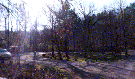 click here for bigger picture
The Big Bend area is broad shoals with several islands. There is a drop off up to 4 feet on the railroad side, so this is a good place to be cautious if you are floating. |

The area is wadable on 0 turbines, (click here for bigger picture, photo courtesy of Mr. Andre Bergeron) |

mostly on 1 turbine, (click here for bigger picture, photo courtesy of Mr. Andre Bergeron) |
and not so wadable on 2 turbines. There is a good parking lot, no boat ramp. Many good fish are caught here every year. Top Of Page |
Stairsteps click here for bigger picture
The Stairsteps is an essentially endless series of ledges, with a world and a half of pocket water. I don't fish it much because I am strictly a wader, and I haven't found it to be fun wading, even on 0 turbines. It makes me drool, though, and I keep trying. Below the Stairsteps is a big pool that tails out to a series of broad shoals. Big fish rise at the tailout in the evening. One can cross the river on some of these shoals, even on 2 turbines. Top Of Page |
Little Rock Island click here for bigger picture
This is where I want my ashes scattered. Above the island is a series of shoals that, with care, are wonderfully wadable on 2 turbines. Most of the big fish I have caught were taken here. It doesn't fish as well in years when low rainfall keeps the turbines off a lot. |

The 2 top pools on the railroad side of the island hold big fish in wet years, but are a mud puddle when the water is off. (click here for bigger picture, photo courtesy of Mr. Andre Bergeron) |
|
The pools on the other side of the top of
the island fish well on 1 or 2 turbines. If you float,
beware the heavy run next to the trail side bank across
from the Island. On 2 turbines there is a boil next to
the big rock that will bang you against the rock. The
guides call this "The A**hole". Below Little Rock Island is the Spinner Pool. The float guides spend a lot of time here, and catch some big fish. I don't fish it much because I haven't found it to be wadable. Top Of Page |
Big Island click here for bigger picture
There is a big ledge at the head of the island that is only wadable on 0 turbines, but fishes well then. Below the ledge is a big, long pool that is deep enough for good big fish cover, but is not wadable so I don't fish it. If you are floating, the best slot across the big ledge is toward the railroad side, between the small islands and the main island. Above Big Island is a series of ledges called the Rock Garden. A lot of this wades well, even on 2 turbines, and I catch a lot of fish there in the summer. I sometimes see big rainbows chasing minnows, but I haven't caught one of them yet. Downstream of Big Island there are shoals above and below the mouth of Big Lost Creek that are fairly wadable and I catch fish there in summer. In early June, smallmouth spawn back up Big Lost Creek. Downstream of Big Lost Creek, Devil's Shoals is the toughest rapids on the river, and can be quite dangerous. The best float passage is right next to the railroad. The big deep pool below is not my kind of water, but I have heard stories of monstrous browns. Top Of Page |
Woody Island click here for bigger picture
The railroad side of Woody Island is a series of ledges I call "Outfitters Shoals", because it is right next to Hiwassee Outfitters Campground. The wading is not so bad, even with the water on, and I often run up there to fish when I don't have much time. It is great dry fly water in the evening, and I have caught some nice fish there. A lot of people also fish the run on the Childers Creek side of Woody Island. Top Of Page |
Childers Creek click here for bigger picture
There is a National Forest Service parking area at Childers Creek providing access to the John Muir Trail and the quality zone. A $2 daily parking permit is required. To reach the parking area, cross the bridge at Reliance, take the 1st right, and the parking area is on your right just where the road leaves the river. Top Of Page |