| Duck Pass Trail |
4 October 1998 |
| From: trailhead at the end of the Coldwater campground road, Lake Mary
| Vertical gain: 1700 ft.
| To: Duck Lake
| Mileage: 10 mi. round trip
| Heinous Factor: steep to Arrowhead |
People Factor: tons
| | |
October 3, 1998
Keith says, "Where are we going hiking tomorrow?" I mumble something about Lundy Canyon and maybe the aspen trees will be changing colors. He says "I thought we might try Duck Lake." Wow. We've never gone to Duck Lake before. It's 5 miles from the trailhead, and rated as a "strenuous" hike. The 10 mile round trip with 1700 feet of vertical gain is a bit beyond our normal 3 miles in a day hike. But the thought gets me excited. If we leave early maybe we can make it. I spend the rest of the evening getting ready. Get out the pack and the fanny pack, make sure all the batteries are charged for the digital camera, wash the clothes I'm gonna wear, pack the shorts and an extra pair of leggings (just in case), check the Mammoth weather on the Internet. A high of 52 degrees is predicted.
October 4, 1998
Despite all our best efforts to leave "early", we get to Coldwater Creek trailhead at 11:30. Blue sky and sunshine, but cool. The car thermometer registers 47 degrees. As I sit in the car pulling my jeans on over my leggings, we see a couple head up the trail in shorts. What's up with that? We head out with our jackets on, me with my fleece hat pulled over my ball cap.
|


| It's not too long before we're headed off the trail. We are hiking with Keith, the cross-country meister, after all. Soon we find ourselves up on a little ridge above Mammoth Creek. There's a gorgeous view. Back down the canyon, Ritter, Banner and the Minarets are perfectly framed in Mammoth Pass. To their right is Mammoth Mountain, with Lake Mary shining below, and you can see Hole In The Wall. Further right is the Sherwin Crest, and just across from us on the Sherwins is the little basin where Heart Lake is. On our left is a view of the Mammoth Crest and Crystal Crag. We stop to take pictures, and since I've warmed up a bit I take off my jacket.
|
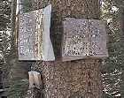
| We head on up the ridge and after a bit pass by a tree with three old signs nailed to it. The signs are wooden, covered by a sheet of tin, and hand painted. They are old surveying signs. Discovery Friend Fraction, 600 easterly, 300 northerly, DH Watkins, Bishop, CA. I wondered how old they were.
| 
|
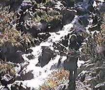
We ran into a small trail that went along Mammoth Creek. I was just telling Keith that the guidebooks I'd studied the night before had mentioned this trail, and said that it went along the tops of several waterfalls, when we began to hear the sound of falling water. We looked ahead through the trees, and caught a glimpse of a beautiful cascade. I laughed with pleasure. So far, the trip had been perfect. Perfect weather, perfect temperature, and perfect scenery.
The trail climbed up to the top of the falls, and after looking down at the top of the cascade Keith said we didn't want to follow the creek all the way up to the outlet of Arrowhead Lake, we wanted to be higher up. So we headed for higher ground.
| 
|
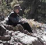
12:45 found us on a ridge top between Coldwater Creek and Mammoth Creek, again with stunning views. We stopped for a rest. We could see Sky Meadows, which is the headwaters for Coldwater Creek. Between Sky Meadows and the Mammoth Creek drainage stood Blue Crag, elevation 10, 669. At this point I took off my jeans. Since I had to take off my shoes, I took off my socks too and wiggled my toes in the fresh air.
|
|
|
|
|
|
|
|
| you are here | click here next |


![]()
