|
Footloose in Rocamadour |
|||
BUY "Footloose in Rocamadour" DVD |
OUR HISTORIC TRAIL IN THE LOT |
||
| Home Page |
Footloose in Rocamadour ~ Travel and Historic DVD Footloose in rural France at its best ~ THE DETAILS... We found hiring a car was the best way to reach this remote area of France. Our trail starts in the busy market town of Bretenoux and lasts for around 50 Km, which will probably take 4 days. Leaving the town, you set out along a French National Trail GR652, through rich farmland, so typical of the area known historically as Quercy. It's worth stopping to explore the ancient and impressive Chateau Castelnau -Bretenoux, a reminder that this region was once the battleground for the Hundred Years' War between the French and the English. The trail then follows in the steps of pilgrims through stunning Autoire, with its amazing limestone cliff to reach Loubressac, high on the Causse de Gramat.  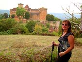 Passing over the dry pastures you can find the ruined castle of Taillefer with spectacular views of the Dordogne river. It's not too far then to reach medieval Carennac, with its distinctive Quercy houses, church and priory. There is accomodation here too.   As you are half way to Rocamadour, it is a good idea to make a side trip to the nearby Gouffre de Padirac, an amazing chasm in the limestone Causse, which was once a huge underground cavern until the roof fell in thousands of years ago. It has been open to the public for over a century. Better still, included in the entrance ticket is an underground boat ride on the 'Silent River' taking you past some amazing cave formations, culminating at the Great Dome Chamber ...one of the best in Europe. Returning back to Carennac, you begin the second half of the trail rejoining the GR652 then GR46 to Rocamadour. 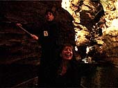 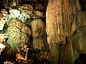

|
See what it's like - Walk with us on this DVD extract - press the 4-arrows button if you want full screen playback La Cité Religieuse Back on the trail, we pass by the village of Floirac and climb the limestone cliffs back up to the top of the Causse again, stopping briefly at the unspoilt village of Montvalent with more views of the Dordogne valley. It's only 10 kilometres across the natural parkland to reach L'Hospitalet, the last resting place for pilgrims. They would then travel down the 'Voie Sainte' into the religious city of Rocamadour, clinging fantastically to the side of the Alzou Gorge. 
In our DVD Abbé Ronan de Gouvello, the priest of the Shrine of the Black Madonna, tells the story of the amazing city on the rock and why pilgrims have arrived there for centuries. If you are lucky you can see a candlelit procession, which is a reminder of just how important this religious site is.    Find out more in DEBRA'S DIARY The Causse de Gramat ~ consists of plates of Jurassic limestone separated by valleys which can be deep and often dry; for example, the canyon of Alzou between Gramat and Rocamadour. The lack of water and the rocky nature of the ground does not allow much agricultural development. The breeding of Caussenarde sheep has constituted the main activity on the Causse de Gramat for centuries. Cabécou goat's cheese is a local delicacy  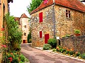 |
|
| Feature pages: | |||
| Austrian Tyrol | |||
| Austria | |||
| Switzerland | |||
| Spain | |||
| East European Cities | |||
| Ireland | |||
| Scottish Highlands | |||
| Classic Tour Scotland | |||
| Dubrovnik | |||
| Tallinn | |||
| Rocamadour | |||
| Bavaria | |||
| London | |||
| London II Unusual | |||
| Poland | |||
| Holland | |||
| Keukenhof Gardens | |||
| Madeira | |||
| Italian Lakes | |||
| Italy | |||
| Italy III Campania | |||
| Italy IV TuscanyRome | |||
| Italy V South&Sicily | |||
| Cotswolds | |||
| England Lake District | |||
| Oxford & York | |||
|
See all our DVDs on: or order by mail |
|||
| Useful links: Climate~ (Limoges) ROCAMADOUR REGIONAL MAP Our trail plotted on Googlemaps Mostly on footpath GR652 and the last part on GR46 http://www.visit-dordogne-valley.co.uk/rocamadour http://www.gouffre-de-padirac.com http://www.notre-dame-de-rocamadour.com (Google translated) http://castelnau-bretenoux.monuments-nationaux.fr Hiring a car from Bordeaux Airport seemed the best way to reach Rocamadour. Toulouse Airport also has possibilities. Getting to and from a day's hike was done by driving to a manageable point at a village on the trail. We would then park the hire car there, and arrange for a taxi to take us to the start of the day's hike, walking 12Km or so back to the car. We could then drive straight back to our accomodation at the end of the day. There is a regional railway station quite close to Rocamadour with only a few trains each day, and a taxi pickup from there could work. Rocamadour Hotels are quite heavily booked up, and you may have to check out a nearby town or village for a room. We recommend hotel bookings by www.expedia.co.uk |
|||