|
CAHERDANIEL STONE FORT
Map Reference: V544592
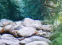
There is a large ruined cashel to the west of Caherdaniel. It sits
on a rocky outcrop, covering most of the summit. The wall on the west and north is almost intact and the combined heights
of the wall and outcrop in that area is probably greater than 6m. The interior height of the wall is now probably no more
than 1m. The cashel is more ruinous in the south and east and the entrance is probably in that area. The internal diameter
is about 20m. Although there are many stones scattered throughout the interior of the fort, some of the bedrock is exposed,
showing that the original floor level is more or less as it is today. A short distance away is a smaller cashel. It is very
ruinous and the walls are grass grown and scattered.

GALLARUS ORATORY
Map Reference: Q395048
Gallarus Oratory is a fine boat-shaped structure with a narrow doorway with inclined jambs. It is the most perfectly preserved
of such oratories in Co Kerry. There is a small round-headed east window. Just above the doorway on the inside are two hinge-stones.
The walls are about 1m thick and internally the oratory measures about 5m by 3m by 5m high. Close to the building is a stone
about 1m high and inscribed with a cross within a ring, as well as some writing.

KENMARE MARKET HOUSE
Kenmare Market House has a two-storey three-bay front with a clock. Stretching back from this is a long building with a nine-bay
arcade. All the arches are now blocked.

KENMARE STONE CIRCLE
Map Reference: V907707
Kenmare Stone Circle is about 17m diameter. It has 15 stones, all fairly low. The tallest is a thin slab about 1m high and
the others are rounded boulders. In the centre is a boulder burial. The boulder is about 1.5m wide and less than 1m thick.
It rests on at least three low stones.

LOHER STONE FORT
Map Reference: V506615
Loher Stone Fort has recently been restored. It is a neat circular cashel about 20m internal diameter. It may be entered through
a stone-lined passage similar to Staigue. The walls are more than 2m high and may be climbed by a series of stone stairways.
Within the fort were a large round house and a rectangular house. These occupied most of the interior of the fort. The walls
of the houses have been rebuilt to about 1m high. A covered drain leads from the doorway of the rectangular house out through
the entrance of the fort. During excavation and restoration the entrance to a souterrain was discovered within the round house
but this is not now accessible.

STAIGUE STONE FORT
Map Reference: V610632
Staigue Fort is a large cashel about 30m internal diameter. It may
be entered through a lintelled gateway. A series of X-shaped stairways lead to the top of the walls which is up to 5m high
in places and about 4m thick. The height of the wall varies and it is not clear if these variations are original. Just to
the left of the entrance is a small mural chamber. This rises to about 1.8m high and is about 2.5m long. The short entrance
passage is less than 1m high. A second, smaller mural occurs a short distance further along the wall. The fort sits on a central
mound and is surrounded by a ditch and an outer bank.

|