|
ANNADORN DOLMEN
Map Reference: J428459
At Annadorn there is a small dolmen. It is very low. Three stones about 60cm high support a large capstone about 65cm thick.
According to a description published in 1802 this chamber was originally covered in a cairn about 20m across and was approached
by a lintelled passage. If this description is reliable Annadorn seems to have been some sort of passage tomb. However the
chamber would have been very low and not typical. Another possible explanation is that the large stones were originally upright
supporting the capstone. This would then represent a more typical tripod dolmen. The monument has not been excavated and closer
examination is necessary to correctly interpret the remains.

JORDAN'S CASTLE, ARDGLASS
Map Reference: J559372
This 15th century tower-house is the largest of the Co Down group. It is three storeys high with an attic. There is a vault
above the ground floor. Twin towers project from the corners of the N wall and the gap is spanned by an arch at roof level.
This arch functions as a machicolation. A smaller machicolation at right angles to this protects the door at the base of the
W tower. This tower houses a spiral stairway. The E tower has latrines at two levels. The castle was bought in 1911 by the
antiquarian Francis Joseph Bigger. He restored and furnished it. It was bequeathed to the State in 1926.

MARGARET'S CASTLE, ARDGLASS
Map Reference: J560371
This 15th century tower-house was at least three storeys high but the upper storey is now fragmentary. It is vaulted above
the ground floor. The entrance at ground level in the N wall is protected by a murder-hole. There are northwards projecting
turrets at the E and W corners of the N wall. The W turret has a spiral stairway.

COWD CASTLE, ARDGLASS
Map Reference: J561371
This small 15/16 century tower is thought by some to be part of the original town wall. However there is no firm evidence
of this. The tower is two storeys high with a doorway in the W wall. A mural stairway rises to the right of the door. There
are gun-loops at the ground floor.

AUDLEY'S CASTLE
Map Reference: J578506
This 15th century tower-house was built by the Audley family but passed to the Wards in 1646. It has a prominent position
overlooking Strangford Lough and originally sat at the corner of a bawn. Only the foundations of the bawn remain. There are
projecting turrets as found in Jordan's Castle and Kilclief Castle. These house a spiral stairway and latrines. They are connected
by a machicolation arch at roof level. The castle is three storeys high with a vault above the first floor.

BALLYALTON COURT TOMB
Map Reference: J531443
The court tomb at Ballyalton is surrounded by a thorn and bramble thicket making exploration difficult. Six stone survive
from an eastern court. Two of them act as portal stones leading to a two-chambered gallery. Many of the gallery stones survive.
The maximum height of any of the stones is about 1m. Excavation in 1933 revealed the fragmentary bones of at least seven individuals
and potsherds of at least 20 vessels. These appear to have been rimmed and decorated bowls. The term "Ballyalton ware"
was applied for many years to similar vessels from other excavated sites. Numerous worked flints were also found including
a lozenge arrowhead, several plano-convex knives and some hollow scrapers.

BALLYLOUGHLIN STANDING STONE
Map Reference: J391342
This large standing stone is set into a roadside fence. It is 3.2m high by 90cm wide and 8cm thick. On the other side of the
fence is a smaller stone 1.6m high by 1.4m wide and 80cm thick. The stones are about 1m apart and may be part of a larger
structure. There is reference in the past to "10 or 12 pillar stones standing in a circle". This may refer to a
true stone circle or the facade of a count tomb. Wateresk Portal Tomb stands a short distance to the NE.

THE GIANT'S RING, BALLYNAHATTY
Map Reference: J327677
This large circular enclosure is about 200m diameter. The bank is about 20m wide and 4m high. Excavation has shown that the
bank is built of gravel and small boulders, retained on the inner edge by a revetment of boulders and on the outer edge by
a low clay bank. Building material was obtained by skimming the surface of the enclosed area. Flint flaking was carried out
in the shelter of the bank soon after its completion. Just to the SE of the centre of the enclosure is a megalithic tomb.
Five basalt uprights enclose a polygonal chamber roofed by a single capstone. There are several other large stones but they
are not deeply seated and their original position in the structure cannot be determined. Excavations in recent years of the
field to the N of the monument have found evidence of several large circular wooden structures which may be associated with
the Giant's Ring. They may also represent a major necropolis where excarnation was the main process.

BALLYNOE STONE CIRCLE
Map Reference: J481404
This large stone circle contains at least 50 stones placed close together with several large gaps. They range in size from
about 60cm to 1.8m high. The circle is about 34m diameter. Within it is a long, low, oval cairn bounded on the E side by an
arc of about 25 low stones and on the E side by a short arc of 5 stones. Excavation uncovered a rectangular stone cist at
each end of the mound with cremated bones. Dating evidence is scarce and it is possible that the cairn and the circle may
not be contemporary. A Late Neolithic or Early Bronze Age date seems likely. There are several outliers, four of which form
a rough N-S alignment. A low pair of outliers to the W may also be significant.

BARNMEEN STANDING STONE
Map Reference: J172330
This stone is about 3m high by 1.3m wide at the base. It has a definite shoulder a little above half height.

CASTLE BRIGHT
Map Reference: J507383
This three-storey tower-house was probably constructed in the late 15th or early 16th century. Less than half the structure
survives. The E wall and adjoining fragments of the N and S walls stand to roof level but the western portion of the castle
has completely disappeared. There are some indications that there may have been a vault above the ground floor. However it
would have been very flat and it is possible that it was never completed.

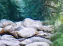
BURREN DOLMEN
Map Reference: J134226
This small tomb has a capstone about 1.8m long by 1.2m wide and 60cm thick supported by two side stones, each about 1.3m long
by 70cm high and 60cm thick. The side stones are about 60cm apart. It is known that there were traces of a long cairn extending
southwards from the dolmen but all this evidence was removed when a bungalow was built close to the structure. The structure
is very similar to Lough Money Dolmen.

CARROWNACAW STANDING STONE
Map Reference: J544464
Carrownacaw Standing Stone is situated a short distance to the east of Loughmoney Dolmen. This stone is about 75cm square
and about 3m high. It is inclined slightly towards the south. Excavation in 1955 showed that it tapered to a point below
the ground, and that it was set in a socket and tightly packed with chocking stones. Just to the NE of the stone was a ring
ditch about 6m diameter. Many worked flints, including arrowheads, were found in the filling of the ditch and in the surface
soil surrounding the stone.

CLOUGH CASTLE
Map reference J409403
This is an excellent example of an Anglo-Norman motte and bailey. Excavations have shown that the summit of the motte was
surrounded by a timber palisade within which were pits for archers. In the middle of the 13th century a large hall, probably
of timber, was built near the E edge of the motte. This was replaced later in the century by a stone tower close to the W
edge. Part of this tower remains. It was extended some time in the 15th century to form an L-shaped tower-house. The small
kidney-shaped bailey lies to the S of the motte and is separated from it by a 2m deep ditch.

DUNDRUM CASTLE
Map Reference: J404369
Dundrum Castle is situated on a rocky hill overlooking Dundrum Bay. It was started by John de Courcy about 1177. The earliest
part is the polygonal upper ward which is surrounded by a substantial rock-cut ditch. The circular keep was begun soon after
and the twin-towered gatehouse was completed by the early 13th century. The date of the large lower ward is uncertain. It
may be 13/15th century. The keep was repaired in the 15th century. In the 17th century the Blundells built the large house
in the lower ward. It remains as an impressive ruin.

DUNNAMAN COURT TOMB
Map Reference: J289151
This monument is classified as a court tomb although there is no evidence of a court. The burial gallery is about 12m long
and the jamb stones suggest that there are four chambers. There are no sill stones visible but these may be discovered by
excavation. The side stones overlap in a manner seen in some Scottish court tombs. Apart from the large stones there is no
surviving cairn material.

GOWARD DOLMEN
Map Reference: J244310
This megalithic tomb is known locally as Cloghmore Cromlech, or Pat Kearney's Big Stone. It has a long rectangular chamber
with side stones about 1m high and an end stone about 1.5m high. The enormous capstone has slipped from its original position.
The higher end rests on two stones about 1.5m and 2m tall which seem, with other stones, to form a crescentic facade. This
type of feature has been found with some other portal tombs and has been suggested, by some scholars, as evidence of a link
between portal tombs and court tombs. Excavations in the 19th century uncovered a cremation urn and a flint arrowhead.

GREENCASTLE
Map Reference: J247119
This is a royal castle built in the 13th century. It was attacked and taken several times in the 14th century but still maintained
as a garrison for Elizabeth in the 1590s. There is a large rectangular keep with three vaulted chambers at the ground floor.
The upper levels contain many mural passages and small chambers. There are small roof turrets at the four corners. Most of
the upper storeys were remodelled in the 15th century. The keep was surrounded by a strong wall with corner flankers. Outside
of this was a rock-cut ditch which is now partly uncovered.

GREY ABBEY
Map Reference: J583682
The Cistercian Abbey of Jugum Dei, or Mainistir-liath, was founded by Affreca, wife of John de Courcy, in 1193. It was colonised
by monks from Holm Cultram in Cumberland. The monastery was dissolved about 1541 but the nave of the church was restored
in the 17th century and used as the parish church until 1778. The original cruciform church had an aisle-less nave and a pair
of E chapels in each of the transepts. There is a very fine pointed W doorway which probably dates to the middle of the 13th
century. There are two tiers of three lancet windows in the E wall of the presbytery. The plan of the monastery is typical
of the Cistercians, with the chapter house along the E side of the cloister and the refectory along the S side. There was
a range of buildings along the W side of the cloister but there is now no trace of them. The roof of the chapter house was
supported by six pillars but only the bases of these remain. The S wall of the refectory has some fine lancet windows and
there are traces of a pulpit in the W wall. The warming room was at the NE corner of the refectory. The builders of nearby
Rosemount House (1762) could see the gothic ruins from their home, and in keeping with this theme they built a Gothick room
in the house and a small Gothick gate lodge.

INCH ABBEY
Map Reference: J477455
The Cistercian Abbey of Inch or Inniscourcy (J477455) was founded by John de Courcy and colonized by monks from Furness in
1187. The site was occupied by the earlier monastery of Inis Cumhscraigh, which was plundered by Vikings in 1002. It is known
that this early monastery was surrounded by a large earthwork which was in existence before 800. The presence of this earthwork
has been revealed in recent years by aerial photography. The abbey sits on a former island in the Quoile marshes and is approached
by a causeway from the north. The ruins show the typical Cistercian layout. A large cruciform church stands to the north of
the cloister garth. Along the east of the cloister is a range of buildings including the vestry, chapter house and parlour.
Above these may have been the dormitories. To the south was the kitchen and refectory. There do not appear to have been any
buildings along the west of the cloister although such buildings are found in some other Cistercian abbeys. The church had
two chapels in each of the transepts and a north and south aisle. The walls have been reduced to low level except at the east
end. Enough remains to show that the chapels were vaulted and that there was a tower over the choir. There are three large
lancet windows in the E wall of the chancel and two such windows in the N and S walls. There are traces of a triple sedilia
and a piscina in the S wall of the chancel. None of the carved stone from this area has remained in situ except for the quatrefoil
basin of the piscina. There is evidence that there was a fire during the 15th century which may have caused the destruction
or demolition of the tower. The transept arches and the first bay of the nave were then enclosed and the west doorway moved
to its present position. Only the lower courses of the doorway remain. Presumably the rest of the nave was then abandoned.
The cloister was rebuilt in the 15th century and appears to have had ogee arches and dumb-bell piers. To the SW of the main
cluster of building are the remains of a bakehouse which had two ovens. Beside this is a well. To the SE is the foundation
of a small rectangular building which may have been an infirmary. At some time an oven with a long flue was been inserted
into this building.

KILCLIEF CASTLE
Map Reference: J597457
This tower-house was supposedly built by John Sely, Bishop of Down, between 1413 and 1141. It has twin projecting turrets
similar to Audley's Castle and Jordan's Castle, with a high machicolation arch spanning the gap. The entrance in the SE turret
leads to a spiral stairway. The NE turret has three garderobes and a latrine chute. The castle is vaulted above the ground
floor.

KILFEAGHAN DOLMEN
Map Reference: J232154
This portal tomb has a massive capstone estimated to weigh over 30 tonnes. It is supported by five uprights and is set near
the N end of a long cairn, some of which may be modern field clearance. The true height of the uprights is masked by the cairn
material which has been piled up against them. Partial clearance has shown that the portal stones are about 2.5m high and
the side stones are about 1.5m high. Excavations in the early 20th century uncovered bones, pottery and flint scrapers.

KILKEEL DOLMEN
Map Reference: J307149
This small dolmen is known as the Crawtree Stone. Four uprights less than 1m high support a capstone about 1.5m across and
less than 1m thick. There is no back stone and the small boulder situated between the portal stones may not be an ancient
feature. The dolmen is set within a field bank.

KIRKISTOWN CASTLE
Map Reference: J646580
This tower-house was built in 1622 by Roland Savage although the style of building dates from two centuries earlier. The entrance
in the SE is protected by a machicolation. The tower is three storeys high and there is a vault above the first floor. At
the beginning of the 19th century the castle was extensively remodelled in the Gothic Revival style. Later in that century
massive buttresses were added to the SE face. There are substantial remains of the bawn wall with three-quarter round flanking
towers at the corners.

LEGANANNY DOLMEN
Map Reference: J288434
This is the classic tripod dolmen. There is a pair of well matched portal stones about 1.8m high and a back stone about 1.2m
high. They support a capstone about 3m long by 1.5m wide and 60cm thick. It has been described as 'coffin shaped'. There
is no other visible cairn material.

LOUGHINISLAND CHURCHES
Map Reference: J423454
The old graveyard at Loughinisland occupies a natural island in Loughinisland Lake and now reachable by a modern causeway
from the west. The three churches among the graves are of different dates. The Middle Church may date from the 13th century
although there is evidence that the walls were refaced at a later date. It was a rectangular gabled structure measuring about
11m by 6m internally. The gables have now fallen and the walls have been reduced to an average 3m high. The south doorway
has been largely destroyed with only the base of the jambs remaining. There is a good base batter on the south wall. The North
Church probably dates from the 15th or 16th century and it continued in use until 1720 when the roofing materials were removed
for re-use in the Church of Ireland building at Seaforde. It measures about 19m by 8m internally with west and south doorways.
There is a small lancet window over the west doorway and above this is a small weathered mask. The stone on the inside of
the south wall with the long Latin inscription in raised lettering is part of a gravestone. It dates from 1617 although the
date is no longer traceable. There is a similar stone to the left of the south doorway but the inscription is no longer legible.
The South Church is also called MacCartan's Chapel and was built in 1636. It is a rectangular gabled structure about 7m by
4.5m internally. It has a two-light eat window and small north and south windows. The west doorway has a semicircular head,
rising from moulded imposts, with a square architrave framing the arch. There are panelled spandrels bearing the initials
P.M.C. and the date 1636. On the gable above the doorway is a carved mask. The gravestones are mainly 19th and 20th century
but there are some late 18th century examples. There are many simple gravestones some of which are plain. Others are inscribed
with initials and a simple cross, but no date. There are also two large burial vaults, one of which is dated 1835 and 1855.

LOUGH MONEY DOLMEN
Map Reference: J539464
This monument consists of two sidestones supporting a capstone. Each of the sidestones is about 2m long by about 90cm high
and 50cm thick. The capstone is about 3m long by 1.5m wide and 60cm thick. The stones are Silurian shale and there are no
traces of a covering cairn. The length of the stones and the lack of endstones suggests that this may be the remnants of a
lintelled gallery. If this is the case it may be part of a wedge tomb where this type of construction is common. That being
so it would be the only example of a wedge tomb in Co Down. However not enough of the monument remains to give evidence of
its true nature.

MAYO STANDING STONE
Map Reference: J160266
This is a massive granite boulder over 3m high and about 1.5m wide at the base.

NARROW WATER CASTLE
Map Reference: J127193
This castle was built in the 1560s for an English garrison but was later taken over by the Magennis family. The entrance in
the W wall is protected by a machicolation and a murder-hole. A straight stairway rises in the W and N walls to roof level.
The tower is three storeys high plus attic. It is vaulted above the first floor. It was extensively renovated in the 1960s
when the roof was restored. Most of the bawn wall may be original but the gateway dates from the 19th century when the large
house on the opposite side of the road was built.

NENDRUM CASTLE
Map Reference: J524639
This tower house is also known as Mahee Castle and stands near the end of the causeway leading to Mahee Island. It was built
in 1570 by Captain Browne. It measures about 12m by 7m externally and the walls are about 1.5 to 2m thick. The doorway is
in the NW wall. It is about 1m wide and defended by a murder hole. There is a vault above the ground floor. The castle was
apparently originally three storeys high but now stands to only about 7.5m high. There are possible remains of a bawn.

NENDRUM MONASTIC SITE
Map Reference: J524636
This monument, on Mahee Island, is the site of a monastery founded by St Mochaoi in the 5th century. There are references
in the annals during the succeeding centuries and in 987 it was burned, probably in a Viking raid. In the late 12th century
the Benedictines founded a monastic cell here but by the early 14th century it was abandoned. It remained lost until the
1920s when an extensive excavation revealed the remains of the walls, a church and a Round Tower. The small glacial hill is
crowned by three concentric oval walls. Between the outer and the middle wall were found foundations of circular huts and
of a rectangular building known as "the schoolhouse". Associated with this building were found many "trial
pieces" bearing interlacing and animal carvings similar to those found on the High Crosses and in the illuminated manuscripts.
Within the inner monastic wall is the stump of a Round Tower and the low ruins of a small church. This appears to have had
a lintelled W doorway although the appearance of the building today owes much to restoration following the 1920s excavations.
Fragments of an early sundial were also found and have been re-erected at the SW corner of the church.

PORTAFERRY CASTLE
Map Reference: J593509
This small 16th century tower-house was built by the Savage family. It is a square building with a small projecting turret
at the S corner. It is three storeys high plus attic. There is no vault. Most of the eastern corner is ruinous. The entrance
at the base of the turret is protected by a small machicolation. Entrance to the ground floor chamber is protected by a murder-hole.
A curved stairway within the turret rises to first floor level and a spiral stairway in the W corner continues to roof level.

QUOILE CASTLE
Map Reference: J497470
This late 16th century tower-house is now three storeys high but probably originally had an attic. It stood foursquare until
the 20th century when the S angle fell. During the later 20th century extensive renovations were made but the fallen corner
was not rebuilt. The entrance in the NE wall leads to a small lobby which was protected by a murder-hole. Beyond this are
two vaulted chambers. They have many gun-loops, all at low level. A straight mural stairway rises to the right of the entrance
to first floor level. There is another murder-hole at the top of the stairs. There is a fireplace at the first floor level
and another straight mural stairway rises within the NW wall to the upper level. There is another fireplace at the second
floor level.

ST JOHN'S POINT CHURCH
Map Reference: J528339
This small rectangular church probably dates from the 10th or 11th century. It may mark the site of an early monastery associated
with John, Son of Cairland. It has a lintelled west doorway with inclined jambs and there are antae on the E and W walls.
The E wall is now reduced to foundations but a mid-19th century description indicated that it had a small pointed window.
There is a small S window which would appear to have had a lintelled head. Excavations in 1978 revealed burials under the
N wall. At the roadside nearby is a Holy Well and a bullaun stone.

SKETRICK CASTLE
Map Reference: J525625
Sketrick Castle was probably built is the 15th century. The Annals of the Four Masters record its capture in 1470 and it was
mentioned several times in the 16th century. It remained fairly intact until the end of the 19th century when half of it collapsed
during a storm. The rectangular building stands to its original four storeys only in the NE corner. The entrance in the E
wall was protected by a murder-hole. A straight mural stairway rose to the left of the doorway and continued in the S wall
to the second floor level. A spiral stairway near the NE corner gave access to the upper levels. There were four chambers
on the ground floor. The large chamber in the middle may have been a boat bay. The small windowless chamber at the Ne corner
may have been a treasury or a lock-up. There are remains of a bawn wall in the east. Excavations in 1957 revealed a subterranean
passage, stone-lined and lintelled, which ran eastwards under the bawn wall to a corbelled chamber, which covered a fresh
water spring. The passage is less than 1m high and about 15m long.

STRANGFORD CASTLE
Map Reference: J589498
Strangford Castle was probably originally built in the 15th century but most of the present building dates from the late 16th
century. It is a small three-storey building with no vault or stone stairway. The present entrance, in the NE wall, is protected
by a machicolation. The original entrance may have been at the first floor. The ground floor chamber is lit only by small
gun-loops. The roof has very fine crenellations.

STRUELL WELLS
Map Reference: J513442
The wells and baths at Struell have been visited by pilgrims in search of a cure since before the 16th century, although the
name of the site is not ancient. At the NE end of the site is a ruined church which was built about 1750 but probably never
completed. It probably replaced an earlier church on the same site. Beside it is the Drinking Well, a circular stone building
with a domed stone roof showing impressions of wicker-centering. A stone in the outer wall is carved with a small cross with
triangular terminals. The well is fed by the stream which continues through the middle of the site to the Eye Well. This well
is covered by a small square building with a very fine corbelled roof. After flowing through the Eye Well the stream divides
to feed the bath houses. The Men's Bath House is contained in a rectangular building with a pointed barrel vault covered
externally by overlapping courses of heavy stone slates. The Men's Changing Room has a west doorway and occupies the W portion
of the bath house. It has stone seats and small square windows. The Men's Bath occupies about half of the eastern portion
of the building. It is a deep stone tank fed by a strong flow from a spout. A channel in the S wall of the tank indicates
that it had some form of sluice gate which allowed the tank to fill. The Womens Changing room occupies the rest of the building.
It has its own entrance in the east. It also has stone seats and small square windows. The Women's Bath House is a small separate
rectangular building (now roofless) just to the E of the larger building. Its western doorway is opposite the doorway of the
Women's Changing Room. It bath house is fed by a spout about halfway up the wall and the flow continues along a central channel
and out under the S wall. The site has been associated with St Patrick for at least 300 years.

WATERESK PORTAL TOMB
Map Reference: J394344
This portal tomb is known as Slidderyford Dolmen. The massive capstone is supported by three uprights. The tallest stone is
about 1.8m high and the shorter stones are about 1.3m high. A fourth stone lies under the capstone but does not support it.
An early 19th engraving shows another orthostat and possible remains of a cairn. There are now no traces of these extra stones.

|